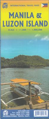
Stadsplattegrond Manila & Luzon | ITMB

0
Stadsplan Manila   Manila on a double-sided indexed street plan, with a diagram of the city’s metro network. The plan divides the city north/south, roughly along the upper part of the Pasig River, with a generous overlap between the two sides. Coverage of the northern side extends to Caloocan City - San Francisco del Monte and inland to the Cubao ...

Verkopers met dit product

Verkoper
Bezorging
Prijs
DeZwerver.nl logo
DeZwerver.nl
2,95
14,50

Anderen bekeken ook

Nieuw
Wegenkaart - landkaart - Stadsplattegrond San Diego - California south | ITMB
Wegenkaart en stadsplattegrond in een kaart: aan de ene zijde San Diego stadsplattegrond en op de andere kant een kaart van het zuiden van Californië. San Diego on a clear, well presented street plan from ITMB, with a transit system diagram, a road map of the city and its environs, and a street plan of central Tijuana, plus on the reverse a road map of the US/Mexico border region extending east beyond El Paso and within USA north to Las Vegas.   On one side is an indexed street plan of San Diego, covering the city’s central districts (as indicated in our coverage image), including the downtown area, the Old Town for which an enlargement is provided, Balboa Park, University Heights, the Mission Bay Park with the SeaWorld, and the city’s international airport. The plan clearly shows the MTS and other public transit stations, highlights main traffic arteries and indicates one way streets. Also marked are recommended cycle routes. Streets are annotated with selected block numbers for easi…
13,95
Stadsplattegrond Streetwise Budapest | Michelin
REVISED 2023Streetwise Budapest Map is a laminated city center map of Budapest, Hungary. The accordion-fold pocket size travel map has an integrated metro map including lines & stations. Coverage includes:Main Budapest Map Front 1: 17,000Main Budapest Map Back 1:11,000Budapest City Center Map 1:11,000Millennium City Center Map 1:17,000Budapest Metro MapDimensions: 4" x 8.5" folded, 8.5" x 27" unfoldedPeople say Budapest is the Paris of Central Europe.   Maybe that statement is true because it combines a combination of western luxuries, architectural beauty, and cosmopolitan European traditions. But this baroque city is still connected to its Eastern European heritage with the steaming baths, incredibly complex language and lusty cuisine. Budapest straddles a curve in the river Danube which bisects two distinct parts.   The east side is known as Pest and the west side is known as Buda, hence Budapest. It's a very logical, well laid out city. Castle Hill is the premier destination for v…
9,95
Nieuw
Stadsplattegrond Hanoi & North Vietnam - Noord Vietnam | ITMB
Overzichtelijke stadsplattegrond met register, schaal 1:15700 en een kaart van  Noord Vietnam op schaal 1:920.000. Double-sided map with north Vietnam on one side and a street plan of Hanoi on the reverse. The road map at 1:920,000 shows the area’s road and rail networks and local airports. National parks, nature reserves, beaches and numerous places of interest are highlighted. Provincial boundaries are marked and names of administrative regions prominently shown. Topography is indicated by altitude colouring. Latitude and longitude lines are drawn at 30’ intervals. On the reverse is a street plan of Hanoi at 1:15,700 annotated with numerous places of interest, accommodation, and various facilities. An enlargement shows the Old Town at 1:10,000, and a further inset covers the city’s suburbs area at 1:920,000. Both the road map and the street plan are indexed. All place names are shown in the Roman alphabet but with scrupulous transliteration, since the map was prepared by a company w…
13,95
Stadsplattegrond Turin - Turijn | Touring Club Italiano
Goede stadskaart van Turijn met register en openbaar vervoernet. Bezienswaardigheden en hoogtepunten zijn helder zichtbaar. The plan covers Turin with the outer suburbs. Main traffic arteries across the city are highlighted and car parks in the city’s historic centre are marked. The metro line is clearly marked and stations are shown with their names. Churches and other important historic or municipal buildings are prominently coloured and named. For those wanting to venture outside the city centre, coverage includes both Juventus’s Stadio delle Alpi and the Fiat Mirafiori complex.
11,50
Wegenkaart - landkaart - Stadsplattegrond Fleximap Shanghai | Insight Guides
Geplastificeerde centrumkaart van Shanghai, met register. Voor de 'gewone' toerist een handige kaart, geen groot formaat, overzichtelijk met alle belangrijke plaatsen goed weergegeven.   Flexi Map Shanghai is laminated, tear-resistant comprising 2 separate maps featuring the city and its surroundings; each map has its own index which has been categorised for ease of use.    It includes a list - with descriptions and some photographs - of 37 recommended sights, divided by theme and linked to the mapping by numbered markers. There is also a handy information section with concise details on getting around, tourist offices, money, tipping, opening times, public holidays, telecommunications, emergency tel...ephone numbers and climate.   On one side is a street plan of the city's central districts at a scale of 1:18 500 (1cm = 0.18km). One way streets, car parks, train and metro routes are clearly shown, in addition a Metro map is located on the back cover for easy reference. Many prom…
9,95
Stadsplattegrond Rome | Freytag & Berndt
Stadsplattegrondkaart met register. De benaming is goed leesbaar door het helder kaartbeeld. Met de toeristische bezienswaardigheden in symbolen weergeven: monumenten, musea, stadions e.a. Daarnaast handige zaken als postkantoren, parkeergarages en stations. Veelal ook met een openbaar vervoer of metro kaart als inzet.    Symbolen geven de plaats aan van  toeristische bezienswaardigheden, monumenten, historisch belangrijke plekken, uitzichtpunten, postkantoren, parkeergarages en stations. In de inzet vind je meer informatie over het openbaar vervoer of metro. Explore Rome with this Freytag & Berndt street map. The best way to plan your trip, prepare your itinerary, and to travel independently in the Italian capital.   Der Stadtplan Rom 1:10.000 bietet zahlreiche Zusatzinformationen wie öffentliche Verkehrsmittel und touristische Informationen. Im umfangreichen Index finden Sie außerdem jede Adresse. Alle Inhalte werden natürlich regelmäßig aktualisiert. Details: Touristische Informat…
14,95
Nieuw
Stadsplattegrond Tokio & Kanto / Chubu | ITMB
Tokyo is one of the most populous cities in the world, so it is very difficult to capture all of it on one map sheet. The areas of touristic interest tend to exist in a relatively small portion of the metropolis, essentially from the Shibuya and Shinjuku shopping areas in the west to the Asakusa temple complex in the east. All the subway lines are shown, as well as stations. The rail lines passing through the city are numerous, but well-portrayed, including the monorail going to Haneda Airport and the main Shinkensen Terminal. The imperial palace is prominently shown, although not open for tourists. Tokyo tends to be a bit overwhelming, so having a good map is essential. This map includes an inset of the Narita International Airport and train routes into Tokyo, as well as a large inset showing the spaghetti-like network of subway/rail lines serving Tokyo. The reverse side of the sheet is essentially a detailed map of central Japan as far west as Nagoya and north to Yamagata, offering …
13,95
Nieuw
Wegenkaart - landkaart - Stadsplattegrond Toronto & Southern Ontario - Ontario zuid | ITMB
Overzichtskaart van het zuiden van Ontario - schaal 1:600.000 - met op de andere kant een grote plattegrond van Toronto op schaal 1:12.000 Legend Includes: Roads by classification, Accomodations, Museum, Churches, Buildings, Points of tourist, Public Interests, Post Offices, Police Stations, Schools, Live Theatres, Cinemas, Ruins, Bus Terminals, Ferry Terminals, Service Areas, Hospitals, Ports, Mines, RCMP, Major Airports, Secondary Airports, Camp Grounds, National Park and Equivalent Reserves, Ski, Picnic Sites, and much more.   Toronto is the largest city in Canada by far. Touristically, its attraction rests with its central core, from High Park in the west to the Don River in the east, and from the park-like islands in Lake Ontario to Bloor Street in the north. In this area, one finds remnants of the oldest portion of ‘muddy York’, the original fort built to deter American raiders (close to the exhibition grounds), Campbell House (at Queen & University), and the first public schoo…
13,95
Wegenkaart - landkaart Philadelphia & Pennsylvania | ITMB
This map began as a result of a map conference held in Philadelphia a few years ago. Maps of the city at that time tended to concentrate on the entire spread-out urban area, resulting in the historic core, which was of interest mostly to visitors, crowded into a small portion of the map. Our map covers from the zoo and art gallery in the north to West Oregon St in South Phillie, so takes on much more than the historic area and the downtown, but does so at an excellent scale, so everything from the Liberty Bell to the University of Pennsylvania campus shows up clearly and easy to read. The other side of the map is also a brand new map for ITMB.     Legend Includes: Roads by classification, Airports, Aerodromes and small aircrafts, Ferrie routes, Bus terminals, Metro Stations, Railway stations, Gas stations, Car Parks, Border crossing, State parks with or without campsites, Hospitals, Shopping centres, Postoffices, Police stations, FireStations, Museums, Tourist information centers, Poi…
13,95
Stadsplattegrond Streetwise Rome | Michelin
Handige stadsplattegrond van Rome in de vorm van een uitklapkaart, die aan twee zijden bedrukt is. Prettig leesbaar, helder kaartbeeld, met een register en een kleine kaart van het openbaar vervoer. Deze kaart is geplastificeerd   REVISED 2023Streetwise Rome Map is a laminated city center map of Rome, Italy. The accordion-fold pocket size travel map has an integrated metro map including subway & railway lines and stations. Coverge includes:Main Rome Map 1:17,000Rome Historic District Map 1:8,700Rome Metro MapDimensions: 4" x 8.5" folded, 8.5" x 32" unfoldedA great map can be the key to discovering all the city has to offer.   Our STREETWISE (R) Rome Map provides a comprehensive and fully detailed map of Rome to aid you in finding your way to all there is to do and see in this great center of history and culture. From Vatican City to the southeast corner of Palatine, the STREETWISE (R) Rome Map covers the entire city in full-color, including graphic representations of the major buildin…
10,50

Klanten-reviews van Stadsplattegrond Manila & Luzon | ITMB

Er zijn nog geen beoordelingen voor dit productBen jij de eerste die een review plaatst?

Meer over Stadsplattegrond Manila & Luzon | ITMB

Productomschrijving

Stadsplan Manila   Manila on a double-sided indexed street plan, with a diagram of the city’s metro network. The plan divides the city north/south, roughly along the upper part of the Pasig River, with a generous overlap between the two sides. Coverage of the northern side extends to Caloocan City - San Francisco del Monte and inland to the Cubao district. The southern side includes the Legaspi Vill and the Ayala Centre area. The plan clearly shows the city’s main traffic arteries, indicating one way streets, car parks and locations of petrol stations. Metro or railway stations and bus terminals are marked and in the port pier numbers are also shown.

Verken gerelateerde categorieën

Webshop.nl maakt gebruik van cookies. Ga je verder op onze website, ga dan akkoord met het plaatsen van cookies en de verwerking van deze data door ons en vermelde partners.