
Stadsplattegrond Lima & Central Peru | ITMB

0
Peru is one of the most popular travel destinations in South America, and everyone going there arrives in Lima, which is a very large and complicated city. In this edition, we have updated all the information for the city, covering the portion between the ocean and the historic centre and southerly to the Miraflores district. Lima is not blessed w...

Alle aanbiedingen van dit product

Verkoper
Bezorging
Prijs
DeZwerver.nl logo
DeZwerver.nl
2,95
14,95

Anderen bekeken ook

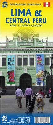
Stadsplattegrond Lima & Central Peru | ITMB
Peru is one of the most popular travel destinations in South America, and everyone going there arrives in Lima, which is a very large and complicated city. In this edition, we have updated all the information for the city, covering the portion between the ocean and the historic centre and southerly to the Miraflores district. Lima is not blessed with a good rapid transit system, but we show the two lines and the busway, embassies, hotels, shopping areas, historic sites etc. the new part of the map is a detailed travel map of the central portion of Peru on the other side. This side would be particularly useful for those visitors planning to travel from Lima to Cuzco, or Pisco, or north to Cajamarca., or even into the upper reaches of the Amazon. It has excellent road information, and hundreds of touristic points of interest are noted on the map. This map is printed double-sided, on paper. Legend Includes: Roads by classification, parks, sanctuaries, native tribes, churches, ruins, spri…
14,95
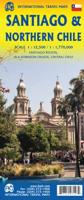
Stadsplattegrond Jakarta en omgeving | ITMB
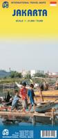
Kaart van het centrum op gedetailleerde schaal en een kaart op de achterzijde van de regio en voorsteden op een schaal van 75.000. Indonesia is emerging quickly as one of the power-houses of Asia. Jakarta is a huge urban area, with a charming city centre. This double-sided map shows Greater Jakarta on one side, with its expressways and inter-urban train network and is, in my opinion very useful to business visitors to the city. It includes the airport, the city centre, the enormous soccer stadium (worth a visit), and the roads connecting the different neighbourhoods of this spread-out city. The other side concentrates on the central core of Jakarta, which is where most visitors would spend most time. Road and rail connections are clearly shown, as well as a good range of embassies, museums, hotels, gas stations, religious buildings, hospitals, and touristic attractions. Asian cities tend not to be well-mapped; the last map of the city that I recall was done about ten years ago, so thi…
14,95
Stadsplattegrond Shanghai & China zuidoost | ITMB
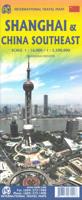
Goede stadsplattegrond van Shanghai. Met register en suburban treinsysteem. De echte buitenwijken van deze megastad staan er niet op. daarnaast een overzichtskaart van zuidoost China. This updated map of rapidly-changing Shanghai has been enhanced in this edition by being printed on ITM waterproof plastic paper and by the addition of a separate map on the reverse side of all of South East China. The regional map covers from Nanning to Beijing, so perhaps covers a wider area than just Fujian and Guangdong provinces, but this is a much more detailed map than anything we have attempted before, and is an excellent aid to anyone based in Shanghai and thinking of travelling to Xi’an, or Guilin, as well as closer destinations. The Shanghai side has been updated with the latest road and subway additions including, for the first time on any map, the route of the new MAGLEV line being built through the southern part of the city. Double-sided, on ITM plastic, Legend Includes: Roads/highways, pub…
14,95
Stadsplattegrond Beijing en de Chinese Muur - Great Wall | ITMB
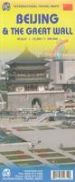
Duidelijke stadskaart van Beijing en op de achterzijde een overzicht van de delen van de Chinese Muur. Beijing is on the must-see list for any visitor to China. This updated edition includes new information post-2008 Olympics, such as the new subway line (No. 4) that has just been opened, plus new information about further extensions and lines being developed. The other side of the map is just as interesting. It covers the portion of the Great Wall of China that all visitors see, near Badaling, and also shows those sections that have disappeared over time, or have fallen into disrepair. As well, the famous Ming tombs of former emperors is also shown, as well as the Marco Polo bridge on the western edge of Beijing, so-named in honour of the famous trader/explorer who set out from this point on his return trip to Europe. This time, we have printed our Beijing/great Wall map in durable ITM plastic; printed double-sided Legend Includes: Roads by classifications, public transport lines, mu…
14,95
Stadsplattegrond Vancouver & Greater Vancouver | ITMB
Stadsplattegrond van Vancouver met een extra inzet op kleinere schaal van het centrum. Met register. Waterproof! ITMB first published our own map of Vancouver six editions and twenty years ago. Each time we update, we're surprised at how much change has taken place. This is a double-sided map, with the city on one side and the metropolitan area on the other side. Like many North American cities, Vancouver consists of several separate urban areas that have merged together physically but not politically. Greater Vancouver's population is 2,500,000, most of which consists of residential areas. The 'regional' side is where the growth in population is taking place (about 100,000 people move to Vancouver each year) and this is where noticeable developments are taking place - the new South Perimeter Road following the Fraser River eastwards, the new Port Mann toll bridge, the new toll Golden Ears toll bridge across the Fraser. None of this will make sense to non-locals, but since most of our…
14,95
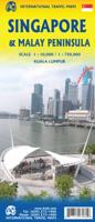
Stadsplattegrond Singapore & Malay Peninsula | ITMB
Goede stadsplattegrond van Singapore. Met register en suburban treinsysteem. De echt verre buitenwijken van deze megastad staan er niet op. Aan de achterzijde een overzichtskaart van het vasteland van Maleisië met een schaal van 730.000 Singapore is Asia as it should be: clean, modern, well-governed, efficient, and attractive.  In this edition, which technically should be a first edition due to the transformation of the map into a double-sided one, includes for the first time, our detailed map of the part of Malaysia known as the Malay Peninsula, the ‘mainland’ portion of the country. Singapore and Malaysia are joined together by two motorway crossings and a train operated by Malaysian Railways. Side one of our map concentrates on the urbanized portion of Singapore and its attractions, with a large and detailed inset map of the country of Singapore. Side two covers all of the mainland portion of Malaysia to the Thai border and includes a large inset map of Kuala Lumpur. Motorways are …
14,95
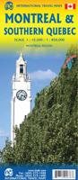
Wegenkaart - landkaart - Stadsplattegrond Montreal & Southern Quebec | ITMB
Stadsplattegrond van Montreal met register. Op de achterzijde een kaart van het zuiden van Quebec. 1:12,500/1:850,000 on waterproof paper. In this third, updated, edition of Canada's third largest city, we have added a user-friendly bonus. As is common now to most of our city maps, we have included a regional map of the hinterland of the urban area, so buyers won't have to purchase a second map to explore the environs of the city being presented. In the case of Montreal, being in a huge geographic country, this means Southern Quebec which, because of its size, dictates a map of more than one to a million scale. In the European context this would be the equivalent of Paris and all of France as a 'regional' map of the surrounds of Paris - but that's France and this is Canada.   Montreal (or Mont Royale in its original) was a village called Hochelaga when the early French explorers arrived in the early 1600s. They established a trading fort and, generally speaking, maintained good relati…
14,95
Stadsplattegrond Rio de Janeiro & Brasil East Coast | ITMB
Stadsplattegrond met register en landkaart Brazil East Coast. This new edition not only updates and adds more information about Rio but includes for the first time a major improvement for visitors. Anyone coming to Rio probably also wants to see the surrounding countryside, but not necessarily all of Brasil, so we have created a detailed map of the coastal area of Brasil, from Porto Alegre in the south to Fortaleza in the north, and extending inland to include Sao Paulo, Brasilia, and Belo Horizonte. Legend Includes: Railway stations, Pedestrian routes, Parks, Museums, Points of interest, Tourist information, Shopping centres, Bus terminals, Stadiums, and more.
14,95
Stadsplattegrond Northern Morocco - Marokko & Marrakesh - Marrakech | ITMB
Een degelijke kaart met aanduidingen van o.a. nationale parken, vliegveld, benzinepomp, dirt-roads. The fabled city of Marrakesh (also can be spelled Marrakech), with its enormous Medina (old town) and its souks and mosques, is one of the most visited cities in Africa. This map is double-sided, with a very large-scale and detailed map of the city occupying one side, showing both the older Medina and the newer ‘French quarter’. Hotels, markets, squares, souks, palaces, and mosques are well-portrayed. The other side covers the northern half of Morocco and will assist drivers and those exploring Morocco as part of a tour. Insets of Rabat/Sale and Tangier are included. Printed on ITM plastic paper; Legend Includes: International and provincial borders, roads by classification, road distances, parks, lakes, rivers, contours, airports, hotels, car and scooter rental, places of interest, historic sites, and other information. Includes insets of: Casablanca, Rabat, Sale, Tangier and Medina
14,95

Klanten-reviews van Stadsplattegrond Lima & Central Peru | ITMB

Er zijn nog geen beoordelingen voor dit productBen jij de eerste die een review plaatst?

Meer over Stadsplattegrond Lima & Central Peru | ITMB

Productomschrijving

Peru is one of the most popular travel destinations in South America, and everyone going there arrives in Lima, which is a very large and complicated city. In this edition, we have updated all the information for the city, covering the portion between the ocean and the historic centre and southerly to the Miraflores district. Lima is not blessed with a good rapid transit system, but we show the two lines and the busway, embassies, hotels, shopping areas, historic sites etc. the new part of the map is a detailed travel map of the central portion of Peru on the other side. This side would be particularly useful for those visitors planning to travel from Lima to Cuzco, or Pisco, or north to Cajamarca., or even into the upper reaches of the Amazon. It has excellent road information, and hundreds of touristic points of interest are noted on the map. This map is printed double-sided, on paper.

Legend Includes:
Roads by classification, parks, sanctuaries, native tribes, churches, ruins, springs, museums, lodges, beaches, world heritage sites, Inca culture, tourist information, public transit, points of interest and other information.

Lima 1:13.000
Centraal Peru 1:1.500.000

Productinformatie

    Verken gerelateerde categorieën

    Webshop.nl maakt gebruik van cookies. Ga je verder op onze website, ga dan akkoord met het plaatsen van cookies en de verwerking van deze data door ons en vermelde partners.