webshop.nl
Categorieën
  Sluiten

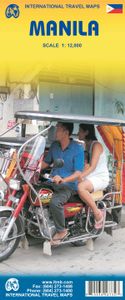
Stadsplattegrond Manila | ITMB

Goede overzichtelijke stadskaart van Manila en directe omgeving. Manila is the capital of the Philippines and a historic city, as well as a major economic and governmental centre. It is also a very big, sprawling city, like many in Asia, and difficult to map. We have prepared a double-sided map of the city, divided north/south, from Quezon City in ...
13,95

Webshops met dit product

Webshop
Bezorging
Prijs

Anderen bekeken ook

Stadsplattegrond - Wegenkaart - landkaart Quito & Ecuador Central | ITMB
Een degelijke wegenkaart van Ecuador met aanduidingen van o.a. nationale parken, vliegveld, benzinepomp, dirt-roads en kleine plattegrond van hoofdstad. Als overzichtskaart goed te gebruiken. Finally, ITMB releases its long-awaited re-worked map of the wonderful South America city of Quito. The city is squeezed in between mountain ranges and, the entire city stretches from north (on the right-hand side of the map) to the south. The "bottom" of the map is, actually the eastern portion. A regional inset map clarifies the situation. The street network is clearly shown, along with the rapid line bus way and the city's Metro. The Old Town is perhaps the most interesting portion of the city for visitors and is on the left-hand portion of the map. The newer downtown is centered on La Carolina Park on the right-hand side of the map. This is where most of the shopping malls and hotels are located. The old airport is shown in part on the far right, but the new international airport is located fa…
13,95
Wegenkaart - landkaart Mexico Central & Mexico City | ITMB
Goede wegenkaart met duidelijk kleurgebruik. Het betreft een deel van Mexico met op de achterkant een stadsplattegrond van het centrale deel van Mexico City. MC is the largest city in the Western Hemisphere, with a population of 28,000,000 (or twice as big as New York City!). It would be impractical to portray the entire urban area on one map and have it make sense, so we show the portion of greatest interest to visitors, from the Chapultepec Zoological Park in the west to the incredibly busy Tapo Bus Terminal in the east, and from the railway station in the north to the southern east-west motorway just south of the main hospital complex. Much of MC’s touristic interest is concentrated in the Zona Rosa, Reforma, and Zocalo segments of the city centre, and these are shown in detail, noting hotels, major restaurants, shopping areas, and points of interest.   The map also includes inset maps of the San Angel area just north of the university, an inset map of the greater Mexico City Federa…
13,95
Wegenkaart - landkaart - Stadsplattegrond Toronto & Southern Ontario - Ontario zuid | ITMB
Overzichtskaart van het zuiden van Ontario - schaal 1:600.000 - met op de andere kant een grote plattegrond van Toronto op schaal 1:12.000 Legend Includes: Roads by classification, Accomodations, Museum, Churches, Buildings, Points of tourist, Public Interests, Post Offices, Police Stations, Schools, Live Theatres, Cinemas, Ruins, Bus Terminals, Ferry Terminals, Service Areas, Hospitals, Ports, Mines, RCMP, Major Airports, Secondary Airports, Camp Grounds, National Park and Equivalent Reserves, Ski, Picnic Sites, and much more.   Toronto is the largest city in Canada by far. Touristically, its attraction rests with its central core, from High Park in the west to the Don River in the east, and from the park-like islands in Lake Ontario to Bloor Street in the north. In this area, one finds remnants of the oldest portion of ‘muddy York’, the original fort built to deter American raiders (close to the exhibition grounds), Campbell House (at Queen & University), and the first public school…
13,95
Stadsplattegrond Lima & Central Peru | ITMB
Peru is one of the most popular travel destinations in South America, and everyone going there arrives in Lima, which is a very large and complicated city. In this edition, we have updated all the information for the city, covering the portion between the ocean and the historic centre and southerly to the Miraflores district. Lima is not blessed with a good rapid transit system, but we show the two lines and the busway, embassies, hotels, shopping areas, historic sites etc. the new part of the map is a detailed travel map of the central portion of Peru on the other side. This side would be particularly useful for those visitors planning to travel from Lima to Cuzco, or Pisco, or north to Cajamarca., or even into the upper reaches of the Amazon. It has excellent road information, and hundreds of touristic points of interest are noted on the map. This map is printed double-sided, on paper. Legend Includes: Roads by classification, parks, sanctuaries, native tribes, churches, ruins, sprin…
13,95
Wegenkaart - landkaart Liechtenstein & Oostenrijk West | ITMB
Europe is dotted with mini-states that exist solely for historic reasons but are fiercely independent. Liechtenstein, surrounded by Switzerland on its west and south and Austria on its other borders, is such a state. It is larger and more diverse than many imagine and is quite a popular ski resort region. Side 1 is a detailed map of the principality, framed on the west by the Rhine River and a bit of Switzerland and on the east by Austria. Most development occurs in the Rhine Valley in a north-south direction, dominated by the capital city of Vaduz. There are five access points from Switzerland across the Rhine, one from the south, and two from Austria in the north. The ski haven of Malbun is prominently shown, and the scale of the map is detailed enough to name every major street. This also enabled us the opportunity to include schools, shopping areas, post offices, and churches, as well as a wide range of eating establishments. Walking/hiking trails have also been included. This is t…
14,95
Stadsplattegrond Vancouver & Greater Vancouver | ITMB
Stadsplattegrond van Vancouver met een extra inzet op kleinere schaal van het centrum. Met register. Waterproof! ITMB first published our own map of Vancouver six editions and twenty years ago. Each time we update, we're surprised at how much change has taken place. This is a double-sided map, with the city on one side and the metropolitan area on the other side. Like many North American cities, Vancouver consists of several separate urban areas that have merged together physically but not politically. Greater Vancouver's population is 2,500,000, most of which consists of residential areas. The 'regional' side is where the growth in population is taking place (about 100,000 people move to Vancouver each year) and this is where noticeable developments are taking place - the new South Perimeter Road following the Fraser River eastwards, the new Port Mann toll bridge, the new toll Golden Ears toll bridge across the Fraser. None of this will make sense to non-locals, but since most of our …
13,95
Wegenkaart - landkaart - Stadsplattegrond Poland east - Warsaw, Oost Polen en Warschau | ITMB
ITMB wegenkaarten en wandelkaarten kenmerken zich door het kleurgebruik waarbij zo de nadruk wordt gelegd op de natuurkundige aspecten van het land of de streek. Het soort landschap en de hoogte worden hierdoor zeer duidelijk zichtbaar. Natuurlijk vind je ook de 'gewone' zaken als wegennet, spoorwegen, vliegvelden, ferrys, toeristische bezienswaardigheden en nationale parken er op terug.. Vaak - maar niet op alle kaarten - staat op de achterzijde een stadsplattegrond van hoofdstad of belangrijkste stad in de regio.  Voorzijde: Oost Polen shcaal 1:650.000 Achterzijde: Warschau, schaal 1:9.000 This is, at the same time, our second edition updated map of Warsaw and a brand new title for ITMB, in that we have added a regional map of the eastern half of Poland to the second side of the map. This gives the end user two maps for the price of one by combining the many attractions of the city with its surrounding countryside. Anyone with a small amount of historical knowledge knows that Warsaw …
13,95
Wegenkaart - landkaart New Orleans - Mississippi River Basin | ITMB
New Orleans stadsplattegrond met schaal 1:15.000, bijzonder uitgebreid. ITMB is pleased to continue its detailed coverage of the USA with its first-ever map of the historic City of New Orleans. The urban area was settled by the French, and was the capital of the vast Louisiana Territory for many years. Napoleon, needing money to fight his many wars, sold the colony to the USA, in 1803, doubling the size of the new American nation overnight. The French Quarter, with buildings dating back 300 years, is the heart of the city and home to dozens of jazz emporiums. The British expulsion of the Acadians from what is now the Canadian provinces of Nova Scotia and New Brunswick, added a vibrant component to the city, creating the concept of the Cajuns. The oldest cathedral in the USA, St Louis, has dominated the city's skyline since 1794, opened just as the French Revolution was at its height. The city offers much more than just music, however, The Louisiana State Museum is where the agreement t…
13,95
Stadsplattegrond Munchen - Munich | Borch
Borch München is een duidelijke, geplastificeerde plattegrond van het centrum met informatie over openbaar vervoer en bezienswaardigheden. Inclusief straatnamenregister. Our soft-laminated map of Munich shows: Munich City Centre 1:11 000, Munich 1:22 000, Greater Munich 1:130 000, Munich Exhibition Centre 1:22 000, Allianz Arena 1:22 000, Alpine Foreland 1: 850 000, Public Transport Munich, 30 top sights, Germany administrative & time zones, interesting statistics, conversion chart for temperatures, weights and measures, climate chart with temperatures, sunshine hours, precipitation and humidity.   The Hofbräuhaus and the annual Oktoberfest are only two of many reasons to visit Munich, a charming city in the south of the German state of Bavaria, which is still best known for its many breweries and tasty beer. But beautiful palaces in and around the city, fascinating museums, churches, great cafés, theaters, opera houses, the zoo, charming parks, classical squares, and the stunning alpi…
10,25
Stadsplattegrond Letland - Latvia & Riga | ITMB
Een degelijke kaart met aanduidingen van o.a. nationale parken, vliegveld, benzinepomp, dirt-roads en plattegrond van hoofdstad. Als overzichtskaart goed te gebruiken. This is a brand new mapping area for ITMB. We have had a map of Riga for years, but not the country of Latvia, which now graces one side of the sheet while Riga occupies the other. The country is larger than one might think, touristically friendly, historically significant, and strategically important. Wedged between Estonia on the north and Lithuania on the south, Latvia tends to be a fast north-south route through the Baltic States, but its strength lies in being an east-west country with a very long coastline. Riga itself is a very interesting city, and our map shows it to perfection. This map would be very useful for anyone going to the Baltic Sea countries and firs very well with our companion map of Estonia/Talinn
13,95

Klanten-reviews van Stadsplattegrond Manila | ITMB

Er zijn nog geen beoordelingen voor dit productBen jij de eerste die een review plaatst?

Meer over Stadsplattegrond Manila | ITMB

Productomschrijving

Goede overzichtelijke stadskaart van Manila en directe omgeving. Manila is the capital of the Philippines and a historic city, as well as a major economic and governmental centre. It is also a very big, sprawling city, like many in Asia, and difficult to map. We have prepared a double-sided map of the city, divided north/south, from Quezon City in the north to the new Alaya shopping centre and the world trading centre in the south. The heart of Manila is the area just north of the Pasig River, with its bustling streets and many shops. The hotel region is south of the river, close to the ocean, and we have done our best to show the hotels well, but there are too many to show all of them. This is an excellent map of a major Asian city; one that has never been mapped to this extent for travel previously. Legend Includes: Roads by classification, domestic airports, public transport lines, ferries, prominent buildings, parks, police stations, hospitals, banks, cinemas, hotels, temples, museums, shopping centres, post offices, sports centres, bus terminals and other information.  
Webshop.nl maakt gebruik van cookies. Ga je verder op onze website, ga dan akkoord met het plaatsen van cookies en de verwerking van deze data door ons en vermelde partners.