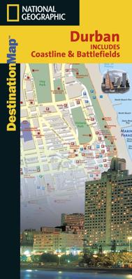
Stadsplattegrond Durban Coastline & Battlefields | National Geographic

0
Handige geplastificeerde stadsplattegrond van Durban. In addition to the easy-to-read map on the front, the back includes: Regional map Points of interest Information and map of the North Coast Information and map of the South Coast - Airport diagram Major roads route map Information and map of KwaZulu-Natal Battlefields Multi-language...

Verkopers met dit product

Verkoper
Bezorging
Prijs
DeZwerver.nl logo
DeZwerver.nl
2,95
8,95

Anderen bekeken ook

Reisgids 1e Wereldoorlog - World War I Battlefields | Bradt Travel Guides
Thoroughly updated for this new 3rd edition, Bradt's World War I Battlefields remains the only compact practical travel guide to cover both French and Belgian battlefield sites involved in one of the deadliest conflicts in human history, which changed the face of foreign policy and European geography forever. The 2014-18 centenary of the First World War was a huge catalyst for battlefield tourism, leading to a proliferation of innovative new museums, memorials, commemorative trails, statues and more - which are comprehensively covered in this update. Co-authored by two award-winning travel writers, this lightweight and pocket-friendly guidebook is perfect for visitors. It covers all the main sites, memorials and museums of the entire Western Front alongside practical information such as travelling there and getting around, and how to book the best guided tours.   In the Belgian section of the book, chapters cover Ypres and the Ypres Salient; Poperinge and Heuvelland; Diksmuide, Veurne…
13,95
Wegenkaart - landkaart 3019 Adventure Map Turkey Mediterranean Coast Turkije | National Geographic
Wegenkaart van de zuidelijke kust van Turkije met vermelding van veel bezienswaardigheden, nationale parken en attrakties. Watervast en scheurvast.   National Geographic's Turkey, Mediterranean Coast Adventure Map is designed to meet the unique needs of adventure travelers with its durability and accurate information. This folded map provides global travelers with the perfect combination of detail and perspective, highlighting hundreds of points of interest and the diverse and unique destinations within the country.   The front side of the Turkey Mediterranean Coast map details the southern coastal region of the country. This side shows the Mediterranean Sea to the south and Syria to the east. The coastline extends from Kas to Iskenderum. The reverse side of the map details Turkey’s western coastal region of the country and its border with Greece and Bulgaria. This side shows the western coast from the Sea of Marmara down to the Mediterranean Sea. The map includes the locations of cit…
17,50
Wegenkaart - landkaart Sierra Nevada | National Geographic
&; Waterproof &; Tear-Resistant &; Travel Map   National Geographic's Sierra Nevada Destination Map strikes the perfect balance between map and guidebook and is an ideal resource for touring the rugged landscape of this culturally and geographically unique region of California and Nevada.   The front side of the print map reveals a detailed map of the region stretching from the Oregon border to California's Eldorado National Forest, bordered by the Sacramento Valley to the west and Nevada's Great Basin to the east. Modoc, Shasta-Trinity, Lassen, Plumas, and Humbolt-Toiyabe National Forests are also included on the map. The map features a comprehensive road network including scenic byways as well as areas of interest such as Indian Reservations, National Parks and Monuments, and Recreation Areas. Trails, historic sites, museums, cultural centers, scenic areas, state parks and other points of interest are also included. In addition, the map features beautiful photographs and inform…
17,50
Wandelkaart 901 Banff North National Park | National Geographic
Prachtige geplastificeerde kaart van het bekende nationaal park. Met alle recreatieve voorzieningen als campsites, maar ook met topografische details en wandelroutes ed. Door uitgekiend kleurgebruik zeer prettig in gebruik. Scheur en watervast! The front side of the Banff North map details the south side of the national park, from Siffleur Wilderness Area to the north, to Kootenay National Park to the south. This side also covers survival tips, area trails, entry fees and details both Kootenay and Yoho Nationals Parks. The reverse side of the map details the north side of the park, extending from Siffleur Wilderness area to the south, to White Goat Wilderness to the North. Insets show safe travel in Bear Country, and all the recreation the park has to offer with backpacking, camping, biking, hiking and horseback riding.  National Geographic's Trails Illustrated map of Banff North is a two-sided, waterproof map designed to meet the needs of outdoor enthusiasts with unmatched durability…
17,95
Wegenkaart - landkaart State Guide Map Washington | National Geographic
The front side features insets of Olympia, Yakima and Spokane. The back includes a map and information for Seattle, information for Olympic, North Cascades, and Mt. Rainier National Parks, points of interest, scenic drives, and Park Service sites in Washington. National Geographic Guide Maps combine the most reliable road maps available with detailed travel guide information. One side features a detailed state highway map, enhanced with terrain detail and major city insets. The flip side presents tourist, historic, and recreation information, along with color photos, maps, and illustrations. All this folds into a convenient, durable, laminated map perfect for either vacation or business travel.
12,95
Wandelkaart - Topografische kaart 147 Uncompahgre Plateau North | National Geographic
Prachtige geplastificeerde kaart van het bekende nationaal park. Met alle recreatieve voorzieningen als campsites, maar ook met topografische details en wandelroutes ed. Door uitgekiend kleurgebruik zeer prettig in gebruik. Scheur en watervast! National Geographic's Trails Illustrated map of Uncompahgre Plateau North is a two-sided, waterproof map designed to meet the needs of outdoor enthusiasts with unmatched durability and detail. This map was created in conjunction with local land management agencies and is loaded with valuable recreation information.   The front side of the map details the northeastern section of Uncompahgre National Forest and the Roubideau Area, the eastern portions of Dominguez Escalante National Conservation Area and Dominguez Canyons Wilderness, and the city of Delta. On the reverse side of the map, the northwestern section of Uncompahgre National Forest is featured as well as the Tabeguache Area, Grand Mesa National Forest, and the western portions of Domin…
17,95
Wandelkaart - Topografische kaart 146 Uncompahgre Plateau South | National Geographic
Prachtige geplastificeerde kaart van het bekende nationaal park. Met alle recreatieve voorzieningen als campsites, maar ook met topografische details en wandelroutes ed. Door uitgekiend kleurgebruik zeer prettig in gebruik. Scheur en watervast!   National Geographic's Trails Illustrated map of Uncompahgre Plateau South is a two-sided, waterproof map designed to meet the needs of outdoor enthusiasts with unmatched durability and detail. This map was created in conjunction with local land management agencies and is loaded with valuable recreation information.   The front side of the map details the southeastern portion of the Plateau and Uncompahgre National Forest, as well as Ridgway State Park. On the reverse side of the map, the southwestern portion of Uncompahgre National Forest, including the Naturita Division, is featured as well as the Tabeguache Area, Roubideau Special Management Area, Unaweep/Tabeguache Scenic and Historic Byway, and Dry Creek Basin and Dan Noble State Wildl…
17,95
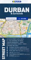
Stadsplattegrond Streetmap Durban | MapStudio
Duidelijke dubbelzijdige plattegrond van Durban en omliggende wijken met een uitgebreide index. Te vinden op de kaart zijn o.a. spoorlijnen + stations, hotels, campings, bezienswaardigheden en natuurreservaten. Detailed map of Durban at 1 : 25 000 scale; Kloof to Merewent; Durban CBD in detail; Indexed street & suburb names; index indicating new + old street names; main routes with route numbers, freeways & interchanges; schools; sports fields; hospitals / clinics & municipal clinics; shopping malls; police stations & fire departments; parks & Reserves; industrial areas; places of interest; historical monuments; provincial heritage sites; museums/art galleries; includes Moses Mabhida soccer stadium position.    
11,50
Natuurgids Adventure Set Denali National Park & Preserve | National Geographic
Handige combinatie van een uitstekende wegenkaart van National Geographic en de uitklapkaart van natuur van uitgever Waterford.   National Geographic: Zeer gedetailleerde kaart. Misschien wel de beste kaart! Gedrukt op scheur- en watervast papier. Waterford: Een bijzonder handige uitklapkaart met alle veelvoorkomende dieren. Duidelijke illustraties, goede korte omschrijving van soort en leefgebied, geplastificeerd. Denali National Park and Preserve Adventure Set consists of a Pocket Naturalist Guide and National Geographic Map, offering a perfect resource for travelers wanting "hands on" information on what to see and where to go to find some of the world's most dramatic natural attractions. Waterford's DENALI WILDLIFE is beautifully illustrated and highlights more than 100 familiar species of birds, mammals, and a lone amphibian (the only herp found there) and includes a regional map of the area. Laminated for durability, this handy guide is a great source of portable information and…
18,50

Klanten-reviews van Stadsplattegrond Durban Coastline & Battlefields | National Geographic

Er zijn nog geen beoordelingen voor dit productBen jij de eerste die een review plaatst?

Meer over Stadsplattegrond Durban Coastline & Battlefields | National Geographic

Productomschrijving

Handige geplastificeerde stadsplattegrond van Durban.

In addition to the easy-to-read map on the front, the back includes:

  • Regional map
  • Points of interest
  • Information and map of the North Coast
  • Information and map of the South Coast - Airport diagram
  • Major roads route map
  • Information and map of KwaZulu-Natal Battlefields
  • Multi-language legend.

Productinformatie

    Verken gerelateerde categorieën

    Webshop.nl maakt gebruik van cookies. Ga je verder op onze website, ga dan akkoord met het plaatsen van cookies en de verwerking van deze data door ons en vermelde partners.