webshop.nl

Spoorwegenkaart The British Isles by Train and Ferry | Cosmographics

0
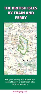
Plan your journey and explore the British Isles by train and ferry. This attractive, detailed map shows how the rail network, along with ferries to the more isolated areas, allows you to travel to places right across the British Isles and take in the beautiful scenery. The map clearly shows National Parks, Areas of Outstanding Natural Beauty, fore...

Webshops met dit product

Webshop
Bezorging
Prijs
DeZwerver.nl logo
DeZwerver.nl
niet bekend
19,50

Anderen bekeken ook

Wandelgids Epic British Walks | Ordnance Survey
This magnificent collection of truly EPIC WALKS brings together Britain’s most beautiful countryside with the long-distance trails that present the very best means of experiencing it.   An inspiring introduction to distance walking, discover thirty-eight amazing trails of immense diversity incorporating National Parks, Areas of Outstanding Natural Beauty, National Scenic Areas, Heritage Coastline, and UNESCO World Heritage Sites.   The perfect book for planning a walking adventure, hiking holiday or weekend ramble, discover insightful introductions to each route, suggested itineraries, the must-see highlights to take in along the way and, of course, the list of Ordnance Survey sheet maps for completing the walks.   Epic in so many ways…   Thirty-eight EPIC long-distance walks across England, Scotland, and Wales 5000 miles of inspirational walking in National parks, AONBs, UNESCO World Heritage Sites and more Stunning and inspiring photography revealing the character of each walk A…
27,95
Wandelkaart - Topografische kaart 161 OS Explorer Map London South (greenw.m) | Ordnance Survey
Follow the Thames Path through the heart of London’s oldest and most historic areas. Discover Westminster, a square mile densely packed with some of the world’s most famous attractions: Buckingham Palace, Westminster Abbey, Westminster Cathedral and the Palace of Westminster, home to the Houses of Parliament.    Visit the World Heritage Sites of Kew Gardens, Maritime Greenwich including the Royal Observatory and the Palace of Westminster & Abbey complex  Explore the suburbs of Croydon, Esher and Twickenham, home of English rugby and Horace Walpole’s miniature Gothic castle, Strawberry Hill  Walk or cycle the Thames Path National Trail or recreational paths including the London Loop and Vanguard Way  Met zijn 4cm voor 1 km (2 ½ cm voor 1 mijl) schaal, is de OS Explorer kaartenserie de ideale en meest gedetailleerde kaartenreeks voor mensen die graag outdoor-activiteiten zoals fietsen, wandelen, paardrijden, klimmen en watersporten. Deze kaart is nog gedetailleerder dan de 'gewone' L…
19,50
Wegenatlas Road Atlas Britain and Ireland 2024 | Philip's Maps
Let op! Ierland en een gedeelte van Schotland hebben een andere schaal dan de rest van de atlas.   PHILIP'S - Market leaders and No. 1 in the UK for clear maps'Good balance between detail and clarity with excellent town maps' What Car? * Super-clear mapping at a scale of 3 miles to 1 inch = 1:200,000* Includes the latest highway code requirements* Completely updated and revised for 2024* New map showing Smart Motorways- Practical spiral bound, lie-flat format- 160 pages of fully updated super-clear road maps - 10 pages of detailed route-planning maps - plan your route in advance - 88 indexed town-centre maps - 14 pages of city approach maps with named arterial roads - 2 page road map of Ireland- Map of scenic Britain and a map highlighting railways, airports and ferry ports Philip's 2024 Road Atlas Britain and Ireland is the top-of-the-range spiral road atlas featuring the latest maps from the Philip's digital database. Voted Britain's clearest and most detailed in an independent cons…
23,95
Wandelkaart - Topografische kaart 439 OS Explorer Map Coigach, Summer Isles | Ordnance Survey
Met zijn 4cm voor 1 km (2 ½ cm voor 1 mijl) schaal, is de OS Explorer kaartenserie de ideale en meest gedetailleerde kaartenreeks voor mensen die graag outdoor-activiteiten zoals fietsen, wandelen, paardrijden, klimmen en watersporten. Deze kaart is nog gedetailleerder dan de 'gewone' Landranger maps. Voor- en achterzijde bedrukt! Zeker op de moors en andere natuurgebieden van onschatbare waarden met echt alle aspecten van het landschap op de kaart ingetekend. Zeer goede detailkaart met topografische ondergrond. Hierop zijn toeristische symbolen van bezienswaardigheden ingetekend, daarnaast staan bijvoorbeeld campings en jeugdherbergen vermeld en - voor wandelaars het belangrijkst - alle right of way paden en Lange afstands Wandelpaden zijn er op te vinden. De ideale kaart voor het wandelen in Engeland, Wales of Schotland.   These highly detailed maps show all the administrative boundaries, settlements as small as isolated farms, the road network down to unfenced roads and country tra…
19,50
Wandelkaart - Topografische kaart 101 OS Explorer Map Isles of Scilly | Ordnance Survey
Met zijn 4cm voor 1 km (2 ½ cm voor 1 mijl) schaal, is de OS Explorer kaartenserie de ideale en meest gedetailleerde kaartenreeks voor mensen die graag outdoor-activiteiten zoals fietsen, wandelen, paardrijden, klimmen en watersporten. Deze kaart is nog gedetailleerder dan de 'gewone' Landranger maps. Voor- en achterzijde bedrukt! Zeker op de moors en andere natuurgebieden van onschatbare waarden met echt alle aspecten van het landschap op de kaart ingetekend. Zeer goede detailkaart met topografische ondergrond. Hierop zijn toeristische symbolen van bezienswaardigheden ingetekend, daarnaast staan bijvoorbeeld campings en jeugdherbergen vermeld en - voor wandelaars het belangrijkst - alle right of way paden en Lange afstands Wandelpaden zijn er op te vinden. De ideale kaart voor het wandelen in Engeland, Wales of Schotland. These highly detailed maps show all the administrative boundaries, settlements as small as isolated farms, the road network down to unfenced roads and country track…
19,50
Wandelkaart - Topografische kaart OL08 OS Explorer Map Chichester, South Harting & Selsey | Ordnance Survey
Explore the South Downs National Park, follow the South Downs Way up to the picturesque village of South Harting sheltered beneath Harting Down. Discover Chichester Harbour with its delightful fishing villages or range further afield to Selsey at the tip of the Manhood Peninsula.    Seek unspoiled coastlines and countryside on Hayling Island, where windsurfing was invented  Marvel at Chichester’s intact Roman walls and cathedral tower now home to a family of peregrine falcons  Walk or cycle the South Downs Way through gorgeous countryside past South Harting, or explore Chichester Harbour on the Sussex Border Path and Shipwrights Way    Met zijn 4cm voor 1 km (2 ½ cm voor 1 mijl) schaal, is de OS Explorer kaartenserie de ideale en meest gedetailleerde kaartenreeks voor mensen die graag outdoor-activiteiten zoals fietsen, wandelen, paardrijden, klimmen en watersporten. Deze kaart is nog gedetailleerder dan de 'gewone' Landranger maps. Voor- en achterzijde bedrukt! Zeker op de moors e…
19,50
Wandelkaart - Topografische kaart 149 OS Explorer Map Sittingbourne, Faversham | Ordnance Survey
Explore the serene Isle of Sheppey and follow the Saxon Shore Way to discover the towns of Sittingbourne and Faversham. Further inland, the Kent Downs – an Area of Outstanding Natural Beauty – are beckoning.  Sail, kayak, fly kites or just relax on the sandy and pebbled beaches of Sheppey, or go birdwatching at the Swale National Nature Reserve  Discover Faversham, home of Britain’s oldest brewer and nearby Oare Gunpowder Works Country Park, where gunpowder was manufactured for the battles of Trafalgar and Waterloo  Walk, ramble or cycle along the Saxon Shore Way through Faversham and Sittingbourne, or head inland to the North Downs Way, a National Trail Met zijn 4cm voor 1 km (2 ½ cm voor 1 mijl) schaal, is de OS Explorer kaartenserie de ideale en meest gedetailleerde kaartenreeks voor mensen die graag outdoor-activiteiten zoals fietsen, wandelen, paardrijden, klimmen en watersporten. Deze kaart is nog gedetailleerder dan de 'gewone' Landranger maps. Voor- en achterzijde bedrukt! …
19,50
Wandelkaart - Topografische kaart 150 OS Explorer Map Canterbury, Isle of Thanet | Ordnance Survey
Discover Canterbury, city of saints and kings, ancient heartland of England at the foot of the Kent Downs and the head of the River Stour Valley with its vineyards. Follow the river to the coast to discover unspoiled Deal, artistic Margate and picturesque Whitstable.  Starting in Canterbury, take the Stour Valley Walk to Sandwich and the long sweeping sand and shingle beach of Sandwich Bay  Walk the Long Rock from Whitstable to Herne Bay before taking the Thanet Coastal Path around the Isle of Thanet and its three famous Georgian and Victorian resorts of Margate, Ramsgate and Broadstairs   Take the National Trails of the England Coast Path and North Downs Way or choose from a lattice of other popular recreational paths  Met zijn 4cm voor 1 km (2 ½ cm voor 1 mijl) schaal, is de OS Explorer kaartenserie de ideale en meest gedetailleerde kaartenreeks voor mensen die graag outdoor-activiteiten zoals fietsen, wandelen, paardrijden, klimmen en watersporten. Deze kaart is nog gedetailleer…
19,50
Wandelkaart - Topografische kaart 162 OS Explorer Map Greenwich, Gravesend | Ordnance Survey
Consider yourself at home as you explore London's East End, a byword for cheeky Cockneys, gruesome murders and political activism. See the Thames in a new light in Greenwich, where you can stand on the Meridian Line at the Royal Observatory and climb aboard the Cutty Sark.    Explore the maritime town of Gravesend, visit a Cold War bunker  Uncover London's history as an Imperial trading hub at West India Docks, built in 1802  Walk and cycle along the London Loop through West Thurrock and Sidcup, and other recreational paths including the Thames Path National Trail through the heart of London Met zijn 4cm voor 1 km (2 ½ cm voor 1 mijl) schaal, is de OS Explorer kaartenserie de ideale en meest gedetailleerde kaartenreeks voor mensen die graag outdoor-activiteiten zoals fietsen, wandelen, paardrijden, klimmen en watersporten. Deze kaart is nog gedetailleerder dan de 'gewone' Landranger maps. Voor- en achterzijde bedrukt! Zeker op de moors en andere natuurgebieden van onschatbare waard…
19,50
Wandelkaart - Topografische kaart 124 OS Explorer Map Hastings & Bexhill | Ordnance Survey
Experience the history-rich countryside where the High Weald, an Area of Outstanding Natural Beauty, sweeps down to the shore where the fate of Britain was decided in 1066. Explore Battle and visit the actual spot where the Battle of Hastings took place, now a beautiful wildflower meadow dotted with the ruins of a grand abbey built in penance for the slaughter.  Visit the seaside towns of Hastings and Bexhill with their medieval Old Towns, Victorian and Edwardian seafronts and pavilions  Glimpse wild deer and boar roaming in the forests near Robertsbridge and Dartwell Reservoir in the High Weald  Walk or cycle in the footsteps of William the Conqueror on the 1066 Path, or start the Saxon Shore Way from Hastings to head north to Winchelsea  Met zijn 4cm voor 1 km (2 ½ cm voor 1 mijl) schaal, is de OS Explorer kaartenserie de ideale en meest gedetailleerde kaartenreeks voor mensen die graag outdoor-activiteiten zoals fietsen, wandelen, paardrijden, klimmen en watersporten. Deze kaart…
19,50

Klanten-reviews van Spoorwegenkaart The British Isles by Train and Ferry | Cosmographics

Er zijn nog geen beoordelingen voor dit productBen jij de eerste die een review plaatst?

Meer over Spoorwegenkaart The British Isles by Train and Ferry | Cosmographics

Productomschrijving

Plan your journey and explore the British Isles by train and ferry. This attractive, detailed map shows how the rail network, along with ferries to the more isolated areas, allows you to travel to places right across the British Isles and take in the beautiful scenery. The map clearly shows National Parks, Areas of Outstanding Natural Beauty, forest and woodland areas and the Heritage Coast in England and Wales, much of which is accessible by train and ferry. The rail network includes seasonal and heritage railways. There is also a more detailed map of the London National Park City, the world’s first National Park City. Designed to be fully inclusive and accessible for everyone, including those with colour vision deficiency (CVD).   Map includes:  
  • Passenger rail network with the majority of stations.
  • Seasonal and heritage railways
  • Ferry routes
  • National Parks
  • Areas of Outstanding Natural Beauty
  • Main forest and woodland areas
  • Heritage coast in England and Wales

Formaat:  74.5cm x 110cm

Verken gerelateerde categorieën

Webshop.nl maakt gebruik van cookies. Ga je verder op onze website, ga dan akkoord met het plaatsen van cookies en de verwerking van deze data door ons en vermelde partners.