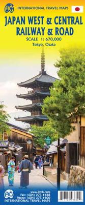

Spoorwegenkaart Japan West & Central | ITMB

0
Spoorwegen kaart van het west en midden van Japan. Schaal 1:670.000. Toont spoorlijnen, snelwegen, secundaire wegen en andere wegen, veerboten en belangrijke scheepvaartdiensten; bergen met de hoogte in meters. Met index van plaatsen; Afstanden in kilometers. Gedrukt op twee zijden. Japan is too large and densely populated a country to show effect...

Alle aanbiedingen van dit product

Verkoper
Bezorging
Prijs
DeZwerver.nl logo
DeZwerver.nl
niet bekend
2,95
14,95

Anderen bekeken ook

Spoorwegenkaart Japan West & Central | ITMB
Spoorwegen kaart van het west en midden van Japan. Schaal 1:670.000. Toont spoorlijnen, snelwegen, secundaire wegen en andere wegen, veerboten en belangrijke scheepvaartdiensten; bergen met de hoogte in meters. Met index van plaatsen; Afstanden in kilometers. Gedrukt op twee zijden. Japan is too large and densely populated a country to show effectively on one map while showing all the attractions and smaller towns of the country. With this map, we are attempting to concentrate on the way the vast majority of visitors travel around Japan - by rail. The road network is still shown in excellent detail, but the rail routes that connect Tokyo to Osaka, Kyoto, and Hiroshima, and to the northern coastal cities of Nigata and Kanazawa are the way most visitors to Japan explore the country. The map also includes an excellent inset map of central Tokyo on one side and another of Osaka on the other side The map extends from Fukoka in the west to Tokyo in the east and to Sendai in the north, and i…
14,95
Spoorwegenkaart Schotland - Scotland Central and South Rail and Road | ITMB
Een degelijke kaart met aanduidingen van o.a. spoorlijnen, nationale parken, vliegveld, benzinepomp, dirt-roads en kleine plattegrond van hoofdstad. Als overzichtskaart goed te gebruiken. This is another new ITMB title and extends our sectional coverage of the UK northwards from the southernmost border at Gretna Green through the densely-populated Glasgow/Edinburgh/Stirling conurbation to the highlands. The reason for this sectional map is to provide additional space to show 25% more detail than our map of all of Scotland can provide. The north of Scotland is my favourite part of the country, but there isn’t much there except heather and single-lane tracks across treeless moors. The South, like it or not, is where most of Scotland’s four million people live and where most of the castles, palaces, battlefields, parks, and touristic attractions are located. The map also shows the ferry routes to the outer islands of Arran and Mull, and the most poignant battlefield I’ve ever visited, Cu…
14,95
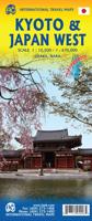
Wegenkaart - landkaart - Stadsplattegrond Kyoto & Japan West | ITMB
Dubbelzijdige kaart met aan de ene kant een plattegrond, 1 op 12.500, van Kyoto. Aan de andere kant een degelijke kaart met aanduidingen van o.a. nationale parken, vliegveld, benzinepomp en bezienswaardigheden van West Japan. Als overzichtskaart goed te gebruiken.   We are very pleased to see another updated edition of this very popular part of Japan coming out. Kyoto itself is rich in cultural heritage and has an excellent transit system for getting around. Regardless, one really needs a good map to find the temples and shrines. The map also includes an excellent inset map of Nara, a smaller city with an even greater concentration of temples and historic buildings. It is, however, the other side of the map, covering the western part of Japan that is the real value of this map. Stretching from Nagoya in the east past Kyoto and Osaka to Hiroshima and on to Fukuoka, this regional map is at an excellent scale to enable travellers to find their way around easily. All rail lines are includ…
14,95
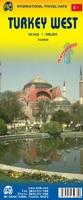
Wegenkaart - landkaart West Turkije - Turkey west | ITMB
Turkey is a big country. Most visitors concentrate on Istanbul and the Izmir Coast, which is a shame as there are so many other interesting parts of the country to visit. This map covers the western third of the country as a double-sided map, covering from the Greek/Bulgarian border south to the Mediterranean and east to Eregli and Antalya in the east. Naturally, at a better scale, roads and road conditions can be shown to better advantage, and the ferry routes from Istanbul make more sense. The topography is now showing as contouring more easily, and we have been able to add the next layer of villages. The scale is still not appropriate for showing minor roads and tracks, but we have included as many as we feel we can. The map is printed on durable plastic paper, so will stand up to the rigours of travel quite well. A basin inset map of Istanbul has been included as well.   Legend Includes: Road by classification, Motorways, Multilane Hwy, Main Roads, Rail Ways, Ferry Routes, Nationa…
14,95
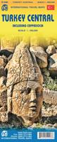
Wegenkaart - landkaart Turkije - Turkey Central including Cappadocia | ITMB
Covering the central portions of Turkey and especially the popular Cappadocia region. Turkey itself is a fascinating country. This map covers the portion from the Mediterranean coast all the way to Syria and north to the Black Sea port of Samsun. This part of Turkey is somewat less sophisticated than the western coastal cities and Istanbul, but it evokes memories of the many e,pires that have traversed the region. Cappadochia was created centuries ago by local people fearing the hordes of invaders that periodically appeared on the horizon and secreted themselves in soft stone caves carved in an inhospitable part of the country. Today, this is one of Turkey's touristic attractions, but the map is much more than that, this is detailed road map to explore an exciting part of the world.
14,95
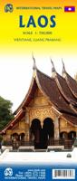
Wegenkaart - landkaart Laos | ITMB
Een degelijke kaart van Laos met aanduidingen van o.a. nationale parken, vliegveld, benzinepomp, dirt-roads en kleine plattegronden van Vientiane, Luang Prabang we're very pleased to introduce you to this new, double-sided, map at a great scale, with fantastic detail. To me, the north side is the most interesting, covering the portion of Laos from Vientiane, the capital, to the Chinese border. Detailed inset maps of Vientiane and Louang Prabang, the temple city, are included on this side, as are bits of both Thailand and Vietnam. The south portion fills the other side of the sheet, including a goodly portion of Vietnam, showing all border crossings. Much of Thailand has had to be obscured, unfortunately, to make room for the place names index, but the immediate border areas are shown, including the rail line south from Vientiane. In an interesting departure from previous ITMB maps, the back cover consists of a detailed inset map of Vientiane at 1:16,000 scale, making it easy to use in…
14,95
Wegenkaart - landkaart New England and New York State | ITMB
Goede dubbelzijdige wegenkaart waarbij met kleurgebruik de hoogte en natuurkundige aspecten wat duidelijker wordt weergegeven dan op andere kaarten. De wegen worden aangeduid met de bekende wegnummers en afstanden tussen steden staan weergegeven. Met symbolen worden toeristisch belangrijke aspecten getoond en ook bijvoorbeeld campings. Nationale parken zijn goed terug te vinden op deze kaart.  ITMB expands its coverage of the USA with a detailed map of New York State and New England on a double-sided map at a very detailed scale. The one side covers most of the state and the southern portion of the New England states, along with an inset map of the greater NYC area, the other side covers from Boston and Cape cod to the northern extremes of Maine and west into Vermont, with inset maps of Boston and Boston Region. The reality of mapping the USA is that it is too large a country and too populous to be mapped in detail except by regions. As a sophisticated economy, it has thousands of tow…
14,95
Wegenkaart - landkaart - Stadsplattegrond China South - Zuid | ITMB
Een degelijke wegenkaart met aanduidingen van o.a. nationale parken, vliegveld, benzinepomp, dirt-roads. Als overzichtskaart goed te gebruiken.   China is a very large country. While our map of the entire country is fine for general travel and sells well, China is too large to show areas in detail. This map concentrates on the part of China from Shanghai south and all the way west to Lhasa and includes Taiwan and Hainan Island. We are not trying to make any sort of political comment here, but geographically, both Tibet and Taiwan fall within the area of coverage and are both included for this reason alone. The map also includes insets of Hong Kong, Guangzhou and Shanghai   Legend Includes: Roads by classification, Points of Interest, National Parks, Airports, Golf Courses, Beaches, Campsites, Waterfalls, Viewpoints, Churches, Surfing/Scuba Diving Spots, Fishing Spots, Hospitals, harbours/Ports, Lighthouses, Museums, Monuments, Caves, Mosques, Mountain Peaks, Botanic Gardens, Wildlife …
14,95
Wegenkaart - landkaart Baja California - Mexico | ITMB
Een degelijke kaart met aanduidingen van o.a. nationale parken, vliegveld, benzinepomp, dirt-roads. Als overzichtskaart goed te gebruiken. The long peninsula on the north-western edge of Mexico (the ‘lost’ province of Alta California being the temporary possession of that country to the north) is a favourite travel destination for visitors from all over the world, whether they be day-trippers crossing into Tijuana, RVers headed for the Gulf, 4x4ers wanting to explore the dreaded Viscaino Desert, or intrepid explorers wanting to experience a part of Mexico that has always prided itself as being a little ‘different’. I remember the first time Kevin Healey and I visited the peninsula in 1988. He couldn’t handle the spicy food, and we had to beat a retreat to the north after three days, but he produced the definitive Baja map two months later. This digitized, double-sided map is based on his efforts, but has been updated several times since his death, and Lan and I love going to Baja to r…
14,95
Wegenkaart - landkaart Bangladesh & India oost | ITMB
Een degelijke kaart met aanduidingen van o.a. nationale parken, vliegveld, benzinepomp, dirt-roads en kleine plattegrond van hoofdstad. Als overzichtskaart goed te gebruiken. I like Bangladesh. Sure, the government is too corrupt and the country gets schmucked every time there's a hurricane, but the people are friendly and hard-working and gradually improving their country. As a travel destination, Bangladesh has to be considered as part of a trip to India for most people, so in addition to updating and modernizing our artwork, we have added a map of the easternmost portion of India, showing access routes and sites of interest in both countries. One of the great treats of Bangladesh is to take a ferry from Dhaka to Khulna, a two-day trip. The map also includes an inset of Dhaka, the capital, although we had to show only a few of the thousands of mosques in the city.    Legend Includes: Roads by classification, Airports, Ferrie routes, Bus stations, Car parks, State boudaries, border c…
14,95

Klanten-reviews van Spoorwegenkaart Japan West & Central | ITMB

Er zijn nog geen beoordelingen voor dit productBen jij de eerste die een review plaatst?

Meer over Spoorwegenkaart Japan West & Central | ITMB

Productomschrijving

Spoorwegen kaart van het west en midden van Japan. Schaal 1:670.000. Toont spoorlijnen, snelwegen, secundaire wegen en andere wegen, veerboten en belangrijke scheepvaartdiensten; bergen met de hoogte in meters. Met index van plaatsen; Afstanden in kilometers. Gedrukt op twee zijden.

Japan is too large and densely populated a country to show effectively on one map while showing all the attractions and smaller towns of the country. With this map, we are attempting to concentrate on the way the vast majority of visitors travel around Japan - by rail. The road network is still shown in excellent detail, but the rail routes that connect Tokyo to Osaka, Kyoto, and Hiroshima, and to the northern coastal cities of Nigata and Kanazawa are the way most visitors to Japan explore the country. The map also includes an excellent inset map of central Tokyo on one side and another of Osaka on the other side The map extends from Fukoka in the west to Tokyo in the east and to Sendai in the north, and includes many of the most popularly-visited cities of Japan, showing all the Shinkensen "bullet" train routes as well as the non-express regular lines. Japan has the most advanced rail network in the world, and this map captures its essence.    Legend Includes: Urban Area, Lake, River, Waterfall, National Parks, Heights in meter, Volcano, Tourist Site, Buddist Temple  


Productinformatie

    Verken gerelateerde categorieën

    Webshop.nl maakt gebruik van cookies. Ga je verder op onze website, ga dan akkoord met het plaatsen van cookies en de verwerking van deze data door ons en vermelde partners.