Spoorwegenkaart Railmap Europe - Treinkaart Europa | Kümmerly & Frey

0
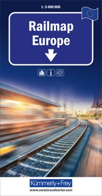
Duidelijke kaart van Europa waarop de verschillende spoorwegen staan ingetekend. Er wordt onderschied gemaakt in de soort treinen, al of niet electrisch, diesel of anders. De kaart is te grof om alle stations te vermelden, het is een ideale kaart om je treinreis te plannen.  Large physical map of Europe with political boundaries, showing the railw...

Verkopers met dit product

Verkoper
Bezorging
Prijs
DeZwerver.nl logo
DeZwerver.nl
2,95
14,95

Anderen bekeken ook

Wegenkaart - landkaart Sudan and South Sudan | Gizi Map
Sudan and South Sudan as separate countries on an excellent indexed map at 1:2,500,000 from Gizi Maps with detailed presentation of the topography, administrative divisions, street plans of Khartoum and Juba, etc. Excellent presentation of the terrain in the publisher’s characteristic style provides a vivid picture of the region’s geography: bold altitude colouring with plenty of spot heights and names of peaks, mountain ranges, etc, plus additional graphics for flood plains, swamps, salt flats, deserts, lava fields, wadis and water wells. National parks or other protected areas and interesting natural sites are highlighted. The map indicates the boundary of the disputed Abyei area and shows the internal administrative boundaries and names of the provinces. Within North Sudan names of larger towns and of the provinces are also given in Arabic. Where appropriate, alternative versions of town names are provided (Khartoum/Al Khartum, Omdurman/Umm Durman, etc). The map shows the road n…
15,95
Wegenkaart - landkaart Ethiopia Ethiopië - Eritrea | ITMB
Een degelijke kaart met aanduidingen van o.a. nationale parken, vliegveld, benzinepomp, dirt-roads en kleine plattegrond van hoofdstad. Als overzichtskaart goed te gebruiken. This is the latest updating of one of the most interesting countries in Africa. There isn’t anything brilliantly innovative to report. We have tidied up the different layers of the artwork, have updated the road system, and have added more tourist information. We have also modernized the cover design and changed the ISBN – printed on paper, single-sided, inset map of Addis Ababa. Legend Includes: roads by classification, Airports, Ports, Gasolines, Polices, Post Offices, Bus Stations, Hospitals, Schools, Universities, Buildings, Point of Interests, Bridges, Lodgings, Campsites or Huts, Museums, and many more   Double-sided map from ITMB presenting on one side a road map of Ethiopia at 1:2,000,000 accompanied by a street plan of Addis Ababa, with on the reverse Eritrea at 1:900,000 with a plan of Asmara. Both roa…
13,95
Wegenkaart - landkaart 742 Maroc - Marokko | Michelin
Kaart van beroemde kaartenmakers en voor Marokko weer een hele goede. Uitermate goed leesbaar, prettig kleurgebruik. Onder Marokko-gangers staat deze kaart zeer goed bekend. Zoals je van Michelin mag verwachten is deze kaart zeer overzichtelijk en heeft een duidelijk helder kaartbeeld. De kaart geeft uitgebreid toeristische informatie weer. Met register, afstanden en reistijden. Wegen worden naar verschillende klasse ingedeeld en - mooi van Michelin - de interessante mooie routes worden gemarkeerd met een groene streep.    Hindernissen voor automobilisten met caravans zijn gemarkeerd: steile hellingen, bergpassen of een anderzins moeilijke route. Bezienswaardigheden als een kasteel, religieus gebouw, ruine of grot is door een symbool goed te vinden.   Morocco at 1:1,000,000 on a road map from Michelin, with enlargements showing in greater detail four of the country’s most visited areas, including the High Atlas around Marrakesh and Jbel Toubkal, plus an additional map of the whole cou…
12,95
Fietskaart 01 Cycling guides Cornwall | Goldeneye
Our maps are double-sided, printed on an A2 sheet with a concertina fold. This allows for easy folding and folding, and an ease of access to the mapping. The material is rain and tear-resistant. Our early maps were designed at the scale of 2 miles to 1 inch/1:126,720. The later designs along with digitalisation are 1: 100,000. We were encouraged by the Cycle Touring Club to convert our cartography toward the cycle market (to replace the out-of-print Bartholomew series). As time and the series progressed we have added more data: The National Cycle Network routes, Regional Routes, and Traffic-Free Family Routes, as and when they are developed. These routes are in addition to the Circular Routes Goldeneye Commissioned at the outset of our publishing schedule. We are also adding to new editions; bike shops, cycle hire, and tea rooms, along with the tourist attractions already featured. Our plan is to make available digital versions for cell phones and tablets and to update, on an annual b…
15,95
Wandelkaart 9 Bern | Kümmerly & Frey
Zeer duidelijke wandelkaart van een deel van Zwitserland. Deze kaart - gemaakt op scheur en watervast papier - is bedoeld voor de gewone en gemiddelde bergwandelaar. Ook voor huttentochten is deze zeker geschikt. Slechts voor de gevorderde wandelaar die glesjers gaat overschrijden zijn de 25.000 topografische kaarten aan te raden. Op deze 1:60.000 kaarten staan de wandelroutes in 3 soorten weergegeven: Wanderweg, Bergweg en Alpine route. De routes staan goed ingetekend en werken prima naast de vele markingen in het veld. Hoogteverschillen, overnachtingsmogelijkheden, bus routes en gps-informatie ontbreken allemaal niet op deze landkaarten.   The maps have contours at 50m or 25m intervals according to the terrain, enhanced by graphic relief and shading. An overprint distinguishes between sign-posted hiking paths, mountain path where proper walking shoes are necessary, and alpine paths requiring special equipment.   Mountain huts are marked, plus various types of accommodation: campsite…
22,50
Wandelkaart 28 Oberengadin | Kümmerly & Frey
Zeer duidelijke wandelkaart van een deel van Zwitserland. Deze kaart - gemaakt op scheur en watervast papier - is bedoeld voor de gewone en gemiddelde bergwandelaar. Ook voor huttentochten is deze zeker geschikt. Slechts voor de gevorderde wandelaar die glesjers gaat overschrijden zijn de 25.000 topografische kaarten aan te raden. Op deze 1:60.000 kaarten staan de wandelroutes in 3 soorten weergegeven: Wanderweg, Bergweg en Alpine route. De routes staan goed ingetekend en werken prima naast de vele markingen in het veld. Hoogteverschillen, overnachtingsmogelijkheden, bus routes en gps-informatie ontbreken allemaal niet op deze landkaarten.   The maps have contours at 50m or 25m intervals according to the terrain, enhanced by graphic relief and shading. An overprint distinguishes between sign-posted hiking paths, mountain path where proper walking shoes are necessary, and alpine paths requiring special equipment.   Mountain huts are marked, plus various types of accommodation: campsite…
22,50
Wandelkaart 11 Vierwaldstättersee | Kümmerly & Frey
Zeer duidelijke wandelkaart van een deel van Zwitserland. Deze kaart - gemaakt op scheur en watervast papier - is bedoeld voor de gewone en gemiddelde bergwandelaar. Ook voor huttentochten is deze zeker geschikt. Slechts voor de gevorderde wandelaar die gletsjers gaat overschrijden zijn de 25.000 topografische kaarten aan te raden. Op deze 1:60.000 kaarten staan de wandelroutes in 3 soorten weergegeven: Wanderweg, Bergweg en Alpine route. De routes staan goed ingetekend en werken prima naast de vele markingen in het veld. Hoogteverschillen, overnachtingsmogelijkheden, bus routes en gps-informatie ontbreken allemaal niet op deze landkaarten.   The maps have contours at 50m or 25m intervals according to the terrain, enhanced by graphic relief and shading. An overprint distinguishes between sign-posted hiking paths, mountain path where proper walking shoes are necessary, and alpine paths requiring special equipment.   Mountain huts are marked, plus various types of accommodation: campsit…
22,50
Wandelkaart 20 Surselva | Kümmerly & Frey
Zeer duidelijke wandelkaart van een deel van Zwitserland. Deze kaart - gemaakt op scheur en watervast papier - is bedoeld voor de gewone en gemiddelde bergwandelaar. Ook voor huttentochten is deze zeker geschikt. Slechts voor de gevorderde wandelaar die glesjers gaat overschrijden zijn de 25.000 topografische kaarten aan te raden. Op deze 1:60.000 kaarten staan de wandelroutes in 3 soorten weergegeven: Wanderweg, Bergweg en Alpine route. De routes staan goed ingetekend en werken prima naast de vele markingen in het veld. Hoogteverschillen, overnachtingsmogelijkheden, bus routes en gps-informatie ontbreken allemaal niet op deze landkaarten.   The maps have contours at 50m or 25m intervals according to the terrain, enhanced by graphic relief and shading. An overprint distinguishes between sign-posted hiking paths, mountain path where proper walking shoes are necessary, and alpine paths requiring special equipment.   Mountain huts are marked, plus various types of accommodation: campsite…
22,50
Wandelkaart 14 Unterengadin | Kümmerly & Frey
Zeer duidelijke wandelkaart van een deel van Zwitserland. Deze kaart - gemaakt op scheur en watervast papier - is bedoeld voor de gewone en gemiddelde bergwandelaar. Ook voor huttentochten is deze zeker geschikt. Slechts voor de gevorderde wandelaar die glesjers gaat overschrijden zijn de 25.000 topografische kaarten aan te raden. Op deze 1:60.000 kaarten staan de wandelroutes in 3 soorten weergegeven: Wanderweg, Bergweg en Alpine route. De routes staan goed ingetekend en werken prima naast de vele markingen in het veld. Hoogteverschillen, overnachtingsmogelijkheden, bus routes en gps-informatie ontbreken allemaal niet op deze landkaarten.   The maps have contours at 50m or 25m intervals according to the terrain, enhanced by graphic relief and shading. An overprint distinguishes between sign-posted hiking paths, mountain path where proper walking shoes are necessary, and alpine paths requiring special equipment.   Mountain huts are marked, plus various types of accommodation: campsite…
22,50
Wegenkaart - landkaart 715 Nederland 2025 | Michelin
Zoals je van Michelin mag verwachten is deze kaart zeer overzichtelijk en heeft een duidelijk helder kaartbeeld. De kaart geeft uitgebreid toeristische informatie weer. Met stadsplattegrond van de hoofdstad.   Netherlands at 1:400,000 from Michelin, with information on driving regulations, a distance and journey time table, plus enlargements showing in greater detail road access to Amsterdam, The Hague and Rotterdam with the Europoort and Hoek Van Holland.   Roads network includes local roads and is graded according to the number of lanes. Junctions show full or partial interchanges. Steep gradients (!), level crossings and restricted entry sections are marked; scenic routes are highlighted. Railway lines and ferry routes are included.   Relief shading is used to indicate the topography, with colouring for forested areas. National parks are also marked. Small symbols indicate various landmarks or places of interest including campsites and youth hostels, but the map is not primarily de…
11,95

Klanten-reviews van Spoorwegenkaart Railmap Europe - Treinkaart Europa | Kümmerly & Frey

Er zijn nog geen beoordelingen voor dit productBen jij de eerste die een review plaatst?

Meer over Spoorwegenkaart Railmap Europe - Treinkaart Europa | Kümmerly & Frey

Productomschrijving

Duidelijke kaart van Europa waarop de verschillende spoorwegen staan ingetekend. Er wordt onderschied gemaakt in de soort treinen, al of niet electrisch, diesel of anders. De kaart is te grof om alle stations te vermelden, het is een ideale kaart om je treinreis te plannen. 

Large physical map of Europe with political boundaries, showing the railway network graded into 18 different types of lines. The base map with very fine cartography clearly shows various mountain ranges. Coverage extends to beyond the Urals and the eastern side of the Caspian Sea, large part of the Middle East with most of Iraq and Iran, and the coast of North Africa, and includes railway lines in all these areas.   Country and geographical names are in English and cities in local languages with, where appropriate, English versions. In countries using other alphabets, larger cities are additionally given in Cyrillic, Greek, Arabic, etc.   The railway network distinguishes 18 different types of lines, from new high speed lines or upgraded high speed lines to narrow gauge electrified or non-electrified. Railway ferry lines, passenger or freight, are also marked.   Map legend is in English, German, French, Italian, Spanish and Russian. Also included is a panel with flags and details of area, population and the length of rail network for all European countries.

Productinformatie

    Verken gerelateerde categorieën

    Webshop.nl maakt gebruik van cookies. Ga je verder op onze website, ga dan akkoord met het plaatsen van cookies en de verwerking van deze data door ons en vermelde partners.