webshop.nl
Categorieën
  Sluiten

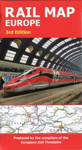
Spoorwegenkaart Rail Map Europe | European Rail Timetable Limited

The definitive rail map for today's independent traveller This is the 3rd edition of the map which includes the latest high speed routes and updates (as of December 2021) This map seeks to show all passenger rail routes in Europe (other than those of the suburban networks of major cities) and is the ideal companion to the European Rail Timetable. I...
19,95

Webshops met dit product

Webshop
Bezorging
Prijs

Anderen bekeken ook

Spoorwegenkaart Europe Western Railroad & Road | ITMB
Spoorwegen kaart van West Europa in kleur. Schaal 1:2,500,000. Toont spoorlijnen, snelwegen, secundaire wegen en andere wegen, veerboten en belangrijke scheepvaartdiensten; internationale grenzen, de grenzen van de gebieden met reisbeperkingen; bergen met de hoogte in meters. Met index van plaatsen. Schaal 1:2,500,000. . Gedrukt op twee zijden. This is a new title for ITMB. It focusses on the western half of the European land mass at a much better scale than would be possible for all of Europe. Even at this scale, showing the rail lines and the major roads results in a map with a lot of information on it, but it meets the needs of those travelling around Europe by rail, which is its primary market. It can also be used by those driving, although it would be better for vehicle users to rely on individual country maps. Side 1 covers the British Isles, the Low Countries, Germany, Denmark, the Czech Republic, most of Poland, and southern Scandinavia. The second side covers the Iberian Penin…
13,95
Spoorwegenkaart Japan West & Central | ITMB
Spoorwegen kaart van het west en midden van Japan. Schaal 1:670.000. Toont spoorlijnen, snelwegen, secundaire wegen en andere wegen, veerboten en belangrijke scheepvaartdiensten; bergen met de hoogte in meters. Met index van plaatsen; Afstanden in kilometers. Gedrukt op twee zijden. Japan is too large and densely populated a country to show effectively on one map while showing all the attractions and smaller towns of the country. With this map, we are attempting to concentrate on the way the vast majority of visitors travel around Japan - by rail. The road network is still shown in excellent detail, but the rail routes that connect Tokyo to Osaka, Kyoto, and Hiroshima, and to the northern coastal cities of Nigata and Kanazawa are the way most visitors to Japan explore the country. The map also includes an excellent inset map of central Tokyo on one side and another of Osaka on the other side The map extends from Fukoka in the west to Tokyo in the east and to Sendai in the north, and in…
13,95
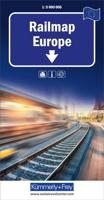
Spoorwegenkaart Railmap Europe - Treinkaart Europa | Kümmerly & Frey
Duidelijke kaart van Europa waarop de verschillende spoorwegen staan ingetekend. Er wordt onderschied gemaakt in de soort treinen, al of niet electrisch, diesel of anders. De kaart is te grof om alle stations te vermelden, het is een ideale kaart om je treinreis te plannen.  Large physical map of Europe with political boundaries, showing the railway network graded into 18 different types of lines. The base map with very fine cartography clearly shows various mountain ranges. Coverage extends to beyond the Urals and the eastern side of the Caspian Sea, large part of the Middle East with most of Iraq and Iran, and the coast of North Africa, and includes railway lines in all these areas.   Country and geographical names are in English and cities in local languages with, where appropriate, English versions. In countries using other alphabets, larger cities are additionally given in Cyrillic, Greek, Arabic, etc.   The railway network distinguishes 18 different types of lines, from new high …
14,95
Spoorwegenkaart Eastern Europe Railway & Road | ITMB
Spoorwegen kaart van Oost Europa in kleur. Schaal 1:2,600,000. Toont spoorlijnen, snelwegen, secundaire wegen en andere wegen, veerboten en belangrijke scheepvaartdiensten; internationale grenzen, de grenzen van de gebieden met reisbeperkingen; bergen met de hoogte in meters. Met index van plaatsen. Schaal 1:2,600,000. . Gedrukt op twee zijden. ITMB is pleased to announce the release of the final regional map covering Europe at an enhanced scale. Europe may be small in comparison to Canada, but it is densely populated and difficult to map as a continent while providing detail. Eastern Europe used to be defined as everything behind the Iron Curtain during the Cold War, but now it encompasses everything east of Germany and Switzerland, which means that this map covers Italy, Greece and the Balkan countries, the Central European countries of Romania and Hungary and most of Ukraine, Poland and the three Baltic states, and western Russia as far east as Volgograd, as well as much of Turkey. …
13,95
Wegenkaart - landkaart 3011 Adventure Map India | National Geographic
Wegenkaart van India met vermelding van veel bezienswaardigheden, nationale parken en attrakties. Watervast en scheurvast.   National Geographic's India Adventure Map is designed to meet the unique needs of adventure travelers with its durability and detailed, accurate information. The map includes the locations of thousands of cities and towns with a user-friendly index, as well as a clearly marked road network complete with distances and designations for highways, major routes and secondary roads.   The India Adventure Map differs from a traditional road map for it includes hundreds of points of interest that highlight diverse and unique destinations in the region. The map features UNESCO World Heritage sites, national parks, archaeological sites, nature reserves, Hindu and Buddhist temples, and other points of interest, making it an invaluable resource to travelers hoping to experience all the history and culture India has to offer. Additional travel aids include the location of air…
17,50
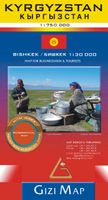
Wegenkaart - landkaart Kyrgyzstan - Kirgizië | Gizi Map
Met name door het kleurgebruik een mooie kaart: heel duidelijk wordt het landschap weergegeven. Daarnaast veel topografische details.   Kyrgyzstan at 1:750,000 from Gizi Map with excellent presentation of the country’s mountainous terrain through bold altitude colouring and plenty of names of mountain ranges, etc, road network indicating routes of the old Silk Road, plus a street plan of Bishkek and an administrative map of the country. All place names are in the Latin alphabet.   Topography is vividly shown by bold elevation colouring, with spot heights and graphics for swamps, salt flats and deserts, plus plenty of names of mountain ranges, peaks, valleys, etc. National parks are highlighted. The map shows internal provincial boundaries and also clearly indicates the country’s Uzbek and Tadjik enclaves. Road network includes selected local tracks and highlights routes which used to the part of the old Silk Road. Railway lines are included and local airports are marked. Symbols indica…
15,95
Spoorwegenkaart England Southeast & Midlands Rail/Road | ITMB
The shape of the UK makes it difficult to map logically. The term South East, within crowded England, is generally more restrictive than is appropriate for a map. Our definition of SE is from the English Channel north to the northern tip of East Anglia and west to Portsmouth/Reading/Peterborough. This occupies side one of the sheet. Side two consists of that complex portion of England generally called ‘The Midlands’ stretching from Cambridge/Peterborough west to the Welsh border and from Luton/Gloucester north to Manchester/Grimsby. London is, of course, prominent, but only as a main roads map. This is the most recent sectional map of the UK that ITMB has published, and was necessitated by the realization that, to see England properly, one needs a detailed enough map to show rail lines, motorways, A-type highways and B-type secondary roads, but also the tertiary level of road joining villages. The road network of England is incredibly complex and cannot be shown in proper detail withou…
13,95
Wegenkaart - landkaart Adventure Map Myanmar - Birma | National Geographic
Mooie, heldere kaart van Myanmar, gedrukt op scheurvast en watervast papier.   National Geographic's Myanmar (Burma) Adventure Map is designed to meet the needs of adventure travelers with its durability and detailed, accurate information. This map includes the locations of cities and towns with a user-friendly index, a clearly marked road network complete with distances and designations for roads/highways, plus secondary routes for those seeking to explore off the beaten path. Adventure Maps differ from a traditional road map because of the specialty content they include. Each map contains hundreds of diverse and unique recreational, ecological, cultural, and historic destinations — outside of the major tourist hubs. National Geographic Adventure Maps are the perfect companion to a guidebook, yet far easier to pack!   Myanmar is a country with a varied landscape. From the highest peak, Hkakabo Razi, in the Hengduan Shan mountains on the border with China to the lowlands at the mouth o…
17,50
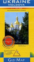
Wegenkaart - landkaart Ukraine - Moldova | Gizi Map
Kaart van Oekraïne met Moldavië, met een uitbreiding met de Krim in meer detail, plus plattegronden van het centrum van Kiev en Lviv. Wegennet is ingedeeld in zes typen, rij-afstanden aangegeven op hoofd-en secundaire routes, en verder worden grensovergangen weergegeven. Ukraine with Moldova on an indexed road map at 1:1,100,000 from Gizi Map, with an enlargement showing southern Crimea in greater detail, plus street plans of central Kiev and Lviv. All place names are shown transliterated into Latin alphabet, with those of major cities also given in their Cyrillic versions. Altitude colouring with relief shading indicates the mountainous regions, with the marshlands of northern Ukraine also marked. National parks and other protected areas are highlighted. Road network is graded into six types, driving distances are marked on main and secondary routes, and border crossings are shown. Railway lines, ferry routes on the Black Sea and Azov Sea, and local airports are included. Symbols high…
15,95
Wegenkaart - landkaart 3024 Adventure Map Cambodia - Cambodja | National Geographic
Mooie, heldere kaart van Cambodja,  gedrukt op scheurvast en watervast papier. National Geographic's Cambodia Adventure Map is designed to meet the needs of adventure travelers with its durability and detailed, accurate information. This map includes the locations of cities and towns with a user-friendly index, a clearly marked road network complete with distances and designations for roads/highways, plus secondary routes for those seeking to explore off the beaten path. Adventure Maps differ from a traditional road map because of the specialty content they include. Each map contains hundreds of diverse and unique recreational, ecological, cultural, and historic destinations — outside of the major tourist hubs. National Geographic Adventure Maps are the perfect companion to a guidebook, yet far easier to pack!   Cambodia is perhaps best know to international travelers as the home of the Angkor empire for six hundred years. Angkor Wat and Angkor Thom are part of the vast temple complex …
17,50

Klanten-reviews van Spoorwegenkaart Rail Map Europe | European Rail Timetable Limited

Er zijn nog geen beoordelingen voor dit productBen jij de eerste die een review plaatst?

Meer over Spoorwegenkaart Rail Map Europe | European Rail Timetable Limited

Productomschrijving

The definitive rail map for today's independent traveller This is the 3rd edition of the map which includes the latest high speed routes and updates (as of December 2021) This map seeks to show all passenger rail routes in Europe (other than those of the suburban networks of major cities) and is the ideal companion to the European Rail Timetable. Important Tourist Railways are also shown, many of which operate only during the tourist season. -Features every mainline railway route across Europe -Colour coding for all high-speed routes -Highlighting for scenic lines -Also includes some principal tourist and heritage lines (services on these lines may not run all year or on every day of the week)
Webshop.nl maakt gebruik van cookies. Ga je verder op onze website, ga dan akkoord met het plaatsen van cookies en de verwerking van deze data door ons en vermelde partners.