Meer Tu Delft Open

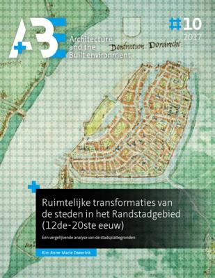
Ruimtelijke transformaties van de steden in het Randstadgebied (12de-20ste eeuw) (Paperback)

0
In this issue of A+BE (written in Dutch), the transformation of the form of nine cities in the Randstad between 1250 and 1940 in relation to changes in infrastructure is central, namely Utrecht, Dordrecht, Leiden, Haarlem, Delft, Gouda, Amsterdam, Rotterdam and The Hague. Within this time span, three periods of great spatial dynamics are identified...

Verkopers met dit product

Verkoper
Bezorging
Prijs

Anderen bekeken ook

Military Commanders of the Baltic States: Esronia, Latvia, Lithuania, 1918-1940 (Paperback)
The collapse of the Romanov dynasty that had ruled Russia for 300 years created a unique set of circumstances whereby the Baltic States of Estonia, Latvia and Lithuania, which had been part of the Russian Empire, were, in 1918, able to proclaim their independence. This independence was to last only twenty-two years, until 1940, when the Soviet Union occupied all three nations. This book is intended to honor and commemorate the 100th anniversary of the declarations of independence of the Baltic States of Estonia (February 24, 1918), Latvia (November 18, 1918), and Lithuania (February 16, 1918). It provides a brief history of how these nations gained and maintained their independence, and includes biographical information about the senior officers (generals and admirals) of the armed forces during the 1918-1940 period. Forewords to the Latvian and Lithuanian sections of the book were graciously provided by Lieutenant-General Leonīds Kalniņš, the current Commanding General of the Armed
24,95
Integrated Urban River Corridors (Paperback)
This PhD thesis focuses on Urban River Corridors (URCs) as spaces of social-ecological integration par excellence-that is, spaces where the interaction between the urban systems (carrying the 'social-') and the river system (carrying the '-ecological') is (potentially) the most intense. The general hypothesis is that with an integrated spatial understanding, planning and design of rivers and the urban fabric surrounding them, cities could become more resilient, not just to flood-related disturbances, but to general chronic stresses as well. Hence, the thesis addresses a number of spatial problems arising from the loss of synergy between the natural dynamics of rivers and the spatial configuration and composition of urban areas that they cross, namely: the relationship between fluvial geomorphology and urban morphology weakened by river-taming operations; the physical barrier caused by riverside vehicular traffic; the latent flood risk built up through resistance-based flood-protection
39,95
Dynamics in economic geography (Paperback)
Understanding spatial socio-economic inequalities Global transformations such as globalization and climate change influence the economic fate of people and places very differently. Also, places differ in terms of the opportunities they offer to firms and the people living there. As a result, there are important socio-economic inequalities across space. Economic Geography gives you the tools to understand such inequalities. The aim of this book is to provide students and other interested readers with an up-to-date introduction to economic geography, applied to the Netherlands and beyond. It provides an overview of what economic geography studies and summarizes and explains its main approaches. As such, the book is broad in scope and it serves as a starting point for more in-depth exploration. Ton van Rietbergen studied Social Geography of Developing Countries. After a short period at the Ministry of Foreign Affairs, he has worked as a lecturer-researcher at the Faculty of Geographical
33,95
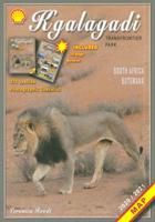
Wegenkaart - landkaart Kgalagadi - Tourist Map of Kgalagadi Transfrontier Park Botswana | Shell
Zeer bijzondere landkaart van het grensgebied van Botswana en Zuid Afrika. Uitermate handig zijn de GPS coordinaten van de meest belangrijke punten als campings of uitzichtpunten. De kaart is gebaseerd op een luchtfoto, waarbij alle details zijn ingetekend. The map: The map consists of a large map of the entire Park on the front of the map. On the back is enlargements of six maps - the South African side, Mabuasehube, Swart Pan area, Gemsbok Wilderness Trail, Mabuasehube Wilderness Trail and of the Kaa Kalahari Concession. Satellite images were used and the roads were tracked by GPS. There are 168 GPS coordinates on this map. Establishment of a Transfrontier Park: On the 7 th of April 1999 Botswana and South Africa signed a bilateral agreement in which they agreed to manage their adjacent national parks, Gemsbok National Park in Botswana and Kalahari Gemsbok National Park in South Africa, as a single ecological unit – the Kgalagadi Transfrontier Park. It is the first formally declared…
17,50
De Landschapsarchitectuur van het Polder-boezemsysteem (Paperback)
The Dutch lowlands is an artificial landscape, created as a result of the wish to regulate the water that dominated the topography in the Delta. This 'confined' lowland water, the polder-boezem system12, features an enormously diverse range of water structures and forms, which largely dictates the spatial planning of the lower Netherlands. This dissertation concerns the polder-boezem system, a water system that was created by trial-anderror, has been adapted continually and now needs to be expanded to cope with the effects of climate change. The research focuses on answering the following question: What potential does the current polder-boezem system have, with the help of landscape architectonic design, to define (or redefine) the spatial identity of the lowlands?
39,95
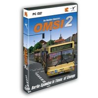
OMSI 2, The Omnibus Simulator
Experience a new omnibus simulator with OMSI 2 and start discovering Spandau . OMSI 2 is the successor of the well-known and awarded omnibus simulator "OMSI - The Bus Simulator". OMSI 2 not only offers the routes and buses available in the original OMSI, but adds lots of exciting new features. In OMSI 2 you can drive the first ever articulated bus in the OMSI history, the MAN NG272. Explore the new omnibus line 5 covering a total distance of 12 km from the subway station Ruhleben to the psychiatric clinic Spandau. Thanks to the newly added chronology function you are not only able to drive through Spandau in 1986, but also to relive the changes taking place in Spandau between 1986 and 1994.Enjoy the charm of the 80s and 90s and experience the period after the fall of the Berlin Wall - all at the wheel of a double-decker or articulated bus.New features in OMSI 2:- The articulated bus MAN NG272 with the exact physical and visual recreation of the joint kinematics as well as corresponding…
28,95
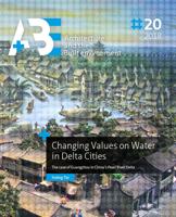
Changing Values on Water in Delta Cities (Paperback)
The thesis develops an empirically tested analytical framework which links value theory with planning and design practices to investigate context-specific spatial transformations as a result of individual and collective value judgements. Four key aspects of water values including flood safety, as well as economic, social and environmental values, are studied, and their interrelationships are discussed. Morphological analyses and value assessments are conducted to explore in what sense spatial changes can be considered an expression of the changing values and what we can learn from it to deal with complex spatial situations. The empirical studies are based on the long-term spatial development of Guangzhou as representative of a historical and rapidly growing delta city in China. Three development stages are illustrated to show different patterns of water-city interactions, the waterways city (before the 1920s) that was mainly structured by natural forces including natural waterways, the
29,95
Leonard Cohen - Live in London 3LP
Live In London (2009) contains some of the maestro's best work, 26 songs in all. Recorded at London's O2 Arena on July 17, 2008, Cohen mesmerized the 20.000 heads in the audience with big, yet subtle renditions of classics like "Who by Fire", "Suzanne", "The Future" and "Democracy"..SIDE A1. DANCE ME TO THE END OF LOVE2. THE FUTURE3. AIN'T NO CURE FOR LOVE4. BIRD ON THE WIRE SIDE B1. EVERYBODY KNOWS2. IN MY SECRET LIFE3. WHO BY FIRE4. HEY, THAT'S NO WAY TO SAY GOODBYESIDE C1. ANTHEM2. INTRODUCTION3. TOWER OF SONG4. SUZANNE5. THE GYPSY'S WIFE SIDE D1. BOOGIE STREET2. HALLELUJAH3. DEMOCRACY4. I'M YOUR MANSIDE E1. RECITATION W/N.L.2. TAKE THIS WALTZ3. SO LONG, MARIANNE4. FIRST WE TAKE MANHATTAN SIDE F1. SISTERS OF MERCY2. IF IT BE YOUR WILL3. CLOSING TIME4. I TRIED TO LEAVE YOU5. WHITHER THOU GOESTAfter a sabbatical period, resting in a Buddhist monastery, Leonard Cohen was prompted to tour again as in his absence his former manager embezzled his savings. If one expected Cohen not to amaz…
55,99
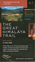
Wandelkaart The Great Himalaya Trail | GHT
  Prachtige kaartenserie van één van 'swerelds mooiste wandeltochten.   The Far West is one of the least explored areas of Nepal. Its area is bounded to the east by mighty, turquoise Karnali river which flows from Tibet’s sacred Mount Kailash.   Myth and superstition remain part of the fabric of life here. Though the Nepali language originated here, it seems a distant world from ‘modern’ Nepal. One Nepali visitor described his visit as “fascinating, like travelling back to the 18th century.”   Along the trails you may meet a turbaned Dhami, a shaman, with silver-bangled limbs and gold-ringed ears, who are still depended on for treating sickness.   Organised tourism has so far been limited to Khaptad National Park, the only national park in the mid-hills of Nepal and held dearly by conservationists. Gentle hills, pristine forests and abundant wildlife with a snow-covered backdrop of the Nampa, Api and Saipal peaks make for beautiful trekking.   It’s also a holy place associated with Kh…
26,95
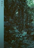
Jejudo (Paperback)
Jejudo (Paperback)
Jejudo, South Korea's largest island, is marked by the tragic April 3 Incident (1948-1949), a period of extreme violence when the Korean government forces massacred innocent civilians in a brutal suppression of a local uprising. This dark chapter in Jeju's history made a deep impression on Park Hyung-Geun (KR), who learned that many of today's tourist sites were once scenes of mass killings. His fascination with the landscape takes us from rugged natural scenes to abandoned buildings that serve as reminders of the island's often unacknowledged histories and its ongoing transformation. His photographs reveal spaces that were once populated, prompting the viewer to reflect on the countless people who vanished. With essays by Elisa Medde and Nayun Jang. Jejudo is co-published with Vostok Press, and part of Layers of Memories.
40,-

Klanten-reviews van Ruimtelijke transformaties van de steden in het Randstadgebied (12de-20ste eeuw) (Paperback)

Er zijn nog geen beoordelingen voor dit productBen jij de eerste die een review plaatst?

Meer over Ruimtelijke transformaties van de steden in het Randstadgebied (12de-20ste eeuw) (Paperback)

Productomschrijving

In this issue of A+BE (written in Dutch), the transformation of the form of nine cities in the Randstad between 1250 and 1940 in relation to changes in infrastructure is central, namely Utrecht, Dordrecht, Leiden, Haarlem, Delft, Gouda, Amsterdam, Rotterdam and The Hague. Within this time span, three periods of great spatial dynamics are identified, namely the period 1240-1450, 1580-1680 and 1870-1940. Comparing the city maps with each other, they made a development from uniformity to diversification to levelling between 1250 and 1940. Typical for the spatial development was that in the first period urban centres were created in which the various urban functions were concentrated. In the second period, specialization took place, in addition to strengthening the regional market function in the late medieval centres, functions were moved to the city edges. In the third period, the international goods transports continued to be moved out of the late medieval centres. In addition, the

Productspecificaties

Artikelnummer(s)
Brand
Tu Delft Open
Webshop.nl maakt gebruik van cookies. Ga je verder op onze website, ga dan akkoord met het plaatsen van cookies en de verwerking van deze data door ons en vermelde partners.