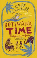
Reisverhaal Botswana Time | Will Randall

0
Vermakelijk boekje over de belevenissen van een engelse Leraar in een klein dorpje in Botswana. Will Randall travels with a purpose, as well as an outrageous sense of fortune. In Indian Summer he found himself, by chance, having the extraordinary experience of helping slum schoolchildren put on a play to help save their school. In Botswana he was ...

Verkopers met dit product

Verkoper
Bezorging
Prijs
DeZwerver.nl logo
DeZwerver.nl
2,95
13,50

Anderen bekeken ook

Reisverhaal Botswana Time | Will Randall
Vermakelijk boekje over de belevenissen van een engelse Leraar in een klein dorpje in Botswana. Will Randall travels with a purpose, as well as an outrageous sense of fortune. In Indian Summer he found himself, by chance, having the extraordinary experience of helping slum schoolchildren put on a play to help save their school. In Botswana he was taken up by a headmaster to teach a class of six year olds at The River of Life school. They are football crazy and one of Will's jobs is to take them to play neighbouring (sometimes as much as 100 miles away) schools. Camping en-route or staying in farms and rural villages, often travelling by foot or dug-out punts, thousands of antelope, elephant, buffalo and zebra follow their progress. The sound of lions, leopards and hyenas become the soundtrack of their dreams. Against all the odds they find themselves preparing for the Grand Final of the season - the titanic clash with arch rivals, Victoria Falls Primary school.Both an endearing person…
13,50
Accommodatiegids - Campergids - Campinggids Botswana Self-Drive Guide | Tracks4Africa
De Self Drive Guide Botswana van Tracks4Africa is een uitgebreide gids met alle informatie voor mensen die zelf met een eigen of gehuurde auto door Botswana willen reizen. De gids bevat informatie over parken en routes, over overnachtingsmogelijkheden en campings, maar ook over de veiligheid, de beste reistijd, de planning, de keuze van welk vervoermiddel en de hulpmiddelen die vereist zijn. Zo vindt u bijvoorbeeld ook informatie over het huren van een 4x4 met tent op het dak en campingspullen, over de techniek van de auto, over voorbereiding, over navigatie, communicatie en vereiste documenten. De gids ziet er aantrekkelijk en overzichtelijk uit en bevat veel kaarten met routes en ook kleurenfoto's. De gids is groot van formaat : A4 !   This guide is specifically aimed at self-drive travellers. If you are a self-drive tourist, there are five things that you need to know when you are on the road:  1. Where to sleep.  2. Where to get fuel.  3. What to see and do.  4. Where to buy suppl…
52,50
Reisverhaal De olifanten van Botswana | Ada Rosman
Met een vierwielaangedreven (4×4) auto door de parken van de Okavango Delta in Botswana. Ada en Jan Rosman reisden door het Moremi Game Reserve en Chobe National Park. De auteur en haar echtgenoot maakten een reis door het noorden van Botswana. Vanuit Windhoek reden ze over prima asfalt, waar ezels, geiten en koeien medeweggebruikers zijn naar Botswana. In Maun werden de tanks volgegooid, extra proviand en water, erg veel water ingeslagen. Eenmaal aangekomen in de Okavango Delta werd het asfalt ingeruild voor diepe zandwegen, maakten de ezels, koeien en geiten plaats voor overstekende olifanten, rondslenterende zebra’s, statige giraffen, koninklijke leeuwen en brutale apen. In dit deel van Afrika zijn de dieren de baas en heeft de reiziger zich aan te passen.   In de auto, voorzien van een kampeeruitrusting en daktent, legde het echtpaar duizenden kilometers af. Via de Caprivistrip en een bezoek aan het Etosha park werd de auto in Windhoek weer ingeleverd. Jan en Ada hadden al 6 keer …
11,-
Wegenkaart - landkaart Kgalagadi - Tourist Map of Kgalagadi Transfrontier Park Botswana | Shell
Zeer bijzondere landkaart van het grensgebied van Botswana en Zuid Afrika. Uitermate handig zijn de GPS coordinaten van de meest belangrijke punten als campings of uitzichtpunten. De kaart is gebaseerd op een luchtfoto, waarbij alle details zijn ingetekend. The map: The map consists of a large map of the entire Park on the front of the map. On the back is enlargements of six maps - the South African side, Mabuasehube, Swart Pan area, Gemsbok Wilderness Trail, Mabuasehube Wilderness Trail and of the Kaa Kalahari Concession. Satellite images were used and the roads were tracked by GPS. There are 168 GPS coordinates on this map. Establishment of a Transfrontier Park: On the 7 th of April 1999 Botswana and South Africa signed a bilateral agreement in which they agreed to manage their adjacent national parks, Gemsbok National Park in Botswana and Kalahari Gemsbok National Park in South Africa, as a single ecological unit – the Kgalagadi Transfrontier Park. It is the first formally declared…
17,50
Reisgids Botswana Safari Guide | Bradt Travel Guides
Er bestaat geen uitgebreide Lonely Planet van Botswana. Voor Afrikaanse landen net zo goed, zo niet beter dan de Planet. Beduidend soberder uitgevoerd, maar ook met veel informatie voor backpackers en met veel kaartmateriaal. Een aanrader! This new, thoroughly updated sixth edition of Bradt's Botswana Safari Guide remains the only full-blown, standalone guide to one of Africa's most popular and rewarding safari destinations. This is the sole guide to focus on Botswana's key safari locations: the Okavango Delta, Chobe National Park and the Northern Kalahari. Botswana's wilderness is pristine, a virtue underpinned by governmental commitment to sustainable tourism.   The Okavango Delta's permanent waters attract year-round wildlife, including all the 'big five'. Outside the Delta, this English-speaking country offers tremendous variety in landscapes, from the arid Kalahari to lush forests. Riverine areas harbour spectacular herds of elephants and buffalo, as well as mighty predator po…
27,95
Wegenkaart - landkaart Moremi - Tourist Map of Moremi Game Reserve Botswana | Shell
Zeer bijzondere landkaart van Moreni Game Reserve in Botswana. Uitermate handig zijn de GPS coördinaten van de meest belangrijke punten als campings of uitzichtspunten. De kaart is gebaseerd op een luchtfoto, waarbij alle details zijn ingetekend. The map: The Moremi map is based on satellite photos. The front of the map consists of a map of the entire Reserve and on the back are six separate maps of Khwai river-front east, Khwai river-front west, an orientation map of Moremi, Xakanaxa area and the Moanachira river, Xakanaxa game-drive area and Bodumatau area. The roads were tracked by GPS and there are 162 GPS co-ordinates on the map. General: As part of the Okavango Delta, Moremi consists of permanent swamp, seasonally swamped areas and dry land. It is one of the prime tourist destinations in Botswana and offers water activities, top game-viewing, some of the best bird-life in Africa and incredible scenery. Not to be missed! Locality and size: The Moremi Game Reserve is nestled withi…
17,50
Reisgids Botswana & Namibia - Namibië | Lonely Planet
De perfecte reisgids voor zowel de georganiseerde als de zelfstandige reiziger. Naast een algemene inleiding van het land / streek vol met praktische informatie over hoe je er het beste kunt reizen: slapen, eten, vervoer, excursies ... alles kun je er in vinden. Engelstalig. Lonely Planet Lonely Planet's Botswana and Namibia is our most comprehensive guide that extensively covers all the region has to offer, with recommendations for both popular and lesser-known experiences. Spot jackals in Etosha National Park, explore the German colonial town of Luederitz; or marvel at mighty Victoria Falls; all with your trusted travel companion. Inside Lonely Planet's Botswana and Namibia Travel Guide: Lonely Planet's Top Picks - a visually inspiring collection of the destination's best experiences and where to have themItineraries help you build the ultimate trip based on your personal needs and interestsLocal insights give you a richer, more rewarding travel experience - whether it's history, …
23,95
Wegenkaart - landkaart 3207 Adventure Map Botswana | National Geographic
Wegenkaart van Botswana met vermelding van veel bezienswaardigheden, nationale parken en attrakties. Watervast en scheurvast. Juist door deze vermeldingen onderscheidt de kaart zich van andere wegenkaarten. National Geographic's Botswana Adventure Map is designed to meet the unique needs of adventure travelers with its durability and accurate information. This folded map provides global travelers with the perfect combination of detail and perspective, highlighting hundreds of points of interest and the diverse and unique destinations within the country. The map includes the locations of cities and towns with a user-friendly index, plus a clearly marked road network complete with distances and designations for major highways, main roads, and tracks and trails for those seeking to explore more remote regions.   The front side of the Botswana map details the northern region of the country, from Namibia to the north and west, to the bordering country of Zimbabwe to the east. The reverse s…
17,50
Wegenkaart - landkaart Botswana - Zimbabwe | ITMB
Een degelijke kaart met aanduidingen van o.a. nationale parken, vliegveld, benzinepomp, dirt-roads en kleine plattegrond van hoofdstad. Als overzichtskaart goed te gebruiken. 7th Edition 1:1,600,000/11:1,000,000 on waterproof stone paper Both Botswana and its neighbour, Zimbabwe, form a common entity and a British heritage in Central Southern Africa, but there the resemblance ends. The Bechuana formed an alliance of sorts with the Pritish to protect them from the Boers in the then-nearby Transvaal. Upon a peaceful transition to independence as Botswana, it has evolved into a democratic and peaceful country. Zimbabwe, formerly Rhodeisa, is a failed state, although potentially, Zimbabwe could dominate tourism if governmental affairs were orderly. This map focuses on Botswana simply because that country is a beacon of orderly pleasantness in the continent; well run, routistacally well developed, with good infrastructure, and close to the game preserves of both South Africa and Zimbabwe. …
13,95
Wegenkaart - landkaart Okavango Delta - Tourist Map of the Okavango Delta and Linyanti Botswana - Veronica Roodt | Shell
Zeer bijzondere landkaart van de Okavango Delta en Linyanti. Uitermate handig zijn de GPS coördinaten van de meest belangrijke punten als campings of uitzichtpunten. De kaart is gebaseerd op een luchtfoto, waarbij alle details zijn ingetekend. The map: The map of the Okavango and Linyanti was compiled by using LANDSAT satellite images. The main reason for a tourist map of the area is to indicate the localities of the lodges as well as the wildlife management areas in which they occur. Tourists to the Okavango often visit more than one lodge and this will give them a good idea of where they have been. On the back of the map are enlargements of the different tourist areas, which shows more detail of the landscape. There are no GPS co-ordinates on the Okavango map as all the Wildlife areas consist of private concessions, which are not open to the general public. The roads in the private concessions have also not been indicated as this may mislead the self-driving public, making them thin…
17,50

Klanten-reviews van Reisverhaal Botswana Time | Will Randall

Er zijn nog geen beoordelingen voor dit productBen jij de eerste die een review plaatst?

Meer over Reisverhaal Botswana Time | Will Randall

Productomschrijving

Vermakelijk boekje over de belevenissen van een engelse Leraar in een klein dorpje in Botswana.

Will Randall travels with a purpose, as well as an outrageous sense of fortune. In Indian Summer he found himself, by chance, having the extraordinary experience of helping slum schoolchildren put on a play to help save their school. In Botswana he was taken up by a headmaster to teach a class of six year olds at The River of Life school. They are football crazy and one of Will's jobs is to take them to play neighbouring (sometimes as much as 100 miles away) schools. Camping en-route or staying in farms and rural villages, often travelling by foot or dug-out punts, thousands of antelope, elephant, buffalo and zebra follow their progress. The sound of lions, leopards and hyenas become the soundtrack of their dreams. Against all the odds they find themselves preparing for the Grand Final of the season - the titanic clash with arch rivals, Victoria Falls Primary school.Both an endearing personal story and a travel book about a little-known but highly successful country.

Productinformatie

    Verken gerelateerde categorieën

    Webshop.nl maakt gebruik van cookies. Ga je verder op onze website, ga dan akkoord met het plaatsen van cookies en de verwerking van deze data door ons en vermelde partners.