webshop.nl
Categorieën
  Sluiten

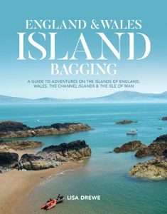
Reisgids England and Wales Island Bagging | Vertebrate Publishing

England & Wales Island Bagging by Lisa Drewe is a stunning and informative guide to the islands of England, Wales, the Channel Islands and the Isle of Man. It is ideal for swimmers, kayakers, adventure travellers, wildlife spotters and ice cream connoisseurs. Go on an inspirational and fascinating coastline journey - familiar islands are visited, s...
27,95

Webshops met dit product

Webshop
Bezorging
Prijs

Anderen bekeken ook

Reisgids Scottish Island Bagging | Vertebrate Publishing
Erg mooie gids met aandacht voor 154 Schotse eilanden die de moeite waard zijn om te bezoeken.   Scottish Island Bagging by Helen and Paul Webster, founders of Walkhighlands, is a guide to the magical islands of Scotland.   Focusing on the ninety-nine islands that have regular trips or means of access for visitors, plus fifty-five other islands which have no regular transport but are still of significant size or interest, the authors have described the best ways to experience each one. Of the islands featured, many are household names – Skye, Lewis, Bute – while some, such as the isolated St Kilda archipelago and the remote Sula Sgeir, will be unknown to all but a hardcore few.   When it comes to things to see and do, the islands of Scotland have it all. Wildlife enthusiasts can watch out for otters, orcas and basking sharks, while birdwatchers in particular are spoilt: look out for the rare corncrake on Islay, sea eagles on Mull, or sight puffins, gannets, storm petrels and many other…
24,95
Wandelgids Big Trails Great Britain & Ireland Volume 2 | Vertebrate Publishing
Big Trails: Great Britain and Ireland Volume 2 is the second volume of this inspirational guide to the most iconic long-distance trails in England, Scotland, Wales, Ireland and the Channel Islands.   The twenty-five routes featured in this book comprise more of the best trails in Great Britain and Ireland. From some of Wales’ best views on the Pembrokeshire Coast Path and the magnificent moorlands of the Two Moors Way (Devon Coast to Coast) in South-West England, to Scotland’s wild moors on the Southern Upland Way and over high cliffs on Ireland’s Burren Way. In the shadows of Lakeland peaks on the Cumbria Way and around five islands on the Channel Island Way, the book incorporates the highlights of Great Britain and Ireland, from its centre to its outermost edges.   Big Trails books are designed to inspire big adventures. Rather than being carried along the route, this guide provides everything you need to plan and explore further, including a general overview of the trails, specific …
16,50
Campergids Off the Beaten Track: England and Wales | Bloomsbury
England and Wales might feel familiar to many, but there are countless hidden idylls and remote wildernesses to discover amongst the soaring passes, spectacular coastlines and boundless moorlands. For many, Martin's 'slow road' routes will have opened up the country's most well known highways and byways, but there is so much more to England and Wales than these, at times overcrowded, hotspots. This book is the next, natural step in Martin's wanderings around England and Wales. If Take The Slow Road whetted the appetite for a Great British adventure, this book will be the main course, filling you up with inspiring writing and beautiful imagery from the most remote and wild corners of England and Wales. It will take you to the very edges of the map, on a series of personal journeys to uncover parts of these countries that the masses never reach but wish they could. In discovering these secret and beautiful places this fabulous book shows the reader that, with a little imagination, and …
27,95
Reisgids The Beaches of Wales | Vertebrate Publishing
Surrounded on three sides by water, Wales has hundreds of beaches to choose from. The Beaches of Wales by Alistair Hare is the first guide to every beach and cove around the Welsh coastline. Listing approximately 500 named beaches, this book offers something for everyone – from secret beaches and remote coves to dog-friendly beaches, surf beaches and more. It is an invaluable guide for families, holidaymakers, anglers, surfers and other watersports enthusiasts.   The author is no stranger to Wales’s coastline: his research for this guide has taken him to every beach on the entire coast of Wales, exploring and taking photographs to help visitors find their perfect beach, first time. Split into easy-to-use sections, this guide includes everything from Penarth Beach near Cardiff in the south to Talacre Beach near Prestatyn in the north, as well as an additional section for beaches located on the country’s islands. Discover Wales’s most beautiful and popular beaches, such as Barafundle Bay…
27,95
Wandelgids Great Britain & Ireland | Vertebrate Publishing
Big Trails: Great Britain & Ireland is an inspirational guide to the most iconic, spectacular and popular long-distance trails in England, Scotland, Wales, Northern Ireland, Ireland and the Isle of Man.   The twenty-five featured routes will take you across the best of the British Isles. From the South Downs Way in South-East England and across Wales' mountains in the Cambrian Way, the book delves into the heart of Scotland on the West Highland Way, along the Causeway Coast Way on Northern Ireland’s coast, and into southern Ireland on the Beara Way.   The book is designed to inspire big adventures. Rather than being carried along the route, this guide provides everything you need to plan and explore further, including a general overview of the trails, specific technical information, overview mapping, key information and stunning photography. As well as this, each route specifies approximate timings devised using the Jones–Ross formula, which allows for custom itineraries to be generate…
27,95
Wegenkaart - landkaart Groot - Brittannië | Borch
Mooie geplasticieerde kaart van Groot - Brittanië. Deze kaart biedt een goed overzicht van het land met detailkaarten.   Our soft-laminated folded map of Great Britain shows: Scotland and Northern Ireland 1:800 000, England and Wales 1:800 000, Channel Crossings 1:800 000, Great Britain and Ireland administrative, Europe time zones. Borch Maps are easy to fold, durable and water-repellent with a wipeable surface. Borch Maps show hotels, museums, monuments, markets, public transport, top sights and points of interest, useful statistics, conversion charts for temperatures, weights and measurements, climate charts showing temperatures, sunshine hours, precipitation and humidity, overview maps, time zones, and much more...   "Great Britain", the largest island in Europe, is not one individual country, but the combination of Wales, England and Scotland. It also includes smaller islands such as the Hebrides, the Isle of Wight, Anglesy, the Isles of Scilly as well as the Shetland and Orkney I…
11,50
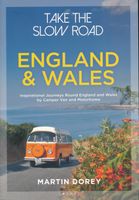
Campergids - Reisgids Take the Slow Road: England - Engeland and Wales | Bloomsbury
The ultimate guide to the very best scenic and fun routes for camper vans and motorhomes around the valleys, mountains and coastlines of wonderful England and Wales. In this book we define the best driving routes around England and Wales for camper vans and motorhomes. We show you the coolest places to stay, what to see, what to do and explain why it's special. We meander around England and Wales on the most breathtaking roads, chugging up mountain passes along the coast. We show you stuff that's fun, often free. We include the best drives for different kinds of drivers; for surfers, wildlife watchers, climbers and walkers. We include the steepest, the bendiest, those with the most interesting bridges or views or obstacles, ferries and tidal causeways. And you don't even have to own a camper van or motorhome--we'll tell you the many places you can rent one to take you on the journey. All of this is interspersed with beautiful photos, handy maps and quirky travel writing from the king …
27,95
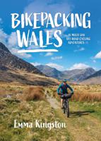
Fietsgids Bikepacking Wales | Vertebrate Publishing
Bikepacking Wales by Emma Kingston contains 18 great multi-day mountain bike adventures.   For such a compact country, Wales has a fantastic variety of trails to explore. Explore the world-class tracks around the remote Elan Valley, traverse the long, grassy ridges of Bannau Brycheiniog (Brecon Beacons), enjoy the stunning coastal bridleways along the Gower peninsula, tackle the popular Trans Cambrian Way across Mid Wales, ride the heather-lined singletrack in the Clywdian Hills, and take a tour around the highest mountain in Wales and England – Yr Wyddfa (Snowdon) – including an optional route to its summit. The trails aren’t the only draw though; these routes take you under towering castle walls, through huge slate quarries and past some of the country’s prehistoric monuments so you can better appreciate Wales’s rich culture and heritage.   Each route includes all the information you need to help you plan your ride, including points of interest along the route, swimming spots, food r…
27,95
Wegenkaart - landkaart England & Wales - Engeland | ITMB
Een degelijke kaart met aanduidingen van o.a. nationale parken, vliegveld, benzinepompen. ITMB publishes a map of Great Britain, but each portion of GB needs its own map to show roads and attractions in more detail. This is a brilliant map of both England and Wales, showing the entire 'country' in a double-sided format. The place names index is formidable, but England in particular is a series of little villages, so it has been very difficult to decide what to include and what to leave out. This map is showing motorways, divided carriageways, all A & B highways, railway lines, airports, historic sites and touristic attractions, parks and gardens, and just about everything that we could fit on to the page to provide users with a detailed, usable map. We have been able to fit all of southern England/Wales as far north as Chester/Lincoln on side A and with a little overlap, from those cities north to the well over the Scottish border, up to Perth/Dundee filling side B. The Isle of Man and…
13,95
Wegenkaart - landkaart Wales & southwest England | ITMB
Een degelijke kaart met aanduidingen van o.a. nationale parken, vliegveld, benzinepompen. Finally, we have been able to create our own map of the lovely country of Wales. I use the word ‘country’ in its truest sense, as Wales was invaded and taken over by the English centuries ago. Regardless, the Welsh language and Welsh culture continue to flourish, although English is commonly spoken. We have visited Wales on several occasions and find that the attractions are so numerous that we could never see them all. There are too many castles to count, but some of the best preserved in the British Isles are in Wales, notable Caernarfon, but nearby Harlech is a World Heritage Site. St, David’s must be one of the smallest and loveliest cathedrals in the world, and Tintern Abbey ruins among the most poignant anywhere. We took Johnny to Abergavenny for lunch in March, not that it made any difference; he just pined for a McDonalds. This map is double-sided, with Wales on one side and the West Count…
13,95

Klanten-reviews van Reisgids England and Wales Island Bagging | Vertebrate Publishing

Er zijn nog geen beoordelingen voor dit productBen jij de eerste die een review plaatst?

Meer over Reisgids England and Wales Island Bagging | Vertebrate Publishing

Productomschrijving

England & Wales Island Bagging by Lisa Drewe is a stunning and informative guide to the islands of England, Wales, the Channel Islands and the Isle of Man. It is ideal for swimmers, kayakers, adventure travellers, wildlife spotters and ice cream connoisseurs. Go on an inspirational and fascinating coastline journey - familiar islands are visited, such as Lundy and the Isle of Wight; others are less well known, such as Gewni in Pembrokeshire and Coquet Island in Northumberland.   Almost 300 islands are included, from larger, populated islands to remote, uninhabited islets - some can be reached by foot at low tide, others have ferry services, and some you will need your own transport, or be content to view them from the mainland. Once you've found your island this book introduces you to the best sites on the island to appreciate: hidden beaches and coves, the tastiest local food and the wildlife that can be seen in the locality. Watch the Cemlyn Bay terns on Anglesey, go paddleboarding around Mersea Island in Essex, walk in the footsteps of pilgrims on Lindisfarne in Northumberland, or enjoy ice cream from one of the smallest dairy herds in the country on St Agnes in the Isles of Scilly ...   it's all there to be enjoyed in England & Wales Island Bagging.
Webshop.nl maakt gebruik van cookies. Ga je verder op onze website, ga dan akkoord met het plaatsen van cookies en de verwerking van deze data door ons en vermelde partners.