Political PhilosophyThis course questions the political and social order and considers the ways in which thinkers have responded to the particular political problems of their time.25,-
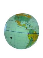
Opblaasbare wereldbol - globe World Political | ITMB Een staatkundige opblaasglobe, dus elk land heeft zijn eigen kleur. De opblaasglobe heeft een diameter van 40 centimeter. De oceaan is lichtblauw. De wereldsteden staan erop. De globe is vervaardig van sterk plastic. Daardoor is de globe uitermate geschikt voor educatieve doeleinden. Political 16” Globe Ball with light blue ocean, countries shown in differing colours, urban place names The inflatables are stored in individual plastic bags with an identifying header stapling it closed. Each label notes the ball is phthalate free and safe for children. 14,95
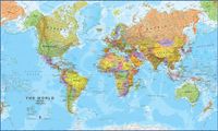
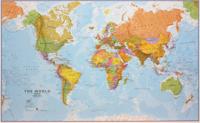
Magneetbord - Wereldkaart Political, 101 x 59 cm | Maps International Door het heldere en vrij felle kleurgebruik is deze kaart uitermate geschikt voor scholen, kantoren of gewoon als politieke wereldkaart thuis. De kleurstelling is zodanig dat elk land zich zeer goed onderscheidt van haar buren. De natuurkundige aspecten zijn minder goed te zien, al worden de gebergten door schaduwwerking goed uitgelicht. De nadruk ligt echter duidelijk op een ‘gewone’ wereldkaart. De belettering is uitstekend leesbaar door vetgedrukte naamgeving. Engelstalig, maten: 101 x 59 cm , zonder vlaggen., prijs is incl. BTW. De kaart wordt in deze versie gelijmd op een plaat, voorzien van een mooie aluminium lijst en een ophangsysteem wordt meegeleverd. Daarnaast krijgt u een bakje bijgeleverd dat u er aan kunt bevestigen voor pennen, stiften of magneetjes. Bij deze kaart wordt een set magneetjes ( 10 stuks) gratis meegeleverd189,-
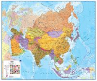
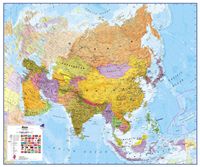
Wandkaart - Prikbord Azië Politiek - Asia Political, 120 x 100 cm | Maps International Fraaie politieke kaart van het continent, waarbij vooral de politieke aspecten heel duidelijk te lezen zijn. Alle landen hebben verschillende kleuren, steden en belangrijke verbindingen zijn goed te vinden. De wandkaarten op prikbord worden geleverd met een aluminium lijst en een eenvoudig te monteren ophangsysteem. Zij zijn geschikt voor allerhande markeringsystemen als vlaggetjes en prikkers. Maps International's political wall map of Asia shows all countries from Turkey in the West to Japan in the East, down to Indonesia in the South of Asia. The largest and most populated continent, Asia has a lot to fit onto a map! Rest assured though, with Maps International's high quality of mapping nothing is missed out! This political wall map of Asia features countries marked in different colours, with international borders clearly shown. The map's key shows the flags from the countries displayed in this map. This Asia physical wall map also contains city population detail, capital cit…185,-
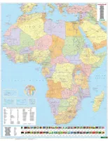
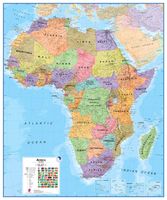
Wandkaart - Prikbord Afrika Politiek - Africa Political, 120 x 100 cm | Maps International Fraaie politieke kaart van het continent, waarbij vooral de politieke aspecten heel duidelijk te lezen zijn. Alle landen hebben verschillende kleuren, steden en belangrijke verbindingen zijn goed te vinden. De wandkaarten op prikbord worden geleverd met een aluminium lijst en een eenvoudig te monteren ophangsysteem. Zij zijn geschikt voor allerhande markeringsystemen als vlaggetjes en prikkers. Maps International's Africa political wall map shows the whole African continent from Morocco in the north, to South Africa and Madagascar in the south. This political wall map of Africa features countries marked in different colours, with international borders clearly shown. The map's key shows a panel of flags from each of the countries displayed in this African continent map. This political wall map of Africa also contains population detail, capital cities and all the major towns and cities in this continent. As with most of Maps International's maps, the Africa political wall map,…185,-
Wandkaart - Magneetbord Azië Politiek - Asia Political, 120 x 100 cm | Maps International Fraaie politieke kaart van het continent, waarbij vooral de politieke aspecten heel duidelijk te lezen zijn. Alle landen hebben verschillende kleuren, steden en belangrijke verbindingen zijn goed te vinden. De kaart wordt in deze versie gelijmd op een plaat, voorzien van een mooie aluminium lijst en een ophangsysteem wordt meegeleverd. Daarnaast krijgt u een bakje bijgeleverd dat u er aan kunt bevestigen voor pennen, stiften of magneetjes. Maps International's political wall map of Asia shows all countries from Turkey in the West to Japan in the East, down to Indonesia in the South of Asia. The largest and most populated continent, Asia has a lot to fit onto a map! Rest assured though, with Maps International's high quality of mapping nothing is missed out! This political wall map of Asia features countries marked in different colours, with international borders clearly shown. The map's key shows the flags from the countries displayed in this map. This Asia physical wall map als…269,-