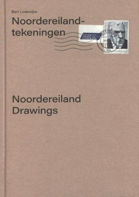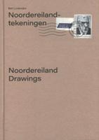
Noordereiland-tekeningen (Hardback)

0
Situated in the middle of the river Maas, between the northern and southern parts of Rotterdam, Noordereiland is shaped like a typical riverboat. Bart Lodewijks trekked from its western to its eastern end, making his drawings in chalk on commercial buildings, ship cabins, quay walls, houses, and steel pipes. He then wrote a poetic account of the li...

Verkopers met dit product

Verkoper
Bezorging
Prijs

Anderen bekeken ook

Noordereiland-tekeningen (Hardback)
Situated in the middle of the river Maas, between the northern and southern parts of Rotterdam, Noordereiland is shaped like a typical riverboat. Bart Lodewijks trekked from its western to its eastern end, making his drawings in chalk on commercial buildings, ship cabins, quay walls, houses, and steel pipes. He then wrote a poetic account of the life he encountered on the island, published in three parts. His presence as an outsider there elicited both questions and stories from the island's inhabitants; snapshots of trust and distrust. Although wind and rain will inevitably erase the artist's traces on the island, through this publication it becomes permanently anchored in memory.
22,50
Reisgids New Zealand's North Island - Nieuw Zeeland Noordereiland | Lonely Planet
De perfecte reisgids voor zowel de georganiseerde als de zelfstandige reiziger. Naast een algemene inleiding van het land / streek vol met praktische informatie over hoe je er het beste kunt reizen: slapen, eten, vervoer, excursies ... alles kun je er in vinden. Lonely Planet's local travel experts reveal all you need to know to plan the trip of a lifetime to New Zealand's North Island.   Discover popular and off the beaten track experiences from discovering Napier's beautiful art deco architecture, to kayaking down the history-making Whanganui River, and relaxing on sweeping beaches in the Coromandel Peninsula.   Build a trip to remember with Lonely Planet's New Zealand's North Island travel guide:   Our classic guidebook format provides you with the most comprehensive level of information for planning multi-week trips Updated with an all new structure and design so you can navigate New Zealand's North Island and connect experiences together with ease Create your perfect tr…
26,50
Wegenkaart - landkaart Planning Map New Zealand's North Island - noordereiland Nieuw Zeeland | Lonely Planet
Durable and waterproof, with a handy slipcase and an easy-fold format, Lonely Planet's New Zealand's North Island Planning Map helps you explore with ease. Get more from your map and your trip with images and information about top attractions, itinerary suggestions, a transport guide, planning information, themed lists and practical travel tips. With this easy-to-use, full-colour map in your back pocket, you can truly get to the heart of New Zealand's North Island - so begin your journey now! Durable and waterproof Easy-fold format and convenient size Handy slipcase Full colour and easy to use Before-you-go info Beautiful imagery Tailored itineraries Can't-miss regional highlights Detailed town index Transport planner Themed lists Covers: New Zealand's North Island  
10,95
Wegenkaart - landkaart Nieuw Zeeland - Noordereiland , North Island | Reise Know-How Verlag
Tweetalige kaart (Engels en Duits). Door ingetekende lengte- en breedtegraden is het gebruik van GPS mogelijk. Met hoogtelijnen en uitgebreid wegennetwerk: daarnaast worden ook de afstanden tussen belangrijke plaatsen duidelijk leesbaar weergegeven. Het kleurgebruik is zodanig dat je een goede indruk krijgt van hoogteverschillen en soorten landschap. Natuurlijk staan de toeristische bezienswaardigheden duidelijk vermeld.   Gedrukt op water- en scheurvast papier! Polyart is een synthetisch product vrij van giftige stoffen dus duurzaam. Het papier gaat echt lang mee.   Hochreißfeste und 100% wasserfeste Landkarte „Neuseeland, Nordinsel“ aus der Serie world mapping project.   Reise Know-How Landkarten zeichnen sich durch besonders stabiles Kunststoffpapier aus, das beschreibbar ist wie Papier, sogar mit Bleistift. Der Pappumschlag ist abnehmbar, so dass sich die Karte bequem in jede Tasche stecken lässt. Eine Schutzhülle ist nicht erforderlich. Die kartografische Darstellung konzentriert…
15,95
Wegenkaart - landkaart Easter Island - Paaseiland en Santiago | ITMB
Easter Island is so isolated that it is not certain whether it is part of Polynesia or an off-shoot of South America. Geologically, it is neither; just a volcanic lump in the vast expanse of the Pacific Ocean. Its original inhabitants probably came from Polynesia; since supplanted by migrants from Chile, which is the political authority governing the island. Regardless, it is an intriguing place, famous for the Maoi - giant heads originally raised to protect family holdings. These huge, mysterious heads rest in various locations on the island and are one of the wonders of the world. This map also includes a detailed map of Santiago de Chile, the capital of Chile, for the simple reason that all flights to Easter Island originate in that city, so everyone going to Easter Island needs a map of Santiago as well. This usage is merely for the convenience of visitors going to Easter Island. ITMB publishes a separate map of Santiago and Central Chile and we intend to continue to do so.   Lege…
13,95
Reisgids Chile & Easter Island - Chili en Paaseiland | Insight Guides
Een rijk geillustreerde reisgids  voor Chili en Paaseiland, met diepgaande teksten: één van de beste reisgidsen die er bestaan. Eerste deel bestaat uit een beschrijving van de unieke aspecten van de regio, daarna een deel echte reisgids en als afsluiting een deel met praktische informatie. De uitstekende informatie wordt vergezeld van prachtige foto's en heldere kaarten. Niet alleen om mee te nemen, maar ook om vooraf en zelfs achteraf weer in de stemming te komen. This Chile & Rapa Nui (Easter Island) guidebook is ideal for travellers seeking inspirational guides and planning a more extended trip. It provides interesting facts about Chile & Rapa Nui (Easter Island)'s people, history and culture and detailed coverage of the best places to see. This Chile & Rapa Nui (Easter Island) travel book has the style of an illustrated magazine to inspire you and give a taste of Chile & Rapa Nui (Easter Island).   The book is printed on paper from responsible sources, and verified to meet FSC…
24,95
Reisgids Grenada, Carriacou, Petit Martinque | Bradt Travel Guides
Voor vele landen net zo goed, zo niet beter dan de Planet. Beduidend soberder uitgevoerd, maar ook met veel informatie voor backpackers en met veel kaartmateriaal. Een aanrader! Written by Caribbean-based writer, publisher and photographer Paul Crask, this new, thoroughly updated fourth edition of Bradt's Grenada, Carriacou and Petite Martinique remains the only standalone guide to this alluring Caribbean-island destination. With insider knowledge gleaned from 15-plus years' exploration, Bradt's guidebook is rich in detail, local colour and practical information. Detailed listings covering accommodation (from homestays to top-range boutique hotels), dining and activities (including off-the-beaten-path experiences) are complemented by the author's personal take on making the most of your stay.   Grenada is an English-speaking tri-island nation famed for its nutmeg and cocoa, sailing regattas attracting international crowds, jaw-dropping beaches, pastoral villages, mountain trails, f…
24,95
Wegenkaart - landkaart Guam - West Pacific Cruising | ITMB
Een degelijke kaart met aanduidingen van o.a. nationale parken, vliegveld, benzinepomp, dirt-roads. Als overzichtskaart goed te gebruiken. Certainly, this is the only map of Guam by any major cartographic publishing house. Here are some details: Guam is a north-south island considerably north of New Guinea, and forms part of the American-held group of islands known as the Northern Marianas. Its capital is Hagatna, and the main town is called Tamuning. The island has a well-developed international airport in the middle portion of the island, with a large US military airbase in the northeast corner. The vast majority of the island is touristic, and well worth a visit. The island was "discovered" by Ferdinand Magellan in 1521, and Hagatna is the oldest "European" city in the Pacific, dating from 1686. The town of Inarajan retains a decidedly Spanish appearance to this day. Other attractions include Tumon Beach and its many resorts, the Piti Underwater Observatory, and the famous Cocos Is…
13,95
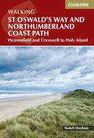
Wandelgids St Oswald's Way and Northumberland Coast Path | Cicerone
This guidebook describes the St Oswald's Way and Northumberland Coast Paths, both long-distance trails through Northumberland. St Oswald's Way (156km, 97 miles) begins in Heavenfield and traverses parts of Northumberland National Park and visits Hadrian's Wall, the Simonside Hills and the beautiful Coquet Valley, before continuing up the coast to Lindisfarne (Holy Island). The Northumberland Coast Path (100km, 62 miles) takes in the whole of the Northumberland Coast AONB with its breathtaking coastal scenery and birdlife.   Both trails converge on Holy Island, with the Coast Path continuing up to Berwick-upon-Tweed. Each trail can be walked in a week. The guide includes practical advice on when to go and what to take, and information on the region, its weather, wildlife, history and heritage.   Detailed route descriptions and clear, step-by-step instructions are accompanied by 1:50K OS mapping. Public transport options and accommodation listings are also given. Described as the cradle…
23,95
Spoorwegenkaart - Wegenkaart - landkaart Scotland Far North & Islands Railway & Road | ITMB
Great Britain, by its shape, is difficult to map. The population is dense, the road network intense, and the coastline convoluted. A map of the British Isles shows only the major features. Sectional maps of just England, or Just Wales, make little sense, due to the geographic shape of the island kingdom. Scotland also needs more than one map to show its treasures in sufficient detail. ITMB previously issued Scotland Central and South, and now extends its coverage at 1:300,000 to the sparsely-populated highlands and the isolated Western, Orkney, and Shetland island archipelagos that are usually shrunk to insignificance on most maps, as insets. This double-sided map covers the area from Loch Lochy south of Invergarry to John O’Groats in the north, and from the Western islands of Uist and Lewis to the Moray Firth and Craigellachie in the east. The second side has to duplicate part of the first side in order to extend the artwork further eastward to include Aberdeen and northward to inclu…
13,95

Klanten-reviews van Noordereiland-tekeningen (Hardback)

Er zijn nog geen beoordelingen voor dit productBen jij de eerste die een review plaatst?

Meer over Noordereiland-tekeningen (Hardback)

Productomschrijving

Situated in the middle of the river Maas, between the northern and southern parts of Rotterdam, Noordereiland is shaped like a typical riverboat. Bart Lodewijks trekked from its western to its eastern end, making his drawings in chalk on commercial buildings, ship cabins, quay walls, houses, and steel pipes. He then wrote a poetic account of the life he encountered on the island, published in three parts. His presence as an outsider there elicited both questions and stories from the island's inhabitants; snapshots of trust and distrust. Although wind and rain will inevitably erase the artist's traces on the island, through this publication it becomes permanently anchored in memory.

Productinformatie

    Webshop.nl maakt gebruik van cookies. Ga je verder op onze website, ga dan akkoord met het plaatsen van cookies en de verwerking van deze data door ons en vermelde partners.