webshop.nl
Categorieën
  Sluiten

Natuurgids Folds, Faults and Fossils - exploring geology in Pembrokeshire | Llygad Gwalch

The varied and beautiful landscape of Pembrokeshire has been sculpted over millions of years from the underlying rocks, giving us the unrivalled views of mountains, valleys and sea cliffs that are an integral part of the county today. The human heritage is also imprinted on the geological landscape. Cyfrol sy'n astudiaeth o ddaeareg sir Benfro. Mae...
20,95

Webshops met dit product

Webshop
Bezorging
Prijs

Anderen bekeken ook

Wandelgids Jurassic Coast | Cicerone
The Jurassic Coast of Devon and Dorset, stretching between Exeter and Bournemouth, is a geological wonderland. Natural wonders like Chesil Beach, Durdle Door and fossils so numerous you'll be tripping over them, combine with southern England's rolling Downs, tiny villages, beaches and sunny summers to provide a stunning and awe-inspiring landscape to explore.   The 30 walks in this guide let walkers discover the best and most spectacular areas on the coast. The walks are between 5 and 25km (3 to 16 miles) and provide a range suitable for all abilities. The guide has been divided into areas: Devon's Red Beds, the Lias, Chesil Beach, Chalk walks (Lulworth and inland) and the Isle of Purbeck.    The geological descriptions are accompanied by strata diagrams, geological timelines, explanations of the creation of the various sedimentary rocks along the coast, and discussion of how and why the various formations formed millennia ago. The incredible - yet readable - detail brings these walks …
19,95
Wandelgids National Parks: Pembrokeshire | Northern Eye Books
This superbly-written and good looking book will take you on ten short circular walks to the very best stretches of coast, pubs, tea shops, and viewpoints that the beautiful Pembrokeshire coast, in West Wales, has to offer.   Defining the south-westernmost tip of Wales, Pembrokeshire’s coastline is arguably the most beautiful and varied in the British Isles. Virtually all of it lies within the Pembrokeshire Coast National Park. Relative isolation has left it largely untouched by modern development and most of its length is a wild frontier where the endless confrontation between sea and land is played out. Long stretches of coast face the fury of Atlantic storms and weakness and faults in the high cliffs are eroded into caves, coves and inlets. However, the harder rock, some of which is 700 million years old, resists the onslaught and stands out in rugged promontories and headlands.   Elsewhere, sheltered landings and harbours, fine beaches and secluded bays reveal other aspects of this…
9,95
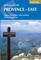
Wandelgids Walking in Provence - East | Cicerone
This guide offers 30 circular day walks in the eastern half of Provence, the large sun-kissed coastal region of south-east France. Spanning from the red rocks in the Ésterel on the Mediterranean to high mountains inland, the walks are set in the areas of the Alpes Maritimes, the Alpes de Haute-Provence and the Mercantour. Provence’s sunshine and Mediterranean charm attract many visitors to its coast, yet the area also has much more to offer the walker. The countryside inland boasts a range of scenery from remote mountaintops to spectacular gorges. History is everywhere, in medieval villages, arcaded streets, abbeys, churches and castles.    This guide covers the eastern regions, with its companion volume, Walking in Provence: West, covering the rest of this fascinating and historic landscape. The walking is incredibly diverse, and explores the country that hugs the Côte d'Azur and Italian border. The Alpes Maritimes rise craggy and wild above towns as unique as Grasse, Cannes and Monac…
21,95
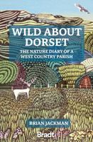
Reisverhaal - Natuurgids Wild about Dorset | Brian Jackman
Wild About Dorset is a new collection of nature writing from award-winning journalist and author Brian Jackman. Drawing on a decade's worth of monthly columns in his local community magazine, Jackman paints a 'year in the life' of wildlife and wild places in West Dorset's Area of Outstanding Natural Beauty (AONB), where he has lived for fifty years. A rumpled, tumbling world of green-gold hills, bordered by the Jurassic Coast's crumbling cliffs and melting away inland somewhere north of Beaminster, few corners of England are so rich in wildlife or so intensely rural. Arranged month-by-month, this book celebrates the only place in the British Isles that reminds Jackman of the lost countryside of his youth. Complementing Jackman's love letter are thirteen full-page color illustrations by celebrated nature artist Carry Akroyd, an award-winning member of the Society of Wildlife Artists. This is a book about nature - an account of natural history observations. Start the year by joining Jack…
18,50
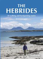
Wandelgids The Hebrides - De Hebriden Schotland | Cicerone
This inspirational guide offers 50 varied hiking and backpacking routes on the Scottish Hebrides islands, set out in a large guidebook to be savoured. The hikes highlight all the very best landscapes and scenery to be found on the spectacular islands of the Hebrides, a wonderland for adventurous walkers to return to time and time again. Inspirational guidebook to walking in Scotland's Hebrides islands. 50 adventurous walks on well-known and remote islands; from Syke, Mull, Rum, the Uists and Barra, Ulva, Iona, Eigg and Muck and more besides. Most of the walks provide a full day for experienced walkers, with a few multi-day adventures as well as some shorter routes. The terrain is often rough, rugged and pathless, while waymarking and public transport can, in many places, be hard to find. The challenge of wild walking, and the self-reliance needed to discover the best of the Hebrides, make the islands all the more appealing for adventurous walkers.   The walks also include Hebrides clas…
28,50
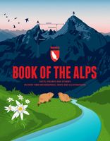
Reisinspiratieboek - Reisboek Book of the Alps | Marmota Maps
The Book of the Alps  the great illustrated book about the Alps.290 pages with over 1000 illustrations, graphics, and maps on geography, sports, history, culture, climate, environment and much more. Understand the Alps like never before.Created in cooperation with the Alpine clubs of Germany, Austria, and South Tyrol. CONTENTS The Book of the Alps has 46 chapters in seven subject areas: Geography   Flora and Fauna   Climate and Environment    Alpinism   Mountain Sports   Society and Economy   Arts and Culture   GEOGRAPHY Geological Formation Ice Age Mountains Valleys Mountain Passes Lakes and Rivers Glaciers The Alps are unique. How did they form and evolve? How do glaciers, passes, valleys, lakes, and rivers shape the landscape? Answers to these and many more questions can be found in the geography chapter.   FLORA AND FAUNA Biodiversity Plants Forests Animals National Parks The Alpine environment is fascinating. Alpine flowers such as the edelweiss and Alpine animal…
44,95
Wandelgids Wales Coast Path: Snowdonia and Ceredigion | Northern Eye Books
Official Guide: Wales Coast Path: Snowdonia & Ceredigion Coast One of seven Official Guides to the Wales Coast Path This Official Guide to the Snowdonia & Ceredigion Coast section of the Wales Coast Path contains everything local and long-distance walkers need to enjoy the path.   Cardigan Bay probably offers a more diverse walking experience than any other section of the Wales Coast Path. The stretch covered in this book – from Porthmadog in the north to Cardigan in the south – largely covers two contrasting Welsh counties.   The first 97 kilometres pass through Gwynedd, along the western edge of the Snowdonia National Park. Here, just before the rivers that rise in the highest of the Welsh mountains reach the sea, they fan out to form broad estuaries that provide rich pickings for waders and other birdlife. The estuaries of the Dwyryd, the Mawddach and the Dyfi are the largest of these. Between them are some very large dune systems, including Morfa Harlech and Morfa Dyffryn – home to…
23,95
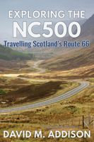
Reisgids Exploring the Nc500 | Extremis Publishing Limited
Travelling anti-clockwise, David M. Addison seeks his kicks on Scotland's equivalent of Route 66. Otherwise known as NC500, the route takes you through five hundred miles of some of Scotland's most spectacular scenery. No wonder it has been voted as one of the world's five most scenic road journeys. There are many mays of exploring the NC500. You can drive it, cycle it, motorbike it or even walk it, even if you are not one of The Proclaimers! And there are as many activities, places of interest and sights to be seen along the way as there are miles. This is a personal account of the author's exploration of the NC500 as well as some detours from it, such as to the Black Isle, Strathpeffer and Dingwall. Whatever your reason or reasons for exploring the NC500 may be, you should read this book before you go, or take it with you as a vade mecum. It will enhance your appreciation of the NC500 as you learn about the history behind the turbulent past of the many castles; hear folk tales, myths…
18,50
Wandelgids The high mountains of Crete - Kreta | Cicerone
Guidebook to walking and trekking the high mountains of Crete. The largest of the Greek Islands, Crete's mountains provide breathtaking walking and wilderness to this popular island. The routes in this guidebook are graded for difficulty and range from short, easy strolls to challenging, multi-day treks and summit climbs, so there are options for walkers of all abilities.    All the mountain ranges of Crete feature high plains, gorges and ravines, but in the heart of the Lefka Ori there is something else. High above the treeline snow thaws by July to reveal a great circle of massive barren peaks, interspersed with ‘moonscape’ outcrops, or depressions, of sinkholes in black, grey or red rock. This high desert wilderness is seldom visited but covers some 960sqkm.   In central Crete, where the island is at its widest, the huge mass of Psiloritis (Mount Ida) dominates the whole region. Covering about 560sqkm this massif is different in that a single huge, partly scree-surfaced summit ridge…
26,50
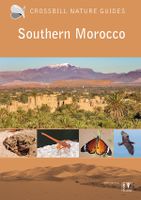
Natuurgids - Reisgids Crossbill Guides Southern Morocco - Zuid Marokko | KNNV Uitgeverij
Zeer gedegen natuurgids van het betreffende gebied. Unieke gids met streekinformatie, plekken waar je echt  moet zijn, routes en veel achtergrondinformatie over het landschap, de ecologie, ontstaansgeschiedenis en de flora en fauna. De routes en plekken die beschreven worden in de gids zijn zo gekozen dat je een heel compleet beeld krijgt van het gebied: landschappelijk, flora en fauna ... alle toppers van de streek zijn goed te vinden. Echt een aanrader voor elke natuurliefhebbers die zich wat meer in het gebied wil verdiepen.   This nature travel guidebook to Southern Morocco contains routes and background info on landscape, flora and fauna.   Landscape history Ecosystems Geology Flora and Fauna Where to watch birds Finding mammals, reptiles, butterflies, dragonflies and wildflowers 25 detailed routes with tips for finding wildlife and 29 site descriptions   Region covered by this Crossbill Guide The Crossbill Guide Southern Morocco covers the part of Morocco that lies rou…
29,95

Klanten-reviews van Natuurgids Folds, Faults and Fossils - exploring geology in Pembrokeshire | Llygad Gwalch

Er zijn nog geen beoordelingen voor dit productBen jij de eerste die een review plaatst?

Meer over Natuurgids Folds, Faults and Fossils - exploring geology in Pembrokeshire | Llygad Gwalch

Productomschrijving

The varied and beautiful landscape of Pembrokeshire has been sculpted over millions of years from the underlying rocks, giving us the unrivalled views of mountains, valleys and sea cliffs that are an integral part of the county today. The human heritage is also imprinted on the geological landscape. Cyfrol sy'n astudiaeth o ddaeareg sir Benfro. Mae tirwedd arfordif Penfro wedi cael ei llunio a'i cherflunio dros filiynau o flynyddoedd, gan greu'r mynyddoedd, dyffrynnoedd a chlogwyni sy'n rhan annatod o'r sir. Having tutored Earth Science students at the Open University for many years, the author appreciates the significance of ‘enigmatic discussion’ of the origin and ‘riddle’ of rocks, and he approaches geology in the field in this spirit of enquiry. This particular guide on the subject relating to Pembrokeshire is intended for students, walkers, amateur geologists and anyone who would like to discover the wonderful geology of this coastline. He starts with a brief outline of the geological history of south-west Wales, prefaced by an introduction to the shift, over millions of years, in plate tectonics, of magma rising, and the opening and closing of the Iapetus Ocean which shunted, drifted and pulled together what we now recognise as the British Isles. The chapters are organised chronologically, starting with the oldest Precambrian outcrops and concluding with the deposits and landforms of the Pleistocene Ice Age. Each chapter begins with an overview of the region and then focuses on particular sites of interest and directions on how to visit them. One of many examples to highlight is the chapter on the Precambrian and Cambrian rocks of the St. David’s Peninsula whose cliffs ‘display some magnificent geological sections through some of the oldest rocks in Wales.’ For the complete beginner, some of the more technical geological terms which might baffle and bemuse are thoughtfully highlighted in bold and defined in a thorough glossary: Alkali feldspar, Gash Breccia, Variscan orogeny, Flexural slip, Seat Earth, Liquefaction, Scoriaceous and Bioturbation, to name a few. The text also benefits from diagrams and colour plates illustrating specific rock formations. There are some lovely images here: the cliffs of Caerbwdy sandstone at Porth Glais, the columnar dolerite sill at Point St. John, the disused slate workings at Abereiddi, the block of ‘spotted dolerite’ and the shattered tors on Carn Menyn, harmonic folding in the cliffs of Pen-yr-Afr, St. Govan’s chapel at the foot of limestone cliffs, Elegug rocks (wonderful sea stacks much loved by sea birds), and the Green Bridge of Wales, a natural arch of carboniferous limestone near Castlemartin. This is a complex and fascinating subject, and this volume is perhaps more suited to the amateur geologist and student, rather than someone stepping into the subject for the first time. Having said that, by highlighting individual places the reader and walker can visit and explore, the author attempts to open it out to the novice who is starting to read the story of these ancient rocks. Just remember to keep the glossary in your pocket.
Webshop.nl maakt gebruik van cookies. Ga je verder op onze website, ga dan akkoord met het plaatsen van cookies en de verwerking van deze data door ons en vermelde partners.