Meer REPEAT cashmere
Meer REPEAT cashmere in Blouses

Linnen blouse met overhemdkraag met ruches

0
pleated and ruffle details on front...

Verkopers met dit product

Verkoper
Bezorging
Prijs
Repeatcashmere.com logo
Repeatcashmere.com
niet bekend
99,98

Anderen bekeken ook

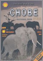
Wegenkaart - landkaart Chobe | Shell
Zeer bijzondere goede landkaart van Chobe National Park in Botswana. Uitermate handig zijn de GPS coordinaten van de meest belangrijke punten als campings of uitzichtpunten. De kaart is gebaseerd op een luchtfoto, waarbij alle details zijn ingetekend. The map: The Chobe map consists of a complete map of Chobe on the front of the map and there are 5 individual maps of the major tourist areas on the back of the map. These are Chobe river front east, Chobe river front west, Nogatsaa, Savute and a small orientation map. The map was compiled by using satellite images, giving one a birds eye-view of the area. The roads were tracked by means of a GPS and then super-imposed on the photographs. Detailed GPS co-ordinates are supplied for game-drive areas. The Chobe map contains 126 GPS co-ordinates. The four main tourist areas: The Chobe National Park consists of a variety of vegetation types and geological features, offering extreme contrasts and a wide range of wildlife experiences within the…
17,50
Nieuw
Nasa Mini Co. PVC Figure Apollo 11 Astronaut 23 cm
Who is Apollo 11 Astronaut?In the Apollo 11 manned spaceflight, astronauts Neil Armstrong and Buzz Aldrin landed the lunar module Eagle, and Armstrong became the first man to step on the lunar surface, followed by Aldrin. Michael Collins piloted the command and service module Columbia alone in lunar orbit while his teammates were on the surface. They collected material to bring back to Earth. The fifth manned mission of NASA's Apollo Program was launched on the Saturn V rocket. Broadcast live worldwide, Armstrong stepped onto the lunar surface and spoke the famous words: That's one small step for man, one giant leap for mankind. The three astronauts were welcomed with massive celebrations in the United States and around the world, receiving numerous decorations and honors. Exploring the Apollo 11 Astronaut statue:One cute and memorable release from Iron Studios, one exciting new item for collectors! Marking the local terrain in style with the American flag planted in the ground of a ba…
77,50
Nieuw
Wegenkaart - landkaart 3327 Adventure Map Western Balkans - Westelijke Balkan | National Geographic
Wegenkaart van de Westelijke Balkan met vermelding van veel bezienswaardigheden en attrakties. Watervast en scheurvast. Juist door deze vermeldingen onderscheidt de kaart zich van andere wegenkaarten. Landen: Slovenië, Kroatië, Bosnië Herzegovina, Montenegro, Albanië, Servië,  Kosovo, and Macedonië.   The Western Balkans region, an adventure playground and rising star of Europe, is loaded with Old World traditions, slow food culture, ancient towns, and rarely visited villages. The area stretches from the Adriatic Sea in the west, up and over mountain ranges, raging rivers, tectonic lakes, steep gorges, and thousands of miles of paths, trails, and routes. Discover eight countries—all with their special brand of Balkan magic: Slovenia, Croatia, Bosnia and Herzegovina, Montenegro, Albania, Serbia, Kosovo, and Macedonia.   National Geographic's Western Balkans Adventure Map will meet the needs of travelers with its detailed and accurate information. The map includes the locations of UNESC…
17,50
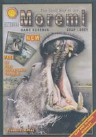
Wegenkaart - landkaart Moremi - Tourist Map of Moremi Game Reserve Botswana | Shell
Zeer bijzondere landkaart van Moreni Game Reserve in Botswana. Uitermate handig zijn de GPS coördinaten van de meest belangrijke punten als campings of uitzichtspunten. De kaart is gebaseerd op een luchtfoto, waarbij alle details zijn ingetekend. The map: The Moremi map is based on satellite photos. The front of the map consists of a map of the entire Reserve and on the back are six separate maps of Khwai river-front east, Khwai river-front west, an orientation map of Moremi, Xakanaxa area and the Moanachira river, Xakanaxa game-drive area and Bodumatau area. The roads were tracked by GPS and there are 162 GPS co-ordinates on the map. General: As part of the Okavango Delta, Moremi consists of permanent swamp, seasonally swamped areas and dry land. It is one of the prime tourist destinations in Botswana and offers water activities, top game-viewing, some of the best bird-life in Africa and incredible scenery. Not to be missed! Locality and size: The Moremi Game Reserve is nestled withi…
17,50
Nieuw
Historische Kaart Militair Erfgoed - In Flanders fields Belgium | NGI - Nationaal Geografisch Instituut
Kaart voor militair erfgoed in West Vlaanderen, zowelvoor WO l als voor WO ll. The Western Front in Flanders on a detailed map at 1:100,000 highlighting locations of numerous monuments, cemeteries, front lines and other WWI-related sites, listed in the accompanying panels with, where appropriate, their phone numbers. The map is double-sided but all the main WWI battlefields from the French border to beyond Passendale/Paschendaele are together on one side.   The map shows the present-day road and rail networks in the province of West Flanders. Extensive overprint highlights locations of WWI-related sites, indicating whether open to the general public or by appointment only: museums, military cemeteries, war memorials and monuments to the missing soldiers, bunkers and battery remains, etc. Sites in France in the immediate vicinity of the Belgian border are also marked. The overprint also indicates battlefields and fortifications from other periods of history of Flanders, from the Middle…
8,50
Nieuw
Wandelkaart - Topografische kaart 250 Cape Cod | National Geographic
Prachtige geplastificeerde topografische wandel- en vaarkaart van het Cape Cod kustgebied. Met alle recreatieve voorzieningen als campsites, stranden, en watersport maar ook met topografische details en wandelroutes ed. Door uitgekiend kleurgebruik zeer prettig in gebruik. Scheur en watervast! National Geographic's Cape Cod Coastal Recreation map is the ideal companion for adventures along shore and on the water.National Geographic's new family of Coastal Recreation maps are two-sided, waterproof maps designed specifically for recreation along America's most beautiful shorelines. These hybrid maps strike the perfect balance between professional boating charts and detailed topographic maps for land. There is no other map in the market today that provides as much versatility for coastal recreation as National Geographic's Coastal Recreation series. For paddlers, sail, and power boaters these maps are ideal for planning, cover waters up to three nautical miles off-shore, conveniently siz…
16,95
Nieuw
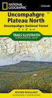
Wandelkaart - Topografische kaart 147 Uncompahgre Plateau North | National Geographic
Prachtige geplastificeerde kaart van het bekende nationaal park. Met alle recreatieve voorzieningen als campsites, maar ook met topografische details en wandelroutes ed. Door uitgekiend kleurgebruik zeer prettig in gebruik. Scheur en watervast! National Geographic's Trails Illustrated map of Uncompahgre Plateau North is a two-sided, waterproof map designed to meet the needs of outdoor enthusiasts with unmatched durability and detail. This map was created in conjunction with local land management agencies and is loaded with valuable recreation information.   The front side of the map details the northeastern section of Uncompahgre National Forest and the Roubideau Area, the eastern portions of Dominguez Escalante National Conservation Area and Dominguez Canyons Wilderness, and the city of Delta. On the reverse side of the map, the northwestern section of Uncompahgre National Forest is featured as well as the Tabeguache Area, Grand Mesa National Forest, and the western portions of Domin…
17,95
My Neighbor Totoro Notebook Catbus Plush
Featuring Catbus, this soft, embroidered plush journal features lined interiors and full colour illustrations on the pages.Perfect for writing down your ideas or reminders.With lined interiors and full-color artwork on the front and back pages, this collectible, irresistible notebook is sure to cast a spell on Studio Ghibli fans and animation lovers of all ages!DISTINCTIVE FORMAT: A plush-wrapped hardcover with embroidered details, full-color artwork on the front and back pages, plus 1-color spot illustrations throughout the lined interior.GREAT GIFT: Fans of My Neighbor Totoro, Hayao Miyazaki and Studio Ghibli will love this soft plush journal. A unique present for animation enthusiasts, collectors, and fans of Japanese art, stationery, and pop culture.- Size: 16 x 2,5 x 21,6 cm
30,50

Klanten-reviews van Linnen blouse met overhemdkraag met ruches

Er zijn nog geen beoordelingen voor dit productBen jij de eerste die een review plaatst?

Meer over Linnen blouse met overhemdkraag met ruches

Productomschrijving

pleated and ruffle details on front

Productspecificaties

Artikelnummer(s)
Brand
REPEAT cashmere

Verken gerelateerde categorieën

Webshop.nl maakt gebruik van cookies. Ga je verder op onze website, ga dan akkoord met het plaatsen van cookies en de verwerking van deze data door ons en vermelde partners.