Kinderpuzzel GeoPuzzle Africa and the Middle East - Afrika en het Midden Oosten | GEOtoys

0
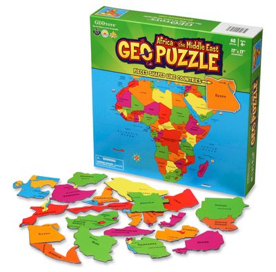
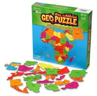
Unieke, educatieve puzzel van Afrika en het Midden Oosten met 65 puzzelstukjes in landvormen.  Gemaakt van gerecycled materiaal en ontwikkeld voor kinderen vanaf 4 jaar.   GeoPuzzles are maps of the major continents, with pieces shaped like individual countries. By putting together a GeoPuzzle, children learn what countries look like, what their n...

Verkopers met dit product

Verkoper
Bezorging
Prijs
DeZwerver.nl logo
DeZwerver.nl
5,95
18,95

Anderen bekeken ook

Kinderpuzzel GeoPuzzle Africa and the Middle East - Afrika en het Midden Oosten | GEOtoys
Unieke, educatieve puzzel van Afrika en het Midden Oosten met 65 puzzelstukjes in landvormen.  Gemaakt van gerecycled materiaal en ontwikkeld voor kinderen vanaf 4 jaar.   GeoPuzzles are maps of the major continents, with pieces shaped like individual countries. By putting together a GeoPuzzle, children learn what countries look like, what their names are, and where they are in relation to one another. At 50-70 pieces, the puzzles are perfect for ages 4-12. Designed by an art professor, GeoPuzzles are generously sized, brightly colored, and each piece is large enough to be easily handled.   GeoPuzzle Africa has 65 pieces, and is a jumbo-sized 17 x 17 inches.
18,95
Kinderpuzzel GeoPuzzle Asia - Azië | GEOtoys
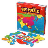
Unieke, educatieve puzzel van Azië met 50 puzzelstukjes in landvormen.  Gemaakt van gerecycled materiaal en ontwikkeld voor kinderen vanaf 4 jaar.   GeoPuzzles are maps of the major continents, with pieces shaped like individual countries. By putting together a GeoPuzzle, children learn what countries look like, what their names are, and where they are in relation to one another. At 50-70 pieces, the puzzles are perfect for ages 4-12. Designed by an art professor, GeoPuzzles are generously sized, brightly colored, and each piece is large enough to be easily handled.   The Asia GeoPuzzle does not include the Middle East. Though the Middle East is geographically part of the Asian landmass, it is culturally associated with North Africa. The Middle East has been included with the Africa GeoPuzzle.   GeoPuzzle Asia has 50 pieces, and is a jumbo-sized 19 x 16 inches.
18,95
Kinderpuzzel GeoPuzzle Latin America - Latijns Amerika | GEOtoys
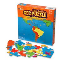
Unieke, educatieve puzzel van Latijns Amerika met 50 puzzelstukjes in landvormen.  Gemaakt van gerecycled materiaal en ontwikkeld voor kinderen vanaf 4 jaar.   GeoPuzzles are maps of the major continents, with pieces shaped like individual countries. By putting together a GeoPuzzle, children learn what countries look like, what their names are, and where they are in relation to one another. At 50-70 pieces, the puzzles are perfect for ages 4-12. Designed by an art professor, GeoPuzzles are generously sized, brightly colored, and each piece is large enough to be easily handled.    
18,95
Kinderpuzzel GeoPuzzel Wereld | GEOtoys
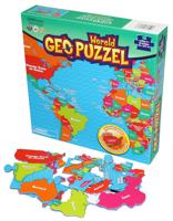
Unieke, educatieve puzzel van de wereld met 68 puzzelstukjes in de landvormen of de vorm van landengroepen De buitenste stukjes vormen een frame om de landvormige stukjes op de plaats te houden. Gemaakt van gerecycled materiaal en ontwikkeld voor kinderen vanaf 4 jaar. From Afghanistan and Belgium to Venezuela and Zimbabwe, multiple award-winning GeoPuzzles make learning geography fun! Each Geopuzzle has pieces shaped like countries, and helps to build fine motor, cognitive, language, and problem-solving skills. GeoPuzzle World has 68 pieces, with pieces shaped like individual countries and groups of countries. The outside of the puzzle forms a frame to keep the rest of the pieces, which are country-shaped, in place.    GeoPuzzle World is a jumbo-sized 26 x 12.5 inches. Ages 4 and up. Made in Germany and USA from recycled materials.
17,95
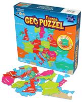
Kinderpuzzel GeoPuzzel Europa | GEOtoys
Unieke, educatieve puzzel van europa met 58 puzzelstukjes in landvormen. De buitenste stukjes vormen een frame om de landvormige stukjes op de plaats te houden.   Gemaakt van gerecycled materiaal en ontwikkeld voor kinderen vanaf 4 jaar.   Met de GeoPuzzel Europe van GEOtoys leren kinderen Europa kennen op een speelse manier. De puzzelstukken zijn in de vorm van de landen en groepen landen zodat kinderen spelenderwijs aardrijkskunde leren. De buitenkant van de puzzel vormt het frame, die de rest van de landen puzzelstukjes op zijn plaats houdt. Puzzelen is leuk om samen of alleen te doen en bovendien stimuleert puzzelen de fijne motoriek verder te ontwikkelen. Deze vrolijk gekleurde puzzel is educatief en leuk om te maken!   - Puzzelstukken in de vorm van het land - Materiaal: gerecycled - Materiaal - Afmetingen: 48,3 x 40,6 (na voltooiing) - Aantal stukken: 58 - Gewicht: 475 gram - Aanbevolen leeftijd: 4+ - Verkrijgbaar in taal: Nederlands, Engels, Frans - Ook verkrijgbaar…
17,95
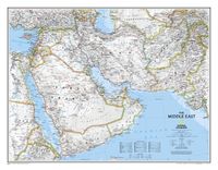
Magneetbord Middle East - Midden Oosten | National Geographic
Magneetbord - Wandkaart van het Midden Oosten, met o.a. Afghanistan - Pakistan - National Geographic wandkaart geplastificeerd - Afmeting ca 76 x 58cm    National Geographic Maps' recently updated wall map of the Middle East region, formerly titled Afghanistan/Pakistan and the Middle East.   Includes updated place names and the addition of significant locations currently in the news, such as Marjah, Afghanistan. This wall map covers a broad geographic area ranging from northern Africa through the Middle East to the western edge of China and India.   Includes complete coverage of Afghanistan, Pakistan, Tajikistan, Iran, Iraq, Kuwait, Syria, Israel, Jordan, Lebanon, Saudi Arabia, Qatar, Bahrain, United Arab Emirates, Yemen, Oman, Cyprus, and Eritrea.   Also includes parts of India, China, Kyrgyzstan, Uzbekistan, Turkmenistan, Azerbaijan, Armenia, Turkey, Egypt, Sudan, Ethiopia, and Djibouti. Features thousands of place names, accurate political boundaries, archeological sites, and major…
189,-
Vogelgids Birds of Europe, North Africa, and the Middle East: A Photographic Guide | Princeton University Press
Birds of Europe, North Africa, and the Middle East is the first comprehensive pocket-sized photographic field guide to every bird species in Europe – this includes winter visitors and common migrants but also all rarities to the region, even if they have been recorded only once. The guide also covers hypothetical species – those that have a good chance of being recorded due to such factors as range expansion and changing weather patterns.   The book's 2,200 stunning color photographs mean that every species is pictured, making field identification quick and easy. Succinct text covers key identification features, voice, habitat, and distribution, and distribution maps are provided for regular breeding species. Particular attention and details are given to help differentiate similar-looking species.   Lavishly illustrated, up-to-date, and wide-ranging, Birds of Europe, North Africa, and the Middle East is an essential field guide for every naturalist and birder.   "This is an excellent …
38,95
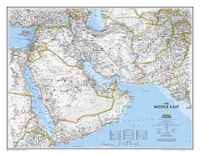
Wandkaart Middle East - Midden Oosten 76 x 58 cm | National Geographic
Wandkaart van het Midden Oosten, met o.a. Afghanistan - Pakistan - National Geographic wandkaart geplastificeerd - Afmeting ca 76 x 58 cm  National Geographic Maps' recently updated wall map of the Middle East region, formerly titled Afghanistan/Pakistan and the Middle East. Includes updated place names and the addition of significant locations currently in the news, such as Marjah, Afghanistan. This wall map covers a broad geographic area ranging from northern Africa through the Middle East to the western edge of China and India.   Includes complete coverage of Afghanistan, Pakistan, Tajikistan, Iran, Iraq, Kuwait, Syria, Israel, Jordan, Lebanon, Saudi Arabia, Qatar, Bahrain, United Arab Emirates, Yemen, Oman, Cyprus, and Eritrea.   Also includes parts of India, China, Kyrgyzstan, Uzbekistan, Turkmenistan, Azerbaijan, Armenia, Turkey, Egypt, Sudan, Ethiopia, and Djibouti. Features thousands of place names, accurate political boundaries, archeological sites, and major infrastructure n…
31,95
Wegenkaart - landkaart Africa Equatorial - Afrika midden | ITMB
This is the third of our regional maps covering the African continent and covers the portion just south of Nigeria/Cameroun that, essentially, straddles the equator. The jungle-like western half has always been referred to as Equatorial Africa, which is a bit of a mis-nomer because Uganda and Kenya also straddle the equator. The area of coverage of this map is two-fold: to bring the western portion into our growing digital data base and to provide our first-ever ITM map of beautiful East Africa (the KUT countries, Rwanda, and Burundi). Unlike Michelin, that places what it calls Central and Southern Africa on to one large single-sided sheet, we have decided to divide the southern half of the African continent into three double-sided sheets at a better scale. This is the first one, covering Africa as far south as Zambia, with a bit of Zimbabwe. As with all of our regional African maps, this one focuses on road conditions, distances, urban areas, facilities, parks, and attractions.  Lege…
13,95

Klanten-reviews van Kinderpuzzel GeoPuzzle Africa and the Middle East - Afrika en het Midden Oosten | GEOtoys

Er zijn nog geen beoordelingen voor dit productBen jij de eerste die een review plaatst?

Meer over Kinderpuzzel GeoPuzzle Africa and the Middle East - Afrika en het Midden Oosten | GEOtoys

Productomschrijving

Unieke, educatieve puzzel van Afrika en het Midden Oosten met 65 puzzelstukjes in landvormen.  Gemaakt van gerecycled materiaal en ontwikkeld voor kinderen vanaf 4 jaar.   GeoPuzzles are maps of the major continents, with pieces shaped like individual countries. By putting together a GeoPuzzle, children learn what countries look like, what their names are, and where they are in relation to one another. At 50-70 pieces, the puzzles are perfect for ages 4-12. Designed by an art professor, GeoPuzzles are generously sized, brightly colored, and each piece is large enough to be easily handled.   GeoPuzzle Africa has 65 pieces, and is a jumbo-sized 17 x 17 inches.

Productinformatie

    Verken gerelateerde categorieën

    Webshop.nl maakt gebruik van cookies. Ga je verder op onze website, ga dan akkoord met het plaatsen van cookies en de verwerking van deze data door ons en vermelde partners.