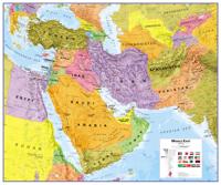

Magneetbord Middle East - Midden Oosten | National Geographic

0
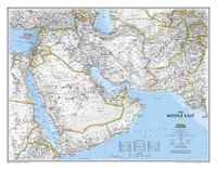
Magneetbord - Wandkaart van het Midden Oosten, met o.a. Afghanistan - Pakistan - National Geographic wandkaart geplastificeerd - Afmeting ca 76 x 58cm    National Geographic Maps' recently updated wall map of the Middle East region, formerly titled Afghanistan/Pakistan and the Middle East.   Includes updated place names and the addition of signifi...

Alle aanbiedingen van dit product

Verkoper
Bezorging
Prijs
DeZwerver.nl logo
DeZwerver.nl
5,95
189,-

Anderen bekeken ook

Magneetbord Middle East - Midden Oosten | National Geographic
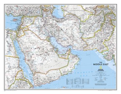
Magneetbord - Wandkaart van het Midden Oosten, met o.a. Afghanistan - Pakistan - National Geographic wandkaart geplastificeerd - Afmeting ca 76 x 58cm    National Geographic Maps' recently updated wall map of the Middle East region, formerly titled Afghanistan/Pakistan and the Middle East.   Includes updated place names and the addition of significant locations currently in the news, such as Marjah, Afghanistan. This wall map covers a broad geographic area ranging from northern Africa through the Middle East to the western edge of China and India.   Includes complete coverage of Afghanistan, Pakistan, Tajikistan, Iran, Iraq, Kuwait, Syria, Israel, Jordan, Lebanon, Saudi Arabia, Qatar, Bahrain, United Arab Emirates, Yemen, Oman, Cyprus, and Eritrea.   Also includes parts of India, China, Kyrgyzstan, Uzbekistan, Turkmenistan, Azerbaijan, Armenia, Turkey, Egypt, Sudan, Ethiopia, and Djibouti. Features thousands of place names, accurate political boundaries, archeological sites, and major…
189,-
Wandkaart Middle East - Midden Oosten 76 x 58 cm | National Geographic
Wandkaart van het Midden Oosten, met o.a. Afghanistan - Pakistan - National Geographic wandkaart geplastificeerd - Afmeting ca 76 x 58 cm  National Geographic Maps' recently updated wall map of the Middle East region, formerly titled Afghanistan/Pakistan and the Middle East. Includes updated place names and the addition of significant locations currently in the news, such as Marjah, Afghanistan. This wall map covers a broad geographic area ranging from northern Africa through the Middle East to the western edge of China and India.   Includes complete coverage of Afghanistan, Pakistan, Tajikistan, Iran, Iraq, Kuwait, Syria, Israel, Jordan, Lebanon, Saudi Arabia, Qatar, Bahrain, United Arab Emirates, Yemen, Oman, Cyprus, and Eritrea.   Also includes parts of India, China, Kyrgyzstan, Uzbekistan, Turkmenistan, Azerbaijan, Armenia, Turkey, Egypt, Sudan, Ethiopia, and Djibouti. Features thousands of place names, accurate political boundaries, archeological sites, and major infrastructure n…
31,95
Magneetbord - Wandkaart British Isles - Groot Brittannië en Ierland, 61 x 76 cm | National Geographic
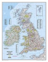
Magneetbord van een wandkaart van Groot Brittannië en Ierland: prachtig kaartbeeld met heel veel details, gemaakt door de gerenommeerde makers van National Geographic. British Isles at 1:1,687,000 on a small wall map, 61 x 76cm (1’11” x 2’5” approx) , from the National Geographic Society showing the constituent parts of the United Kingdom, Irish Republic, Isle of Man and the Channel Islands. Shetland Islands are shown on an inset. The map uses NGS’s classic presentation style of white background plus relief shading to show the topography, with boundaries shown in colour. Within Great Britain, national parks are prominently highlighted. Names of many geographical regions are shown (The Wolds, South Downs, etc.); county boundaries are marked, but county names are indicated only by numbers cross-referenced to lists of counties and unitary authorities in England, with corresponding lists for Scotland, Wales, Northern Ireland and the Irish Republic. Latitude and longitude lines are drawn a…
189,-
Magneetbord 26M Wereldkaart, politiek & antiek, 117 x 76 cm | National Geographic
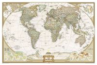
Een prachtige, stijlvol gekleurde kaart - bruin, antieke uitstraling - met een modern kaartbeeld. Alle landen staan er met grenzen en belangrijke steden keurig op, maar de nadruk ligt op de kleurstelling: deze is ‘ouderwets‘ en past goed in een klassiek interieur. Door het kleurgebruik is het reliëf van de bodem van oceanen goed te zien.   Het is de meest verkochte wereldkaart uit ons assortiment!   De kaart wordt in deze versie gelijmd op een plaat, voorzien van een mooie aluminium lijst en een ophangsysteem wordt meegeleverd. Daarnaast krijgt u een bakje bijgeleverd dat u er aan kunt bevestigen voor pennen, stiften of magneetjes.   Bij dit magneetbord wordt een set magneetjes (10 stuks) gratis meegeleverd   National Geographic is a renowned authority in cartography. For 120 years the Society's maps have helped spread geographic knowledge around the globe. A vast database allows National Geographic to combine the latest data gained by space-age technology with innovative digital mapp…
299,-
Magneetbord 28M Wereldkaart, politiek & antiek, 185 x 122 xm | National Geographic
Een prachtige, stijlvol gekleurde kaart - bruin, antieke uitstraling - met een modern kaartbeeld. Alle landen staan er met grenzen en belangrijke steden keurig op, maar de nadruk ligt op de kleurstelling: deze is ‘ouderwets‘ en past goed in een klassiek interieur. Door het kleurgebruik is het reliëf van de bodem van oceanen goed te zien.   Het is de meest verkochte wereldkaart uit ons assortiment!   De kaart wordt in deze versie gelijmd op een plaat, voorzien van een mooie aluminium lijst en een ophangsysteem wordt meegeleverd. Daarnaast krijgt u een bakje bijgeleverd dat u er aan kunt bevestigen voor pennen, stiften of magneetjes.   Bij dit magneetbord wordt een set magneetjes (10 stuks) gratis meegeleverd   National Geographic is a renowned authority in cartography. For 120 years the Society's maps have helped spread geographic knowledge around the globe. A vast database allows National Geographic to combine the latest data gained by space-age technology with innovative digital mapp…
475,-
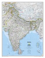
Wandkaart 20546 India, 60 x 77 cm | National Geographic
See India as only National Geographic can depict it. This new reference map is one of the most detailed and comprehensive ever published for India and southern Asia. It includes India, Sri Lanka, Nepal, Bangladesh, Bhutan, Tajikistan, and portions of China, Pakistan, Afghanistan, and Myanmar. The India map is punctuated with thousands of place names, and embellished with shaded relief which highlights the region's dramatic topography in such places as the Tibetan Plateau and the Himalaya.
25,95
Reisgids Middle East - Midden Oosten | Lonely Planet
De perfecte reisgids voor zowel de georganiseerde als de zelfstandige reiziger. Naast een algemene inleiding van het land / streek vol met praktische informatie over hoe je er het beste kunt reizen: slapen, eten, vervoer, excursies ... alles kun je er in vinden. Engelstalig. Lonely Planet Lonely Planet's Middle East is our most comprehensive guide that extensively covers all the region has to offer, with recommendations for both popular and lesser-known experiences. Wonder at the enchanting Petra, visit Ancient Egyptian sites and explore the ruins of Persepolis; all with your trusted travel companion.   Inside Lonely Planet's Middle East Travel Guide: Lonely Planet's Top Picks - a visually inspiring collection of the destination's best experiences and where to have them Itineraries help you build the ultimate trip based on your personal needs and interests Local insights give you a richer, more rewarding travel experience - whether it's history, people, music, landscapes, wild…
27,95
Woordenboek Phrasebook & Dictionary Middle East - Midden Oosten | Lonely Planet
Handige taalgids voor basis talen in dit gebied. Zowel woorden, phonetisch uitgelegd, als zinnen. Met Modern Standaard Arabisch, Egyptisch Arabisch, Golf Arabisch, Levantine Arabisch, Tunesisch, Farsi, Hebreews en Turks. The Middle East beckons you. With 8 key languages in this first ever phrasebook to the region, let no barriers - language or culture - get in your way. Find your way to the qahwa (cofee house) for a sheesha (water pipe), and have a chat with some of the world's most hospitable people. Immerse yourself in the culture section packed with fascinating and useful info on this unique region.    
9,95
Magneetbord - Wereldkaart 82PM politiek, 110 x 77 cm | National Geographic
Politieke wereldkaart van National Geographic. De klassieke blauwe vorm, met helder kaartbeeld. De landen hebben met kleuren duidelijke grenzen en er staan opvallend veel topografische details op. Ondanks de schaal een behoorlijk aantal plaatsnamen. Simpelweg een mooie kaart voor aan de muur op uw kantoor of studeerkamer op een bescheiden formaat (er zijn veel grotere in de handel!) De kaart wordt in deze versie gelijmd op een plaat, voorzien van een mooie aluminium lijst en een ophangsysteem wordt meegeleverd. Daarnaast krijgt u een bakje bijgeleverd dat u er aan kunt bevestigen voor pennen, stiften of magneetjes. We leveren bij dit magneetbord 1 set (10 stuks) gratis magneetjes. 
249,50

Klanten-reviews van Magneetbord Middle East - Midden Oosten | National Geographic

Er zijn nog geen beoordelingen voor dit productBen jij de eerste die een review plaatst?

Meer over Magneetbord Middle East - Midden Oosten | National Geographic

Productomschrijving

Magneetbord - Wandkaart van het Midden Oosten, met o.a. Afghanistan - Pakistan - National Geographic wandkaart geplastificeerd - Afmeting ca 76 x 58cm 

  National Geographic Maps' recently updated wall map of the Middle East region, formerly titled Afghanistan/Pakistan and the Middle East.   Includes updated place names and the addition of significant locations currently in the news, such as Marjah, Afghanistan. This wall map covers a broad geographic area ranging from northern Africa through the Middle East to the western edge of China and India.   Includes complete coverage of Afghanistan, Pakistan, Tajikistan, Iran, Iraq, Kuwait, Syria, Israel, Jordan, Lebanon, Saudi Arabia, Qatar, Bahrain, United Arab Emirates, Yemen, Oman, Cyprus, and Eritrea.   Also includes parts of India, China, Kyrgyzstan, Uzbekistan, Turkmenistan, Azerbaijan, Armenia, Turkey, Egypt, Sudan, Ethiopia, and Djibouti. Features thousands of place names, accurate political boundaries, archeological sites, and major infrastructure networks such as roads, canals, ferry routes, airports, and railroads. The region's diverse terrain is detailed through accurate shaded relief, coastal bathymetry, and symbolism for water features and other land forms. Elevations of major peaks and depth soundings are expressed in meters.   The Middle East Wall Map is printed on high-quality 80# paper suitable for framing, and is also available in a laminated edition. Additional, more detailed, wall maps are available for many of the countries featured on this map.

Productinformatie

    Verken gerelateerde categorieën

    Webshop.nl maakt gebruik van cookies. Ga je verder op onze website, ga dan akkoord met het plaatsen van cookies en de verwerking van deze data door ons en vermelde partners.