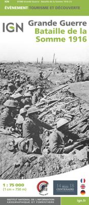
Historische Kaart Battle of the Somme 1916 | IGN - Institut Géographique National

0
Speciale themakaart over de slag bij de Somme in de 1e Wereldoorlog. Veel details over slagvelden, troepenbewegingen en andere locaties. Gedetailleerd genoeg om alle plekken in het veld terug te vinden. WW1, 1e wereldoorlog, Eerste wereldoorlog...

Verkopers met dit product

Verkoper
Bezorging
Prijs
DeZwerver.nl logo
DeZwerver.nl
2,95
11,95

Anderen bekeken ook

Historische Kaart Bataille de Verdun 1916 - Slag om Verdun | IGN - Institut Géographique National
Speciale themakaart over de slag bij Verdun in de 1e Wereldoorlog. Veel details over slagvelden, troepenbewegingen en andere locaties. Gedetailleerd genoeg om alle plekken in het veld terug te vinden. The Great War, World War I commemorative map published by IGN France which presents an overview of the Verdun   Includes three maps. An overview map at a scale of 1:75,000 A more detailed inset map of the battle area A reproduction of a contemporary map showing the area around the Fort de Douaumont at 1:5,000   WW1, 1e wereldoorlog, Eerste wereldoorlog
11,95
Historische Kaart Grande guerre 1914 - 1918, Great War | IGN - Institut Géographique National
Bijzondere kaart van de slagvelden in de 1e wereldoorlog. Op de verschillende kaarten wordt heel duidelijk weergegeven wat zich waar heeft afgespeeld in Frankrijk. Wereldoorlog I kaart ( Eerste Wereldoorlog ) met het frontgebied van Zwitserland tot de Noordzee met de herdenkingsplekken, de begraafplaatsen, musea en de oude verdedigingswerken.     Grande Guerre 1914 - 1918 A l’occasion du centenaire de la première guerre mondiale, l'IGN édite la carte de la Grande Guerre 1914-1918 qui couvre toute la zone de front de la Suisse à la mer du Nord à l’échelle 1 : 410 000 (1cm = 4,1 km). Cette carte présente les lignes de front, les lieux de mémoire (mémoriaux, cimetières militaires, anciens ouvrages défensifs, musées), les lieux de bataille et les chemins de mémoire. Réalisée en partenariat avec la Mission du Centenaire, les comités régionaux et départementaux du tourisme des régions et départements couvrant la zone de front, cette carte propose une légende trilingue : français, anglais et…
11,95
Historische Kaart Grande Guerre - Chemin des Dames 1917 | IGN - Institut Géographique National
Historische kaart van het gebied rond Chemin des Dames. De Chemin des Dames is een bijzondere weg gelegen in het noorden van Frankrijk, midden in de driehoek Soissons, Laon en Reims. De weg is grotendeels gelegen op een heuvelrug die enkele tientallen meters uitsteekt boven het omringende, zacht glooiende, land.   Op deze kaart zijn de troepen en slagvelden ingetekend rond 1917 ten tijde van de 1e Wereldoorlog.    L'IGN édite la carte de « Bataille du Chemin des Dames 1917  » pour commémorer son centenaire. Cette carte, à l’échelle du 1 : 75 000 (1cm =750m) présente les lignes de front, les lieux de mémoire (mémoriaux, cimetières militaires, anciens ouvrages défensifs, musées). Réalisée en partenariat  avec la Mission du Centenaire de la première guerre mondiale et le Comité Départemental  du Tourisme de l’Aisne, cette carte propose une légende et des informations éditoriales en trois langues : français, anglais et allemand.   WW1, 1e wereldoorlog, Eerste wereldoorlog
11,95
Wandelkaart - Topografische kaart 2107OT Le Tréport | IGN - Institut Géographique National
De wandelkaart die de perfectie benadert! Werkelijk alle topografische details zijn er op te vinden; van hoogtelijnen tot aan bruggetjes en allerlei wandelpaden. Daarnaast hebben de makers een flinke dosis toeristische informatie op de kaart verwerkt: campings, gites d étape, restaurants en ingetekende doorgaande wandelpaden, de grandes randonnées. Het kleurgebruik is geweldig met schaduwzijdes, bos, weiland, etc goed te onderscheiden. De kaart is uitgevoerd met raster van graden, dus deze is GPS - toepasbaar! De TOP 25 kaarten (kaart nummers die eindigen op "T") hebben betrekking op gebieden van bijzonder toeristisch belang zoals de Alpen, de Pyreneeën,De Cevennes, de Vogezen, de Provence, en de Atlantische en Middellandse zeekusten. De kaarten hebben een opdruk en benadrukken zo de lokale wandelpaden, lange afstand GR routes en, in voorkomend geval, ski routes. Andere toeristische informatie omvat campings, paardensport of kanocentra, hutten, berghutten, etc. Elke "TOP 25" kaart bed…
17,95
Wandelkaart - Topografische kaart 2106ET Baie de Somme, Le Crotoy, Fort-Mahon-Plage | IGN - Institut Géographique National
De wandelkaart die de perfectie benadert! Werkelijk alle topografische details zijn er op te vinden; van hoogtelijnen tot aan bruggetjes en allerlei wandelpaden. Daarnaast hebben de makers een flinke dosis toeristische informatie op de kaart verwerkt: campings, gites d étape, restaurants en ingetekende doorgaande wandelpaden, de grandes randonnées. Het kleurgebruik is geweldig met schaduwzijdes, bos, weiland, etc goed te onderscheiden. De kaart is uitgevoerd met raster van graden, dus deze is GPS - toepasbaar!   De TOP 25 kaarten (kaart nummers die eindigen op "T") hebben betrekking op gebieden van bijzonder toeristisch belang zoals de Alpen, de Pyreneeën,De Cevennes, de Vogezen, de Provence, en de Atlantische en Middellandse zeekusten. De kaarten hebben een opdruk en benadrukken zo de lokale wandelpaden, lange afstand GR routes en, in voorkomend geval, ski routes. Andere toeristische informatie omvat campings, paardensport of kanocentra, hutten, berghutten, etc. Elke "TOP 25" kaart b…
17,95
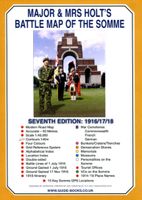
Historische Kaart Major & Mrs Holt's Battle Map of The Somme | Pen and Sword publications
This is the only map available that shows the exact locations of 300 memorials and places of interest on the battlefields of the Somme   This Sixth Edition also covers the American and Canadian areas between Amiens and Montdidier.    It is double sided in four colours with an overall view on one side and a detailed view on the other, both showing battle lines and ORBAT information   There are detailed alphabetical and thematic indexes to all 300 points.   Size - The map measures 19.5 inches (49cm) by 28 inches (71cm). It is printed in four colours and is double sided on firm glossy paper.   On one side at a scale of 1:70,000 is shown the whole of the Somme battle area from Bullecourt in the north to Amiens in the south and from Doullens in the west to Pyronne in the east. Also on this side are the colour coded indexes and the map of the 1918 sector from Villers Bretonneux to Cantigny.   On the other side at a scale of 1:40,000 the battle area mostly, but not exclusively, associat…
9,95
Wandelgids Walking in the Footsteps of the Fallen - Verdun 1916 | Pen and Sword publications
A visit to the battlefield of Verdun is usually dominated by the forts of Douamont and Vaux, the museum at Fleury and the striking, huge Ossuary, Although this gives a flavour of the horrific fighting that took place in the area, particularly in 1916, the visitor will be hard pressed to get much more than an impression from such places.This book seeks to guide the battlefield pilgrim into parts of the battlefield that get rarely visited by means of a series of walks, a number of which include the major sites.The four tours have been carefully walked. All are practicable for a reasonably healthy adult; the tours vary in length, most taking a half day to complete and the longest (the last) a day.In a twist to the usual walks to be found in the Battleground series,. Christina makes full use of the numerous field graves and isolated memorials that are to be found on the Verdun battlefield, a number of which will bring visitors to the most visited sites. In the course of these walks many p…
20,95
Wandelkaart - Topografische kaart 2913 SB - Serie Bleue Châlons-en-Champagne | IGN - Institut Géographique National
Een nieuwe serie van IGN: de oude versies Est en Ouest (E en O aanduiding achter het nummer van de kaart) gaan verdwijnen en worden vervangen door een kaart met nummer en gevolgd door de letters SB. In de meeste gevalen is het een samenvoeging van de E en O kaart, de SB kaart beslaat dan ook een groter gebied. Het gebied bestrijkt ongeveer 28 x 20 km.   De wandelkaart die de perfectie benadert! Werkelijk alle topografische details zijn er op te vinden; van hoogtelijnen tot aan bruggetjes en allerlei wandelpaden. Daarnaast hebben de makers een flinke dosis toeristische informatie op de kaart verwerkt: campings, gites d étape en ingetekende doorgaande wandelpaden, de grandes randonnées. Het kleurgebruik is geweldig met schaduwzijdes, bos, weiland, etc goed te onderscheiden. De kaart is uitgevoerd met raster van graden, dus deze is GPS - toepasbaar!   De TOP 25 kaarten (kaart nummers die eindigen op "T") hebben betrekking op gebieden van bijzonder toeristisch belang zoals de Alpen, de Py…
17,95
De slag van de Somme 1916 (Paperback)
Op 1 juli 1916 begon The Big Push de gezamenlijke poging van de Britse en Franse legers om aan het Noord-Franse front bij de rivier de Somme een beslissende doorbraak te forceren in de vastgelopen stellingenoorlog. Het plan liep uit op een fiasco, waarbij op die eerste dag alleen al aan Britse zijde 60.000 slachtoffers vielen. De Somme werd, samen met Verdun, het symbool voor de zinloze slachting die de Eerste Wereldoorlog heet. Koen Koch schetst het verloop van de slag, beschrijft de hoofdrolspelers en maakt duidelijk hoe tot op de dag van vandaag de discussie woedt over de militaire en politieke betekenis van de slag. In een slothoofdstuk neemt hij de lezer mee op reis naar Noord-Frankrijk, en laat hij zien wat er in het huidige landschap is terug te vinden van de verschrikkingen van weleer. Het boek is geïllustreerd met foto's en verhelderende kaartjes.
26,99
Historische Kaart Militair Erfgoed - In Flanders fields Belgium | NGI - Nationaal Geografisch Instituut
Kaart voor militair erfgoed in West Vlaanderen, zowelvoor WO l als voor WO ll. The Western Front in Flanders on a detailed map at 1:100,000 highlighting locations of numerous monuments, cemeteries, front lines and other WWI-related sites, listed in the accompanying panels with, where appropriate, their phone numbers. The map is double-sided but all the main WWI battlefields from the French border to beyond Passendale/Paschendaele are together on one side.   The map shows the present-day road and rail networks in the province of West Flanders. Extensive overprint highlights locations of WWI-related sites, indicating whether open to the general public or by appointment only: museums, military cemeteries, war memorials and monuments to the missing soldiers, bunkers and battery remains, etc. Sites in France in the immediate vicinity of the Belgian border are also marked. The overprint also indicates battlefields and fortifications from other periods of history of Flanders, from the Middle…
8,50

Klanten-reviews van Historische Kaart Battle of the Somme 1916 | IGN - Institut Géographique National

Er zijn nog geen beoordelingen voor dit productBen jij de eerste die een review plaatst?

Meer over Historische Kaart Battle of the Somme 1916 | IGN - Institut Géographique National

Productomschrijving

Speciale themakaart over de slag bij de Somme in de 1e Wereldoorlog. Veel details over slagvelden, troepenbewegingen en andere locaties. Gedetailleerd genoeg om alle plekken in het veld terug te vinden.

WW1, 1e wereldoorlog, Eerste wereldoorlog

Verken gerelateerde categorieën

Webshop.nl maakt gebruik van cookies. Ga je verder op onze website, ga dan akkoord met het plaatsen van cookies en de verwerking van deze data door ons en vermelde partners.