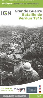
Historische Kaart Bataille de Verdun 1916 - Slag om Verdun | IGN - Institut Géographique National

0
Speciale themakaart over de slag bij Verdun in de 1e Wereldoorlog. Veel details over slagvelden, troepenbewegingen en andere locaties. Gedetailleerd genoeg om alle plekken in het veld terug te vinden. The Great War, World War I commemorative map published by IGN France which presents an overview of the Verdun   Includes three maps. An overview map...

Verkopers met dit product

Verkoper
Bezorging
Prijs
DeZwerver.nl logo
DeZwerver.nl
2,95
11,95

Anderen bekeken ook

Historische Kaart Bataille de Verdun 1916 - Slag om Verdun | IGN - Institut Géographique National
Speciale themakaart over de slag bij Verdun in de 1e Wereldoorlog. Veel details over slagvelden, troepenbewegingen en andere locaties. Gedetailleerd genoeg om alle plekken in het veld terug te vinden. The Great War, World War I commemorative map published by IGN France which presents an overview of the Verdun   Includes three maps. An overview map at a scale of 1:75,000 A more detailed inset map of the battle area A reproduction of a contemporary map showing the area around the Fort de Douaumont at 1:5,000   WW1, 1e wereldoorlog, Eerste wereldoorlog
11,95
Historische Kaart Verdun - Eerste Wereldoorlog | War travel
Themakaart over de geschiedenis van de Eerste Wereldoorlog in en rond Verdun. Met gedetailleerde inzetten van Verdun, Argonne en Saint-Michel. Aandacht voor monumenten, musea, vestingen, loopgraven en kerkhoven.  Mooi kleurgebruik, veel detail en heel gedetailleerd. Gedrukt op stone-paper, dat gaat echt veel langer mee.   Van de uitgever Discover Verdun and its surroundings. This double-sided printed map shows the locations of cemeteries, monuments, forts, trenches and museums in and around Verdun. The map is printed on Stone Paper, 100% water-repellent, very durable in use and paper-free. Folded size 12.5 * 25 cm, unfolded 70 * 100 cm.   Discover 10 destroyed villages, 66 World War I cemeteries (37 French, 28 German and 1 American), 30 fortresses, 40 monuments, 16 trenches and 10 World War I museums using this highly detailed map.   The map is divided into 4 sections:   The city of Verdun. Visit the underground Citadelle, the beautiful Victory Monument, the old town in Vauban style a…
15,-
Historische Kaart Grande guerre 1914 - 1918, Great War | IGN - Institut Géographique National
Bijzondere kaart van de slagvelden in de 1e wereldoorlog. Op de verschillende kaarten wordt heel duidelijk weergegeven wat zich waar heeft afgespeeld in Frankrijk. Wereldoorlog I kaart ( Eerste Wereldoorlog ) met het frontgebied van Zwitserland tot de Noordzee met de herdenkingsplekken, de begraafplaatsen, musea en de oude verdedigingswerken.     Grande Guerre 1914 - 1918 A l’occasion du centenaire de la première guerre mondiale, l'IGN édite la carte de la Grande Guerre 1914-1918 qui couvre toute la zone de front de la Suisse à la mer du Nord à l’échelle 1 : 410 000 (1cm = 4,1 km). Cette carte présente les lignes de front, les lieux de mémoire (mémoriaux, cimetières militaires, anciens ouvrages défensifs, musées), les lieux de bataille et les chemins de mémoire. Réalisée en partenariat avec la Mission du Centenaire, les comités régionaux et départementaux du tourisme des régions et départements couvrant la zone de front, cette carte propose une légende trilingue : français, anglais et…
11,95
Historische Kaart Grande Guerre - Chemin des Dames 1917 | IGN - Institut Géographique National
Historische kaart van het gebied rond Chemin des Dames. De Chemin des Dames is een bijzondere weg gelegen in het noorden van Frankrijk, midden in de driehoek Soissons, Laon en Reims. De weg is grotendeels gelegen op een heuvelrug die enkele tientallen meters uitsteekt boven het omringende, zacht glooiende, land.   Op deze kaart zijn de troepen en slagvelden ingetekend rond 1917 ten tijde van de 1e Wereldoorlog.    L'IGN édite la carte de « Bataille du Chemin des Dames 1917  » pour commémorer son centenaire. Cette carte, à l’échelle du 1 : 75 000 (1cm =750m) présente les lignes de front, les lieux de mémoire (mémoriaux, cimetières militaires, anciens ouvrages défensifs, musées). Réalisée en partenariat  avec la Mission du Centenaire de la première guerre mondiale et le Comité Départemental  du Tourisme de l’Aisne, cette carte propose une légende et des informations éditoriales en trois langues : français, anglais et allemand.   WW1, 1e wereldoorlog, Eerste wereldoorlog
11,95
Reisgids Historische Route Verdun | Uitgeverij Elmar
Nergens ter wereld wordt de waanzin van de oorlog zo duidelijk als op het slagveld van Verdun, waar tijdens de Eerste Wereldoorlog in nog geen jaar tijd bijna een miljoen soldaten sneuvelden, terwijl er van enige terreinwinst nauwelijks sprake was.   Verdun betekende een ommekeer in de oorlog: de Fransen hervonden hun zelfvertrouwen. De Franse regering was zich hiervan zeer bewust en riep het gebied rond Verdun uit tot nationaal monument en liet het gebied in de staat zoals het was na afloop van de slag. Dit maakt dat de hedendaagse reiziger een goede indruk kan krijgen van de situatie zoals die was in 1916.   Deze gids is daarbij een uitstekend hulpmiddel. Geen historische plek wordt hierbij overgeslagen en daarbij krijgt de lezer ook nog een uitleg, met veel oog voor het bijzondere detail, over de gebeurtenissen tijdens dat dramatische jaar.
16,99
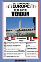
Historische Kaart 14 - 18 Map of Verdun (Battlefield map) | Eerste Wereld Oorlog | Pen and Sword publications
Comprehensive mapping for the Battle of Verdun 1916 and a sizable part of the early days of the Meuse-Argonne Offensive 1918. Clearly produced in full color, with different types of feature in different colors, all supported by two comprehensive keys. For many years the Holts have provided tourers to the battlefields with excellent mapping for the Ypres Salient and the Somme. This map of the Verdun/Meuse area fills one of the many gaps in the coverage of the Western Front. This map of the Verdun battlefield is in the same style, using a color coded system to distinguish the different types of features. It includes some 300 locations of memorials, cemeteries, significant remnants of the battle terrain, remaining fortifications, trenches, the destroyed villages and other vestiges of the war. On the reverse there is a cut out and enlarged section of the Verdun battlefield in particular - the most visited part of the area, which provides greater detail. This section includes the Ossuary…
9,95
Historische Kaart Militair Erfgoed - In Flanders fields Belgium | NGI - Nationaal Geografisch Instituut
Kaart voor militair erfgoed in West Vlaanderen, zowelvoor WO l als voor WO ll. The Western Front in Flanders on a detailed map at 1:100,000 highlighting locations of numerous monuments, cemeteries, front lines and other WWI-related sites, listed in the accompanying panels with, where appropriate, their phone numbers. The map is double-sided but all the main WWI battlefields from the French border to beyond Passendale/Paschendaele are together on one side.   The map shows the present-day road and rail networks in the province of West Flanders. Extensive overprint highlights locations of WWI-related sites, indicating whether open to the general public or by appointment only: museums, military cemeteries, war memorials and monuments to the missing soldiers, bunkers and battery remains, etc. Sites in France in the immediate vicinity of the Belgian border are also marked. The overprint also indicates battlefields and fortifications from other periods of history of Flanders, from the Middle…
8,50
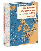
Historische Atlas De Tweede Wereldoorlog in 100 kaarten | Tree Books
De Eerste Wereldoorlog kenmerkte zich door een enorme groei in het gebruik en de productie van militaire kaarten. Maar in de Tweede Wereldoorlog gingen de strijdende partijen nog een stap verder: kaarten, luchtfoto’s, en het systematisch vastleggen en verwerken van geografische en topografische gegevens speelden een rol van ongekende omvang. Zoals Jeremy Black – een van de meest vooraanstaande militaire en cartografische historici ter wereld – overtuigend aantoont in dit schitterende fullcolourboek, is het onmogelijk om de gebeurtenissen en uitkomsten van de Tweede Wereldoorlog te begrijpen zonder diepgaande kennis van het gebruik van kaarten. In de Tweede Wereldoorlog werden kaarten zelfs een wapen. In De Tweede Wereldoorlog in 100 kaarten schetst Jeremy Black hoe militaire cartografie zich ontwikkelde van het simpelweg vastleggen van feiten tot een beslissende factor op wereldschaal. Aan de hand van honderd sleutelkaarten uit de ongeëvenaarde collectie van de British Library en ande…
49,50
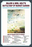
Historische Kaart Major & Mrs Holt's Battle Map of Market Garden | Pen and Sword publications
This is the only map of its kind devised and created by Major and Mrs Holt and is used by many guides   It shows the locations of 300 memorials and war cemeteries over THE WHOLE OPERATION MARKET-GARDEN AREA   It shows the progress of the battle from Leopoldsburg to  Eindhoven, Nijmegen, Arnhem and Oosterbeek overlaid on modern roads   In four colours, double sided and with 10 inset maps it shows all drop and landing zones   Suitable for navigation by car, bicycle or foot   Size - The map measures 19.5 inches (49cm) by 28 inches (71cm). It is printed in four colours and is on firm glossy paper.   On one side at a scale of 1:180,000 is shown the whole of the Market Garden corridor of operations from Arnhem in the north to Leopoldsburg in the south and from Vught in the west to Overloon in the east. See below for details of the other side.   What is Marked on the Map   This map is quite unique and no other exists that shows the Market Garden Corridor in such detail. Over 230 memor…
9,95

Klanten-reviews van Historische Kaart Bataille de Verdun 1916 - Slag om Verdun | IGN - Institut Géographique National

Er zijn nog geen beoordelingen voor dit productBen jij de eerste die een review plaatst?

Meer over Historische Kaart Bataille de Verdun 1916 - Slag om Verdun | IGN - Institut Géographique National

Productomschrijving

Speciale themakaart over de slag bij Verdun in de 1e Wereldoorlog. Veel details over slagvelden, troepenbewegingen en andere locaties. Gedetailleerd genoeg om alle plekken in het veld terug te vinden.

The Great War, World War I commemorative map published by IGN France which presents an overview of the Verdun   Includes three maps. An overview map at a scale of 1:75,000 A more detailed inset map of the battle area A reproduction of a contemporary map showing the area around the Fort de Douaumont at 1:5,000   WW1, 1e wereldoorlog, Eerste wereldoorlog

Productinformatie

    Verken gerelateerde categorieën

    Webshop.nl maakt gebruik van cookies. Ga je verder op onze website, ga dan akkoord met het plaatsen van cookies en de verwerking van deze data door ons en vermelde partners.