

Meer Van Haren Publishing
Meer Van Haren Publishing in Boeken

Global standards and publications - Jane Chittenden, Rene Visser - ebook

0

Alle aanbiedingen van dit product

Verkoper
Bezorging
Prijs
eBook.nl logo
eBook.nl
0
gratis
14,22

Anderen bekeken ook

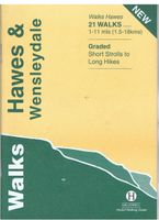
Wandelgids Hawes and Wensleydale | Hallewell Publications
Rewalked and updated in 2016, Walks Hawes & Wensleydale covers the Northern part of the Yorkshire Dales National Park - an area of rolling green hills, dramatic limestone features and quaint villages. The guide features walks in Wensleydale, which includes the popular towns of Hawes and Leyburn. Although there are no high peaks in the area, there are some fine hill walks, as well as paths passing the area's numerous waterfalls. The 21 walks featured range from 1 mile to 11 miles (1.5-18km). Routes include: Aysgill Force, Hardraw Force & Sedbusk, Semer Water, Aysgarth to Castle Bolton and Leyburn Shawl. The guide is part of a popular series of A6 pocket walking guides which describe routes which are suitable for walkers of all abilities and to suit all tastes. Route descriptions are accompanied by 2-colour sketch maps. The guides are illustrated with line illustrations, and will provide walkers with a good introduction to what each area covered has to offer.  
5,95
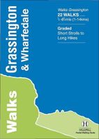
Wandelgids Grassington and Wharfedale | Hallewell Publications
The Yorkshire Dales National Park - an area of rolling green hills, dramatic limestone features and quaint villages - has five main dales (valleys). Walks Grassington & Wharfedale covers Wharfedale - containing the villages of Grassington and Kettlewell - plus the town of Skipton. In the north the walks run by the riverside or climb onto the grassy hills; in the south the rock changes from limestone to sandstone and there are routes through the narrow wooded valley north of Castle Bolton or onto the heather moors to either side. The 22 walks featured range from 0.5 miles to 8.5 miles (1-14km). Routes include: Buckden Loop, a circuit from Kettlewell via Starbotton and Moor End, Grassington to Burnsall, Bolton Abbey & The Strid and Skipton Woods. Part of a popular series of A6 pocket walking guides which describe routes which are suitable for walkers of all abilities and to suit all tastes. Route descriptions are accompanied by 2-colour sketch maps. The guides are illustrated with line …
5,95
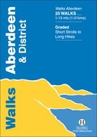
Wandelgids Aberdeen and District | Hallewell Publications
Walks Aberdeen & District covers the city of Aberdeen and the surrounding coast and countryside. Most of the walks are fairly gentle, though there are some fine hill walks on Bennachie. The 25 walks featured range from 0.5 miles to 13 miles (1-21km). Routes include: Old Aberdeen, Banchory to Crathes, Dunnottar Castle and Bennachie: Mither Tap. Part of a popular series of A6 pocket walking guides which describe routes which are suitable for walkers of all abilities and to suit all tastes. Route descriptions are accompanied by 2-colour sketch maps. The guides are illustrated with line illustrations, and will provide walkers with a good introduction to what each area covered has to offer.
5,95
Wandelgids Walking Waterloo: A Guide | Pen and Sword publications
Wandelgids over de Slag bij Waterloo   Charles Esdaile’s new guide to the Battle of Waterloo presents the experience of the soldiers who took part in the battle in the most graphic and direct way possible – through their own words. In a series of walks he describes in vivid detail what happened in each location on 18 June 1815 and he quotes at length from eyewitness accounts of the men who were there.   Each phase of the action during that momentous day is covered, from the initial French attacks and the intense fighting at Hougoumont and La Haye Sainte to the charges of the French cavalry against the British squares and the final, doomed attack of Napoleon’s Imperial Guard.   This innovative guide to this historic site is fully illustrated with a selection of archive images from the War Heritage Institute in Brussels, modern colour photographs of the battlefield as it appears today and specially commissioned maps which allow the visitor to follow the course of the battle on the groun…
24,95
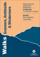
Wandelgids Grasmere, Ambleside and Windermere | Hallewell Publications
Rewalked and revised in 2021, Walks Grasmere, Ambleside & Windermere features walks in The Lake District - the famous area of spectacular peaks and lakes in the north-west of England. This guide covers the central part of the area, which contains many of the most popular towns and villages in the area; not only those mentioned in the title, but also Hawkshead and Rydal. The guide contains walks from all the main centres and around the northern half of Lake Windermere and Grasmere. The 23 walks featured range from 1.5 miles to 9 miles (2.5-14.5km). Routes include: Helm Crag, Alcock Tarn, Great Langdale, Ambleside to Troutbeck, Orrest Head and Tilberthwaite. Last rewalked and updated 2014 - Walks Grasmere is part of a popular series of A6 pocket walking guides which describe routes which are suitable for walkers of all abilities and to suit all tastes. Route descriptions are accompanied by 2-colour sketch maps. The guides are illustrated with line illustrations, and will provide walkers…
5,95
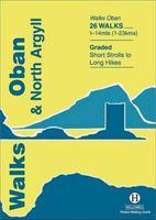
Wandelgids Oban and North Argyll | Hallewell Publications
Rewalked and updated in 2018, Walks Oban & North Argyll covers the area around the popular coastal town of Oban, the offshore islands which can be reached from the town, and inland as far as Bridge of Orchy. The coastal area and islands are fairly gentle in character, but there are some fine, challenging hill walks inland. The 26 walks featured range from 0.5 miles to 14 miles (1-23km). Routes include: Oban to Gallanach, two routes on Lismore, Ben Cruachan and Bridge of Orchy to Tyndrum. Part of a popular series of A6 pocket walking guides which describe routes which are suitable for walkers of all abilities and to suit all tastes. Route descriptions are accompanied by 2-colour sketch maps. The guides are illustrated with line illustrations, and will provide walkers with a good introduction to what each area covered has to offer.  
5,95
Reisgids The Battles of Arras - north | Pen and Sword publications
The First World War battlefields to the north of Arras - including Vimy Ridge - are among the most famous and most visited sites on the Western Front, rivalled only by those around Ypres and the Somme, and this clearly written, highly illustrated guide is the ideal introduction to them. Visitors can trace for themselves the course of each battle across the modern landscape and gain a fascinating insight into the nature of the fighting in the area - and the wider conflict across the Western Front - throughout the war. The book covers the key battles fought in the northern sector of the Arras front, including the 1917 Battle of Vimy Ridge and battles at Villers au Bois, Oppy Wood and Gavrelle. Expert guides Jon Cooksey and Jerry Murland have devised a series of routes that can be walked, biked or driven, explaining the fighting that occurred at each place in vivid detail. They record what happened, where it happened and why, and point out the sights that remain for the visitor to see. T…
20,50
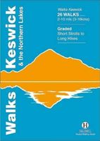
Wandelgids Keswick and the Northern Lakes | Hallewell Publications
Rewalked and updated in 2021 - Walks Keswick & the Northern Lakes features walks in The Lake District - the famous area of spectacular peaks and lakes in the north-west of England. This guide covers the northern part of the area. Many of the walks included are near the town of Keswick, with others in Borrowdale and by Buttermere and Crummock Water. They range in nature from serious hill climbs to gentler, lower-level routes. The 26 walks featured range from 2 miles to 10 miles (3-16km). Routes include: Skiddaw, Cat Bells & Derwent Water, Hay Stacks and a circuit of Buttermere. Now in its 4th edition, Walks Keswick is part of a popular series of A6 pocket walking guides which describe routes which are suitable for walkers of all abilities and to suit all tastes. Route descriptions are accompanied by 2-colour sketch maps. The guides are illustrated with line illustrations, and will provide walkers with a good introduction to what each area covered has to offer.  
5,95

Klanten-reviews van Global standards and publications - Jane Chittenden, Rene Visser - ebook

Er zijn nog geen beoordelingen voor dit productBen jij de eerste die een review plaatst?

Meer over Global standards and publications - Jane Chittenden, Rene Visser - ebook

Productinformatie

    Productspecificaties

    Artikelnummer(s)
    EAN
    9789087538972
    Brand
    Van Haren Publishing

    Verken gerelateerde categorieën

    Webshop.nl maakt gebruik van cookies. Ga je verder op onze website, ga dan akkoord met het plaatsen van cookies en de verwerking van deze data door ons en vermelde partners.