webshop.nl
Categorieën
  Sluiten

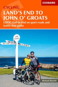
Fietsgids Land's End to John o' Groats | Cicerone

A guidebook describing Britain’s famous ‘End to End’ cycle route, a journey of almost 1000 miles from the very tip of southwest England – Land’s End – to the northernmost point of mainland Scotland – John o’ Groats. Divided into 14 day stages, with each stage covering between 53 and 85 miles, the route features some of the best cycling the UK has t...
20,95

Webshops met dit product

Webshop
Bezorging
Prijs

Anderen bekeken ook

Fietsgids Cycling London to Paris | Cicerone
Uitstekende beschrijving van de klassieke fietsroute tussen de twee steden Londen en Parijs: goede routebeschrijving, met hoogteprofielen, belangrijke informatie en uitstekende kaarten. This guidebook describes two long-distance cycle routes between London and Paris: the 'classic route' and the Avenue Verte. The continuing development of national cycle networks in both countries and an increased interest in cycling have further increased the popularity of this journey, both as a cycle tour and for sponsored challenges. Both routes are well within the capabilities of cyclists of moderate fitness and will generally take between five days and a week - meaning that a round trip, including a few days sightseeing in Paris, can easily be accomplished in a fortnight. The classic route is presented in 11 stages; the Avenue Verte in 9. Primary route description for both routes is from London to Paris, but the reverse direction is also described. Each stage includes clear, step-by-step route des…
20,95
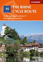
Fietsgids The Rhine Cycle route | Cicerone
This comprehensive guidebook offers a detailed stage-by-stage description of an epic 1370km route along the Rhine, one of Europe's great rivers, which passes through six countries on its way from Switzerland to the North Sea. The cycling is easy, downhill and along dedicated cycle routes, the countries visited are very cycle-friendly and the waymarking is excellent. The whole trip can be completed in two weeks by a fit cyclist.   The guide includes plenty of information to help you plan your trip, with advice on travel, accommodation and facilities. The full route is then presented in 27 stages of 32-69km, with step-by-step route description, 1:100,000 mapping and notes on local points of interest. A facilities table, glossary and list of useful contacts can be found in the appendices.   On its way, the Rhine Cycle Route passes the remains of Roman cities, medieval towns, castles, cathedrals, palaces, great cities of the industrial revolution and relics of 20th-century warfare – and it…
23,95
Fietsgids Britain's Best Bike Ride from Land's End to John o' Groats | Inspiring Adventure
There are many ways to cycle between Land’s End and John o’ Groats, but the route specially created for this book, LEJOG1000, is designed to show you the quiet roads, picturesque villages and dramatic landscapes that make the experience memorable. Instead of taking the most direct route, it invites you to explore the best of each region you pass through. You’ll discover stunning beaches and wild ponies on your way along the quiet wild-flower-edged lanes of Cornwall and Devon, follow the meandering River Wye in Wales, wind your way through a post-industrial landscape of canals and mill chimneys in the North West, before moving on to the epic climbs and grand vistas of Scotland.   Carefully crafted to allow you the freedom to create your own ultimate adventure, the route is split into 30 adaptable stages, each finishing in a town or village with suggested places to eat, drink and stay. Create your own bespoke itinerary, or use one of three itinerary options provided: the 2-week classic, …
27,95
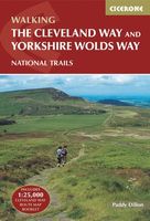
Wandelgids The Cleveland way and the Yorkshire Wolds way | Cicerone
Uitstekende wandelgids van de Cotswolds Way, waarbij naast alle noodzakelijke informatie ook gebruik gemaakt wordt van de echte topografische kaart. Inclusief gidsje met routekaarten van 1:25000 Guidebook to the Cleveland Way and Yorkshire Wolds Way National Trails, plus the Tabular Hills Walk link route. The guidebook also contains a 1:25,000 scale OS route map booklet of the Cleveland Way.   The Cleveland Way National Trail, described in seven day stages, is a fine 177km (110 miles) walk around the North York Moors National Park from Helmsley to Filey. The Yorkshire Wolds Way is one of the quietest of Britain's National Trails and wanders for 130km (80 miles) through gentle, cultivated and sparsely populated countryside. Described here in nine day stages, from Hessle near Redcar to Filey, it links end-to-end with the Cleveland Way on the coast. Also described is the three-day, 80km (50 mile) Tabular Hills Walk, a Regional Trail that allows walkers to close the loop of the Cleveland W…
25,95
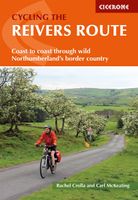
Fietsgids Cycling the Reivers Route | Cicerone
Guidebook to the Reivers Route, a 173 mile (280km) coast-to-coast cycle route across northern England and into Scotland from Tynemouth to Whitehaven. Exploring the rich history of traditional border territory, it is suitable for cyclists of all abilities and most commonly tackled on hybrid or sturdy touring bikes. Road alternatives are available. As the wildest of the northern coast-to-coast cycle routes, the Reivers Route explores the rich Border Reiving history of northern England and the Scottish Borders. Travelling 173 mile (280km) from Whitehaven to Tynemouth, this four-day cycle tour takes in the Cumbrian coast, northern Lake District, Northumberland National Park and North Tynedale, offering memorable off-road cycling through Kershope Forest and around Kielder Water. The route offers both on and off-road cycling, and is suitable for cyclists using touring or hybrid bikes. Places to stay overnight include Carlisle, Bailey Mill and Bellingham.   The guidebook also offers the Borde…
16,50
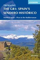
Wandelgids Spain's Sendero Historico: the GR1 | Cicerone
A step by step guide to walking the 1250km long Sendero Historico (the GR1) across northern Spain. Travelling from west to east, the GR1 starts at the Puerto de Tarna, on the border of Asturias and Castilla y Leon, heads east along the southern flank of the Cantabrian Mountains and the foothills of the Pyrenees before finishing on the Mediterranean coast near L'Escala. Arguably one of Spain's best long-distance paths, it follows gently graded paths, making a long but easy walk suitable for a reasonably fit walker. The complete trail requires around 53 days to complete end to end, but the guidebook splits the route into 7 sections, each with a start or endpoint that can be easily reached by train or bus, allowing walkers to explore the route in manageable chunks. The guidebook also describes how to extend the route to Finisterre and the Atlantic using GR routes. As well as extensive notes on the history of modern Spain, from medieval times to more recent events such as the Civil War, th…
26,50
Fietsgids Cycle Touring in Wales | Cicerone
Fietsgids van een langere route door Wales met een paar short-cuts als mogelijkheden: een behoorlijke lange route en niet te onderschatten wat betreft de zwaarte. Goede beschrijvingen, heel wat praktische informatite en redelijk kaartmateriaal al kan een bijbehorende kaart wel handig zijn. Guidebook to cycle touring in Wales. This packed guide describes a circuit of Wales - perfect for a 2-week trip - plus 6 cross routes, which range from 45 to 73 miles and can be completed as day or weekend rides, or used to create shorter versions of the main circuit. Includes all the information needed to plan and execute a successful tour. Guidebook to cycle touring in Wales. Catering to just about any itinerary, it describes a circuit of Wales - perfect for a two-week adventure - plus 6 cross routes, which range from 45 to 73 miles and can be completed as day/weekend rides, or used to create shorter versions of the main circuit.   This guide includes all the information needed to plan and execute …
18,50
Fietsgids London - Land's End Cycle Route | EOS Cycling Holidays Ltd
The guidebook contains routes from both Dover and Harwich ferry ports to London. This makes it possible to cycle around the English Channel, when also using the Plymouth link. The Dover to London route takes you though the fruit orchards of Kent, historic Canterbury and the Medway estuary with its impressive castles.   The Harwich to London route provides pleasant countryside cycling in Essex and takes you through Roman Colchester. Cycling through the heart of London, our route manages to stay away from busy roads, the occasional busy junction crossing excepted. Most of the cycling takes place on towpaths along the River Thames with spectacular views to enjoy.   You will cycle under the Tower Bridge and you'll pass the London Eye, Big Ben, the Houses of Parliament and Buckingham Palace on the way. Greenwich Park, Hyde Park and Richmond Park all provide superb green traffic-free routes. Heading west you'll cycle by Windsor Park and Windsor Castle before making your way to the Aon & Kenn…
41,50
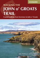
Wandelgids Walking the John o' Groats Trail | Cicerone
Guide to the John o' Groats Trail, a 233km walking route linking Inverness with John o' Groats on the northeast tip of mainland Britain. Much of the walking is coastal, with the northern half characterised by its spectacular seacliffs; however, there is some inland walking too, and the scenery is varied, ranging from dunes and deserted sandy beaches to beautiful woodland. With rough ground and some exposed clifftop walking, the route is suited to experienced hikers.   It takes around a fortnight to complete. The route is described in 14 stages, each of which includes: an overview map; step-by-step route description illustrated with custom mapping; details of accommodation, facilities and transport links; and information on local points of interest. While the main route description is from south to north, notes are supplied for southbound walkers.   Also included is a bonus route linking the trail with the Great Glen, for the benefit of walkers undertaking the Land's End to John o' Groa…
23,95
Fietskaart 10 Cycling guides North York Moors | Goldeneye
Scheur- en watervast foetskaart van de North York Moors  met ingetekende fietsroutes.   Our maps are double-sided, printed on an A2 sheet with a concertina fold. This allows for easy folding and folding, and an ease of access to the mapping. The material is rain and tear-resistant. Our early maps were designed at the scale of 2 miles to 1 inch/1:126,720. The later designs along with digitalisation are 1: 100,000. We were encouraged by the Cycle Touring Club to convert our cartography toward the cycle market (to replace the out-of-print Bartholomew series). As time and the series progressed we have added more data: The National Cycle Network routes, Regional Routes, and Traffic-Free Family Routes, as and when they are developed. These routes are in addition to the Circular Routes Goldeneye Commissioned at the outset of our publishing schedule. We are also adding to new editions; bike shops, cycle hire, and tea rooms, along with the tourist attractions already featured. Our plan is to ma…
14,95

Klanten-reviews van Fietsgids Land's End to John o' Groats | Cicerone

Er zijn nog geen beoordelingen voor dit productBen jij de eerste die een review plaatst?

Meer over Fietsgids Land's End to John o' Groats | Cicerone

Productomschrijving

A guidebook describing Britain’s famous ‘End to End’ cycle route, a journey of almost 1000 miles from the very tip of southwest England – Land’s End – to the northernmost point of mainland Scotland – John o’ Groats. Divided into 14 day stages, with each stage covering between 53 and 85 miles, the route features some of the best cycling the UK has to offer.    Step-by-step route descriptions are accompanied by 1:250,000 mapping and stage profiles. There are links to GPX mapping of the route for simple GPS navigation as well as a handy equipment list, route summary table, tourist office and cycle shop listings, together with information on health and safety, training and fitness. A listing of accommodation en route is also given.   A quintessential British adventure, the End to End cycle route attracts the attention of thousands of cyclists – men and women, young and old – every year. From charming Cornish villages to the brooding magnificence of the Scottish Highlands, scenery abounds on this challenging yet immensely satisfying traverse.    
Webshop.nl maakt gebruik van cookies. Ga je verder op onze website, ga dan akkoord met het plaatsen van cookies en de verwerking van deze data door ons en vermelde partners.