Fietsgids EuroVelo6 Eurovelo 6 - Donauradweg Budapest naar Zwarte Zee | Huber Verlag

0
Acht deelkaarten op schaal 1:100.000, speciaal voor fietsers. In totaal een prachitge set met veel informatie. Mit Radwegeverlauf, Übernachtungsmöglichkeiten, Sehenswürdigkeiten, Fahrradreparaturwerkstätten und Restaurants sind im Kartenbild eingezeichnet. 8 Einzelkarten in einer Kartenmappe. Danube Cycle Route from Budapest to the Black Sea on a ...

Verkopers met dit product

Verkoper
Bezorging
Prijs
DeZwerver.nl logo
DeZwerver.nl
2,95
33,95

Anderen bekeken ook

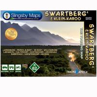
Wegenkaart - landkaart South Africa: Swartberg & Klein-Karoo | Slingsby Maps
All roads from National Highways to minor gravel roads are shown; the many classifications that indi- cate the quality of each road help you plan your route No less than 28 mountain passes are shown — all are public roads! Distances are clearly shown; comprehensive 4 x 4 information GPS coordinates in DD MM SS format are provided for every road-junction All tourism facilities and accommodation establishments are shown in the out-of-town areas; there are insets of the major towns The map links to our maps of the Baviaanskloof, the Garden Route, Overberg and the Tankwa-Karoo Additional info:   Swartberg and Klein-Karoo region on a contoured and GPS compatible, double-sided, waterproof and   tear-resistant map at 1:160,000 from Slingsby Maps, with excellent topographic detail and plenty of tourist information, including street plans of ten main towns.   The map provides a very detailed picture of this mountainous terrain, with altitude colouring, shading, con- tours at 20m intervals and …
29,95
Fietsgids Bikeline Baltic Sea Cycle Route - Iron curtain Trail 2 | Esterbauer
Praktische fietsgids voor een gedeelte van de Iron Curtain Trail, van Riga naar Lübeck. Met detailkaarten, ingetekende route, informatie over overnachten en fietsenmakers, zwaarte en hoogteprofiel. In spiraalbinding, Engelstalig.  The cycling guide contains all the information you need for your cycling vacation along the European Iron Curtain Trail between Riga and Lübeck: Precise maps, a detailed description of the route, a comprehensive list of overnight accommodation, numerous detail maps of cities and towns, and information about the most significant sights. And all that information comes with our bikeline pledge: The route described in this book has been tested and evaluated in person by the author! To assure that the book is as up-to-date as possible, we welcome corrections submitted by readers and local officials or businesses. We cannot, however, always check and confirm such changes before deadline. The maps The detail maps are produced in a scale of 1:85,000 (1 centimeter =…
19,50
Wegenatlas Peloponnese | Anavasi
Paperback, 237-page road atlas of the Peloponnese with detailed contoured mapping at 1;50,000 showing place names in Greek and Roman alphabets and providing a 2km UTM grid for GPS use. The main section of the atlas has 178 pages of detailed maps with contours at 100m intervals, altitude colouring and relief shading to provide a vivid representation of the terrain. Nearly all names: town and villages, geographical features, etc., are given in both Greek and Roman alphabets, with just minor local churches shown in Greek only. Names of most archeological sites and many other places of interest are given in Greek and in English. Road classification has 10 different grades, from toll motorways to minor dirt roads in poor condition and 4WD tracks. Intermediate driving distances are shown on main and secondary roads. The maps also indicate locations of petrol stations (with names of oil companies) and tire repairs facilities. Local footpaths are also marked, with the E4 trans-European long-d…
26,95
Wegenkaart - landkaart 01 Kaapstad - Cape Town and Surrounding Attractions | MapStudio
Het overzicht is soms misschien een beetje onduidelijk. maar de details in de inzetten en delen van de kaart zijn prima en voldoen goed voor het rondrijden met een eigen auto. Double-sided map, with a general road map on one side, plus numerous street plans and descriptions of four special routes on the reverse. The main map covers an area within reach as day trips from Cape Town, extending east to Swellendam and north to Langebaan. Road classification includes unsurfaced roads, intermediate driving distances on main and secondary roads, toll routes with gates, and mountain passes. Railways are shown with local stations. An impression of relief is provided by elevation tinting (perhaps somewhat confusing for regular map users - the higher the altitude, the greener the colour!), spot heights for main peaks, and names of mountain ranges. Nature and forest reserves, plus salt pans and marshes are indicated. Symbols mark local airfields, historical sites, caravan parks, many wine estates,…
16,95
Wegenkaart - landkaart 738 Roemenië - Roemenie | Michelin
Zoals je van Michelin mag verwachten is deze kaart zeer overzichtelijk en heeft een duidelijk helder kaartbeeld. De kaart geeft uitgebreid toeristische informatie weer. Met register, afstanden en reistijden. Wegen worden naar verschillende klasse ingedeeld en - mooi van Michelin - de interessante mooie routes worden gemarkeerd met een groene streep.    Hindernissen voor automobilisten met caravans zijn gemarkeerd: steile hellingen, bergpassen of een anderzins moeilijke route. Bezienswaardigheden als een kasteel, religieus gebouw, ruine of grot is door een symbool goed te vinden.   The Michelin national road map of Romania at 1:750,000 scale is best suited to trip & route planning. The map gives comprehensive coverage of national road networks showing major motorways, dual carriageways, national & regional main roads and some smaller local roads. Unsurfaced roads and tracks and some major footpaths are also shown. The map shows useful motoring information for motorways and major roads …
11,95
Fietsgids Bikeline Danube Bike Trail 5 (Engels - Donau Radweg) | Esterbauer
The fifth part of the Danube Bike Trail begins in Belgrade and ends in Romania on the Black Sea. With a total length of 2,845 kilometres, the Danube is Europe’s second longest river (after the Volga with 3,534 kilometres), and the only one on which kilometres are counted in reverse direction, starting with kilometer zero at the mouth and ending upstream at the source.   The total length of Part 5 of the Danube Bicycle Trail is about 1,400 kilometres. This does not include various side trips and alternative routes. The Danube Bike Trail is part of the Eurovelo-Route 6 and to a great extent identical.   This last part of the Danube Bike Trail mostly follows paved main roads and secondary roads, which you share with a variety of other traffic. It is not unusual in some parts of Bulgaria and Romania that you encounter more horse or mule carts, pedestrians or roaming sheep or geese than motorized traffic. In and around the larger cities, however, you can expect heavy traffic and you should…
15,50
Wegenkaart - landkaart - Fietskaart Donegal | Xploreit Maps
Zeer goed leesbare deelkaart van Ierland. Alle wegen, alle dorpen en steden en veel topografische details staan er op: daardoor zowel als wegenkaart ook als fietskaart goed te gebruiken. Naast de algemene kaartdetails zijn ook de bezienswaardigheden en historische monumenten goed ingetekend en makkelijk te vinden. Campings en jeugdherbergen maken het compleet.  This convenient and informative paper travel map is specifically designed for visitors to Donegal – the northernmost county in Ireland. With a heady mix of peninsulas, promontories and sandy beaches, Donegal’s  long, indented coastline includes some of the most spectacular scenery in the country. Further inland, the attractions are just as enticing and include Glenveagh National Park – an all-time favourite destination. This new map covers all of County Donegal and highlights local walking trails, cycle routes and scenic drives. The road network shown includes local roads and driving distances are indicated on the main routes. …
21,95
Wegenkaart - landkaart SC7-SC8 Baviaanskloof to Addo | Tracks4Africa
The Cape to Addo map series covers the southern parts of the Western Cape of South Africa in a series of eight highly detailed maps, printed on four sheets of A1 durable paper.   We start in Cape Town in the west and move along the southern coast through the Overberg, Winelands, Garden Route, Klein Karoo R62, Baviaanskloof to eventually arrive in the Addo National Park up to Gqeberha (Port Elizabeth) in the east.   The maps are highly detailed and well researched. Our map scale is 1:200 000 which allows us to show a lot of detail including minor gravel roads, hiking trails, farm boundaries and points of interest which are relevant to self-drive tourists.   The size of the paper is kept small enough to allow this to be the perfect road tripping map. We use Duraflex paper and print two maps per sheet of A1 paper, making this a four-sheet series. Each map sheet is individually packed in a plastic protective sleeve.   The maps are perfect for day drives, overlanding or just doing road tri…
29,95
Wegenkaart - landkaart Savannah Way - Cairns to Broome | Hema Maps
Detailkaart van een deel van Australië. Zeer goed leesbaar, met naast de topografische details veel symbolen waarmee allerhande toeristische zaken worden aangeduid als campsites, nationale parken, attracties, wandelmogelijkheden etc. Find out all you need to know about travelling the Savannah Way between Cairns and Broome. As well as providing a detailed road map for the entire length of the Savannah Way, this map includes handy advice on road conditions, average rainfall and safe driving tips. The useful information also highlights the features you pass in Queensland, Northern Territory and Western Australia. Routes between Cairns and Broome in Hema’s range of very popular touring maps showing roads connecting Australia’s main centres of population along some of the most spectacular routes such as the Great Ocean Road or the Savannah Way. The maps highlight 24-hour fuel supplies, roadside rest areas, camping facilities, places of interest, etc., and include distance charts and, in so…
17,50
Wegenkaart - landkaart Kreta | Marco Polo
Goede wegenkaart voorzien van alle noodzakelijke aanduidingen. Daarnaast bijvoorbeeld ook campings, mooie wegen e.d. Crete on a double-sided, indexed map in MairDumont's Marco Polo series, with four street plans, plus special features to make route planning and navigating easier: a fold-out flap in the jacket shows the whole island highlighting popular locations, with the grid reference system in the margins making it easier to find various places on the main map.  Road network shows main and secondary roads with driving distances and highlights scenic routes. Smaller country roads or tracks, presented in white on a background with relief shading, are perhaps less clear to see than on maps with altitude colouring. In addition to the shading, topography is presented by numerous peaks and names of mountain ranges. E4 long-distance hiking route is marked, both the section across the central mountains and the variant along the south coast. Picturesque towns, places of interest and landsca…
14,95

Klanten-reviews van Fietsgids EuroVelo6 Eurovelo 6 - Donauradweg Budapest naar Zwarte Zee | Huber Verlag

Er zijn nog geen beoordelingen voor dit productBen jij de eerste die een review plaatst?

Meer over Fietsgids EuroVelo6 Eurovelo 6 - Donauradweg Budapest naar Zwarte Zee | Huber Verlag

Productomschrijving

Acht deelkaarten op schaal 1:100.000, speciaal voor fietsers. In totaal een prachitge set met veel informatie. Mit Radwegeverlauf, Übernachtungsmöglichkeiten, Sehenswürdigkeiten, Fahrradreparaturwerkstätten und Restaurants sind im Kartenbild eingezeichnet. 8 Einzelkarten in einer Kartenmappe.

Danube Cycle Route from Budapest to the Black Sea on a compact set of eight maps. The main route and its detours are clearly distinguished from the surrounding roads, and non-asphalt surfaces and busy roads are indicated. Intermediate distances on the main route are shown, as well as river distances every 5km, and ferries for bikes. Hill shading and spot heights show the relief and symbols indicate moderate and heavy ascending slopes.
Plenty of symbols show other features, landmarks, and services e.g. bike repair facilities, various types of accommodation, restaurants, information centres, railways with stations, airports, marinas, museums, churches, and other places of interest, swimming pools, forests and swamps. State frontiers with border crossings and boundaries of national parks and reserves are marked.

The maps have a UTM grid at 2km intervals. Map legend is in English, German and Hungarian; other supporting text is in German only. Each sheet is double-sided and measures approx. 98 x 34cm.


Verken gerelateerde categorieën

Webshop.nl maakt gebruik van cookies. Ga je verder op onze website, ga dan akkoord met het plaatsen van cookies en de verwerking van deze data door ons en vermelde partners.