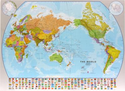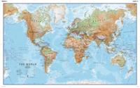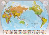
Wereldkaart World pacific-centred wall map, 136 x 100 cm | Maps International

0
View the world from a different perspective with Maps International's Pacific centred world wall map with flags.    Map details: This Pacific centred wall map shows the world centred along the 150° line of longitude. Instead of parting the map along the Pacific Ocean (as most world wall maps are), this one parts the map along the Atlantic Ocean me...

Verkopers met dit product

Verkoper
Bezorging
Prijs
DeZwerver.nl logo
DeZwerver.nl
5,95
37,95

Anderen bekeken ook

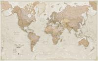
Wereldkaart 97P World executive political, 136 x 84 cm | Maps International
Politieke wandkaart in bijzondere kleurstelling. De indeling van de kaart is natuurlijk wel up-to-date. De kaart is 136 x 84 cm groot en in het Engels. Alle landen staan er op met voor de USA, Brazilië, Canada en Australië ook nog een provincies. Schaduw in reliëf zorgt voor aanduiding van de belangrijkste berggebieden met namen en hoogte van bepaalde toppen. Met symbolen wordt de grootte van een stad aangeduid, met ook een overzicht van de belangrijkste wegverbindingen. Kleurgebruik zorgt voor een mooi beeld van de oceanen.   A popular world wall map within our premium map range! With its antique-style muted tones, it looks simply stunning and rather elegant.   Map details: Splendid premium wall map of the world in muted tones. This premium world wall maps is available mounted on a walnut style frame. Complete with political detail (countries shaded in different tones), country boundaries and cities shown, this really is the most stylish and practical map available!    Laminated: Yo…
31,95
Wereldkaart 97ML World executive political, 136 x 84 cm | Maps International
Politieke wandkaart in bijzondere kleurstelling. De indeling van de kaart is natuurlijk wel up-to-date. De kaart is 136 x 84 cm groot en in het Engels. Alle landen staan er op met voor de USA, Brazilië, Canada en Australië ook nog een provincies. Schaduw in reliëf zorgt voor aanduiding van de belangrijkste berggebieden met namen en hoogte van bepaalde toppen. Met symbolen wordt de grootte van een stad aangeduid, met ook een overzicht van de belangrijkste wegverbindingen. Kleurgebruik zorgt voor een mooi beeld van de oceanen.   A popular world wall map within our premium map range! With its antique-style muted tones, it looks simply stunning and rather elegant.   Map details: Splendid premium wall map of the world in muted tones. This premium world wall maps is available mounted on a walnut style frame. Complete with political detail (countries shaded in different tones), country boundaries and cities shown, this really is the most stylish and practical map available!    Laminated: You…
49,95
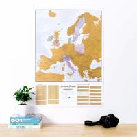
Scratch Map Europa Kraskaart | Maps International
This is a brilliant concept scratch poster of Europe allowing visited destinations to be scratched off revealing the beautifully styled up to date large wall map of Europe underneath. The perfect wall map poster or gift for the travel enthusiast, the scratch off map design allows complete personalization of the European map to display a unique travel story. Simply grab a coin and scratch off all the countries or cities you have visited, creating your own personalized, continually changing European wall map. The detailed Europe scratch off map features country detail along with capital cities making it the perfect travel map – scratch off your favorite spots!   European Travel Scratch Off Map   The Scratch Off Map Of Europe is printed onto high quality silk art paper with a gloss coating for luxury and the scratch off travel map works exactly like a scratch card - once the gold coating is removed it reveals the mapping underneath. The large wall map measures 23 (h) x 33 (w) inches and …
24,95
Wandkaart Zuid Amerika, politiek, 100 x 120 cm, geplastificeerd | Maps International
Fraaie politieke kaart van het continent, waarbij vooral de politieke aspecten heel duidelijk te lezen zijn. Alle landen hebben verschillende kleuren, steden en belangrijke verbindingen zijn goed te vinden. Geplastificeerde versie.   Afwerking: geplastificeerd   De wandkaart wordt afgewerkt met een inkapselingsproces. Inkapseling betekent dat de kaarten met warmte worden geperst tussen twee vellen film van industriële kwaliteit. Houd er rekening mee dat de randen van deze kaart niet zijn geplastificeerd.   Inkapseling geeft de kaart een schrijf- / veegafwerking, wat betekent dat met een droog afveegbare marker elk schrift op de kaart kan worden weggeveegd.   Maps International's South America political wall map shows all countries in South America from Venezuela and the Grenadine Islands down to Argentina and the most Southerly points of Chile and the Falkland Islands.    This political wall map of South America features countries marked in different colours, with international b…
38,95
Wereldkaart Politiek & antiek, pacific centered, 117 x 78 cm | National Geographic
National Geographic's World map is the standard by which all other reference maps are measured. The World map is meticulously researched and adheres to National Geographic's convention of making independent, apolitical decisions based on extensive research using multiple authoritative source.   The Executive style World map uses an antique-style color palette and stunning shaded relief that provide a richness perfect for any decor. The Pacific Centered World map employs a unique view to accentuate the Pacific Rim, and focuses on Oceania and Asia and while showing the entire breadth of the Pacific Ocean. Drawn in a special Winkel Tripel projection, distortions are minimized and unlike many other World maps, Greenland is show the same size as Argentina and not as the size of all of South America.   Thousands of place names are carefully and artistically placed on the map to maintain legibility even in the heavily populated ares of Europe, Asia and the Middle East. Details include clearl…
36,95
Wereldkaart 69H Natuurkundig, 136 x 84 cm | Maps International
Informatieve natuurkundige wereldkaart (Engelstalig). Goede combinatie van de natuurkundige aspecten en de belangrijkste politieke details van landen, steden en verbindingen.   De geplastificeerde kaart wordt geleverd met blank houten stokken aan de boven- en onderzijde, zoals we die uit het klaslokaal nog wel kennen. Aan de bovenstuk zit een linnen koord waarmee de kaart eenvoudig aan een flinke spijker of schroef kan worden opgehangen.   Excellent relief shading presents the mountainous areas in almost 3-D effect. Peak symbols help to identify the highest mountain on each continent or in various countries. 18 different combinations of colouring and graphics show various types of vegetation and terrain: tundra and glaciers or ice caps; coniferous, mixed or rain forests; savannah, grassland or steppe; sand or rocky deserts, lava fields and salt lakes, arable land, etc. Country names and their boundaries are clearly displayed, with town symbols indicating national and, where possible, …
165,-
Wandkaart Antarctica - Zuidpool, 120 x 100 cm | Maps International
Fraaie kaart van het continent waarbij zowel de natuurkundige als de politieke aspecten zichtbaar zijn. Alle bezettingsstations, berggebieden en landingsplaatsen staan er op. Dit is een geplastificeerde versie. Maps International's collection of continental maps would not be complete without this political Antarctica map.  The Antarctica map includes information from the British Antarctic Survey on scientific research. Information on Antarctica's climate and resources is included and as you would expect with a political map, the territory divisions are shown. Shown also are the major expedition routes, camps and weather stations on Antarctica. Map features hill shading, also contains information on the flora and fauna of Antarctica.   The map provides a great opportunity to learn more about a continent that many of us will never visit. Maps International's Antarctica map is available either plain or laminated making it ideal for classrooms or those with an interest in the South Pole a…
37,95
Wandelkaart - Topografische kaart OL43 OS Explorer Map Hadrian's Wall | Ordnance Survey
Een van de beste detailkaarten die er op de wereld gemaakt worden: zeer gedetailleerd, prachtig helder kleurgebruik, veel topografische aspecten en - zeer belangrijk - allerlei toeristische en recreatieve aspecten zijn ingetekend. De perfecte kaart voor vakantie en vrije tijd: wandelen, fietsen of gewoon de omgeving verkennen. Door de grootte van de kaart, voor- en achterzijde, bestrijkt het een behoorlijk groot gebied! These highly detailed maps show all the administrative boundaries, settlements as small as isolated farms, road network down to unfenced roads and country tracks, and field boundaries (hedges and drystone walls) which make navigation across the countryside much easier. Steep gradients on roads are indicated. Various landmarks, eg. powerlines, archaeological sites, windmills, churches and lighthouses are shown, and additional graphics indicate natural terrain features such as cliffs, scree, mud and vegetation variations. Contour interval is 5 metres in the lower parts o…
19,50
Historische Kaart An Archaeological Map of Hadrian's Wall | English Heritage
It was more than just a wall: it was a whole military zone designed to control movement across the northern frontier of the Roman province of Britannia. Great earthwork barriers survive, along with the remains of forts and temporary camps; watch-towers and fortified gates; civilian settlements, temples, cemeteries, bath-houses, roads and bridges. Stretching across the spine of England from the North-East coast to the Irish Sea, the line of the frontier extends for over 100 miles through every type of landscape: from the streets of urban Tyneside, through arable fields; along the crags of the wild Whin Sill; to the sands of the Solway, and down the coast of Cumbria. Drawing upon the extensive expertise and unrivalled archives of English Heritage, and those of its partners, this map depicts the fruits of modern archaeological research: in field survey, geophysics, excavation, and the analysis of aerial photographs. Using Ordnance Survey 1:25,000 data - the ideal scale for walkers - this…
14,95
Wandelkaart - Topografische kaart 316 OS Explorer Map Newcastle upon Tyne | Ordnance Survey
Met zijn 4cm voor 1 km (2 ½ cm voor 1 mijl) schaal, is de OS Explorer kaartenserie de ideale en meest gedetailleerde kaartenreeks voor mensen die graag outdoor-activiteiten zoals fietsen, wandelen, paardrijden, klimmen en watersporten. Deze kaart is nog gedetailleerder dan de 'gewone' Landranger maps. Voor- en achterzijde bedrukt! Zeker op de moors en andere natuurgebieden van onschatbare waarden met echt alle aspecten van het landschap op de kaart ingetekend. Zeer goede detailkaart met topografische ondergrond. Hierop zijn toeristische symbolen van bezienswaardigheden ingetekend, daarnaast staan bijvoorbeeld campings en jeugdherbergen vermeld en - voor wandelaars het belangrijkst - alle right of way paden en Lange afstands Wandelpaden zijn er op te vinden. De ideale kaart voor het wandelen in Engeland, Wales of Schotland.   These highly detailed maps show all the administrative boundaries, settlements as small as isolated farms, the road network down to unfenced roads and country tra…
19,50

Klanten-reviews van Wereldkaart World pacific-centred wall map, 136 x 100 cm | Maps International

Er zijn nog geen beoordelingen voor dit productBen jij de eerste die een review plaatst?

Meer over Wereldkaart World pacific-centred wall map, 136 x 100 cm | Maps International

Productomschrijving

View the world from a different perspective with Maps International's Pacific centred world wall map with flags.    Map details: This Pacific centred wall map shows the world centred along the 150° line of longitude. Instead of parting the map along the Pacific Ocean (as most world wall maps are), this one parts the map along the Atlantic Ocean meaning Europe and the Americas are in separate sides of the map!    Pacific centred world wall map has countries marked in different colours according to international country boundaries. Capital cities (including approximate population size) and hill shading are also shown. Mountain peaks and depths are given on this Pacific centred world wall map. Pacific centred map comes with a panel of country flags displayed on the base of the map.    Map uses: Great for re-learning about world and its geography. Ideal for use in secondary school classrooms and who those wishing to challenge their thinking.  

Afwerking: geplastificeerd

De wandkaart wordt afgewerkt met een inkapselingsproces. Inkapseling betekent dat de kaarten met warmte worden geperst tussen twee vellen film van industriële kwaliteit. Houd er rekening mee dat de randen van deze kaart niet zijn geplastificeerd.   Inkapseling geeft de kaart een schrijf- / veegafwerking, wat betekent dat met een droog afveegbare marker elk schrift op de kaart kan worden weggeveegd.


Productinformatie

    Verken gerelateerde categorieën

    Webshop.nl maakt gebruik van cookies. Ga je verder op onze website, ga dan akkoord met het plaatsen van cookies en de verwerking van deze data door ons en vermelde partners.