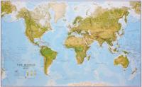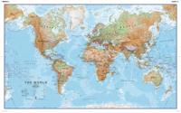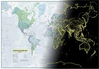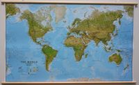
Wereldkaart Text Art 84,1cm x 59,4cm | Maps International

0
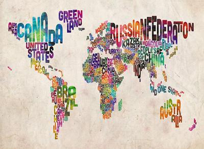
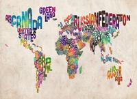
Een andere wereldkaart dan anders. Alle landen zijn weergegeven met hun naam. De kleinere eilanden zoals de Kanarische en een aantal Caribische zijn niet weergegeven. De kaart is gemaakt van wat dikker papier met een zijdeglans afwerking. De achtergrond heeft een antieke look.   A typographic text map of the world in an urban watercolor style. Eac...

Verkopers met dit product

Webshop
Bezorging
Prijs
DeZwerver.nl logo
DeZwerver.nl
5,95
29,95

Anderen bekeken ook

Wandkaart - Magneetbord Noord Amerika - North America Political 120 x 100 cm | Maps International
Fraaie politieke kaart van het continent, waarbij vooral de politieke aspecten heel duidelijk te lezen zijn. Alle landen hebben verschillende kleuren, steden en belangrijke verbindingen zijn goed te vinden. Dit is de papieren uitvoering zonder ophangsysteem.   De kaart wordt in deze versie gelijmd op een plaat, voorzien van een mooie aluminium lijst en een ophangsysteem wordt meegeleverd. Daarnaast krijgt u een bakje bijgeleverd dat u er aan kunt bevestigen voor pennen, stiften of magneetjes.   Maps International's North America political wall map covers a huge expanse of land from Alaska and Canada through the United States down to Mexico, Central America and the Caribbean. One of the finest maps money can buy!    This political wall map of North America features countries shown in different colours, international boundaries and major transport networks. The wall map also contains a panel of flags relating to the countries shown in this North American continent map. Also shown is cit…
269,-
Wandkaart - Prikbord Noord Amerika - North America Political 120 x 100 cm | Maps International
Fraaie politieke kaart van het continent, waarbij vooral de politieke aspecten heel duidelijk te lezen zijn. Alle landen hebben verschillende kleuren, steden en belangrijke verbindingen zijn goed te vinden. Dit is de papieren uitvoering zonder ophangsysteem.   De wandkaarten op prikbord worden geleverd met een aluminium lijst en een eenvoudig te monteren ophangsysteem. Zij zijn geschikt voor allerhande markeringsystemen als vlaggetjes en prikkers.   Maps International's North America political wall map covers a huge expanse of land from Alaska and Canada through the United States down to Mexico, Central America and the Caribbean. One of the finest maps money can buy!    This political wall map of North America features countries shown in different colours, international boundaries and major transport networks. The wall map also contains a panel of flags relating to the countries shown in this North American continent map. Also shown is city population detail, capital cities and all th…
185,-
Wereldkaart 69H Natuurkundig, 136 x 84 cm | Maps International
Informatieve natuurkundige wereldkaart (Engelstalig). Goede combinatie van de natuurkundige aspecten en de belangrijkste politieke details van landen, steden en verbindingen.   De geplastificeerde kaart wordt geleverd met blank houten stokken aan de boven- en onderzijde, zoals we die uit het klaslokaal nog wel kennen. Aan de bovenstuk zit een linnen koord waarmee de kaart eenvoudig aan een flinke spijker of schroef kan worden opgehangen.   Excellent relief shading presents the mountainous areas in almost 3-D effect. Peak symbols help to identify the highest mountain on each continent or in various countries. 18 different combinations of colouring and graphics show various types of vegetation and terrain: tundra and glaciers or ice caps; coniferous, mixed or rain forests; savannah, grassland or steppe; sand or rocky deserts, lava fields and salt lakes, arable land, etc. Country names and their boundaries are clearly displayed, with town symbols indicating national and, where possible, …
165,-
Nieuw
Scratch Map Europa Kraskaart | Maps International
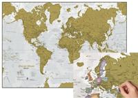
This is a brilliant concept scratch poster of Europe allowing visited destinations to be scratched off revealing the beautifully styled up to date large wall map of Europe underneath. The perfect wall map poster or gift for the travel enthusiast, the scratch off map design allows complete personalization of the European map to display a unique travel story. Simply grab a coin and scratch off all the countries or cities you have visited, creating your own personalized, continually changing European wall map. The detailed Europe scratch off map features country detail along with capital cities making it the perfect travel map – scratch off your favorite spots!   European Travel Scratch Off Map   The Scratch Off Map Of Europe is printed onto high quality silk art paper with a gloss coating for luxury and the scratch off travel map works exactly like a scratch card - once the gold coating is removed it reveals the mapping underneath. The large wall map measures 23 (h) x 33 (w) inches and …
24,95
Wandkaart - Magneetbord Azië Politiek - Asia Political, 120 x 100 cm | Maps International
Fraaie politieke kaart van het continent, waarbij vooral de politieke aspecten heel duidelijk te lezen zijn. Alle landen hebben verschillende kleuren, steden en belangrijke verbindingen zijn goed te vinden.   De kaart wordt in deze versie gelijmd op een plaat, voorzien van een mooie aluminium lijst en een ophangsysteem wordt meegeleverd. Daarnaast krijgt u een bakje bijgeleverd dat u er aan kunt bevestigen voor pennen, stiften of magneetjes.   Maps International's political wall map of Asia shows all countries from Turkey in the West to Japan in the East, down to Indonesia in the South of Asia. The largest and most populated continent, Asia has a lot to fit onto a map! Rest assured though, with Maps International's high quality of mapping nothing is missed out!   This political wall map of Asia features countries marked in different colours, with international borders clearly shown. The map's key shows the flags from the countries displayed in this map. This Asia physical wall map als…
269,-
Wandkaart - Magneetbord Zuid Amerika - South America political, 120 x 100 cm | Maps International
Fraaie politieke kaart van het continent, waarbij vooral de politieke aspecten heel duidelijk te lezen zijn. Alle landen hebben verschillende kleuren, steden en belangrijke verbindingen zijn goed te vinden.   De kaart wordt in deze versie gelijmd op een plaat, voorzien van een mooie aluminium lijst en een ophangsysteem wordt meegeleverd. Daarnaast krijgt u een bakje bijgeleverd dat u er aan kunt bevestigen voor pennen, stiften of magneetjes.   Maps International's South America political wall map shows all countries in South America from Venezuela and the Grenadine Islands down to Argentina and the most Southerly points of Chile and the Falkland Islands.    This political wall map of South America features countries marked in different colours, with international borders clearly shown. The map's key shows the flags from the countries displayed in this map. This South American political wall map also contains city population detail, capital cities and all the major towns and cities in …
269,-
Wandkaart - Magneetbord Europa - Europe 140 x 100 cm | Maps International
Fraaie politieke kaart van het continent, waarbij vooral de politieke aspecten heel duidelijk te lezen zijn. Alle landen hebben verschillende kleuren, steden en belangrijke verbindingen zijn goed te vinden.    Maps International's large European political wall map is great looking map available to buy.   This politically coloured wall map of Europe features countries marked in a different colour, with international boundaries shown. All major towns and cities are featured within our large map of Europe. Map contains hill and sea shading adding to the vibrant overall effect. The wall map also contains a section showing the different flags of countries in Europe.   Maps International's Europe map is available either plain or laminated. If you are looking to buy a map of Europe, you won't be disappointed with this large stunning wall map.   De kaart wordt in deze versie gelijmd op een plaat, voorzien van een mooie aluminium lijst en een ophangsysteem wordt meegeleverd.
289,-
Wandkaart - Magneetbord Afrika Politiek - Africa Political, 120 x 100 cm | Maps International
Fraaie politieke kaart van het continent, waarbij vooral de politieke aspecten heel duidelijk te lezen zijn. Alle landen hebben verschillende kleuren, steden en belangrijke verbindingen zijn goed te vinden.   De kaart wordt in deze versie gelijmd op een plaat, voorzien van een mooie aluminium lijst en een ophangsysteem wordt meegeleverd. Daarnaast krijgt u een bakje bijgeleverd dat u er aan kunt bevestigen voor pennen, stiften of magneetjes.   Maps International's Africa political wall map shows the whole African continent from Morocco in the north, to South Africa and Madagascar in the south.    This political wall map of Africa features countries marked in different colours, with international borders clearly shown. The map's key shows a panel of flags from each of the countries displayed in this African continent map. This political wall map of Africa also contains population detail, capital cities and all the major towns and cities in this continent.    As with most of Maps Intern…
269,-
Wandkaart - Magneetbord Europa - Europe, Huge 170 x 124 cm | Maps International
Fraaie politieke kaart van het continent, waarbij vooral de politieke aspecten heel duidelijk te lezen zijn. Alle landen hebben verschillende kleuren, steden en belangrijke verbindingen zijn goed te vinden.    De kaart wordt in deze versie gelijmd op een plaat, voorzien van een mooie aluminium lijst en een ophangsysteem wordt meegeleverd.   Maps International's large European political wall map is great looking map available to buy.   This politically coloured wall map of Europe features countries marked in a different colour, with international boundaries shown. All major towns and cities are featured within our large map of Europe. Map contains hill and sea shading adding to the vibrant overall effect. The wall map also contains a section showing the different flags of countries in Europe.   Maps International's Europe map is available either plain or laminated. If you are looking to buy a map of Europe, you won't be disappointed with this large stunning wall map.
385,-
Wandkaart - Prikbord Azië Politiek - Asia Political, 120 x 100 cm | Maps International
Fraaie politieke kaart van het continent, waarbij vooral de politieke aspecten heel duidelijk te lezen zijn. Alle landen hebben verschillende kleuren, steden en belangrijke verbindingen zijn goed te vinden.   De wandkaarten op prikbord worden geleverd met een aluminium lijst en een eenvoudig te monteren ophangsysteem. Zij zijn geschikt voor allerhande markeringsystemen als vlaggetjes en prikkers.   Maps International's political wall map of Asia shows all countries from Turkey in the West to Japan in the East, down to Indonesia in the South of Asia. The largest and most populated continent, Asia has a lot to fit onto a map! Rest assured though, with Maps International's high quality of mapping nothing is missed out!   This political wall map of Asia features countries marked in different colours, with international borders clearly shown. The map's key shows the flags from the countries displayed in this map. This Asia physical wall map also contains city population detail, capital cit…
185,-

Klanten-reviews van Wereldkaart Text Art 84,1cm x 59,4cm | Maps International

Er zijn nog geen beoordelingen voor dit productBen jij de eerste die een review plaatst?

Meer over Wereldkaart Text Art 84,1cm x 59,4cm | Maps International

Productomschrijving

Een andere wereldkaart dan anders. Alle landen zijn weergegeven met hun naam. De kleinere eilanden zoals de Kanarische en een aantal Caribische zijn niet weergegeven. De kaart is gemaakt van wat dikker papier met een zijdeglans afwerking. De achtergrond heeft een antieke look.   A typographic text map of the world in an urban watercolor style. Each country is represented by its name, which is shaped to fit into the geographically correct area. Virtually all countries are represented expect for some of the very smaller islands in the Pacific and Caribbean.   Afwerking: papier Uw kaart wordt afgedrukt op papier van 110 g / m² en is niet afgewerkt.


Webshop.nl maakt gebruik van cookies. Ga je verder op onze website, ga dan akkoord met het plaatsen van cookies en de verwerking van deze data door ons en vermelde partners.