webshop.nl
Categorieën
  Sluiten

Wereldkaart Text Art 84,1cm x 59,4cm | Maps International

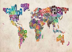
Een andere wereldkaart dan anders. Alle landen zijn weergegeven met hun naam. De kleinere eilanden zoals de Kanarische en een aantal Caribische zijn niet weergegeven. De kaart is gemaakt van wat dikker papier met een zijdeglans afwerking. De achtergrond heeft een antieke look.   A typographic text map of the world in an urban watercolor style. Each...
29,95

Webshops met dit product

Webshop
Bezorging
Prijs

Anderen bekeken ook

Wereldkaart Wereld upside down, 136 x 100 cm | Maps International
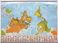
Een totaal andere kijk op de wereld: hang het eens ondersteboven! De mooie heldere kaart van Maps International nu in een upside-down uitvoering. Engelstalig, geplastificeerd, met vlaggen   Afwerking: geplastificeerd met ophangstrips   De wandkaart wordt afgewerkt met een inkapselingsproces. Inkapseling betekent dat de kaarten met warmte worden geperst tussen twee vellen film van industriële kwaliteit. Houd er rekening mee dat de randen van deze kaart niet zijn geplastificeerd.   Inkapseling geeft de kaart een schrijf- / veegafwerking, wat betekent dat met een droog afveegbare marker elk schrift op de kaart kan worden weggeveegd.     View the world from a different direction with Maps International's large political upside down world wall map.    Map details: This is an upside down world wall map with everything reversed! The south is at the top of the map, the north is at the base and the southern hemisphere is now at the top. The countries you expect to see in the east are now on the…
44,95
Wereldkaart 71 Wereld upside down, 136 x 100 cm | Maps International
Een totaal andere kijk op de wereld: hang het eens ondersteboven! De mooie heldere kaart van Maps International nu in een upside-down uitvoering. Engelstalig, geplastificeerd, met vlaggen Afwerking: geplastificeerd De wandkaart wordt afgewerkt met een inkapselingsproces. Inkapseling betekent dat de kaarten met warmte worden geperst tussen twee vellen film van industriële kwaliteit. Houd er rekening mee dat de randen van deze kaart niet zijn geplastificeerd.   Inkapseling geeft de kaart een schrijf- / veegafwerking, wat betekent dat met een droog afveegbare marker elk schrift op de kaart kan worden weggeveegd.   View the world from a different direction with Maps International's large political upside down world wall map.  Map details: This is an upside down world wall map with everything reversed! The south is at the top of the map, the north is at the base and the southern hemisphere is now at the top. The countries you expect to see in the east are now on the left of the map, and tho…
38,95
Wereldkaart Classic Classic politiek, 232 x 158 cm als behang | Maps International
Hele grote politieke wereldkaart wordt in 4 stroken geleverd, die exact aan elkaar passen. De cartografie is op basis van het betrouwbare en mooie kaartmateriaal van Maps International. Het is een klassieke wereldkaart met elk land in een verschillende aardekleurige tint. Hoofdsteden en grote steden zijn duidelijk aangegeven. Hoogeteverschillen zijn door accenten duidelijk weergegeven en daardoor mooi om te zien.   Montage-instructies: Deze muurwereldkaart wordt gemakkelijk op de muur aangebracht met behanglijm (niet meegeleverd).Een handleiding wordt bijgeleverd.   This Giant World Map Contemporary Mural is supplied on two strips of wallpaper to make it easy for you to fit it in any room in your house or office. With subtle tones and a stylish design this map mural will look amazing on your wall space.   Based on Maps International's best selling world map, this is the finest World Map Mural you'll find. The World Map Mural Wallpaper really is giant sized. At 232cm x 158cm, it's pe…
89,95
Wandkaart Antarctica - Zuidpool, 120 x 100 cm | Maps International
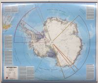
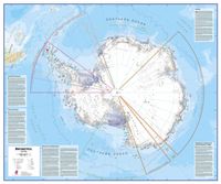
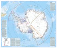
Fraaie kaart van het continent waarbij zowel de natuurkundige als de politieke aspecten zichtbaar zijn. Alle bezettingsstations, berggebieden en landingsplaatsen staan er op. Dit is een geplastificeerde versie met metalen strips boven en onder de kaart waardoor deze eenvoudig is op te hangen. Maps International's collection of continental maps would not be complete without this political Antarctica map.  The Antarctica map includes information from the British Antarctic Survey on scientific research. Information on Antarctica's climate and resources is included and as you would expect with a political map, the territory divisions are shown. Shown also are the major expedition routes, camps and weather stations on Antarctica. Map features hill shading, also contains information on the flora and fauna of Antarctica.   The map provides a great opportunity to learn more about a continent that many of us will never visit. Maps International's Antarctica map is available either plain or lami…
49,95
Wandkaart Noord Amerika, politiek, 100 x 120 cm | Maps International
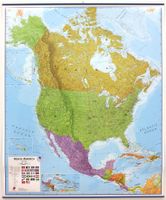
Fraaie politieke kaart van het continent, waarbij vooral de politieke aspecten heel duidelijk te lezen zijn. Alle landen hebben verschillende kleuren, steden en belangrijke verbindingen zijn goed te vinden. Geplastificeerde uitvoering met blauw metalen strips boven en onder de kaart waardoor deze eenvoudig is op te hangen. Maps International's North America political wall map covers a huge expanse of land from Alaska and Canada through the United States down to Mexico, Central America and the Caribbean. One of the finest maps money can buy!  This political wall map of North America features countries shown in different colours, international boundaries and major transport networks. The wall map also contains a panel of flags relating to the countries shown in this North American continent map. Also shown is city population detail, capital cities and all the major towns and cities in this continent of North America.    Maps International's North America map is available either plain or …
49,95
Wandkaart - Magneetbord Antarctica - Zuidpool 120 x 100 cm | Maps International
Fraaie kaart van het continent waarbij zowel de natuurkundige als de politieke aspecten zichtbaar zijn. Alle bezettingsstations, berggebieden en landingsplaatsen staan er op.   De kaart wordt in deze versie gelijmd op een plaat, voorzien van een mooie aluminium lijst en een ophangsysteem wordt meegeleverd. Daarnaast krijgt u een bakje bijgeleverd dat u er aan kunt bevestigen voor pennen, stiften of magneetjes.   Maps International's collection of continental maps would not be complete without this political Antarctica map.    The Antarctica map includes information from the British Antarctic Survey on scientific research. Information on Antarctica's climate and resources is included and as you would expect with a political map, the territory divisions are shown. Shown also are the major expedition routes, camps and weather stations on Antarctica. Map features hill shading, also contains information on the flora and fauna of Antarctica.   The map provides a great opportunity to learn mo…
269,-
Wandkaart Antarctica - Zuidpool, 120 x 100 cm | Maps International
Fraaie kaart van het continent waarbij zowel de natuurkundige als de politieke aspecten zichtbaar zijn. Alle bezettingsstations, berggebieden en landingsplaatsen staan er op. Dit is een geplastificeerde versie. Maps International's collection of continental maps would not be complete without this political Antarctica map.  The Antarctica map includes information from the British Antarctic Survey on scientific research. Information on Antarctica's climate and resources is included and as you would expect with a political map, the territory divisions are shown. Shown also are the major expedition routes, camps and weather stations on Antarctica. Map features hill shading, also contains information on the flora and fauna of Antarctica.   The map provides a great opportunity to learn more about a continent that many of us will never visit. Maps International's Antarctica map is available either plain or laminated making it ideal for classrooms or those with an interest in the South Pole an…
37,95
Wandkaart Antarctica - Zuidpool, 120 x 100 cm | Maps International
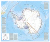
Fraaie kaart van het continent waarbij zowel de natuurkundige als de politieke aspecten zichtbaar zijn. Alle bezettingsstations, berggebieden en landingsplaatsen staan er op. Maps International's collection of continental maps would not be complete without this political Antarctica map.  The Antarctica map includes information from the British Antarctic Survey on scientific research. Information on Antarctica's climate and resources is included and as you would expect with a political map, the territory divisions are shown. Shown also are the major expedition routes, camps and weather stations on Antarctica. Map features hill shading, also contains information on the flora and fauna of Antarctica.   The map provides a great opportunity to learn more about a continent that many of us will never visit. Maps International's Antarctica map is available either plain or laminated making it ideal for classrooms or those with an interest in the South Pole and surrounding areas.
27,95
Wereldkaart (60) World Pacific-centred Wall Map 136 x 100 cm | Maps International
View the world from a different perspective with Maps International's Pacific centred world wall map with flags.  Map details: This Pacific centred wall map shows the world centred along the 150° line of longitude. Instead of parting the map along the Pacific Ocean (as most world wall maps are), this one parts the map along the Atlantic Ocean meaning Europe and the Americas are in separate sides of the map!    Pacific centred world wall map has countries marked in different colours according to international country boundaries. Capital cities (including approximate population size) and hill shading are also shown. Mountain peaks and depths are given on this Pacific centred world wall map. Pacific centred map comes with a panel of country flags displayed on the base of the map.    Map uses: Great for re-learning about world and its geography. Ideal for use in secondary school classrooms and who those wishing to challenge their thinking.   Afwerking: papier Uw kaart wordt afgedrukt op pa…
24,95
Scratch Map Wereldkaart NEDERLANDS | Maps International
Met deze schitterende scratch map kun je de toplaag van de reeds bezochte bestemmingen weg krassen, waardoor de prachtig vormgegeven actuele wereldkaart eronder wordt onthuld. Het is de perfecte kaart of een origineel cadeau voor de enthousiaste reiziger. De kaart vertelt jouw unieke en persoonlijke reisverhaal.    Neem simpelweg een muntje en begin met het wegkrassen van de bestemmingen welke je al bezocht hebt. Zo creëer je jouw persoonlijke en continu veranderende wereldkaart. Niet alleen de landen worden afgebeeld; maar ook de belangrijke steden op zowel de gouden toplaag, als op de wereldkaart eronder, waardoor je nog gedetailleerder kan krassen.    De Scratch Wereldkaart is gedrukt op hoogwaardig zijdezacht papier, met een glanzende toplaag waardoor de kaart werkt zoals een krasbiljet. Wanneer de gouden kraslaag verwijderd is, wordt de gekleurde wereldkaart eronder zichtbaar.    Een geweldig en uniek geschenk voor de reiziger!!   Afmeting: 84.1 x 59.4 cm
24,95

Klanten-reviews van Wereldkaart Text Art 84,1cm x 59,4cm | Maps International

Er zijn nog geen beoordelingen voor dit productBen jij de eerste die een review plaatst?

Meer over Wereldkaart Text Art 84,1cm x 59,4cm | Maps International

Productomschrijving

Een andere wereldkaart dan anders. Alle landen zijn weergegeven met hun naam. De kleinere eilanden zoals de Kanarische en een aantal Caribische zijn niet weergegeven. De kaart is gemaakt van wat dikker papier met een zijdeglans afwerking. De achtergrond heeft een antieke look.   A typographic text map of the world in an urban watercolor style. Each country is represented by its name, which is shaped to fit into the geographically correct area. Virtually all countries are represented expect for some of the very smaller islands in the Pacific and Caribbean.   Afwerking: papier Uw kaart wordt afgedrukt op papier van 110 g / m² en is niet afgewerkt.  
Webshop.nl maakt gebruik van cookies. Ga je verder op onze website, ga dan akkoord met het plaatsen van cookies en de verwerking van deze data door ons en vermelde partners.