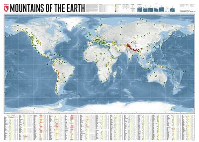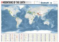
Wereldkaart Mountains of the Earth | Bergen van de Wereld | 140 x 100 cm | Marmota Maps

0
Mountains of the Earth invites you to discover the fascinating summits of our planet. We show Earth's highest peaks in the Himalaya, impressive country high points such as Fuji-san in Japan, mountains of great historic importance like Mount Olympus, particularly beautiful landmarks like the Table Mountain or the Matterhorn, and some of the world's...

Verkopers met dit product

Verkoper
Bezorging
Prijs
DeZwerver.nl logo
DeZwerver.nl
niet bekend
2,95
74,95

Anderen bekeken ook

Wereldkaart Mountains of the Earth | Bergen van de Wereld | 140 x 100 cm | Marmota Maps
Mountains of the Earth invites you to discover the fascinating summits of our planet. We show Earth's highest peaks in the Himalaya, impressive country high points such as Fuji-san in Japan, mountains of great historic importance like Mount Olympus, particularly beautiful landmarks like the Table Mountain or the Matterhorn, and some of the world's most remote and rarely known summits in Siberia, Greenland, or Antarctica.   Information on every mountain We show each mountain's height and prominence, as well as the country or countries it lies in. The altitude bar for each mountain is color-coded, same as the mountain icons on the map. This makes it easy, for instance, to find Earth's 14 8000ers in the list. The Seven (Second / Third) Summits are highlighted, as well as country high points. We also mark mountains of historic importance and particularly beautiful and iconic mountains as landmarks.   Mountain icons on the map  The mountains on our map reveal much more than just the…
74,95
Reisinspiratieboek - Reisboek Book of the Alps | Marmota Maps
The Book of the Alps  the great illustrated book about the Alps.290 pages with over 1000 illustrations, graphics, and maps on geography, sports, history, culture, climate, environment and much more. Understand the Alps like never before.Created in cooperation with the Alpine clubs of Germany, Austria, and South Tyrol. CONTENTS The Book of the Alps has 46 chapters in seven subject areas: Geography   Flora and Fauna   Climate and Environment    Alpinism   Mountain Sports   Society and Economy   Arts and Culture   GEOGRAPHY Geological Formation Ice Age Mountains Valleys Mountain Passes Lakes and Rivers Glaciers The Alps are unique. How did they form and evolve? How do glaciers, passes, valleys, lakes, and rivers shape the landscape? Answers to these and many more questions can be found in the geography chapter.   FLORA AND FAUNA Biodiversity Plants Forests Animals National Parks The Alpine environment is fascinating. Alpine flowers such as the edelweiss and Alpine anima…
44,95
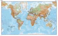
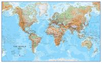
Wereldkaart 69P Natuurkundig, 136 x 84 cm | Maps International
Informatieve natuurkundige wereldkaart (Engelstalig). Goede combinatie van de natuurkundige aspecten en de belangrijkste politieke details van landen, steden en verbindingen.   Geplastificeerd.   Excellent relief shading presents the mountainous areas in almost 3-D effect. Peak symbols help to identify the highest mountain on each continent or in various countries. 18 different combinations of colouring and graphics show various types of vegetation and terrain: tundra and glaciers or ice caps; coniferous, mixed or rain forests; savannah, grassland or steppe; sand or rocky deserts, lava fields and salt lakes, arable land, etc. Country names and their boundaries are clearly displayed, with town symbols indicating national and, where possible, state or provincial capitals. Within USA, Canada, Brazil and Australia state or provincial boundaries are also shown. On oceans, in addition to different shades of colouring, numerous depth figures are provided. Central Pacific, from Siberia/Alaska…
32,95
Wereldkaart 69H Natuurkundig, 136 x 84 cm | Maps International
Informatieve natuurkundige wereldkaart (Engelstalig). Goede combinatie van de natuurkundige aspecten en de belangrijkste politieke details van landen, steden en verbindingen.   De geplastificeerde kaart wordt geleverd met blank houten stokken aan de boven- en onderzijde, zoals we die uit het klaslokaal nog wel kennen. Aan de bovenstuk zit een linnen koord waarmee de kaart eenvoudig aan een flinke spijker of schroef kan worden opgehangen.   Excellent relief shading presents the mountainous areas in almost 3-D effect. Peak symbols help to identify the highest mountain on each continent or in various countries. 18 different combinations of colouring and graphics show various types of vegetation and terrain: tundra and glaciers or ice caps; coniferous, mixed or rain forests; savannah, grassland or steppe; sand or rocky deserts, lava fields and salt lakes, arable land, etc. Country names and their boundaries are clearly displayed, with town symbols indicating national and, where possible, …
165,-
Wandelkaart Mourne Mountains | Harvey Maps
The Mournes, a granite mountain range in County Down, includes the highest mountains in Northern Ireland. The highest is Slieve Donard at 850 metres.   Detailed map for hillwalkers of the Mountains of Mourne at 1:25,000 scale.   The Mournes is an Area of Outstanding Natural Beauty and has been proposed as the first national park in Northern Ireland. The area is partly owned by the National Trust and sees a large number of visitors every year.   The Mourne Wall is among the more famous features in the Mournes. It is a 35km (22mls) drystone wall that crosses fifteen summits, constructed in 1904 and completed in 1922 to define the boundaries of land purchased by the Belfast Water Commissioners in the late 1800s.   Includes The Mourne Way Long Distance Footpath.   Scale: 1:25,000 Ratio: 4cm = 1km Flat size: 696 x 486mm Folded size: 116 x 243mm Weight: 33gms Area of mapping: 353sqkm Double sided  
24,95
Wandelgids The Mountains of Romania - Roemenië | Cicerone
Guidebook to walks and multi-day treks in the Carpathian mountains of Romania. Includes routes in the Maramures and Bucovina regions, Piatra Craiului ridge, and the Retezat and Fagaras mountains. This guide describes 27 short treks of 2-6 days and 10 day walks in the mountains of Romania. Although there is a slight focus on Transylvania, most of the main massifs are included, with chapters covering the Mountains of Maramures, the Eastern Carpathians, the mountains around Brasov, the Fagara?, the region between the Olt and the Jiu, the Retezat, the mountains of Banat and the Apuseni. Also included is an ascent of Moldoveanu, Romania's highest peak at 2544m.   There is a wealth of advice to help you plan your trip and organise the logistics of your walk or trek. Some routes avail of the network of mountain huts; others offer opportunities to camp in attractive wild locations. Overviews and a route summary table make it easy to choose an appropriate excursion. Each route includes clear d…
26,50
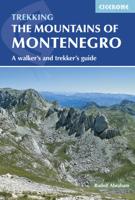
Wandelgids The Mountains of Montenegro | Cicerone
Bijzondere wandelgids van een bijzonder land in opkomst: goed beschreven, met veel informatie en details, dus zeer bruikbaar! This guidebook includes a range of day-walks and multi-day treks throughout the Dinaric Alps of Montenegro. These mountains are some of the wildest, most spectacular, and least visited in Europe. Nevertheless they are easily accessible, and many areas have well-marked trails. They present an opportunity to travel through outstandingly beautiful and remarkably unspoilt natural scenery, which sees few visitors. The guide covers the most spectacular mountain areas in Montenegro, with a selection of circular and linear routes, with variants and extensions.   The guide also includes generous background information, including mountain huts and shelters, travel to and within the country, history and language, as well as what to expect in the various mountains and National Parks the routes explore. This is the first comprehensive English-language guide to walking in th…
25,95
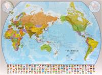
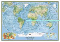
Wereldkaart World pacific-centred wall map, 136 x 100 cm | Maps International
View the world from a different perspective with Maps International's Pacific centred world wall map with flags.    Map details: This Pacific centred wall map shows the world centred along the 150° line of longitude. Instead of parting the map along the Pacific Ocean (as most world wall maps are), this one parts the map along the Atlantic Ocean meaning Europe and the Americas are in separate sides of the map!    Pacific centred world wall map has countries marked in different colours according to international country boundaries. Capital cities (including approximate population size) and hill shading are also shown. Mountain peaks and depths are given on this Pacific centred world wall map. Pacific centred map comes with a panel of country flags displayed on the base of the map.    Map uses: Great for re-learning about world and its geography. Ideal for use in secondary school classrooms and who those wishing to challenge their thinking.   Afwerking: geplastificeerd De wandkaart wor…
37,95
Reisverhaal Georgia in the Mountains of Poetry | Peter Nasmyth
The comprehensive guide to modern Georgia - a cultural-historical journey to one of the world's most beautiful countries. Peter Nasmyth has lived in and travelled extensively throughout Georgia for twenty years. Georgia in the Mountains of Poetry is his fascinating account of this intriguing country, based on his travels and hundreds of wide-ranging interviews. Reprinted numerous times, it remains the only comprehensive book on Georgia's history and culture written for the general reader, now substantially revised and expanded for this new edition. Georgia - no larger than Switzerland - ranks in the world's top twelve countries for geographical diversity. It borders on the Black Sea and contains the heart of the Caucasus mountains, subtropical wetlands and semi-arid regions. Stone towers attest to its 3,000-year-old history, which has witnessed the thousand-year reign of the Bagratuni monarchy, the rise and fall of the Soviet Union, a bitter civil war and the celebration of its indepe…
18,50
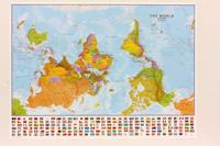
Wereldkaart 71 Wereld upside down, 136 x 100 cm | Maps International
Een totaal andere kijk op de wereld: hang het eens ondersteboven! De mooie heldere kaart van Maps International nu in een upside-down uitvoering. Engelstalig, geplastificeerd, met vlaggen Afwerking: geplastificeerd De wandkaart wordt afgewerkt met een inkapselingsproces. Inkapseling betekent dat de kaarten met warmte worden geperst tussen twee vellen film van industriële kwaliteit. Houd er rekening mee dat de randen van deze kaart niet zijn geplastificeerd.   Inkapseling geeft de kaart een schrijf- / veegafwerking, wat betekent dat met een droog afveegbare marker elk schrift op de kaart kan worden weggeveegd.   View the world from a different direction with Maps International's large political upside down world wall map.  Map details: This is an upside down world wall map with everything reversed! The south is at the top of the map, the north is at the base and the southern hemisphere is now at the top. The countries you expect to see in the east are now on the left of the map, and th…
38,95

Klanten-reviews van Wereldkaart Mountains of the Earth | Bergen van de Wereld | 140 x 100 cm | Marmota Maps

Er zijn nog geen beoordelingen voor dit productBen jij de eerste die een review plaatst?

Meer over Wereldkaart Mountains of the Earth | Bergen van de Wereld | 140 x 100 cm | Marmota Maps

Productomschrijving

Mountains of the Earth invites you to discover the fascinating summits of our planet. We show Earth's highest peaks in the Himalaya, impressive country high points such as Fuji-san in Japan, mountains of great historic importance like Mount Olympus, particularly beautiful landmarks like the Table Mountain or the Matterhorn, and some of the world's most remote and rarely known summits in Siberia, Greenland, or Antarctica.   Information on every mountain We show each mountain's height and prominence, as well as the country or countries it lies in. The altitude bar for each mountain is color-coded, same as the mountain icons on the map. This makes it easy, for instance, to find Earth's 14 8000ers in the list. The Seven (Second / Third) Summits are highlighted, as well as country high points. We also mark mountains of historic importance and particularly beautiful and iconic mountains as landmarks.   Mountain icons on the map  The mountains on our map reveal much more than just their name and location. The color of each icon indicates the mountain's altitude. The mountain symbol shows you if the mountain is an ultra-prominent peak, and underlined mountain names indicate country high points.


Productinformatie

    Verken gerelateerde categorieën

    Webshop.nl maakt gebruik van cookies. Ga je verder op onze website, ga dan akkoord met het plaatsen van cookies en de verwerking van deze data door ons en vermelde partners.