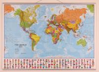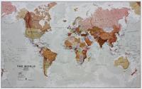
Wereldkaart 97P World executive political, 136 x 84 cm | Maps International

0
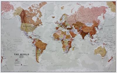
Politieke wandkaart in bijzondere kleurstelling. De indeling van de kaart is natuurlijk wel up-to-date. De kaart is 136 x 84 cm groot en in het Engels. Alle landen staan er op met voor de USA, Brazilië, Canada en Australië ook nog een provincies. Schaduw in reliëf zorgt voor aanduiding van de belangrijkste berggebieden met namen en hoogte van bepa...

Verkopers met dit product

Verkoper
Bezorging
Prijs
DeZwerver.nl logo
DeZwerver.nl
5,95
31,95

Anderen bekeken ook

Wereldkaart 97P World executive political, 136 x 84 cm | Maps International
Politieke wandkaart in bijzondere kleurstelling. De indeling van de kaart is natuurlijk wel up-to-date. De kaart is 136 x 84 cm groot en in het Engels. Alle landen staan er op met voor de USA, Brazilië, Canada en Australië ook nog een provincies. Schaduw in reliëf zorgt voor aanduiding van de belangrijkste berggebieden met namen en hoogte van bepaalde toppen. Met symbolen wordt de grootte van een stad aangeduid, met ook een overzicht van de belangrijkste wegverbindingen. Kleurgebruik zorgt voor een mooi beeld van de oceanen.   A popular world wall map within our premium map range! With its antique-style muted tones, it looks simply stunning and rather elegant.   Map details: Splendid premium wall map of the world in muted tones. This premium world wall maps is available mounted on a walnut style frame. Complete with political detail (countries shaded in different tones), country boundaries and cities shown, this really is the most stylish and practical map available!    Laminated: Yo…
31,95
Wereldkaart 97ML World executive political, 136 x 84 cm | Maps International
Politieke wandkaart in bijzondere kleurstelling. De indeling van de kaart is natuurlijk wel up-to-date. De kaart is 136 x 84 cm groot en in het Engels. Alle landen staan er op met voor de USA, Brazilië, Canada en Australië ook nog een provincies. Schaduw in reliëf zorgt voor aanduiding van de belangrijkste berggebieden met namen en hoogte van bepaalde toppen. Met symbolen wordt de grootte van een stad aangeduid, met ook een overzicht van de belangrijkste wegverbindingen. Kleurgebruik zorgt voor een mooi beeld van de oceanen.   A popular world wall map within our premium map range! With its antique-style muted tones, it looks simply stunning and rather elegant.   Map details: Splendid premium wall map of the world in muted tones. This premium world wall maps is available mounted on a walnut style frame. Complete with political detail (countries shaded in different tones), country boundaries and cities shown, this really is the most stylish and practical map available!    Laminated: You…
49,95
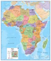
Wandkaart Africa executive Political 2-delig | 176 x 160 cm | MapStudio
Africa Executive Political Wall Map is an easy-to-read comprehensive map of Africa includes the new South Sudan boundary.   Coverage on the Africa Executive Political Wall Map includes capital cities, major towns, towns, major and main routes with route numbers and distances.   Contents of the map of Africa includes national, main and secondary roads in detail, colour-coded countries for convenient overview, rail routes with lines and stations, national parks, reserves, sea routes and distances to major ports, international boundaries, border crossings, airports, airfields, water features (dams, lakes, rivers, deltas), places of interest and historic sites. Coverage shows all countries in Africa including Madagascar.  
78,95
Wereldkaart 66P-zvlE Political, 136 x 86 cm | Maps International
Prachtige geplastificeerde wereldkaart. Door het heldere en vrij felle kleurgebruik is deze kaart uitermate geschikt voor scholen, kantoren of gewoon als politieke wereldkaart thuis. De kleurstellig is zodanig dat elk land zich zeer goed onderscheidt van haar buren. De natuurkundige aspecten zijn minder goed te zien, al worden de gebergten door schaduwwerking goed uitgelicht. De nadruk ligt echter duidelijk op een ‘gewone’ wereldkaart. De belettering is uitstekend leesbaar door vetgedrukte naamgeving.   Engelstalig, maten: 136 x 86 cm., zonder vlaggen, geplastificeerd 
32,95
Wereldkaart 66ML-mvlE Political, 136 x 100 cm | Maps International
Prachtige geplastificeerde wereldkaart met blauw metalen strips om makkelijk op te hangen. Door het heldere en vrij felle kleurgebruik is deze kaart uitermate geschikt voor scholen, kantoren of gewoon als politieke wereldkaart thuis. De kleurstellig is zodanig dat elk land zich zeer goed onderscheidt van haar buren. De natuurkundige aspecten zijn minder goed te zien, al worden de gebergten door schaduwwerking goed uitgelicht. De nadruk ligt echter duidelijk op een ‘gewone’ wereldkaart. De belettering is uitstekend leesbaar door vetgedrukte naamgeving.   ENGELSTALIG, maten: 136 x 100 cm. met vlaggen. De kaart is geplastificeerd en voorzien van blauw metalen strips aan de onder- en bovenzijde. Een spijker in de muur en de kaart kun je er eenvoudig aan hangen.
49,95
Wandkaart - Magneetbord Afrika Politiek - Africa Political, 120 x 100 cm | Maps International
Fraaie politieke kaart van het continent, waarbij vooral de politieke aspecten heel duidelijk te lezen zijn. Alle landen hebben verschillende kleuren, steden en belangrijke verbindingen zijn goed te vinden.   De kaart wordt in deze versie gelijmd op een plaat, voorzien van een mooie aluminium lijst en een ophangsysteem wordt meegeleverd. Daarnaast krijgt u een bakje bijgeleverd dat u er aan kunt bevestigen voor pennen, stiften of magneetjes.   Maps International's Africa political wall map shows the whole African continent from Morocco in the north, to South Africa and Madagascar in the south.    This political wall map of Africa features countries marked in different colours, with international borders clearly shown. The map's key shows a panel of flags from each of the countries displayed in this African continent map. This political wall map of Africa also contains population detail, capital cities and all the major towns and cities in this continent.    As with most of Maps Intern…
269,-
Wandkaart - Prikbord Afrika Politiek - Africa Political, 120 x 100 cm | Maps International
Fraaie politieke kaart van het continent, waarbij vooral de politieke aspecten heel duidelijk te lezen zijn. Alle landen hebben verschillende kleuren, steden en belangrijke verbindingen zijn goed te vinden.   De wandkaarten op prikbord worden geleverd met een aluminium lijst en een eenvoudig te monteren ophangsysteem. Zij zijn geschikt voor allerhande markeringsystemen als vlaggetjes en prikkers.   Maps International's Africa political wall map shows the whole African continent from Morocco in the north, to South Africa and Madagascar in the south.    This political wall map of Africa features countries marked in different colours, with international borders clearly shown. The map's key shows a panel of flags from each of the countries displayed in this African continent map. This political wall map of Africa also contains population detail, capital cities and all the major towns and cities in this continent.    As with most of Maps International's maps, the Africa political wall map,…
185,-
Wereldkaart 90P Antiek & politiek, 136 x 84 cm | Maps International
Politieke wandkaart in ouderwetse kleurstelling. De indeling van de kaart is natuurlijk wel up-to-date. De kaart is 136 x 84 cm groot en in het Engels. Alle landen staan er op met voor de USA, Brazilië, Canada en Australië ook nog een provincies. Schaduw in reliëf zorgt voor aanduiding van de belangrijkste berggebieden met namen en hoogte van bepaalde toppen. Met symbolen wordt de grootte van een stad aangeduid, met ook een overzicht van de belangrijkste wegverbindingen. Kleurgebruik zorgt voor een mooi beeld van de oceanen. 3 Political wall map of the world from Maps International, size 136 x 84cm, in an antique-style presentation: countries in hues of brown, beige and tan with their borders outlined in a stronger colour - oceans in light grey, with graphic relief for the ocean floor and names in italics adding to the overall elegant, old-fashioned feel.
37,95
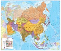
Wandkaart - Magneetbord Azië Politiek - Asia Political, 120 x 100 cm | Maps International
Fraaie politieke kaart van het continent, waarbij vooral de politieke aspecten heel duidelijk te lezen zijn. Alle landen hebben verschillende kleuren, steden en belangrijke verbindingen zijn goed te vinden.   De kaart wordt in deze versie gelijmd op een plaat, voorzien van een mooie aluminium lijst en een ophangsysteem wordt meegeleverd. Daarnaast krijgt u een bakje bijgeleverd dat u er aan kunt bevestigen voor pennen, stiften of magneetjes.   Maps International's political wall map of Asia shows all countries from Turkey in the West to Japan in the East, down to Indonesia in the South of Asia. The largest and most populated continent, Asia has a lot to fit onto a map! Rest assured though, with Maps International's high quality of mapping nothing is missed out!   This political wall map of Asia features countries marked in different colours, with international borders clearly shown. The map's key shows the flags from the countries displayed in this map. This Asia physical wall map als…
269,-
Wandkaart - Prikbord Azië Politiek - Asia Political, 120 x 100 cm | Maps International
Fraaie politieke kaart van het continent, waarbij vooral de politieke aspecten heel duidelijk te lezen zijn. Alle landen hebben verschillende kleuren, steden en belangrijke verbindingen zijn goed te vinden.   De wandkaarten op prikbord worden geleverd met een aluminium lijst en een eenvoudig te monteren ophangsysteem. Zij zijn geschikt voor allerhande markeringsystemen als vlaggetjes en prikkers.   Maps International's political wall map of Asia shows all countries from Turkey in the West to Japan in the East, down to Indonesia in the South of Asia. The largest and most populated continent, Asia has a lot to fit onto a map! Rest assured though, with Maps International's high quality of mapping nothing is missed out!   This political wall map of Asia features countries marked in different colours, with international borders clearly shown. The map's key shows the flags from the countries displayed in this map. This Asia physical wall map also contains city population detail, capital cit…
185,-

Klanten-reviews van Wereldkaart 97P World executive political, 136 x 84 cm | Maps International

Er zijn nog geen beoordelingen voor dit productBen jij de eerste die een review plaatst?

Meer over Wereldkaart 97P World executive political, 136 x 84 cm | Maps International

Productomschrijving

Politieke wandkaart in bijzondere kleurstelling. De indeling van de kaart is natuurlijk wel up-to-date. De kaart is 136 x 84 cm groot en in het Engels. Alle landen staan er op met voor de USA, Brazilië, Canada en Australië ook nog een provincies. Schaduw in reliëf zorgt voor aanduiding van de belangrijkste berggebieden met namen en hoogte van bepaalde toppen. Met symbolen wordt de grootte van een stad aangeduid, met ook een overzicht van de belangrijkste wegverbindingen. Kleurgebruik zorgt voor een mooi beeld van de oceanen.   A popular world wall map within our premium map range! With its antique-style muted tones, it looks simply stunning and rather elegant.   Map details: Splendid premium wall map of the world in muted tones. This premium world wall maps is available mounted on a walnut style frame. Complete with political detail (countries shaded in different tones), country boundaries and cities shown, this really is the most stylish and practical map available!    Laminated: Your wall map will be finished with a gloss encapsulation process. Encapsulation means that the maps are heat sealed between two sheets of industrial quality film. Please note that the edges of this map are not sealed.    Encapsulation gives the map a write on wipe off finish, meaning that, using the appropriate pen (for whiteboard use) or Chinagraph pencil any writing on the map can be wiped off with a damp cloth.    Map uses: Perfect for adding an exclusive feel to a boardroom or office. This world map also adds a touch of luxury hung in the home, ideal for the more discerning customer. 


Productinformatie

    Verken gerelateerde categorieën

    Webshop.nl maakt gebruik van cookies. Ga je verder op onze website, ga dan akkoord met het plaatsen van cookies en de verwerking van deze data door ons en vermelde partners.