webshop.nl
Categorieën
  Sluiten

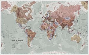
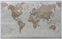
Wereldkaart 97 World executive political, 136 x 84 cm | Maps International

Politieke wandkaart in bijzondere kleurstelling. De indeling van de kaart is natuurlijk wel up-to-date. De kaart is 136 x 84 cm groot en in het Engels. Alle landen staan er op met voor de USA, Brazilië, Canada en Australië ook nog een provincies. Schaduw in reliëf zorgt voor aanduiding van de belangrijkste berggebieden met namen en hoogte van bepaa...
19,95

Webshops met dit product

Webshop
Bezorging
Prijs

Anderen bekeken ook

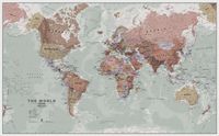
Wereldkaart 97P World executive political, 136 x 84 cm | Maps International
Politieke wandkaart in bijzondere kleurstelling. De indeling van de kaart is natuurlijk wel up-to-date. De kaart is 136 x 84 cm groot en in het Engels. Alle landen staan er op met voor de USA, Brazilië, Canada en Australië ook nog een provincies. Schaduw in reliëf zorgt voor aanduiding van de belangrijkste berggebieden met namen en hoogte van bepaalde toppen. Met symbolen wordt de grootte van een stad aangeduid, met ook een overzicht van de belangrijkste wegverbindingen. Kleurgebruik zorgt voor een mooi beeld van de oceanen.   A popular world wall map within our premium map range! With its antique-style muted tones, it looks simply stunning and rather elegant.   Map details: Splendid premium wall map of the world in muted tones. This premium world wall maps is available mounted on a walnut style frame. Complete with political detail (countries shaded in different tones), country boundaries and cities shown, this really is the most stylish and practical map available!    Laminated: You…
31,95
Wereldkaart 97ML World executive political, 136 x 84 cm | Maps International
Politieke wandkaart in bijzondere kleurstelling. De indeling van de kaart is natuurlijk wel up-to-date. De kaart is 136 x 84 cm groot en in het Engels. Alle landen staan er op met voor de USA, Brazilië, Canada en Australië ook nog een provincies. Schaduw in reliëf zorgt voor aanduiding van de belangrijkste berggebieden met namen en hoogte van bepaalde toppen. Met symbolen wordt de grootte van een stad aangeduid, met ook een overzicht van de belangrijkste wegverbindingen. Kleurgebruik zorgt voor een mooi beeld van de oceanen.   A popular world wall map within our premium map range! With its antique-style muted tones, it looks simply stunning and rather elegant.   Map details: Splendid premium wall map of the world in muted tones. This premium world wall maps is available mounted on a walnut style frame. Complete with political detail (countries shaded in different tones), country boundaries and cities shown, this really is the most stylish and practical map available!    Laminated: Your…
49,95
Wereldkaart Classic Classic politiek, 232 x 158 cm als behang | Maps International
Hele grote politieke wereldkaart wordt in 4 stroken geleverd, die exact aan elkaar passen. De cartografie is op basis van het betrouwbare en mooie kaartmateriaal van Maps International. Het is een klassieke wereldkaart met elk land in een verschillende aardekleurige tint. Hoofdsteden en grote steden zijn duidelijk aangegeven. Hoogeteverschillen zijn door accenten duidelijk weergegeven en daardoor mooi om te zien.   Montage-instructies: Deze muurwereldkaart wordt gemakkelijk op de muur aangebracht met behanglijm (niet meegeleverd).Een handleiding wordt bijgeleverd.   This Giant World Map Contemporary Mural is supplied on two strips of wallpaper to make it easy for you to fit it in any room in your house or office. With subtle tones and a stylish design this map mural will look amazing on your wall space.   Based on Maps International's best selling world map, this is the finest World Map Mural you'll find. The World Map Mural Wallpaper really is giant sized. At 232cm x 158cm, it's pe…
89,95
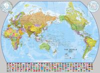
Wereldkaart World pacific-centred wall map, 136 x 100 cm | Maps International
View the world from a different perspective with Maps International's Pacific centred world wall map with flags.    Map details: This Pacific centred wall map shows the world centred along the 150° line of longitude. Instead of parting the map along the Pacific Ocean (as most world wall maps are), this one parts the map along the Atlantic Ocean meaning Europe and the Americas are in separate sides of the map!    Pacific centred world wall map has countries marked in different colours according to international country boundaries. Capital cities (including approximate population size) and hill shading are also shown. Mountain peaks and depths are given on this Pacific centred world wall map. Pacific centred map comes with a panel of country flags displayed on the base of the map.    Map uses: Great for re-learning about world and its geography. Ideal for use in secondary school classrooms and who those wishing to challenge their thinking.   Afwerking: geplastificeerd De wandkaart word…
37,95
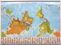
Wereldkaart Wereld upside down, 136 x 100 cm | Maps International
Een totaal andere kijk op de wereld: hang het eens ondersteboven! De mooie heldere kaart van Maps International nu in een upside-down uitvoering. Engelstalig, geplastificeerd, met vlaggen   Afwerking: geplastificeerd met ophangstrips   De wandkaart wordt afgewerkt met een inkapselingsproces. Inkapseling betekent dat de kaarten met warmte worden geperst tussen twee vellen film van industriële kwaliteit. Houd er rekening mee dat de randen van deze kaart niet zijn geplastificeerd.   Inkapseling geeft de kaart een schrijf- / veegafwerking, wat betekent dat met een droog afveegbare marker elk schrift op de kaart kan worden weggeveegd.     View the world from a different direction with Maps International's large political upside down world wall map.    Map details: This is an upside down world wall map with everything reversed! The south is at the top of the map, the north is at the base and the southern hemisphere is now at the top. The countries you expect to see in the east are now on the…
44,95
Wereldkaart (60) World Pacific-centred Wall Map 136 x 100 cm | Maps International
View the world from a different perspective with Maps International's Pacific centred world wall map with flags.  Map details: This Pacific centred wall map shows the world centred along the 150° line of longitude. Instead of parting the map along the Pacific Ocean (as most world wall maps are), this one parts the map along the Atlantic Ocean meaning Europe and the Americas are in separate sides of the map!    Pacific centred world wall map has countries marked in different colours according to international country boundaries. Capital cities (including approximate population size) and hill shading are also shown. Mountain peaks and depths are given on this Pacific centred world wall map. Pacific centred map comes with a panel of country flags displayed on the base of the map.    Map uses: Great for re-learning about world and its geography. Ideal for use in secondary school classrooms and who those wishing to challenge their thinking.   Afwerking: papier Uw kaart wordt afgedrukt op pa…
24,95
Wereldkaart 71 Wereld upside down, 136 x 100 cm | Maps International
Een totaal andere kijk op de wereld: hang het eens ondersteboven! De mooie heldere kaart van Maps International nu in een upside-down uitvoering. Engelstalig, geplastificeerd, met vlaggen Afwerking: geplastificeerd De wandkaart wordt afgewerkt met een inkapselingsproces. Inkapseling betekent dat de kaarten met warmte worden geperst tussen twee vellen film van industriële kwaliteit. Houd er rekening mee dat de randen van deze kaart niet zijn geplastificeerd.   Inkapseling geeft de kaart een schrijf- / veegafwerking, wat betekent dat met een droog afveegbare marker elk schrift op de kaart kan worden weggeveegd.   View the world from a different direction with Maps International's large political upside down world wall map.  Map details: This is an upside down world wall map with everything reversed! The south is at the top of the map, the north is at the base and the southern hemisphere is now at the top. The countries you expect to see in the east are now on the left of the map, and tho…
38,95
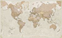
Wereldkaart 90P Antiek & politiek, 136 x 84 cm | Maps International
Politieke wandkaart in ouderwetse kleurstelling. De indeling van de kaart is natuurlijk wel up-to-date. De kaart is 136 x 84 cm groot en in het Engels. Alle landen staan er op met voor de USA, Brazilië, Canada en Australië ook nog een provincies. Schaduw in reliëf zorgt voor aanduiding van de belangrijkste berggebieden met namen en hoogte van bepaalde toppen. Met symbolen wordt de grootte van een stad aangeduid, met ook een overzicht van de belangrijkste wegverbindingen. Kleurgebruik zorgt voor een mooi beeld van de oceanen. 3 Political wall map of the world from Maps International, size 136 x 84cm, in an antique-style presentation: countries in hues of brown, beige and tan with their borders outlined in a stronger colour - oceans in light grey, with graphic relief for the ocean floor and names in italics adding to the overall elegant, old-fashioned feel.
37,95
Wereldkaart 90 Antiek & politiek , 136 x 84 cm | Maps International
Politieke wandkaart in ouderwetse kleurstelling. De indeling van de kaart is natuurlijk wel up-to-date. De kaart is 136 x 84 cm groot en in het Engels. Alle landen staan er op met voor de USA, Brazilië, Canada en Australië ook nog een provincies. Schaduw in reliëf zorgt voor aanduiding van de belangrijkste berggebieden met namen en hoogte van bepaalde toppen. Met symbolen wordt de grootte van een stad aangeduid, met ook een overzicht van de belangrijkste wegverbindingen. Kleurgebruik zorgt voor een mooi beeld van de oceanen.    Political wall map of the world from Maps International, size 136 x 84cm, in an antique-style presentation: countries in hues of brown, beige and tan with their borders outlined in a stronger colour - oceans in light grey, with graphic relief for the ocean floor and names in italics adding to the overall elegant, old-fashioned feel.  
19,95
Wereldkaart 90ML Antiek & politiek, 136 x 84 cm | Maps International
Politieke wandkaart in ouderwetse kleurstelling. De indeling van de kaart is natuurlijk wel up-to-date. De kaart is 136 x 84 cm groot en in het Engels. Alle landen staan er op met voor de USA, Brazilië, Canada en Australië ook nog een provincies. Schaduw in reliëf zorgt voor aanduiding van de belangrijkste berggebieden met namen en hoogte van bepaalde toppen. Met symbolen wordt de grootte van een stad aangeduid, met ook een overzicht van de belangrijkste wegverbindingen. Kleurgebruik zorgt voor een mooi beeld van de oceanen.  Political wall map of the world from Maps International, size 136 x 84cm, in an antique-style presentation: countries in hues of brown, beige and tan with their borders outlined in a stronger colour - oceans in light grey, with graphic relief for the ocean floor and names in italics adding to the overall elegant, old-fashioned feel.  
49,95

Klanten-reviews van Wereldkaart 97 World executive political, 136 x 84 cm | Maps International

Er zijn nog geen beoordelingen voor dit productBen jij de eerste die een review plaatst?

Meer over Wereldkaart 97 World executive political, 136 x 84 cm | Maps International

Productomschrijving

Politieke wandkaart in bijzondere kleurstelling. De indeling van de kaart is natuurlijk wel up-to-date. De kaart is 136 x 84 cm groot en in het Engels. Alle landen staan er op met voor de USA, Brazilië, Canada en Australië ook nog een provincies. Schaduw in reliëf zorgt voor aanduiding van de belangrijkste berggebieden met namen en hoogte van bepaalde toppen. Met symbolen wordt de grootte van een stad aangeduid, met ook een overzicht van de belangrijkste wegverbindingen. Kleurgebruik zorgt voor een mooi beeld van de oceanen.    A popular world wall map within our premium map range! With its antique-style muted tones, it looks simply stunning and rather elegant.   Map details: Splendid premium wall map of the world in muted tones. This premium world wall maps is available mounted on a walnut style frame. Complete with political detail (countries shaded in different tones), country boundaries and cities shown, this really is the most stylish and practical map available! 
Webshop.nl maakt gebruik van cookies. Ga je verder op onze website, ga dan akkoord met het plaatsen van cookies en de verwerking van deze data door ons en vermelde partners.