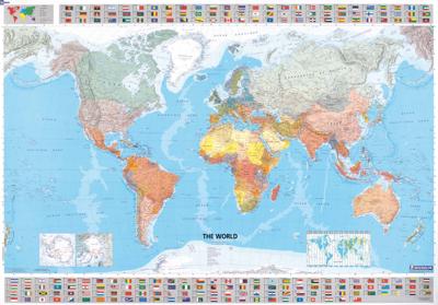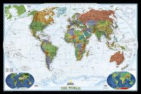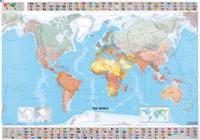
Wereldkaart 01 The World - Wereld, 144 x 100 cm | Michelin

0
Mooie wereldkaart met duidelijke staatkundige weergave van de bekende kaartenmaker Michelin. Met aan de boven en onderkant de vlaggen van landen.   Beautifully colored Michelin world map. Highlights the flags of each country and includes population, surface area and density. Scale 1:28,000,000 - 1cm = 285 km . Laminated for durable use.   The Mich...

Verkopers met dit product

Verkoper
Bezorging
Prijs
DeZwerver.nl logo
DeZwerver.nl
5,95
18,95

Anderen bekeken ook

Wereldkaart 01 The World - Wereld, 144 x 100 cm | Michelin
Mooie wereldkaart met duidelijke staatkundige weergave van de bekende kaartenmaker Michelin. Met aan de boven en onderkant de vlaggen van landen.   Beautifully colored Michelin world map. Highlights the flags of each country and includes population, surface area and density. Scale 1:28,000,000 - 1cm = 285 km . Laminated for durable use.   The Michelin political wall map of the world is updated annually to ensure current representation and comprehensive coverage, including physical and climatic features. Detailed and uncluttered, the map reflects Michelin's superior cartographic standard and complements any office, home, or school setting. Statistical information is included in the map boundaries, along with flags of the world.     Afmeting 100 cm (h) bij 144 cm (b).
18,95
Wereldkaart 02 The World - Wereld | Michelin
Mooie wereldkaart met duidelijke staatkundige weergave van de bekende kaartenmaker Michelin. Met aan de boven en onderkant de vlaggen van landen. Geplastificeerde versie! Beautifully colored Michelin world map. Highlights the flags of each country and includes population, surface area and density. Scale 1:28,000,000 - 1cm = 285 km . Laminated for durable use. The Michelin political wall map of the world is updated annually to ensure current representation and comprehensive coverage, including physical and climatic features. Detailed and uncluttered, the map reflects Michelin's superior cartographic standard and complements any office, home, or school setting. Statistical information is included in the map boundaries, along with flags of the world.
27,95
Wegenkaart - landkaart 701 The world - Wereld | Michelin
De gevouwen Wereldkaart van Michelin: ideaal voor een snel overzicht waar alle landen liggen, de hoofdsteden en verbindingen. The WorldMichelin Map is perfect for route planning as well as excellent road detail and classification and clearly show the regions topography. Included in this map are national flags, population and surface areas and world time zones. The North Pole and the South Pole are shown as insets on this map. Main roads are well classified, as well as international boundaries, capitol and major cities as well as transcontinental railway systems   The map also features a reasonably comprehensive climate chart giving min and max temperatures and average monthly rainfall for major world cities. Also shown are mountains and ocean depths in certain areas.
12,95
Wereldkaart Monde politique | 144 x 100 cm | Michelin
Éducative et décorative, cette carte plastifiée du monde est idéale pour être utilisée à la maison ou au bureau ! Mise à jour chaque année et joliment colorée, cette carte murale met en évidence les drapeaux de chaque pays ainsi que des informations statistiques sur la population, la superficie ou encore la densité de ces pays. Les frontières, les capitales et les principales villes des différents pays sont également représentées. Format : 140 x 100 cm Echelle : 1/28 500 000
22,95
Wereldkaart World pacific-centred wall map, 136 x 100 cm | Maps International
View the world from a different perspective with Maps International's Pacific centred world wall map with flags.    Map details: This Pacific centred wall map shows the world centred along the 150° line of longitude. Instead of parting the map along the Pacific Ocean (as most world wall maps are), this one parts the map along the Atlantic Ocean meaning Europe and the Americas are in separate sides of the map!    Pacific centred world wall map has countries marked in different colours according to international country boundaries. Capital cities (including approximate population size) and hill shading are also shown. Mountain peaks and depths are given on this Pacific centred world wall map. Pacific centred map comes with a panel of country flags displayed on the base of the map.    Map uses: Great for re-learning about world and its geography. Ideal for use in secondary school classrooms and who those wishing to challenge their thinking.   Afwerking: geplastificeerd De wandkaart wor…
37,95
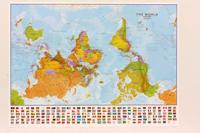
Wereldkaart 71 Wereld upside down, 136 x 100 cm | Maps International
Een totaal andere kijk op de wereld: hang het eens ondersteboven! De mooie heldere kaart van Maps International nu in een upside-down uitvoering. Engelstalig, geplastificeerd, met vlaggen Afwerking: geplastificeerd De wandkaart wordt afgewerkt met een inkapselingsproces. Inkapseling betekent dat de kaarten met warmte worden geperst tussen twee vellen film van industriële kwaliteit. Houd er rekening mee dat de randen van deze kaart niet zijn geplastificeerd.   Inkapseling geeft de kaart een schrijf- / veegafwerking, wat betekent dat met een droog afveegbare marker elk schrift op de kaart kan worden weggeveegd.   View the world from a different direction with Maps International's large political upside down world wall map.  Map details: This is an upside down world wall map with everything reversed! The south is at the top of the map, the north is at the base and the southern hemisphere is now at the top. The countries you expect to see in the east are now on the left of the map, and th…
38,95
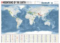
Wereldkaart Mountains of the Earth | Bergen van de Wereld | 140 x 100 cm | Marmota Maps
Mountains of the Earth invites you to discover the fascinating summits of our planet. We show Earth's highest peaks in the Himalaya, impressive country high points such as Fuji-san in Japan, mountains of great historic importance like Mount Olympus, particularly beautiful landmarks like the Table Mountain or the Matterhorn, and some of the world's most remote and rarely known summits in Siberia, Greenland, or Antarctica.   Information on every mountain We show each mountain's height and prominence, as well as the country or countries it lies in. The altitude bar for each mountain is color-coded, same as the mountain icons on the map. This makes it easy, for instance, to find Earth's 14 8000ers in the list. The Seven (Second / Third) Summits are highlighted, as well as country high points. We also mark mountains of historic importance and particularly beautiful and iconic mountains as landmarks.   Mountain icons on the map  The mountains on our map reveal much more than just the…
74,95
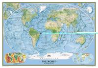
Wereldkaart 09 Natuurkundig - the world physical, 178 x 122 cm | National Geographic
Bijzonder fraaie natuurkundige kaart van National Geographic waarbij het accent ligt op de fysische aspecten van de aarde met veel details van de oceanen. Een schoonheid aan de muur! Deze versie is geplastificeerd.   Our World Physical - Ocean Floor map highlights the Earth's land and undersea forms with exquisite hand-painted relief. Drawn in the Winkel Tripel projection to minimize distortion of the landforms. Two corner inset maps show the Earth's crust and world climatic zones. Scale: 1:24,031,000.  Superb representation of the ocean floor makes this 175.5 x 121.5cm (5ft 9” x 4ft approx.) physical map of the world one of the most interesting titles in the National Geographic Society’s long list of wall maps. Drawn with great skill to achieve a 3-D effect, ocean floor plains, basins, continental shelves, trenches, ridges and fractures are shown with their names, indicating in many places their depth in metres.    On land masses relief shading shows the mountain chains, whilst the c…
74,95
Wereldkaart 22090 Natuurkundig - the world physical, 178 x 122 cm | National Geographic
Bijzonder fraaie natuurkundige kaart van National Geographic waarbij het accent ligt op de fysische aspecten van de aarde met veel details van de oceanen. Een schoonheid aan de muur! Our World Physical - Ocean Floor map highlights the Earth's land and undersea forms with exquisite hand-painted relief. Drawn in the Winkel Tripel projection to minimize distortion of the landforms. Two corner inset maps show the Earth's crust and world climatic zones. Scale: 1:24,031,000. Superb representation of the ocean floor makes this 175.5 x 121.5cm (5ft 9” x 4ft approx.) physical map of the world one of the most interesting titles in the National Geographic Society’s long list of wall maps. Drawn with great skill to achieve a 3-D effect, ocean floor plains, basins, continental shelves, trenches, ridges and fractures are shown with their names, indicating in many places their depth in metres. On land masses relief shading shows the mountain chains, whilst the colouring indicates different types of …
52,95

Klanten-reviews van Wereldkaart 01 The World - Wereld, 144 x 100 cm | Michelin

Er zijn nog geen beoordelingen voor dit productBen jij de eerste die een review plaatst?

Meer over Wereldkaart 01 The World - Wereld, 144 x 100 cm | Michelin

Productomschrijving

Mooie wereldkaart met duidelijke staatkundige weergave van de bekende kaartenmaker Michelin. Met aan de boven en onderkant de vlaggen van landen.   Beautifully colored Michelin world map. Highlights the flags of each country and includes population, surface area and density. Scale 1:28,000,000 - 1cm = 285 km . Laminated for durable use.   The Michelin political wall map of the world is updated annually to ensure current representation and comprehensive coverage, including physical and climatic features. Detailed and uncluttered, the map reflects Michelin's superior cartographic standard and complements any office, home, or school setting. Statistical information is included in the map boundaries, along with flags of the world.     Afmeting 100 cm (h) bij 144 cm (b).

Productinformatie

    Verken gerelateerde categorieën

    Webshop.nl maakt gebruik van cookies. Ga je verder op onze website, ga dan akkoord met het plaatsen van cookies en de verwerking van deze data door ons en vermelde partners.