webshop.nl

Wereldbol - Globe 04 Duorama XL | Columbus Verlag

0
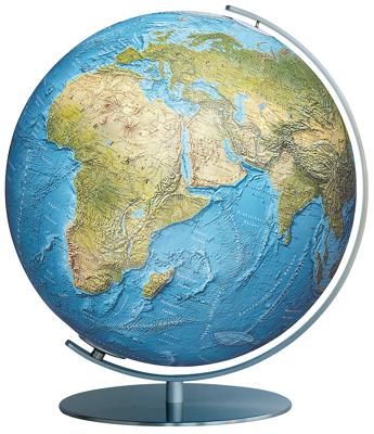
Na vele drukgangen krijgt het kaartbeeld zijn uiteindelijke vorm en ontstaat er een globe die in detail zijn gelijke niet kent. In onverlichte toestand is het kaartbeeld natuurkundig en wordt staatkundig zodra de verlichting aan gaat en de verschillende landen naar voren komen.   Bol is van acrylglas en heeft een diameter van 40 cm. Voet en meridi...

Webshops met dit product

Webshop
Bezorging
Prijs
DeZwerver.nl logo
DeZwerver.nl
niet bekend
497,-

Anderen bekeken ook

Klassieke wereldbol Duo Alba XL | Ø 40 cm | met verlichting | Columbus Verlag
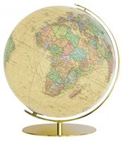
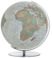
De jury van de toonaangevende Paperworld beurs in Frankfurt heeft deze globe een award toegekend vanwege haar klassieke, tijdloze elegantie gekoppeld aan een moderne uitstraling. Het kaartbeeld DUOALBA is in onverlichte toestand staatkundig met een zeereliëf dat duidelijk zichtbaar is. Met het licht aan toont de bol zijn natuurkundig gezicht. Bol is van acrylglas en heeft een diameter van 40 cm. Voet en meridiaan zijn van edelstaal. Elektradraad extern. Kaart niet-verlicht: politiek Kaart verlicht: natuurkundig Van de uitgever Illuminated globe with acrylic sphere, hand-coated, stainless steel mounting.   Sometimes, changing colors helps to stand out. That is precisely what the DUO ALBA's white oceans do: Offer an eye-catcher for every interior. The subtly cool map emphasizes the arrangement of one-third of land and two-thirds of water on our planet in a completely new way. When illuminated, the globe changes its character: The oceans shine in classical blue, the landmasses in a green…
497,-
Wereldbol - Globe Duo XL | Ø 40 Cm | met verlichting | Columbus Verlag
Na 28 drukgangen krijgt het kaartbeeld DUO zijn uiteindelijke vorm en ontstaat de Koning onder de globes. In onverlichte toestand zijn de verschillende landen zichtbaar en is het beeld staatkundig. Met het licht aan toont de globe zijn natuurkundige gezicht waarbij het reliëf op werkelijk schitterende wijze naar voren komt. Bol is van acrylglas en heeft een diameter van 40 cm. Voet en meridiaan zijn van edelstaal. Elektradraad extern. Van de uitgever Desktop globe made of acrylic glass Ø 40 cm, handcrafted, stainless steel mounting.   Since its introduction over 70 years ago, the DUO symbolizes the two-in-one principle: Non-illuminated, the map shows different countries, illuminated, the complex print additionally reveals the physical image - with detailed topography and seemingly three-dimensional elevations.   A complex 120 halftone printing process ensures that even the smallest writings are crystal clear and sharply depicted, down to details like railway and shipping routes and ev…
497,-
Fietskaart 01 Cycling guides Cornwall | Goldeneye
Our maps are double-sided, printed on an A2 sheet with a concertina fold. This allows for easy folding and folding, and an ease of access to the mapping. The material is rain and tear-resistant. Our early maps were designed at the scale of 2 miles to 1 inch/1:126,720. The later designs along with digitalisation are 1: 100,000. We were encouraged by the Cycle Touring Club to convert our cartography toward the cycle market (to replace the out-of-print Bartholomew series). As time and the series progressed we have added more data: The National Cycle Network routes, Regional Routes, and Traffic-Free Family Routes, as and when they are developed. These routes are in addition to the Circular Routes Goldeneye Commissioned at the outset of our publishing schedule. We are also adding to new editions; bike shops, cycle hire, and tea rooms, along with the tourist attractions already featured. Our plan is to make available digital versions for cell phones and tablets and to update, on an annual b…
15,95
Wegenkaart - landkaart Jasper National Park (Alberta) | Gem Trek Maps
Waterproof and tear-resistant map for Jasper National Park in the Canadian Rockies.   Whether you are a first-time visitor or a long-time local, you’ll find Gem Trek’s Jasper National Park Map to be an invaluable tool. Researched and designed by locals, and printed in Canada, this map features accurate cartography and subtly colored relief that puts the mountainous region in perspective. The map is printed on high-quality synthetic waterproof paper that can be folded and refolded hundreds of times.   The 1:250,000 scale is ideal for discovering the very best of Jasper National Park. Highlights and our recommended hiking trails are marked by numbered stars, then cross-referenced on the reverse side with descriptions. Also included are all mountains and their elevations, along with natural features such as waterfalls, hot springs, and glaciers.   In addition to descriptions for the top highlights and most popular hiking trails, the reverse side has inset maps for the town of Jasp…
16,95
Wandelkaart - Topografische kaart 171 OS Explorer Map Chiltern Hills West | Ordnance Survey
Plunge into lovely countryside as you explore the west Chiltern Hills, an Area of Outstanding Natural Beauty on London’s doorstep. Roam hills clothed in ancient woods and chalk-fed streams, then refresh yourself in the historic market towns of Henley-on-Thames and Wallingford, home of Agatha Christie.    Enjoy Henley-on-Thames, a quintessentially English town set along an exceptionally beautiful stretch of the River Thames  Experience the unique chalk landscape of the Chilterns and glimpse rare butterflies, birds of prey and orchids  Walk or cycle beloved recreational paths including the Chiltern Way, Oxfordshire Way and a section of the ancient Ridgeway, Britain’s oldest road  Met zijn 4cm voor 1 km (2 ½ cm voor 1 mijl) schaal, is de OS Explorer kaartenserie de ideale en meest gedetailleerde kaartenreeks voor mensen die graag outdoor-activiteiten zoals fietsen, wandelen, paardrijden, klimmen en watersporten. Deze kaart is nog gedetailleerder dan de 'gewone' Landranger maps. Voor- …
19,50
Wegenkaart - landkaart Noorwegen - Norge - Norway | Marco Polo
Uitstekende kaart van Noorwegen . Met informatie als benzinepompen, kilometerafstanden, toeristische symbolen. Met index en enkele stadsplattegronden.   De kaart dekt ook Zweden, Denemarken en een klein gedeelte van noord Duitsland en Finland   This Marco Polo map of Norway features really easy to read cartography. Topography is highlighted with relief shading and loads of spot heights and the road network is clearly shown with roads ranging from motorways all the way through to minor secondary roads. The map also clearly indicates airports, places of interest, scenic/tourist routes, view points etc.   The map includes a booklet attached to the cover that contains some useful information and a very extensive index that covers locations, places of interest and geographical features. Also included are a distance/driving time chart, a fold out flap on the cover with an overview map of the region covered and 6 reasonably detailed enlargements showing the major cities in the region.   A un…
14,95
Wegenkaart - landkaart Portugal | Marco Polo
Duidelijke wegenkaart van Marco Polo: alle wegen, zowel de verharde als belangrijke onverharde wegen zijn weergegeven.  Mooie toeristisch interessante wegen die de moeite waard zijn, zijn groen gearceerd. Veel toeristische informatie is toegevoegd zoals de nationale parken, campings, kastelen en vliegvelden. Afstanden tussen belangrijke steden en benzinestations staan ook op de kaart. Een plaatsnamenregister ontbreekt niet.   ---   This Marco Polo map features really easy to read cartography. Topography is highlighted with relief shading and loads of spot heights and the road network is clearly shown with roads ranging from motorways all the way through to minor secondary roads. The map also clearly indicates airports, places of interest, scenic/tourist routes, view points etc.   The map includes a booklet attached to the cover that contains some useful information and a very extensive index that covers locations, places of interest and geographical features. Also included are a dista…
14,95
Wegenkaart - landkaart Europe - Europa | Marco Polo
Duidelijke wegenkaart van Marco Polo: alle wegen, zowel de verharde als belangrijke onverharde wegen zijn weergegeven.  Mooie toeristisch interessante wegen die de moeite waard zijn, zijn groen gearceerd. Veel toeristische informatie is toegevoegd zoals de nationale parken, campings, kastelen en vliegvelden. Afstanden tussen belangrijke steden staan ook op de kaart. Een plaatsnamenregister ontbreekt niet.   ---   This Marco Polo map features really easy to read cartography. Topography is highlighted with relief shading and loads of spot heights and the road network is clearly shown with roads ranging from motorways all the way through to minor secondary roads. The map also clearly indicates airports, places of interest, scenic/tourist routes, view points etc.   The map includes a booklet attached to the cover that contains some useful information and a very extensive index that covers locations, places of interest and geographical features. Also included are a distance/driving time ch…
14,95
Wegenkaart - landkaart Slovenia - Slovenië - Istrie | Marco Polo
Duidelijke wegenkaart van Marco Polo: alle wegen, zowel de verharde als belangrijke onverharde wegen zijn weergegeven.  Mooie toeristisch interessante wegen die de moeite waard zijn, zijn groen gearceerd. Veel toeristische informatie is toegevoegd zoals de nationale parken, campings, kastelen en vliegvelden. Afstanden tussen belangrijke steden en benzinestations staan ook op de kaart. Een plaatsnamenregister ontbreekt niet.   ---   This Marco Polo map features really easy to read cartography. Topography is highlighted with relief shading and loads of spot heights and the road network is clearly shown with roads ranging from motorways all the way through to minor secondary roads. The map also clearly indicates airports, places of interest, scenic/tourist routes, view points etc.   The map includes a booklet attached to the cover that contains some useful information and a very extensive index that covers locations, places of interest and geographical features. Also included are a dista…
14,95
Wegenkaart - landkaart Cordillera Cantabrica - Asturias y provincias limitrofes | Adrados Ediciones
Gedetailleerde wegenkaart an de Cordillera Cantabrica met hoogtelijnen, hoogte verschillen in kleur en schaduw en UTM coördinaten. Met plaatsnamen index! Cordillera Cantabrica on a detailed road map from the Oviedo based Adrados Ediciones, presenting this mountainous region with contours at 100m intervals, altitude coluring, relief shading and UTM coordinates. Since the publishers specialize in detailed hiking maps, including the best coverage of the Picos de Europa, the map includes an exceptionally large number of names of peaks, passes, etc. Symbols highlight best rock and ice climbing areas, huts and refuges, campsites, mountain rescue posts and information centres. Along the coast numerous beaches are named. Road network includes small country roads and tracks. Local railway lines are shown, although not very easy to see on the base map filled with so much information. The map has a 10km UTM grid. Map legend is in Spanish only. On the reverse is a panorama drawing of the area, lo…
14,95

Klanten-reviews van Wereldbol - Globe 04 Duorama XL | Columbus Verlag

Er zijn nog geen beoordelingen voor dit productBen jij de eerste die een review plaatst?

Meer over Wereldbol - Globe 04 Duorama XL | Columbus Verlag

Productomschrijving

Na vele drukgangen krijgt het kaartbeeld zijn uiteindelijke vorm en ontstaat er een globe die in detail zijn gelijke niet kent. In onverlichte toestand is het kaartbeeld natuurkundig en wordt staatkundig zodra de verlichting aan gaat en de verschillende landen naar voren komen.   Bol is van acrylglas en heeft een diameter van 40 cm. Voet en meridiaan zijn van edelstaal. Elektradraad extern.   The DUORAMA™ cartography conveys an extraordinary 3-dimensional picture of the Earth with its detailed relief shadings and the accurate physical cartography. The relief globes have a hand-papered map on which the relief is hand-modelled. Each rise of the geographical map is individually formed with a small piece of clay and placed on the glass ball. The skilled worker sticks on the clay the corrensponding extract of lthe map - a high-complicated fligree work that can not be done without an extremely calm hand and many years of experience.

Verken gerelateerde categorieën

Webshop.nl maakt gebruik van cookies. Ga je verder op onze website, ga dan akkoord met het plaatsen van cookies en de verwerking van deze data door ons en vermelde partners.