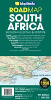
Wegenkaart - landkaart Zuid-Afrika - South Africa, Lesotho & Swaziland | MapStudio

0
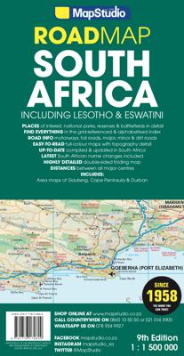
Duidelijke overzichtskaart van Zuid Afrika, Lesotho en Swaziland. Met gedetailleerde kaarten van de regio's Gauteng, Kaapse Schiereiland en Durban. South Africa Lesotho and Swaziland map is a  new edition which includes major and minor routes with route markers, tourist regions and has an index to place names.   Content includes places of interest...

Verkopers met dit product

Verkoper
Bezorging
Prijs
DeZwerver.nl logo
DeZwerver.nl
2,95
16,95

Anderen bekeken ook

Wegenkaart - landkaart Zuid-Afrika - South Africa, Lesotho & Swaziland | MapStudio
Duidelijke overzichtskaart van Zuid Afrika, Lesotho en Swaziland. Met gedetailleerde kaarten van de regio's Gauteng, Kaapse Schiereiland en Durban. South Africa Lesotho and Swaziland map is a  new edition which includes major and minor routes with route markers, tourist regions and has an index to place names.   Content includes places of interest, mountain passes, topography, national parks & reserves, historic sites, railway lines & stations, route numbers, distance table and the latest toll routes and all route classifications.   Coverage includes a detailed map of South Africa at a scale of 1 : 1 500 000 along with detailed area maps of Gauteng, Durban and Cape Peninsula.
16,95
Reisgids South Africa, eSwatini (Swaziland) & Lesotho - Zuid Afrika | Lonely Planet
De perfecte reisgids voor zowel de georganiseerde als de zelfstandige reiziger voor Zuid Afrika. Naast een algemene inleiding van het land / streek vol met praktische informatie over hoe je er het beste kunt reizen: slapen, eten, vervoer, excursies ... alles kun je er in vinden. Engelstalig. Lonely Planet Lonely Planet’s South Africa, Lesotho & Swaziland is your passport to the most relevant, up-to-date advice on what to see and skip, and what hidden discoveries await you. Fill your days with beaches and wineries in Cape Town, spot wildlife galore in Kruger National Park, and hike past majestic mountains in the Drakensberg region – all with your trusted travel companion. Get to the heart of South Africa, Lesotho & Swaziland and begin your journey now!   Inside Lonely Planet’s South Africa, Lesotho & Swaziland:   Colour maps and images throughout Highlights and itineraries help you tailor your trip to your personal needs and interests Insider tips to save time and money and get around …
25,95
Wegenkaart - landkaart Zuid Afrika - South Africa incl Lesotho & Swaziland | Tracks4Africa
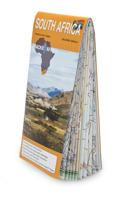
Gerenommeerde wegenkaart van Zuid Afrika, vooral gericht op navigeren met GPS en het rijden over de kleinere wegen. De eerste toeristische kaart van Zuid-Afrika die reistijden en afstanden vermeld. De kaart heeft een schaal van 1:1.000.000 en biedt gedetailleerde informatie over alle toeristische bestemmingen van Zuid-Afrika, zowel populaire als onbekende. De Tracsk4Africa Tourist Map of South Africa is een waterproof landkaart van Zuid-Afrika die het de reiziger gemakkelijk maakt te navigeren. Van alle wegen en tracks worden afstanden en reistijden vermeld. De wegenkaart is geheel geintegreerd met de T4A GPS kaarten. Deze kaarten kunt u voor een klein bedrag kopen op de website en op uw gps apparaat plaatsen, waardoor u niet handmatig coordinaten hoeft in te voeren en zelfs turn-by-turn kunt navigeren. Verder hebben alle plaatsen op de kaart hebben een code die toegang biedt tot Padkos.co.za en waar u POI ( points Of Interest, interessesante plekken) kunt vinden en kan instellen op u…
27,50
Reishandboek Zuid-Afrika, Lesotho en Swaziland (Paperback)
Deze complete reisgids besteedt naast Zuid-Afrika ook uitgebreide aandacht aan Lesotho en Swaziland. Veel reizigers combineren een reis met deze twee landen. Het Reishandboek Zuid-Afrika is geschreven door de Nederlandse auteur Jan Willem Hamel. Hij woonde in zowel Johannesburg als de diamantstad Kimberley. Hij beschrijft in deze reisgids naast de bezienswaardigheden ook de geschiedenis, cultuur, de bevolking en de natuur. Ook praktische informatie en tips komen uitgebreid aan bod. Het Reishandboek Zuid-Afrika, Lesotho en Swaziland is een complete reisgids boordevol nuttige informatie en geschreven door een echte insider. Veelzijdig Zuid-Afrika De kustlijn van Zuid-Afrika is bijna drieduizend kilometer lang; boordevol duik- en snorkelmogelijkheden. Bergen met wandelroutes en ski-oorden, terwijl 'de Kaap' synoniem is voor wijnen, VOC-erfgoed en bloemenpracht. De regio combineert op een unieke manier traditioneel Afrika en Afrika met Europese en Amerikaanse invloeden. Gastvrijheid en
19,99
Reisgids Reishandboek Zuid-Afrika, Lesotho en Swaziland | Uitgeverij Elmar
Praktische en culturele reisgids met alle bezienswaardigheden. Deze complete reisgids besteedt naast Zuid-Afrika ook uitgebreide aandacht aan Lesotho en Swaziland. Veel reizigers combineren een reis met deze twee landen. Het Reishandboek Zuid-Afrika is geschreven door de Nederlandse auteur Jan Willem Hamel. Hij woonde in zowel Johannesburg als de diamantstad Kimberley. Hij beschrijft in deze reisgids naast de bezienswaardigheden ook de geschiedenis, cultuur, de bevolking en de natuur. Ook praktische informatie en tips komen uitgebreid aan bod. Het Reishandboek Zuid-Afrika, Lesotho en Swaziland is een complete reisgids boordevol nuttige informatie en geschreven door een echte insider.   Veelzijdig Zuid-Afrika De kustlijn van Zuid-Afrika is bijna drieduizend kilometer lang; boordevol duik- en snorkelmogelijkheden. Bergen met wandelroutes en ski-oorden, terwijl ‘de Kaap’ synoniem is voor wijnen, VOC-erfgoed en bloemenpracht. De regio combineert op een unieke manier traditioneel Afrika en…
19,99
Wegenkaart - landkaart Lesotho - Swaziland | ITMB
Een degelijke kaart met aanduidingen van o.a. nationale parken, vliegveld, benzinepomp, dirt-roads en kleine plattegrond van hoofdstad. Als overzichtskaart goed te gebruiken. Folded road and travel map in color. Scale 1: 200.000 and 1:350,000. Distinguishes roads ranging from paved roads to tracks (4 wheel drive). Legend includes railway with stations, bordercrossings, border control points, airports (tarred runway), airstrips, hospitals, clinics, outstations, museums, hotels, lodges or rest houses, sites of battle, points of interest. Includes inset map of Maseru.
13,95
Wegenkaart - landkaart Zuid Afrika - South Africa | ITMB
Uitstekende wegenkaart van Zuid Afrika met zowel de toeristische informatie als Nationale Parken en bezienswaardigheden, maar ook de topografische details en afstanden. Gedrukt op 'waterproof' papier. Double-sided map of South Africa printed on waterproof and tear-resistant synthetic paper, with plans of Cape Town, Johannesburg and Pretoria. The map divides the country east/west with a small overlap between the two sides. Elevation tinting in feet shows the general relief. Mountain passes are marked, but there are no spot heights. Road network includes selected local tracks, gives driving distances on major and secondary roads and indicates border crossings. Railways, major ferry connections and local airports are also shown. National parks and protected areas are marked and symbols highlight various places of interest, campsites or huts, rest houses and other tourist accommodation, beaches and diving sites, etc. Presentation of Lesotho and Swaziland is the same as for South Africa. L…
13,95
Natuurgids Southern African Wildlife - Botswana, Leshoto, Mozambique, Zuid-Afrika, Swaziland & Zimbabwe | Bradt Travel Guides
Uitstekende natuurgids voor Botswana, Leshoto, Mozambique, Zuid-Afrika, Swaziland & Zimbabwe met meer dan 300 kleurenfoto's. This new, thoroughly revised edition of Bradt's Southern Africa Wildlife guide provides an overview of all southern African wildlife - not only 'big game' and other large mammals, but also birds, reptiles, amphibians and invertebrates. Excellent for independent travellers, it is reliable as a standalone guide combining both wildlife and visitor information, and is also a perfect complement to traditional field guides. Countries covered include Botswana, Lesotho, Mozambique, Namibia, South Africa, Eswatini and Zimbabwe, with Malawi and Zambia both added to this new edition.   Colour photographs illustrate all key species and the engaging text extends beyond basic identification features to illuminate the natural history and ecology of the wildlife that visitors will encounter. Text has been updated throughout to reflect the latest conservation initiatives and wil…
27,95
Reisgids South Africa, Lesotho & Eswatini | Rough Guides
Zeer goede reisgids voor zowel de georganiseerde maar vooral voor de zelfstandige reiziger. Boordevol informatie over reizen, slapen, eten, maar ook musea en cultuur. Uitputtende bron van informatie, veelal nog completer dan de Lonely Planet. Inleidende informatie over land en cultuur is zeer goed. Safari en wildlife gedeelte!   This South Africa, Lesotho & Eswatini guidebook is perfect for independent travellers planning a longer trip. It features all of the must-see sights and a wide range of off-the-beaten-track places. It also provides detailed practical information on preparing for a trip and what to do on the ground. And this South Africa, Lesotho & Eswatini travel guidebook is printed on paper from responsible sources, and verified to meet the FSC's strict environmental and social standards.   This South Africa, Lesotho & Eswatini guidebook covers: Cape Town and the Cape Peninsula, The Western Cape, The Northern Cape, The Eastern Cape, KwaZulu Natal, Free State, Gauteng, No…
27,95
Reisgids Southern Africa - zuidelijk Afrika - Botswana, Lesotho, Malawi, Mozambique, Namibië, Zambia, South Africa, Zimbabwe | Lonely Planet
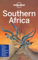
De perfecte reisgids voor zowel de georganiseerde als de zelfstandige reiziger. Naast een algemene inleiding van het land / streek vol met praktische informatie over hoe je er het beste kunt reizen: slapen, eten, vervoer, excursies ... alles kun je er in vinden. Engelstalig. An astonishingly diverse region fused by its prolific wildlife, breathtaking landscapes and remnants of ancient culture, Southern Africa is Africa at its most memorable. Lonely Planet will get you to the heart of Southern Africa, with amazing travel experiences and the best planning advice.   Lonely Planet Southern Africa is your passport to the most relevant, up-to-date advice on what to see and skip, and what hidden discoveries await you. Clamber up the world’s oldest sand dunes in Sossusvlei, step back in time on Mozambique Island, or enjoy world-class wildlife-watching in Etosha National Park; all with your trusted travel companion. Get to the heart of Southern Africa and begin your journey now!   Inside Lonel…
24,95

Klanten-reviews van Wegenkaart - landkaart Zuid-Afrika - South Africa, Lesotho & Swaziland | MapStudio

Er zijn nog geen beoordelingen voor dit productBen jij de eerste die een review plaatst?

Meer over Wegenkaart - landkaart Zuid-Afrika - South Africa, Lesotho & Swaziland | MapStudio

Productomschrijving

Duidelijke overzichtskaart van Zuid Afrika, Lesotho en Swaziland. Met gedetailleerde kaarten van de regio's Gauteng, Kaapse Schiereiland en Durban.

South Africa Lesotho and Swaziland map is a  new edition which includes major and minor routes with route markers, tourist regions and has an index to place names.   Content includes places of interest, mountain passes, topography, national parks & reserves, historic sites, railway lines & stations, route numbers, distance table and the latest toll routes and all route classifications.   Coverage includes a detailed map of South Africa at a scale of 1 : 1 500 000 along with detailed area maps of Gauteng, Durban and Cape Peninsula.

Productinformatie

    Verken gerelateerde categorieën

    Webshop.nl maakt gebruik van cookies. Ga je verder op onze website, ga dan akkoord met het plaatsen van cookies en de verwerking van deze data door ons en vermelde partners.