webshop.nl
Categorieën
  Sluiten

Meer MapStudio

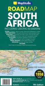
Wegenkaart - landkaart Zuid-Afrika - South Africa, Lesotho & Swaziland

0
Duidelijke overzichtskaart van Zuid Afrika, Lesotho en Swaziland. Met gedetailleerde kaarten van de regio's Gauteng, Kaapse Schiereiland en Durban. South Africa Lesotho and Swaziland map is a  new edition which includes major and minor routes with route markers, tourist regions and has an index to place names.   Content includes places of interest,...

Webshops met dit product

Webshop
Bezorging
Prijs

Anderen bekeken ook

Wegenkaart - landkaart Zuid-Afrika - South Africa, Lesotho & Swaziland
Duidelijke overzichtskaart van Zuid Afrika, Lesotho en Swaziland. Met gedetailleerde kaarten van de regio's Gauteng, Kaapse Schiereiland en Durban. South Africa Lesotho and Swaziland map is a  new edition which includes major and minor routes with route markers, tourist regions and has an index to place names.   Content includes places of interest, mountain passes, topography, national parks & reserves, historic sites, railway lines & stations, route numbers, distance table and the latest toll routes and all route classifications.   Coverage includes a detailed map of South Africa at a scale of 1 : 1 500 000 along with detailed area maps of Gauteng, Durban and Cape Peninsula.
16,95
Reisgids South Africa, Swaziland & Lesotho - Zuid Afrika | Lonely Plan
De perfecte reisgids voor zowel de georganiseerde als de zelfstandige reiziger voor Zuid Afrika. Naast een algemene inleiding van het land / streek vol met praktische informatie over hoe je er het beste kunt reizen: slapen, eten, vervoer, excursies ... alles kun je er in vinden. Engelstalig. Lonely Planet Lonely Planet’s South Africa, Lesotho & Swaziland is your passport to the most relevant, up-to-date advice on what to see and skip, and what hidden discoveries await you. Fill your days with beaches and wineries in Cape Town, spot wildlife galore in Kruger National Park, and hike past majestic mountains in the Drakensberg region – all with your trusted travel companion. Get to the heart of South Africa, Lesotho & Swaziland and begin your journey now!   Inside Lonely Planet’s South Africa, Lesotho & Swaziland:   Colour maps and images throughout Highlights and itineraries help you tailor your trip to your personal needs and interests Insider tips to save time and money and get around l…
24,95
Wegenkaart - landkaart 3204 Adventure Map South Africa - Zuid Afrika |
Wegenkaart van Zuid Afrika met vermelding van veel bezienswaardigheden, nationale parken en attrakties. Watervast en scheurvast. Juist door deze vermeldingen onderscheidt de kaart zich van andere wegenkaarten. National Geographic’s South Africa Adventure Map is designed to meet the unique needs of adventure travelers—detailed, durable, and accurate. It includes the locations of thousands of major cities and towns with an index for easily locating them, plus a clearly marked road network complete with distances and designations for major highways, limited access highways, and more. Both paved and unpaved roads, tracks, and trails are marked for those adventurers who wish to explore less traveled routes.   What sets National Geographic Adventure Maps apart from traditional road maps are the hundreds of points-of-interest that highlight the diverse, unique, and exotic destinations within South Africa including national parks and reserves, sanctuaries, World Heritage sites, archeological s…
17,50
Wegenkaart - landkaart Zuid Afrika - South Africa | ITMB
Uitstekende wegenkaart van Zuid Afrika met zowel de toeristische informatie als Nationale Parken en bezienswaardigheden, maar ook de topografische details en afstanden. Gedrukt op 'waterproof' papier. Double-sided map of South Africa printed on waterproof and tear-resistant synthetic paper, with plans of Cape Town, Johannesburg and Pretoria. The map divides the country east/west with a small overlap between the two sides. Elevation tinting in feet shows the general relief. Mountain passes are marked, but there are no spot heights. Road network includes selected local tracks, gives driving distances on major and secondary roads and indicates border crossings. Railways, major ferry connections and local airports are also shown. National parks and protected areas are marked and symbols highlight various places of interest, campsites or huts, rest houses and other tourist accommodation, beaches and diving sites, etc. Presentation of Lesotho and Swaziland is the same as for South Africa. La…
13,95
Reisgids South Africa, Swaziland & Lesotho - Zuid Afrika | Lonely Plan
De perfecte reisgids voor zowel de georganiseerde als de zelfstandige reiziger voor Zuid Afrika. Naast een algemene inleiding van het land / streek vol met praktische informatie over hoe je er het beste kunt reizen: slapen, eten, vervoer, excursies ... alles kun je er in vinden. Engelstalig. Lonely Planet Lonely Planet’s South Africa, Lesotho & Swaziland is your passport to the most relevant, up-to-date advice on what to see and skip, and what hidden discoveries await you. Fill your days with beaches and wineries in Cape Town, spot wildlife galore in Kruger National Park, and hike past majestic mountains in the Drakensberg region – all with your trusted travel companion. Get to the heart of South Africa, Lesotho & Swaziland and begin your journey now!   Inside Lonely Planet’s South Africa, Lesotho & Swaziland:   Colour maps and images throughout Highlights and itineraries help you tailor your trip to your personal needs and interests Insider tips to save time and money and get around l…
24,95
Wegenkaart - landkaart Pocket map South Africa Zuid Afrika | MapStudio
Handige kleine kaart van Zuid Afrika. South Africa Pocket Map is a  handy pocket map which is an ideal guide to South Africa for any tourist. The map includes detailed area maps of Kruger National Park, the Garden Route, Cape Winelands, Drakensberg, Magaliesberg & the Kwazulu-Natal coast.   South Africa Pocket Map display places of interest, wine estates, national parks & nature reserves, historical sites, accommodation, toll routes, route numbers and a distance table. Also included are border crossings, camps and tented camps.   This is a great map to have on a game drive or tour of South Africa!   Content includes the following as well: – Legend – Index to place names – Freeways – Interchanges – Route numbers – Nature reserves & parks – Tourist information
13,95
Wegenatlas Glovebox South Africa - Zuid-Afrika | A5-Formaat | Ringband
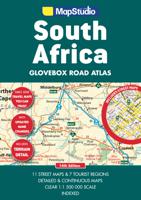
Handzame pocket atlas, A5 formaat, voor Zuid Afrika. Schaal 1 op 1.500.000 en in handige ringband.   This wiro bound Road Atlas South Africa Glovebox is a revised and updated compact atlas.   It includes: Detailed and continuous map section Highlights seven major tourist areas Features eleven street maps Freeways National roads Route numbers Nature reserves and parks Places of interest Tourist information Index to place names and GPS co-ordinates   This edition also features GPS co-ordinates at main interchanges.   COVERAGE: Includes a detailed map of South Africa at a scale of 1 : 1 500 000. The 7 major tourist areas of the Cape Peninsula, South Western Cape and Overberg Region, Garden Route, Gauteng, Kruger National Park, Drakensberg and Kwazulu-Natal coast. The 11 street maps are of Pietermaritzburg, Durban, Nelspruit, Polokwane, Pretoria, Johannesburg, Bloemfontein, Kimberley, East London, Port Elizabeth and Cape Town.
18,95

Klanten-reviews van Wegenkaart - landkaart Zuid-Afrika - South Africa, Lesotho & Swaziland

Er zijn nog geen beoordelingen voor dit productBen jij de eerste die een review plaatst?

Meer over Wegenkaart - landkaart Zuid-Afrika - South Africa, Lesotho & Swaziland

Productomschrijving

Duidelijke overzichtskaart van Zuid Afrika, Lesotho en Swaziland. Met gedetailleerde kaarten van de regio's Gauteng, Kaapse Schiereiland en Durban. South Africa Lesotho and Swaziland map is a  new edition which includes major and minor routes with route markers, tourist regions and has an index to place names.   Content includes places of interest, mountain passes, topography, national parks & reserves, historic sites, railway lines & stations, route numbers, distance table and the latest toll routes and all route classifications.   Coverage includes a detailed map of South Africa at a scale of 1 : 1 500 000 along with detailed area maps of Gauteng, Durban and Cape Peninsula.

Productspecificaties

Artikelnummer(s)
Brand
MapStudio
Webshop.nl maakt gebruik van cookies. Ga je verder op onze website, ga dan akkoord met het plaatsen van cookies en de verwerking van deze data door ons en vermelde partners.