Wegenkaart - landkaart Zuid-Afrika - South Africa, Lesotho & Swaziland | MapStudio

0
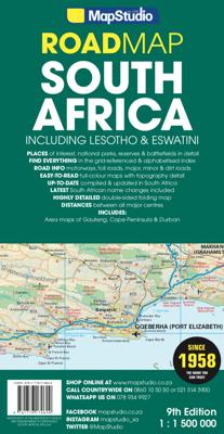
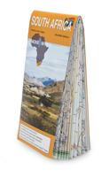
Duidelijke overzichtskaart van Zuid Afrika, Lesotho en Swaziland. Met gedetailleerde kaarten van de regio's Gauteng, Kaapse Schiereiland en Durban. South Africa Lesotho and Swaziland map is a  new edition which includes major and minor routes with route markers, tourist regions and has an index to place names.   Content includes places of interest...

Verkopers met dit product

Verkoper
Bezorging
Prijs
DeZwerver.nl logo
DeZwerver.nl
2,95
16,95

Anderen bekeken ook

Nieuw
Wegenkaart - landkaart 3204 Adventure Map South Africa - Zuid Afrika | National Geographic
Wegenkaart van Zuid Afrika met vermelding van veel bezienswaardigheden, nationale parken en attrakties. Watervast en scheurvast. Juist door deze vermeldingen onderscheidt de kaart zich van andere wegenkaarten. National Geographic’s South Africa Adventure Map is designed to meet the unique needs of adventure travelers—detailed, durable, and accurate. It includes the locations of thousands of major cities and towns with an index for easily locating them, plus a clearly marked road network complete with distances and designations for major highways, limited access highways, and more. Both paved and unpaved roads, tracks, and trails are marked for those adventurers who wish to explore less traveled routes.   What sets National Geographic Adventure Maps apart from traditional road maps are the hundreds of points-of-interest that highlight the diverse, unique, and exotic destinations within South Africa including national parks and reserves, sanctuaries, World Heritage sites, archeological …
17,50
Nieuw
Wegenkaart - landkaart Zuid Afrika - South Africa | ITMB
Uitstekende wegenkaart van Zuid Afrika met zowel de toeristische informatie als Nationale Parken en bezienswaardigheden, maar ook de topografische details en afstanden. Gedrukt op 'waterproof' papier. Double-sided map of South Africa printed on waterproof and tear-resistant synthetic paper, with plans of Cape Town, Johannesburg and Pretoria. The map divides the country east/west with a small overlap between the two sides. Elevation tinting in feet shows the general relief. Mountain passes are marked, but there are no spot heights. Road network includes selected local tracks, gives driving distances on major and secondary roads and indicates border crossings. Railways, major ferry connections and local airports are also shown. National parks and protected areas are marked and symbols highlight various places of interest, campsites or huts, rest houses and other tourist accommodation, beaches and diving sites, etc. Presentation of Lesotho and Swaziland is the same as for South Africa. L…
13,95
Nieuw
Wegenkaart - landkaart Africa central and south - Afrika zuid en centraal | ITMB
This title is in our series of regional titles for Africa at 1:3,400,000 scale. All of Africa is available as a continental sheet at 1:5M scale and as regional titles at 1:3.8M and 1:3.4M, based on GIS data. This is a milestone for ITMB and the realization of a dream that began in 1993. However, the work is still only in its early stages. This map covers that portion of the continent that old Africa hands always referred to as 'central', meaning the Rhodesias and Nyasaland � now known as Zambia, Malawi, and Zimbabwe.   By its shape, generous portions of the southern portions of DEM Congo, the eastern third of Angola, the northern half of Mozambique, and Botswana's Okavunga Delta are included on the one side. The second side covers South Africa, Lesotho, Swaziland, the rest of Botswana, and southern Namibia in great detail. This is an excellent map for anyone visiting the larger region of the southern third of Africa. As with our other regional titles, this is a work in progress. The n…
13,95
Nieuw
Reisgids South Africa, Swaziland & Lesotho - Zuid Afrika | Lonely Planet
De perfecte reisgids voor zowel de georganiseerde als de zelfstandige reiziger voor Zuid Afrika. Naast een algemene inleiding van het land / streek vol met praktische informatie over hoe je er het beste kunt reizen: slapen, eten, vervoer, excursies ... alles kun je er in vinden. Engelstalig. Lonely Planet Lonely Planet’s South Africa, Lesotho & Swaziland is your passport to the most relevant, up-to-date advice on what to see and skip, and what hidden discoveries await you. Fill your days with beaches and wineries in Cape Town, spot wildlife galore in Kruger National Park, and hike past majestic mountains in the Drakensberg region – all with your trusted travel companion. Get to the heart of South Africa, Lesotho & Swaziland and begin your journey now!   Inside Lonely Planet’s South Africa, Lesotho & Swaziland:   Colour maps and images throughout Highlights and itineraries help you tailor your trip to your personal needs and interests Insider tips to save time and money and get around …
25,95
Nieuw
Wegenkaart - landkaart Planning Map Africa - Afrika | Lonely Planet
Durable and waterproof, with a handy slipcase and an easy-fold format, Lonely Planet's Africa Planning Map helps you explore with ease. Get more from your map and your trip with images and information about top attractions, itinerary suggestions and themed lists. With this easy-to-use, full-colour map in your back pocket, you can truly get to the heart of Africa - so begin your journey now! Easy-fold format Handy slipcase Full colour and easy to use Beautiful imagery Tailored itineraries Can't-miss highlights Detailed town index Themed lists Covers Algeria, Angola, Benin, Botswana, Burkina Faso, Burundi, Cameroon, Cape Verde, Central African Republic, Chad, Comoros, Congo, Cote d'Ivoire, Democratic Republic of Congo, Djibouti, eSwatini (Swaziland), Egypt, Equatorial Guinea, Eritrea, Ethiopia, Gabon, The Gambia, Ghana, Guinea, Guinea-Bissau, Kenya, Lesotho, Liberia, Libya, Madagascar, Malawi, Mali, Mauritania, Mauritius, Morocco, Mozambique, Namibia, Niger, Nigeria, Rwanda, S…
10,95
Nieuw
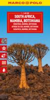
Wegenkaart - landkaart South Africa Namibia Botswana - Zuid Afrika Namibië Bostwana | Marco Polo
Duidelijke wegenkaart van Marco Polo: alle wegen, zowel de verharde als belangrijke onverharde wegen zijn weergegeven.  Mooie toeristisch interessante wegen die de moeite waard zijn, zijn groen gearceerd. Veel toeristische informatie is toegevoegd zoals de nationale parken, campings, kastelen en vliegvelden. Afstanden tussen belangrijke steden staan ook op de kaart. Een plaatsnamenregister ontbreekt niet.   ---   This Marco Polo map of South Africa features really easy to read cartography. Topography is highlighted with relief shading and loads of spot heights and the road network is clearly shown with roads ranging from motorways all the way through to minor secondary roads. The map also clearly indicates airports, places of interest, scenic/tourist routes, view points etc.   The map includes a booklet attached to the cover that contains some useful information and a very extensive index that covers locations, places of interest and geographical features. Also included are a distance…
14,95
Reisgids Southern Africa - zuidelijk Afrika - Botswana, Lesotho, Malawi, Mozambique, Namibië, Zambia, South Africa, Zimbabwe | Lonely Planet
De perfecte reisgids voor zowel de georganiseerde als de zelfstandige reiziger. Naast een algemene inleiding van het land / streek vol met praktische informatie over hoe je er het beste kunt reizen: slapen, eten, vervoer, excursies ... alles kun je er in vinden. Engelstalig. An astonishingly diverse region fused by its prolific wildlife, breathtaking landscapes and remnants of ancient culture, Southern Africa is Africa at its most memorable. Lonely Planet will get you to the heart of Southern Africa, with amazing travel experiences and the best planning advice.   Lonely Planet Southern Africa is your passport to the most relevant, up-to-date advice on what to see and skip, and what hidden discoveries await you. Clamber up the world’s oldest sand dunes in Sossusvlei, step back in time on Mozambique Island, or enjoy world-class wildlife-watching in Etosha National Park; all with your trusted travel companion. Get to the heart of Southern Africa and begin your journey now!   Inside Lonel…
24,95
Nieuw
Wegenkaart - landkaart 3014 Adventure Map India South - Zuid | National Geographic
Wegenkaart van Zuid India met vermelding van veel bezienswaardigheden, nationale parken en attrakties. Watervast en scheurvast. National Geographic's India South Adventure Map is designed to meet the unique needs of adventure travelers with its durability and detailed, accurate information. The map includes the locations of thousands of cities and towns with a user-friendly index, as well as a clearly marked road network complete with distances and designations for highways, major routes and secondary roads.   The India South Adventure Map differs from a traditional road map for it includes hundreds of points of interest that highlight the diverse and unique destinations found in this region. The map features UNESCO World Heritage sites, archaeological sites, wildlife sanctuaries, Hindu and Buddhist temples, sacred sites, forts, palaces, ruins, waterfalls, caves and other points of interest, making it an invaluable resource to travelers hoping to experience all the history and culture…
17,50
Vogelgids South Africa Birds, Zuid-Afrika, Namibië, Botswana, Zimbabwe | Waterford Press
Een bijzonder handige uitklapkaart met alle veelvoorkomende vogels van Zuidelijk Afrika. Duidelijke illustraties, goede korte omschrijving van soort en leefgebied, geplastificeerd.   One of the world's top birding hotspots, South Africa's diverse habitats harbor more than 950 species. This beautifully illustrated guide covers over 140 familiar and unique species found in South Africa, Lesotho, Swaziland, Namibia, Botswana, Zimbabwe, and southern Mozambique and includes a map of birding hotspots. Laminated for durability, this lightweight, pocket-sized folding guide is an excellent source of portable information and ideal for field use by novices and experts alike.  
10,95
Nieuw
Wegenkaart - landkaart Africa north east - noord oost Afrika | ITMB
This is the third ITMB title on Africa to be released using our digital data base material. As with Africa as a continental map and Africa North West, this map covers a large area and tries to do so fairly and in detail. The essential areas of coverage are Libya and Egypt in the north, with Sudan/South Sudan, Ethiopia/Eritrea in the middle, and Kenya/Uganda in the south, with a fair portion of Tanzania and Congo thrown in simply because it fits. Being a regional map, it is useful for the 'big' picture. It is quite detailed, showing roads, towns, and major touristic sites. It is more detailed and at a better scale than the Michelin map of the same name   Legend Includes: Road by classification, Main Road, National Park, Lake, Capital, International Airport, Oasis, Ruins, Hotels and much more...
13,95

Klanten-reviews van Wegenkaart - landkaart Zuid-Afrika - South Africa, Lesotho & Swaziland | MapStudio

Er zijn nog geen beoordelingen voor dit productBen jij de eerste die een review plaatst?

Meer over Wegenkaart - landkaart Zuid-Afrika - South Africa, Lesotho & Swaziland | MapStudio

Productomschrijving

Duidelijke overzichtskaart van Zuid Afrika, Lesotho en Swaziland. Met gedetailleerde kaarten van de regio's Gauteng, Kaapse Schiereiland en Durban.

South Africa Lesotho and Swaziland map is a  new edition which includes major and minor routes with route markers, tourist regions and has an index to place names.   Content includes places of interest, mountain passes, topography, national parks & reserves, historic sites, railway lines & stations, route numbers, distance table and the latest toll routes and all route classifications.   Coverage includes a detailed map of South Africa at a scale of 1 : 1 500 000 along with detailed area maps of Gauteng, Durban and Cape Peninsula.

Verken gerelateerde categorieën

Webshop.nl maakt gebruik van cookies. Ga je verder op onze website, ga dan akkoord met het plaatsen van cookies en de verwerking van deze data door ons en vermelde partners.