webshop.nl
Categorieën
  Sluiten

Meer Infomap
Meer Infomap in Muziekinstrument

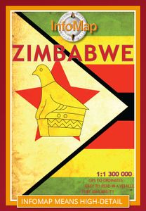
Wegenkaart - landkaart Zimbabwe | Infomap

Easy to read in a vehicle Various accommodation options with contact details Major and secondary roads with many off-road tracks Roads in the national parks and reserves Distances between points on major roads Border post information Points of interest   While Zimbabwe has for many years now made headlines for its economic hardships, it’s wo...
15,95

Webshops met dit product

Webshop
Bezorging
Prijs

Anderen bekeken ook

Wegenkaart - landkaart Zimbabwe | Infomap
Easy to read in a vehicle Various accommodation options with contact details Major and secondary roads with many off-road tracks Roads in the national parks and reserves Distances between points on major roads Border post information Points of interest   While Zimbabwe has for many years now made headlines for its economic hardships, it’s worth remembering that for a long time this country was the ‘’breadbasket of Africa’ and one of the premier wildlife destinations on the continent. A changing political landscape in the late 90’s however, virtually caused a complete collapse in the tourism industry – a vital bloodline to the economy.   Those troubled times seem to be coming to a close and Zimbabwe is back on the tourist map. Foreign visitors are slowly rising and recently the country was voted the World’s Best Tourism Destination by the World Tourism Organisation. With a wealth of tourist-sites, activities and wildlife reserves, any trip to this country will be memorable. From …
15,95
Wegenkaart - landkaart Botswana - Zimbabwe | ITMB
Een degelijke kaart met aanduidingen van o.a. nationale parken, vliegveld, benzinepomp, dirt-roads en kleine plattegrond van hoofdstad. Als overzichtskaart goed te gebruiken. 7th Edition 1:1,600,000/11:1,000,000 on waterproof stone paper Both Botswana and its neighbour, Zimbabwe, form a common entity and a British heritage in Central Southern Africa, but there the resemblance ends. The Bechuana formed an alliance of sorts with the Pritish to protect them from the Boers in the then-nearby Transvaal. Upon a peaceful transition to independence as Botswana, it has evolved into a democratic and peaceful country. Zimbabwe, formerly Rhodeisa, is a failed state, although potentially, Zimbabwe could dominate tourism if governmental affairs were orderly. This map focuses on Botswana simply because that country is a beacon of orderly pleasantness in the continent; well run, routistacally well developed, with good infrastructure, and close to the game preserves of both South Africa and Zimbabwe. T…
13,95
Wegenkaart - landkaart Botswana | Infomap
Goede betrouwbare kaart van Botswana. Met GPS coordinaten. Easy to read in a vehicle Practical, user-friendly scale Extensive countrywide accommodation listing and contact details Experienced-based tips and route comments Includes many off-road tracks GPS co-ordinates of intersections Border post information Many points of interest Distances, fuel points, airports Booking details for national parks Roads and tracks in the national park and reserves Inset of Tuli Block A classic. Our Botswana map, now in its 14th edition, is one of our top sellers. From more frequented destinations such as the country’s famous game parks to other lesser known ones like Tsodilo Hills – Botswana’s World Heritage site with over 4000 rock paintings – this map is a one-stop resource for both self-drive travellers and fly-in tourists alike. Use it to navigate your way from Gaborone to Maun, from Kasane down the Hunters Road to Khubu Island, from Twee Rivieren to the Kalahari, or simply use it as a…
15,95
Wegenkaart - landkaart Namibië | Infomap
Another InfoMap classic – now in its 13th edition and highly recommended!   Famous for its Namib desert, the oldest desert in the world, which straddle the western shore along the Atlantic, Namibia is country of intense beauty and seemingly unlimited space. It is a photographer’s paradise. Watch the afternoon shadows add drama to the dunes at Sossusvlei, walk through the ghost town of Kolmanskop, hike the Fish River Canyon, see the lunar landscape and Quiver trees near Keetmanshoop, experience a world transformed when the Etosha pan fills with water, or look out for the endangered cheetah of which Namibia has the highest population left in Africa.   The country is a hugely popular tourist destination that offers endless possibilities to travellers throughout all budgets and travel requirements. Tourism is one of the country’s main economic activities, with around one million tourists visiting Namibia each year. Given that the country’s population currently sits somewhere around 2 milli…
15,95
Wegenkaart - landkaart Zambia | Infomap
Zambia boasts some of the most beautiful, wild and pristine wilderness in Southern Africa. With 19 national parks including the world famous Kafue and South Luangwa National Parks, Zambia is an exciting wildlife and touring destination. Despite the fact that around 30% of the country being protected for wildlife conservation or management, it is still in many ways under-the-radar in terms of its tourist potential. Largely tropical and subtropical in climate, Zambia is characterized by woodland savannahs, grasslands and forests. Malaria is a concern and visitors are advised to take precautions.   Walking tours through one of the country’s national parks are a truly unforgettable experience. South Luangwa National Park is one of the best places for this, and an excellent destination for game viewing. Other sites such as the Bangweulu wetlands offer visitors a chance to see enormous herds of black lechwe. With so many wilderness areas to choose from though such as Kasanka, Lochinvar, Lowe…
15,95
Wegenkaart - landkaart Namibië | Infomap
Another InfoMap classic – now in its 13th edition and highly recommended!   Famous for its Namib desert, the oldest desert in the world, which straddle the western shore along the Atlantic, Namibia is country of intense beauty and seemingly unlimited space. It is a photographer’s paradise. Watch the afternoon shadows add drama to the dunes at Sossusvlei, walk through the ghost town of Kolmanskop, hike the Fish River Canyon, see the lunar landscape and Quiver trees near Keetmanshoop, experience a world transformed when the Etosha pan fills with water, or look out for the endangered cheetah of which Namibia has the highest population left in Africa.   The country is a hugely popular tourist destination that offers endless possibilities to travellers throughout all budgets and travel requirements. Tourism is one of the country’s main economic activities, with around one million tourists visiting Namibia each year. Given that the country’s population currently sits somewhere around 2 milli…
15,95
Wegenkaart - landkaart Egypt & Cairo | ITMB
Following the so-called Arab spring of a few years ago, northern Africa experienced much turbulence. Egypt experienced the overthrow of the government, the installation of a radical religious-oriented replacement, and the installation of military governance. Tourism plummeted. Most map publishers discontinued their maps of the country. Five years later, Egypt has stabilized and tourism is growing. We feel that the time is right to re-introduce our ITMB map of Egypt. This version focuses on the portions of the country that have been re-opened for tourism, which means from the Mediterranean coastline south to the Aswan Dam. The portion further south remains closed for the moment, as is the border crossing with Sudan. We have also been forced to leave off the Great Sand Sea and the Western Desert portions for the same reason of unrest, as the border areas with Libya remain very unstable. However, we have provided a large inset map of Egypt, covering everything, in the area of desert. We h…
13,95

Klanten-reviews van Wegenkaart - landkaart Zimbabwe | Infomap

Er zijn nog geen beoordelingen voor dit productBen jij de eerste die een review plaatst?

Meer over Wegenkaart - landkaart Zimbabwe | Infomap

Productomschrijving

Easy to read in a vehicle Various accommodation options with contact details Major and secondary roads with many off-road tracks Roads in the national parks and reserves Distances between points on major roads Border post information Points of interest   While Zimbabwe has for many years now made headlines for its economic hardships, it’s worth remembering that for a long time this country was the ‘’breadbasket of Africa’ and one of the premier wildlife destinations on the continent. A changing political landscape in the late 90’s however, virtually caused a complete collapse in the tourism industry – a vital bloodline to the economy.   Those troubled times seem to be coming to a close and Zimbabwe is back on the tourist map. Foreign visitors are slowly rising and recently the country was voted the World’s Best Tourism Destination by the World Tourism Organisation. With a wealth of tourist-sites, activities and wildlife reserves, any trip to this country will be memorable. From Lake Kariba, the world renowned Victoria Falls, Hwange and Gonarezhou National Parks, Harare, Mana Pools, Great Zimbabwe and the Matopos, Zimbabwe has much to offer.   This 3rd edition has been completely redesigned and extensively updated for easier navigation. A detailed road map national roads, secondary roads and off-road tracks, it also has many useful GPS co-ordinates, travel information, national park camps and contact details. The northern part of the country is printed on one side of the map. The southern part is printed on the reverse. It includes a street map of Harare.

Productspecificaties

Artikelnummer(s)
Brand
Infomap

Verken gerelateerde categorieën

Webshop.nl maakt gebruik van cookies. Ga je verder op onze website, ga dan akkoord met het plaatsen van cookies en de verwerking van deze data door ons en vermelde partners.