Wegenkaart - landkaart Yucatan | Borch

0
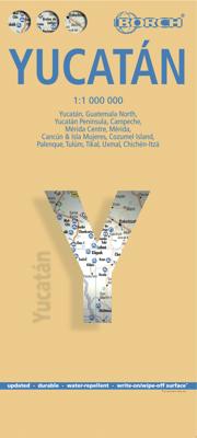
Mooie geplasticieerde kaart van Yucatan. Deze kaart biedt een goed overzicht van dit deel van Mexico met detailkaarten.   Our soft-laminated map of Yucatan includes: Yucatán 1:1 000 000, Guatemala  North 1:1 000 000, Yucatán Peninsula 1:2 500 000, Campeche 1:10 000, Mérida Centre 1:10 000, Mérida 1:100 000, Cancún & Isla Mujeres 1:100 000, Palenqu...

Verkopers met dit product

Verkoper
Bezorging
Prijs
DeZwerver.nl logo
DeZwerver.nl
2,95
11,50

Anderen bekeken ook

Wegenkaart - landkaart 3105 Adventure Map Northern Yucatan Peninsula - Yucatan schiereiland noord | National Geographic
Wegenkaart van Yucatan schiereiland noord met vermelding van veel bezienswaardigheden, nationale parken en attrakties. Watervast en scheurvast. Juist door deze vermeldingen onderscheidt de kaart zich van andere wegenkaarten. The Northern Yucatan Peninsula and Maya Sites map includes: Detailed city inset maps of Cancún and Mérida with locations of attractions and key infrastructure Maya site locations with detailed Maya site inset maps and information for Chichén Itzá, Ek’ Balam, Tulum, El Rey, Uxmal, Cobá, and San Gervasio Detailed descriptions, photographs, and site maps of important Maya buildings and history Popular Yucatán resort towns Isla Mujeres, Cancun, Playa del Carmen, Akumal, Cozumel, Puerto Aventuras, and Tulum Popular adventure travel recreation points of interest Detailed road network UNESCO World Heritage sites
17,50
Wegenkaart - landkaart Belize | Borch
Mooie, geplastificeerde kaart van Belize. Deze kaart biedt een goed overzicht van het land met detailkaarten.   Our soft-laminated folded map of Belize in the 5th edition shows: Belize 1:500 000, Belize City 1:13 000, San Ignacio & Santa Elena 1:25 000, Yucatan Peninsula 1: 2 750 000, Ambergris Caye & Caye Caulker 1:250 000, the Maya sites Altun Ha 1:3 000, Cahal Pech 1:2 500, Caracol 1:7 000, Cerros 1:4 000, El Pilar 1:8 000, Lamanai 1:9 000, Lubaantun 1:5 000, Nim Li Punit 1: 7 000, Xunantunich 1:7 000 and Belize administrative. Borch Maps are easy to fold, durable and water-repellent with a wipeable surface. Borch Maps show hotels, museums, monuments, markets, public transport, top sights and points of interest, useful statistics, conversion charts for temperatures, weights and measurements, climate charts showing temperatures, sunshine hours, precipitation and humidity, overview maps, and much more...   Known as British Honduras until about 1973, Belize is today no longer a Bri…
11,50
Reisgids Cancun, Cozumel and the Yucatan - Mexico | Lonely Planet
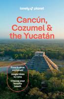
De perfecte reisgids voor zowel de georganiseerde als de zelfstandige reiziger. Naast een algemene inleiding van het land / streek vol met praktische informatie over hoe je er het beste kunt reizen: slapen, eten, vervoer, excursies ... alles kun je er in vinden. Engelstalig. Lonely Planet. Few Mexican destinations can dazzle you with ancient Maya ruins, azure Caribbean and Gulf of Mexico waters and colonial cities all in one fell swoop. Actually, there’s only one – the Yucatán. Lonely Planet is your passport to Cancun, Cozumel & the Yucatan, with amazing travel experiences and the best planning advice.   Swim in the caverns at Cenotes de Cuzamá, savor the flavors of Yucatecan cuisine, or top off a visit to Tulum Ruins with a dip in the azure waters below; all with your trusted travel com-panion. Get to the heart of Cancun, Cozumel & the Yucatan and begin your journey now!   Inside Lonely Planet’s Cancun, Cozumel & the Yucatan Travel Guide:   Colour maps and images throughout H…
22,50
Wegenkaart - landkaart Brazilië - Brazil | Borch
Mooie geplasticieerde kaart van het Brazilië. Deze kaart biedt een goed overzicht van het land met detailkaarten. Our soft-laminated map of Brazil in the 5th edition includes: Brazil 1:4 000 000, Fernando de Noronha Island 1:4 000 000, Brazil Amazon 1:8 000 000, Brasíiia 1:60 000, Manaus 1:15 000, Rio de Janeiro Center 1:15 000, Rio de Janeiro 1:175 000, Sao Paulo 1:20 000, Fortaleza 1:15 000, Natal 1:22 000, Recife 1:15 000, Salvador 1:14 000, Curitiba, Florianópolis, Porto Alegre each 1: 15 000, Brazil administrative & time zones; interesting statistics: conversion chart for temperatures, weights and measures; climate chart with temperatures, sunshine hours, precipitation and humidity; hotels, museums, markets and much more.   The Federative Republic of Brazil is the fifth largest country in the world, the largest and most populous country and largest economy in South America and the seventh largest economy in the world. Bordered by the Atlantic Ocean to the east, the remaining bord…
11,50
Wegenkaart - landkaart Dominicaanse Republiek | Borch
Mooie geplasticieerde kaart van de Dominicaanse Republiek. Deze kaart biedt een goed overzicht van het land met detailkaarten.   Our soft-laminated map of the Dominican Republic includes: Dominican Republic 1:600 000, Puerto Plata & Region 1:250 000, Puerto Plata 1:20 000, Santiago 1:17 500, Santo Domingo & Region 1:250 000, Santo Domingo 1:22 500, Colonial Santo Domingo 1:10 000, Punta Cana & Region 1:185 000, Dominican Republic administrative / time zones; interesting statistics: conversion chart for temperatures, weights and measures; climate chart with temperatures, sunshine hours, precipitation and humidity; table of distances; hotels, museums, markets, public transport and much more.   Christopher Columbus discovered the island of Hispaniola on December 5th 1492 and founded "La Navidad", said to be the first European settlement in the New World. He became viceroy of Hispaniola and settled in the place where today's capital, Santo Domingo, is situated. During the following centur…
11,50
Wegenkaart - landkaart Nieuw - Zeeland | Borch
Mooie geplasticieerde kaart van Nieuw - Zeeland. Deze kaart biedt een goed overzicht van het land met detailkaarten.   Our soft-laminated map of New Zealand includes: North Island 1:1 300 000, South Island 1:1 300 000, Auckland 1:20 000, Christchurch 1:20 000, Dunedin 1:15 000,  Nelson 1:15 000, Rotorua 1:15 000, Queenstown 1:15 000, Wellington 1:20 000, New Zealand administrative & time zones, interesting statistics, conversion chart for temperatures, weights and measures, climate chart with temperatures, sunshine hours, precipitation and humidity and much more.   "4 million inhabitants and 60 million sheep" does not do justice to the charm and natural diversity of this beautiful country. Lush meadows and fertile soils are only some of the natural resources with which New Zealand is endowed, the real natural wealth of this island state in the middle of the South Pacific lies in its incredibly diverse landscape: snow-covered mountains, dense forests, lush green lowlands, crystal-clear…
11,50
Wegenkaart - landkaart Virgin Islands - Maagden eilanden | Borch
The soft-laminated map of the Virgin Islands includes: US Virgin Islands 1:80 000, St. Croix 1:80 000, Charlotte Amalie 1:15 000, Charlotte Amalie Historic District 1:7 500, Cruz Bay 1:15 000, Christiansted, Frederiksted 1:15 000, British Virgin Islands 1:80 000, Anegada 1:80 000, Road Town, The Valley (Spanish Town) 1:15 000, Lesser Antilles 1:7 000 000, Virgin Islands administrative / time zones; interesting statistics British / US Virgin Islands: conversion chart for temperatures, weights and measures; climate chart with temperatures, sunshine hours, precipitation and humidity; hotels, museums, markets and much more.   Virgin Islands is the name of two groups of small islands east of Puerto Rico which form the Virgin Islands archipelago. They lie between the Caribbean Sea and the Atlantic Ocean. One of the groups which consists of St. Croix, St. John and St. Thomas islands, together with many nearby islets, is called the U.S. Virgin Islands. The other group including Anegada, Jost …
11,50
Reisgids Yucatán Peninsula: With Cancún, Cozumel & Tulum | Moon Travel Guides
Experience stunning Maya ruins, dreamy beaches, and epic outdoor thrills, from cenote-diving to kiteboarding, with Moon Yucatán Peninsula. Inside you'll find: Flexible itineraries including a ten-day eco-adventure and a two-week road trip across the whole peninsula Strategic advice for road-trippers, foodies, wellness seekers, outdoor adventurers, honeymooners, families, and more The top outdoor activities: Kayak through lush mangrove forests, or sign up for a mountain bike tour through the jungle for a peek at hidden ruins, remote beaches, and dazzling marine life. Spend a day relaxing on the beach, dive into crystal-clear cenotes, or try standup paddle-boarding Unique, local experiences: Peruse the markets, museums, and churches of Mérida or Tulum, or take a short walk from the shore to visit jaw-dropping Maya ruins. Find the best spots to fill up on authentic salbute and panucho, and stay up late for live music, cocktails, and fire dancers on the beach Honest advice from Yuc…
27,95
Wegenkaart - landkaart 6 Zuidoost USA - Southeast USA | Borch
Mooie geplasticieerde kaart van het Zuidoosten van de USA. Deze kaart biedt een goed overzicht van het land met detailkaarten. Our soft-laminated map of the southeast of the USA - USA 6 includes: The South & Florida 1:3 000 000, Central Florida 1:1 350 000, Atlanta & Region 1:1 000 000, Atlanta Downtown 1:15 000, Miami & Florida Keys 1:1 000 000, Miami Downtown 1:20 000, South Miami Beach 1:20 000, New Orleans & Region 1:1 000 000, New Orleans French Quarter 1:13 000, USA administrative & time zones, interesting statistics, conversion chart for temperatures, weights and measures, climate chart with temperatures, sunshine hours, precipitation and humidity and much more.   From Washington D.C. along the Atlantic coast to Florida and west to Louisiana and Arkansas, this is original plantation country, which has long since "gone with the wind". Yet traces of the charming Old South can still be found in the historic cities of Alexandria, Williamsburg, Charleston, and Savannah, and along th…
11,50
Wegenkaart - landkaart 1 Noordwest USA - Northwest USA | Borch
Mooie geplasticieerde kaart van het Noordwesten van de USA. Deze kaart biedt een goed overzicht van het land met detailkaarten. Our soft-laminated map of USA Northwest - USA 1 includes: Pacific Northwest 1:3 000 000, San Francisco 1:15 000, San Francisco Bay Area 1:400 000, San Francisco & Region 1:1 000 000, Seattle 1:13 000 and Greater Seattle 1:350 000, Seattle & Region 1:1 000 000,  Portland 1:20 000, Denver & Region 1:1 000 000, Salt Lake City & Region 1:1 000 000, Yellowstone National Park 1:1 000 000, USA administrative & time zones, interesting statistics, conversion chart for temperatures, weights and measures, climate chart with temperatures, sunshine hours, precipitation and humidity and much more.   The beautiful landscape of Oregon and Washington includes rugged coastline, mountain ranges, lakes, rivers, rich farmland and burgeoning wine country, as well as the magnificent cities of Portland and Seattle with their bustling cosmopolitan flair. While Seattle is renowned as …
11,50

Klanten-reviews van Wegenkaart - landkaart Yucatan | Borch

Er zijn nog geen beoordelingen voor dit productBen jij de eerste die een review plaatst?

Meer over Wegenkaart - landkaart Yucatan | Borch

Productomschrijving

Mooie geplasticieerde kaart van Yucatan. Deze kaart biedt een goed overzicht van dit deel van Mexico met detailkaarten.   Our soft-laminated map of Yucatan includes: Yucatán 1:1 000 000, Guatemala  North 1:1 000 000, Yucatán Peninsula 1:2 500 000, Campeche 1:10 000, Mérida Centre 1:10 000, Mérida 1:100 000, Cancún & Isla Mujeres 1:100 000, Palenque 1:5 000, Tulúm 1:3 750, Tikal 1:6 200, Uxmal 1:5 500, Chichén-Itzá 1:6 500, Cozumel Island 1:250 000, Mexico administrative & time zones, interesting statistics, conversion chart for temperatures, weights and measures, climate chart with temperatures, sunshine hours, precipitation and humidity, and shows top sights, temples and much more.   The peninsula of Yucatan is located on the easternmost tip of Mexico and faces toward Cuba. After the city states of Chichén Itzá, Uxmal and Labná were founded in ca. 600 B.C. the Mayan civilization, whose mysterious grandeur manifests itself best in the stone pyramid of El Castillo in Chichén Itzá, flourished for the very last time; every year when day and night are of the same length, light and shadow in the northern entrance interact and awaken the illusion of a wriggling snake. The cool, white sand of the beaches of Cancun is a refreshing invitation to this resort which was built in the 70's and is a paradise for all relaxation seekers. Ever since Jacques Cousteau's fascinating diving documentaries, the Palancar Reef off the coast of Cozumel attracts divers from all over the world.    Kartenformat (offen): 880 x 494 mm.  

Verken gerelateerde categorieën

Webshop.nl maakt gebruik van cookies. Ga je verder op onze website, ga dan akkoord met het plaatsen van cookies en de verwerking van deze data door ons en vermelde partners.