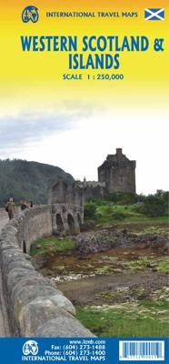
Wegenkaart - landkaart Western Scotland & Islands - Schotland West & Eilanden | ITMB

0

Verkopers met dit product

Verkoper
Bezorging
Prijs
DeZwerver.nl logo
DeZwerver.nl
2,95
14,50

Anderen bekeken ook

Wegenkaart - landkaart Scotland - Schotland | ITMB
Anyone who has been in this business for a few years remembers Ordnance Survey and their brilliantly detailed artwork. They should also remember that OS guarded this artwork religiously. That all changed when the then head of government in the UK, one soon-forgotten Gordon Brown, decreed that commercial OS artwork had to be discontinued and artwork had to be made more freely available to users. I expected an outpouring of new artwork by private UK firms. It did not happen; in fact, the range of travel maps decreased dramatically. However, OS artwork is still an excellent source of mapping artwork. This is a wonderful double-sided, detailed map of Scotland. It is both extremely detailed and accurate. We have added symbols for parks, historic sites, battlefields, country hotels, and anything else that we think would interest visitors. In order to portray Scotland to best scale advantage, the only inset included with this map are those of outlying islands, such as the Shetlands. ITMB als…
13,95
Wegenkaart - landkaart Galapagos Islands - Galapagos eilanden | ITMB
Een degelijke kaart met aanduidingen van o.a. nationale parken, vliegveld, benzinepomp, dirt-roads en kleine plattegrond van hoofdstad. Als overzichtskaart goed te gebruiken.  It seems hard to believe that it has been six months since we enjoying snorkeling in the Galapagos, but time flies when you're having fun. We also used our time there productively and this is reflected in our new and whe hope improved edition of one of our most popular titles. This edition has three changes to note. The first is that we have updated the road network, basic though it is; the second is that most of the sketches that have graced the map for six editions have been replaced by photos, and the third is that the cover photo is one of our own pictures for the first time, thanks to Lan and a supremely proud frigate bird. Going to the Galapagos brought to our attention the importance of 'how' to do so. There are only two places on earth for visitors to leave from in order to land in the Galapagos - Quito …
13,95
Wegenkaart - landkaart Cayman Islands (Kaaiman Eilanden) & Jamaica | ITMB
Een degelijke kaart met aanduidingen van o.a. nationale parken, vliegveld, benzinepomp, dirt-roads en kleine plattegrond van verschillende steden. Als overzichtskaart goed te gebruiken. De kaart is aan twee zijden bedrukt, de ene zijde omvat de Cayman Islands (schaal 1:37.500 en 1:70.000). Op de andere zijde staat de kaart van Jamaica (schaal 1:250.000) en plattegronden van onder andere Kingston. We are pleased to announce the latest new Caribbean map to our growing series. The Caymans, for there are three major islands and numerous little shoals, remains a British colony, like the British Virgin Islands, the Turks and Caicos, and Bermuda. Tourism is the number one industry of the Cayman Islands, with dozens of hotels dotting the beachfronts, especially north of George Town. There are numerous dive sites for viewing tropical fish and we have shown about a hundred on the map, as well as every side street and gas station. One interesting place to visit is Hell, which is a frozen lava er…
13,95
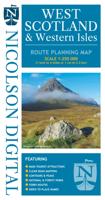
Wegenkaart - landkaart West Scotland & Western Isles | Nicolson
Based on the Ordnance Survey 1/250000 Road mapping.    Road Map 2 covers West Scotland & the Western Isles. Please scroll through the images to see the area of coverage (in white). This sheet covers from Dumbarton in the south west, due north to Loch Eribol (east of Durness) all the way west to Lewis, Harris, the Uists, Benbecula & Barra. It also includes an inset of Islay & Jura.   Features:   • Clear road mapping & ferry routes • Index to place names (which the Ordnance Survey version doesn't have) • National & forest parks • Contours and peak heights   ISBN 9781912046591   Cover size 133mm wide x 240mm tall   Sheet size (when unfolded) 952 mm wide x 1250 mm tall
12,95
Spoorwegenkaart - Wegenkaart - landkaart Scotland Far North & Islands Railway & Road | ITMB
Great Britain, by its shape, is difficult to map. The population is dense, the road network intense, and the coastline convoluted. A map of the British Isles shows only the major features. Sectional maps of just England, or Just Wales, make little sense, due to the geographic shape of the island kingdom. Scotland also needs more than one map to show its treasures in sufficient detail. ITMB previously issued Scotland Central and South, and now extends its coverage at 1:300,000 to the sparsely-populated highlands and the isolated Western, Orkney, and Shetland island archipelagos that are usually shrunk to insignificance on most maps, as insets. This double-sided map covers the area from Loch Lochy south of Invergarry to John O’Groats in the north, and from the Western islands of Uist and Lewis to the Moray Firth and Craigellachie in the east. The second side has to duplicate part of the first side in order to extend the artwork further eastward to include Aberdeen and northward to inclu…
13,95
Wegenkaart - landkaart Cape Verde - Kaapverdische Eilanden en West Afrika | ITMB
Op de voorzijde een gedetailleerde kaart van de Kaapverdische eilanden, alle eilanden op een schaal van ongeveer 1: 200.000, deze varieert enigzins per eiland. De achterkant geeft een overzichtskaart van West Afrika op schaal 1:3.400.000 van Mauretanie in het westen tot en met Benin in het oosten. This map of Cape Verde features the usual care and attention to detail that ITMB put into all their maps. With over 300 maps of international travel destinations now available, ITMB are rightly recognized as one of the Worlds leading travel publishers.
13,95
Wegenkaart - landkaart Cuba West | ITMB
Een degelijke wegenkaart met aanduidingen van o.a. nationale parken, vliegveld. Als overzichtskaart goed te gebruiken. his is a brand new title for ITMB and reflects the growing interest in travel to Cuba resulting from improved relations with the USA. Licenses to fly into the country from a dozen cities have already been approved; 60 more are awaiting approval. All are for flights into Havana and Varadero airports – in other words, the western half of the country. ITMB already has an exceptionally good map of the entire country. We also have a separate map of Havana. This map expands the scale and opens the information for the western half of the island nation as a double-sided map, with the portion west of Havana (La Habana) to Pinar del Rio province in the far west and south to the Isla de la Juventud (better known, but mis-named, as the Bay of Pigs Invasion Site). This side also has an excellent map of the Varadero beach resort area as an inset, and a map of greater Havana. The ot…
13,95
Wegenkaart - landkaart Western Canada | ITMB
Een degelijke kaart met aanduidingen van o.a. nationale parken, vliegveld, benzinepomp, dirt-roads. Als overzichtskaart goed te gebruiken. This is actually our second attempt at mapping the western portion of Canada; the first covered everything from northwestern Ontario to the Pacific Ocean and, while it was an excellent map, the scale that such a huge area covered necessitated severe problems. In this version, all of British Columbia, Alberta, and the Yukon have been mapped from fresh digital data and presented at 1:1.4T scale. This would have been impossible when we prepared the first map. The Northwest Territories portion had to be compressed in two ways; first, the scale is 1:2M; second, only the portion with roads is shown. This is still an extremely large area. One has to consider the actual size of Canada when designing a map. Most countries in Europe would fit into this area, which only covers 20% of Canada. The Fort McMurray forest fire of a year ago covered an area larger t…
13,95

Klanten-reviews van Wegenkaart - landkaart Western Scotland & Islands - Schotland West & Eilanden | ITMB

Er zijn nog geen beoordelingen voor dit productBen jij de eerste die een review plaatst?

Meer over Wegenkaart - landkaart Western Scotland & Islands - Schotland West & Eilanden | ITMB

Verken gerelateerde categorieën

Webshop.nl maakt gebruik van cookies. Ga je verder op onze website, ga dan akkoord met het plaatsen van cookies en de verwerking van deze data door ons en vermelde partners.