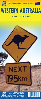
Wegenkaart - landkaart Western Australia | ITMB

0
The State of Western Australia occupies the western third of the continental country of Australia. The main city is Perth, in the southwest portion, and this is the part of the State with the best land and the most people. Much of the interior is arid desert-like grassland with shallow lakes that often dry out. The road network in the south is gen...

Verkopers met dit product

Verkoper
Bezorging
Prijs
DeZwerver.nl logo
DeZwerver.nl
2,95
13,95

Anderen bekeken ook

Wegenkaart - landkaart Western Australia | ITMB
The State of Western Australia occupies the western third of the continental country of Australia. The main city is Perth, in the southwest portion, and this is the part of the State with the best land and the most people. Much of the interior is arid desert-like grassland with shallow lakes that often dry out. The road network in the south is generally paved highways and secondary roads, with one road and one rail line heading east to SZ and the rest of the country. Roads in the north tend to be dirt, with the exception of the highway going towards Darwin in NT. There are no roads through the Great Sandy Desert, but the Canning Stock Route crosses the eastern fringe, going north-south. One needs an expensive permit to drive this hazardous track. Most of the attractions of the State are to be found fairly close to the coastline. Most of the larger urban areas tend to have been named after British places, such as Albany, Exmouth, and Port Hedland, but many names have been adopted from …
13,95
Wegenkaart - landkaart Australia South & Northern Territory | ITMB
Australia was one of the first countries ITMB published, back in the 1980s, albeit a licensed version. Our own original artwork was completed in the mid-1990s, but until recently, we have not focused on sectional maps of the country based on individual states. In 2019, we published Brisbane and Queensland, and Sydney and New South Wales. Now, we are issuing the ‘middle’ states of South Australia and Northern Territory to provide better coverage of these important parts of Australia at a better scale than a country map could provide. South Australia can be thought of as having two parts; the fertile farming economy surrounding Adelaide in the south and the much more arid northern portion. The road network in the south tends to be well developed, with paved roads going more or less east-west to NSW and WA. Northerly roads tend to be gravel or dirt, such as the Birdville Track, and the north-westerly roads tend to pass through land ceded to aboriginals and require permits. Northern Terri…
13,95
Wegenkaart - landkaart Western Australia - West Australië state handy map | Hema Maps
Duidelijke, handzame kaart van Western Australia. Zeer goed leesbaar, met naast de topografische details veel symbolen waarmee allerhande toeristische zaken worden aangeduid als campsites, nationale parken, attracties, wandelmogelijkheden etc. Great for using in the car, Hema's Western Australia Handy Map clearly shows highways, minor and secondary roads, national and state routes and fully-indexed cities, towns and localities. Detailed road distances are also shown.    The map splits the state in two, with half on one side of the map and half on the other. This results in a much smaller piece of paper which is far easier to manage in your car.   The map features:   Camping Areas Rest Areas 24 Hour Fuel Outback Fuel Caravan Parks National Parks Fully Indexed Points of Interest Distance Grid   All of the state handy maps are double-sided and come in an easy-to-fold format.
14,50
Wegenkaart - landkaart South West Western Australia | Hema Maps
Hema's South West Western Australia Map features unequalled road and track information for this picturesque corner in Australia's largest state. A regional map for discovering South West Western Australia (WA). On the reverse side of the map are detailed inset maps of Nambung National Park, Avon Valley National Park, Lane Poole Reservation, the South West Corner, Stirling Range National Park, D, Entrecastreaux National Park and Albany Coast. Also included is tourist information for the Coral Coast, Perth, Avon Valley, the Great Southern Region, Peel, Blackwood River Valley, the Southern Forests, the Margaret River region and the Southern Coast.   The southwestern portion of Western Australia has a spectacular coastline, great surfing beaches, flowing rivers, tall forests, wineries, farms, quaint towns, bustling cities and numerous other attractions. While forest communities remain quiet, the coastal area from Bunbury to Margaret River and Augusta bursts at the seams on long weekend…
17,50
Wegenkaart - landkaart Sydney & Australia Southeast | ITMB
Plattegrond van Sydney, schaal 1:7.500, met aan de andere zijde een overzichtskaart van zuidoost Australië, schaal 1:2.000.000   Sydney is probably the best-known city in Australia and this map benefits from trips we have taken to ground-truth the information. It is attractive, pertinent, and easy to use as a map. As with many of our international city maps, we have re-worked this title into a double-sided map with the souteastern half of Australia on the reverse side. As with many of ITMB's map this edition is freshly printed on waterproof paper, more for its durability in the case of Australia than humidity.   Legend Includes: Roads by classification, International Airports, Airports, Ferry lines, Boat-Ferry docks, Railways, Railway stations, Bus terminals, Bicycle Trails, Foreshore trail systems, Pedestrian streets, Staircases, Small Nature reservesm Zoos, Fishing, Caves, Camps sites, Accomodation, Tourism information centers, Museums, Live Theatres, Cinemas, Post offices, Police S…
13,95
Wegenkaart - landkaart Western Africa - Afrika westen | ITMB
Een degelijke kaart met aanduidingen van o.a. nationale parken, vliegveld, benzinepomp, dirt-roads en kleine plattegrond van hoofdstad. Als overzichtskaart goed te gebruiken.   This map, at 1:3,400,000 scale is ideal for travellers crossing Africa from Europe to central and southern parts of Africa by land. It covers from the southern tip of Spain through Morocco and western Algeria on one side to Mauritania and the Bight of Benin states of West Africa, as far east as western Nigeria. As a regional map, the detail provided is unsurpassed by any other map of this part of the world. It is the most detailed map to date of the West African states of Guinea, Guinea-Bissau, Liberia, and Sierra Leone. As is always the case with Africa, road information is presented in practical terms of road quality, not road designation. This is a practical map for travellers, so information has been provided with the greatest degree of accuracy possible, given that reliable information can be extremely dif…
13,95
Wegenkaart - landkaart Western Australia state map | Hema Maps
Goede, overzichtelijke, leesbare kaart van de hele provincie. Nationale Parken zijn er goed op te vinden en de afstanden worden weergegeven. Op de achterkant nog deelkaartjes van enkele steden en NP s. A state map of Western Australia at a scale of 1:2,500,000. Marked on the map are national parks, points of interest, 24-hour fuel as well as camping and rest areas.    On the reverse side are national park maps of Leeuwin-Naturaliste, Cape Range, Nambung, Francois Peron, Purnululu, Walpole-Nornalup and Karijini.    Also included are CBD and throughroad maps of Perth. There is a full index included, as well as all national park information.   Points of interest 24-hour fuel National parks Camping areas Rest areas Fully indexed
17,50
Wegenkaart - landkaart Planning Map Western Australia | Lonely Planet
Lonely Planet: The world's number one travel guide publisher* Durable and waterproof, with a handy slipcase and an easy-fold format, Lonely Planet's Western Australia Planning Map helps you explore with ease. Get more from your map and your trip with images and information about top attractions, itinerary suggestions, a transport guide, planning information, themed lists and practical travel tips. With this easy-to-use, full-colour map in your back pocket, you can truly get to the heart of Western Australia - so begin your journey now! Durable and waterproof Easy-fold format and convenient size Handy slipcase Full colour and easy to use Before-you-go infoBeautiful imageryTailored itinerariesCan't-miss regional highlightsDetailed town indexTransport plannerThemed lists Covers: Western Australia Looking for more extensive coverage? Check out Lonely Planet's West Coast Australia, our most comprehensive guidebook to the region, covering the top sights and most authentic offbeat experience…
10,95
Wegenkaart - landkaart Explorer Map Mid West Western Australia - West Australië | Hema Maps
Mapping of Mid West Western Australia that has camping areas, national parks, fuel supplies and facility symbols marked on the map. On the reverse is region-specific touring information for Wildflower country, Goldfields, Batavia Coast, Geraldton to Kalbarri, Gascoyne and the Outback Coast, Carnarvon and the Blowhole Coast as well as the Great Eastern Highway, with detailed inset maps for Cape Range National Park, Kalbarri National Park, Francois Peron National Park, Kennedy Range National Park and Mount Augustus National Park also included.    Also featured are the Top 10 4WD Tracks, which include the Holland Track, Cave Hill Circuit, Jaurdi Station, Mount Elvire, Mundaring Powerlines Track, Stockyard Gully & Leseur National Park, Greenough River, Steep Point, Peron Peninsula and Kennedy Range National Park. Each track has a grading, map reference, permits and fees, distances, contact details, things to do and warnings.   Top 10 4WD Tracks Inset maps National parks Camping areas Fuel…
17,50
Wegenkaart - landkaart Western Canada | ITMB
Een degelijke kaart met aanduidingen van o.a. nationale parken, vliegveld, benzinepomp, dirt-roads. Als overzichtskaart goed te gebruiken. This is actually our second attempt at mapping the western portion of Canada; the first covered everything from northwestern Ontario to the Pacific Ocean and, while it was an excellent map, the scale that such a huge area covered necessitated severe problems. In this version, all of British Columbia, Alberta, and the Yukon have been mapped from fresh digital data and presented at 1:1.4T scale. This would have been impossible when we prepared the first map. The Northwest Territories portion had to be compressed in two ways; first, the scale is 1:2M; second, only the portion with roads is shown. This is still an extremely large area. One has to consider the actual size of Canada when designing a map. Most countries in Europe would fit into this area, which only covers 20% of Canada. The Fort McMurray forest fire of a year ago covered an area larger t…
13,95

Klanten-reviews van Wegenkaart - landkaart Western Australia | ITMB

Er zijn nog geen beoordelingen voor dit productBen jij de eerste die een review plaatst?

Meer over Wegenkaart - landkaart Western Australia | ITMB

Productomschrijving

The State of Western Australia occupies the western third of the continental country of Australia. The main city is Perth, in the southwest portion, and this is the part of the State with the best land and the most people. Much of the interior is arid desert-like grassland with shallow lakes that often dry out. The road network in the south is generally paved highways and secondary roads, with one road and one rail line heading east to SZ and the rest of the country. Roads in the north tend to be dirt, with the exception of the highway going towards Darwin in NT. There are no roads through the Great Sandy Desert, but the Canning Stock Route crosses the eastern fringe, going north-south. One needs an expensive permit to drive this hazardous track. Most of the attractions of the State are to be found fairly close to the coastline. Most of the larger urban areas tend to have been named after British places, such as Albany, Exmouth, and Port Hedland, but many names have been adopted from aboriginal sources, such as Kalgoorlie. This is a state of vast distances and varied terrain. It is, however, the friendliest state and well worth spending more time in than most visitors designate. ITMB can provide a separate map of Perth by another publisher.   Legend Includes: Roads by classification, Rivers and Lakes, National Park, Airports, Points of Interests, Mining, Highways, Main Roads, Zoos, Fishing, , and much more...

Productinformatie

    Verken gerelateerde categorieën

    Webshop.nl maakt gebruik van cookies. Ga je verder op onze website, ga dan akkoord met het plaatsen van cookies en de verwerking van deze data door ons en vermelde partners.