webshop.nl
Categorieën
  Sluiten

Meer ITMB
Meer ITMB in Literatuur boeken

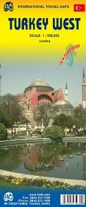
Wegenkaart - landkaart West Turkije - Turkey west | ITMB

Turkey is a big country. Most visitors concentrate on Istanbul and the Izmir Coast, which is a shame as there are so many other interesting parts of the country to visit. This map covers the western third of the country as a double-sided map, covering from the Greek/Bulgarian border south to the Mediterranean and east to Eregli and Antalya in the e...
13,95

Webshops met dit product

Webshop
Bezorging
Prijs

Anderen bekeken ook

Wegenkaart - landkaart West Turkije - Turkey west | ITMB
Turkey is a big country. Most visitors concentrate on Istanbul and the Izmir Coast, which is a shame as there are so many other interesting parts of the country to visit. This map covers the western third of the country as a double-sided map, covering from the Greek/Bulgarian border south to the Mediterranean and east to Eregli and Antalya in the east. Naturally, at a better scale, roads and road conditions can be shown to better advantage, and the ferry routes from Istanbul make more sense. The topography is now showing as contouring more easily, and we have been able to add the next layer of villages. The scale is still not appropriate for showing minor roads and tracks, but we have included as many as we feel we can. The map is printed on durable plastic paper, so will stand up to the rigours of travel quite well. A basin inset map of Istanbul has been included as well.   Legend Includes: Road by classification, Motorways, Multilane Hwy, Main Roads, Rail Ways, Ferry Routes, National…
13,95
Wegenkaart - landkaart Turkije - Turkey | ITMB
Turkey is a fascinating country; so much potential, and seemingly unable to focus on progress as opposed to ideology. Touristically, the country is quite safe, but internal politics are as divided here as in Egypt (and seemingly every Muslim country) between secularists (if it is proper to call them that) who want a 'normal' country with a division between secular and religious affairs and those wanting a more traditional religious society where religious values shape the society. Our first edition sold out in a little more than a year, which is pretty amazing in itself, and we have made major improvements to this edition to maintain its popularity. The biggest change is that we have more strongly emphasized the major road network, as most visitors stay on the well-travelled routes around the country, rather than taking back roads to small villages. The second change has been to increase the font size for major urban areas, to make them easier to read. Turkey is a very large country ge…
13,95
Wegenkaart - landkaart 3018 Adventure Map Turkey Turkije | National Ge
Wegenkaart van Turkije met vermelding van veel bezienswaardigheden, nationale parken en attrakties. Watervast en scheurvast. National Geographic's Turkey Adventure Map is designed to meet the unique needs of adventure travelers with its durability and accurate information. This folded map provides global travelers with the perfect combination of detail and perspective, highlighting hundreds of points of interest and the diverse and unique destinations within the country.   The front side of the Turkey map details the eastern region of the country, from its borders with Syria and Iraq to the south, and with Iran and Armenia to the East, extending to the Black Sea and Georgia to the north. The regions featured on this side are Southeast Anatolia and East Anatolia. The reverse side of the map details Turkey’s western portion of the country, from its border with Greece to the west, to the Mediterranean Sea to the south, extending to the Black Sea to the north. This side covers the Black Se…
17,50
Wegenkaart - landkaart Cuba West | ITMB
Een degelijke wegenkaart met aanduidingen van o.a. nationale parken, vliegveld. Als overzichtskaart goed te gebruiken. his is a brand new title for ITMB and reflects the growing interest in travel to Cuba resulting from improved relations with the USA. Licenses to fly into the country from a dozen cities have already been approved; 60 more are awaiting approval. All are for flights into Havana and Varadero airports – in other words, the western half of the country. ITMB already has an exceptionally good map of the entire country. We also have a separate map of Havana. This map expands the scale and opens the information for the western half of the island nation as a double-sided map, with the portion west of Havana (La Habana) to Pinar del Rio province in the far west and south to the Isla de la Juventud (better known, but mis-named, as the Bay of Pigs Invasion Site). This side also has an excellent map of the Varadero beach resort area as an inset, and a map of greater Havana. The oth…
13,95
Wegenkaart - landkaart 3018 Adventure Map Turkey Turkije | National Ge
Wegenkaart van Turkije met vermelding van veel bezienswaardigheden, nationale parken en attrakties. Watervast en scheurvast. National Geographic's Turkey Adventure Map is designed to meet the unique needs of adventure travelers with its durability and accurate information. This folded map provides global travelers with the perfect combination of detail and perspective, highlighting hundreds of points of interest and the diverse and unique destinations within the country.   The front side of the Turkey map details the eastern region of the country, from its borders with Syria and Iraq to the south, and with Iran and Armenia to the East, extending to the Black Sea and Georgia to the north. The regions featured on this side are Southeast Anatolia and East Anatolia. The reverse side of the map details Turkey’s western portion of the country, from its border with Greece to the west, to the Mediterranean Sea to the south, extending to the Black Sea to the north. This side covers the Black Se…
17,50
Wegenkaart - landkaart Bangladesh & India oost | ITMB
Een degelijke kaart met aanduidingen van o.a. nationale parken, vliegveld, benzinepomp, dirt-roads en kleine plattegrond van hoofdstad. Als overzichtskaart goed te gebruiken. I like Bangladesh. Sure, the government is too corrupt and the country gets schmucked every time there's a hurricane, but the people are friendly and hard-working and gradually improving their country. As a travel destination, Bangladesh has to be considered as part of a trip to India for most people, so in addition to updating and modernizing our artwork, we have added a map of the easternmost portion of India, showing access routes and sites of interest in both countries. One of the great treats of Bangladesh is to take a ferry from Dhaka to Khulna, a two-day trip. The map also includes an inset of Dhaka, the capital, although we had to show only a few of the thousands of mosques in the city.    Legend Includes: Roads by classification, Airports, Ferrie routes, Bus stations, Car parks, State boudaries, border cr…
13,95
Wegenkaart - landkaart Tibet | ITMB
Een degelijke kaart met aanduidingen van o.a. nationale parken, vliegveld, benzinepomp, dirt-roads en kleine plattegrond van hoofdstad. Als overzichtskaart goed te gebruiken. Tibet is fascinating and controversial. It has been occupied by China since Chairman Mao send hordes of Chinese troops into the country and annexed it to China, expanding its borders somewhat by over-running parts of northern India a bit later. We do our best to portray the country as it is, without getting overly involved in the political ramifications, which are pretty severe. At the moment, the Chinese authorities seem to be clamping down on tourism, due to simmering unrest. However, the country, or self-governing province of China is a beautiful place and deserves a good map. It is extremely difficult to get updating information on Tibet; we've done our best, but this is very much a work in progress. Printed on ITM plastic for durability, with a new ISBN and cover picture. Legend Includes: Roads by classificat…
13,95

Klanten-reviews van Wegenkaart - landkaart West Turkije - Turkey west | ITMB

Er zijn nog geen beoordelingen voor dit productBen jij de eerste die een review plaatst?

Meer over Wegenkaart - landkaart West Turkije - Turkey west | ITMB

Productomschrijving

Turkey is a big country. Most visitors concentrate on Istanbul and the Izmir Coast, which is a shame as there are so many other interesting parts of the country to visit. This map covers the western third of the country as a double-sided map, covering from the Greek/Bulgarian border south to the Mediterranean and east to Eregli and Antalya in the east. Naturally, at a better scale, roads and road conditions can be shown to better advantage, and the ferry routes from Istanbul make more sense. The topography is now showing as contouring more easily, and we have been able to add the next layer of villages. The scale is still not appropriate for showing minor roads and tracks, but we have included as many as we feel we can. The map is printed on durable plastic paper, so will stand up to the rigours of travel quite well. A basin inset map of Istanbul has been included as well.   Legend Includes: Road by classification, Motorways, Multilane Hwy, Main Roads, Rail Ways, Ferry Routes, National parks, Province Border, International Border, Lakes, Monuments, Caves, Ruins, Campsites, Hotels, Motels, Viewpoints, Point of Interests and much more...

Productspecificaties

Artikelnummer(s)
Brand
ITMB

Verken gerelateerde categorieën

Webshop.nl maakt gebruik van cookies. Ga je verder op onze website, ga dan akkoord met het plaatsen van cookies en de verwerking van deze data door ons en vermelde partners.