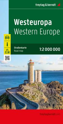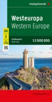
Wegenkaart - landkaart West Europa | Freytag & Berndt

0
Goede overzichtskaart van West Europa: ideaal om een reis te plannen. High quality road maps with place name index. In many countries these are simply the best maps available. Scales vary according to the size of the country. Index is in several languages. Western Europe at 1:2,000,000 from Freytag & Berndt, with coverage extending from the Britis...

Verkopers met dit product

Verkoper
Bezorging
Prijs
DeZwerver.nl logo
DeZwerver.nl
2,95
14,95

Anderen bekeken ook

Wegenkaart - landkaart Balkan - Zuidoost Europa | Freytag & Berndt
A nicely detailed travelers map of Southeast Europe from Prague east to Odessa and south to Italy, Greece and western Turkey, including the Danube, Romania, Bulgaria and the Black Sea from Odessa to Istanbul. At a scale of 1:2,000,000.  Explore the Balkans and South-East Europe with this Freytag & Berndt road map - the best way to prepare your trip, to plan your itinerary, and to travel independently.    This map covers the following countries: Greece, Albania, FYROM, Bulgaria, Kosovo, Serbia, Montenegro, Bosnia Herzegocina, Croatia, Slovenia, Hungary, Romania, Moldova, the Czech & Slovak Republics, Western Turkey, Western Ukraine, Austria, and Southern Italy.   The map includes a localities index and more detailed city maps of Athens, Belgrade, Bratislava, Bucarest, Budapest, Chisinau, Istanbul, Kiev, Ljubljana, Podgorica, Prague, Pristina, Sarajevo, Skopje, Sofija, Tirana, Vienna, and Zagreb.
14,95
Wegenkaart - landkaart Marokko | Freytag & Berndt
Gedetailleerde, tweezijdige landkaart van Marokko, prima geschikt voor planning en rondtrekken over alle eilanden. De berijdbare wegen zijn goed weergeven, zowel de hoofdwegen als provinciale en lokale wegen; wegnummers worden vermeld. Afstanden tussen plaatsen zijn in kilometers op de kaart ingetekend, daarnaast worden ook op belangrijke plekken benzinepompen gemarkeerd. Morocco at 1:800,000 with the Western Sahara at 1:2,000,000 on a large map from Freytag and Berndt with an index booklet attached to the cover providing street plans of central Casablanca, Fès, Marrakesh, Rabat/Salé and Tangier. Relief shading with spot heights, graphics for sandy or rocky deserts, swamps, seasonal streams, etc. show the topography. Road network includes desert tracks and indicates distances on main routes. Railway lines are included and local airports are marked. Places of interest including the country’s UNESCO World Heritage sites are highlighted.
14,95
Wegenkaart - landkaart 618 Sicilie - Sizilien Palermo | Freytag & Berndt
Goede kaart van Sicilie met inzetten van de belangrijkste steden. De kaart is tweezijdig op gedetailleerde schaal. Gevolg is - enig nadeel - een enorme lap van een kaart. Wel prima om op te rijden en te fietsen! Goede wegenkaart van dit deel van Italië. Met register en enkele stadsplattegronden.   De berijdbare wegen zijn goed weergeven, zowel de hoofdwegen als provinciale en lokale wegen; wegnummers worden vermeld. De grotere doorgaande wandelpaden vind je zelfs terug op deze kaart! Afstanden tussen plaatsen zijn in kilometers op de kaart ingetekend, daarnaast worden ook op belangrijke plekken benzinepompen gemarkeerd.   In het kaartbeeld wordt door middel van schaduw het reliëf weergegeven en soms enkele punten in het landschap met de daadwerkelijke hoogte. Provinciegrenzen zijn goed terug te vinden, nationale parken en reservaten ook. Met allerhande symbolen worden toeristische bezienswaardigheden weergegeven als monumenten, historisch belangrijke plekken en uitzichtpunten. In bepa…
14,95
Wegenkaart - landkaart Algarve | Freytag & Berndt
Gedetailleerde wegenkaart met uitgebreide legenda en plaatsnamenregister. De berijdbare wegen zijn goed weergeven, zowel de hoofdwegen als provinciale en lokale wegen; wegnummers worden vermeld. Afstanden tussen plaatsen zijn in kilometers op de kaart ingetekend, daarnaast worden ook op belangrijke plekken benzinepompen gemarkeerd. In het kaartbeeld wordt door middel van schaduw het reliëf weergegeven en soms enkele punten in het landschap met de daadwerkelijke hoogte. Provinciegrenzen zijn goed terug te vinden, nationale parken en reservaten ook. Met allerhande symbolen worden toeristische bezienswaardigheden weergegeven als monumenten, historisch belangrijke plekken en uitzichtpunten. In bepaalde plaatsen zijn hotels en campings te vinden, luchthavens, treinverbindingen en havens vindt u er ook op!High quality road maps with place name index. In many countries these are simply the best maps available. Scales vary according to the size of the country. Index is in several languages. D…
14,95
Wegenkaart - landkaart Tsjechische Republiek - Tsjechië | Freytag & Berndt
Prima wegenkaart / landkaart van Tsjechië, nu met een nieuwe schaal van 1:400.000 en enkelzijdig geprint, in tegenstelling tot de kaart van 1:250.000. Met uitgebreide legenda zodat campings, tankstations, bezienswaardigheden en dergelijke staan aangegeven. High quality road maps with place name index. In many countries these are simply the best maps available. Scales vary according to the size of the country. Index is in several languages. National road networks and provincial and local roads are shown, with each class of road clearly indicated and road numbers, motorway junctions, intermediate distance markers and petrol stations. Railways and airports are displayed. Topography includes spot heights and nominal relief shading, with colour shading used to indicate land types such as forests or urban areas. National Parks and military reservations are marked out, as are National and district boundaries. Camping sites and hospitals are located and legend symbols indicate various sites o…
14,95
Wegenkaart - landkaart Planning Map Europe - Europa | Lonely Planet
With an easy-fold, easy-to-use format, Lonely Planet Europe Planning Map is your conveniently-sized passport to traveling with ease. Get more from your map and your trip with images and information about top country attractions, itinerary suggestions and themed lists. With this easy-to-use, full colour navigation tool in your back pocket, you can truly get to the heart of the Europe, so begin your journey now! Easy-fold format Handy slipcase Full colour and easy-to-use Beautiful imagery Tailored itineraries Can't-miss regional highlights Detailed town index Themed lists Covers London, Paris, Berlin, Rome, Venice, Barcelona, Lisbon, Granada, Amsterdam, Vienna, the Matterhorn, Athens, Santorini, Istanbul, Budapest, Dubrovnik, Prague, Transylvania, British Isles, Western Europe, Central Europe, Mediterranean Europe, Eastern Europe, Scandinavia & the Baltic Sea  
10,95
Wegenkaart - landkaart Corsica - Korsika | Freytag & Berndt
Deze bijzonder gedetailleerde Freytag & Berndt Wegenkaart van Corsica is aan één kant geprint en heeft een schaal van 1:150.000. Op deze kaart staan o.a. fietsroutes, lange afstandswandelpaden, toeristische wegen en bezienwaardigheden aangegeven. In de omslag van de kaart is een apart boekje geniet met een korte beschrijving van de TOP 10 van bezienswaardigheden, een uitgebreide index en plattegrondjes van enkele toeristische plaatsen. Explore the Mediterranean island of Corsica with this Freytag & Berndt single-sided road and leisure map. The best way to plan your trip, prepare your itinerary, and to travel independently on this region. As with all Freytag & Berndt maps, the cartography is clear and detailed with the topography shown with relief shading with plenty of spot heights.   This map features a full map of the island. Using Freytag & Berndt's icon system, important tourist information is shown. You will see icons for tourist information such as:   Picturesque towns and panor…
14,95
Wegenkaart - landkaart Deutschland - Duitsland | Freytag & Berndt
Gedetailleerde, eenzijdige landkaart van de Duitsland. De berijdbare wegen zijn goed weergeven, zowel de hoofdwegen als provinciale en lokale wegen; wegnummers worden vermeld. Afstanden tussen plaatsen zijn in kilometers op de kaart ingetekend, daarnaast worden ook op belangrijke plekken benzinepompen gemarkeerd. In het kaartbeeld wordt door middel van schaduw het reliëf weergegeven en soms enkele punten in het landschap met de daadwerkelijke hoogte. Provinciegrenzen zijn goed terug te vinden, nationale parken en reservaten ook. Met allerhande symbolen worden toeristische bezienswaardigheden weergegeven als monumenten, historisch belangrijke plekken en uitzichtpunten. In bepaalde plaatsen zijn hotels en campings te vinden, luchthavens, treinverbindingen en havens vindt u er ook op! Germany at 1:700,000 on a large, single-sided road map from Freytag & Berndt, with a separate extensive index booklet listing locations with postcodes and providing street plans of 18 town centres in the co…
14,95
Wegenatlas Road Atlas Britain and Ireland 2025 | Ringband | A4-Formaat | Philip's Maps
Let op! Ierland en een gedeelte van Schotland hebben een andere schaal dan de rest van de atlas.   'Good balance between detail and clarity with excellent town maps' What Car?PHILIP'S - Market leader and No. 1 in the UK for clear maps 2025 Philip's Road Atlas of Britain and Ireland is a top-of-the-range, A4-sized, spiral-bound atlas, featuring fully updated maps from the Philip's digital database. Voted Britain's clearest and most detailed in an independent consumer survey, the mapping is super-clear.   * 160 pages of fully updated super-clear road maps * Top tips for better and safer driving and the easiest way to parallel park * Detailed route-planning maps, to help plan your route in advance * 88 fully indexed and detailed town-centre maps throughout the British Isles * Major city approach maps with named arterial roads including the expanded London ULEZ * Clear road map showing all of Ireland * Mapping at a scale of 3 miles to 1 inch = 1:200,000 for easy use * Handy lie-f…
23,95
Wegenkaart - landkaart Dalmatische Kust | Freytag & Berndt
Uitstekende tweezijdige wegenkaart van een  groot deel van de Dalmatische kust van Kroatie. Zeer gedetailleerde kaart met topografische details, maar ook campings. Ideaal om deze eilanden per boot of auto / fiets te ontdekken. Alle bezienswaardigheden staan zeer goed aangegeven. Met register en enkele stadsplattegronden. Dalmatian Coast "Top 10 Tips" Map at 1:150,000 from Freytag & Berndt with a booklet containing an index, brief descriptions of region’s 10 most popular destinations, plus street plans of Dubrovnik’s Old Town and central Pula, Rijeka, Split, Sibenik and Zadar.   The map is double-sided and presents the region in three sections, as indicated on our area coverage image (NB. Istrian Peninsula is included). Topography is shown by relief shading with spot heights, with plenty of names of mountain and hill chains, etc. National parks and other protected areas are clearly marked.    Road network includes small local roads and selected cart tracks, and indicates motorway servi…
14,95

Klanten-reviews van Wegenkaart - landkaart West Europa | Freytag & Berndt

Er zijn nog geen beoordelingen voor dit productBen jij de eerste die een review plaatst?

Meer over Wegenkaart - landkaart West Europa | Freytag & Berndt

Productomschrijving

Goede overzichtskaart van West Europa: ideaal om een reis te plannen.

High quality road maps with place name index. In many countries these are simply the best maps available. Scales vary according to the size of the country. Index is in several languages.

Western Europe at 1:2,000,000 from Freytag & Berndt, with coverage extending from the British Isles to Denmark, the western half of Germany, Switzerland and north-western Italy, with street plans of nine capitals in an index booklet.

Productinformatie

    Verken gerelateerde categorieën

    Webshop.nl maakt gebruik van cookies. Ga je verder op onze website, ga dan akkoord met het plaatsen van cookies en de verwerking van deze data door ons en vermelde partners.