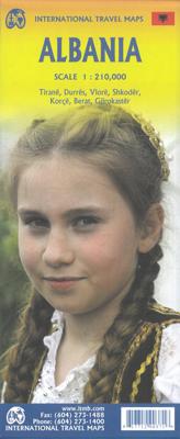
Wegenkaart - landkaart Wegenkaart - landkaart Albanië | ITMB

0

Verkopers met dit product

Verkoper
Bezorging
Prijs
DeZwerver.nl logo
DeZwerver.nl
2,95
14,95

Anderen bekeken ook

Nieuw
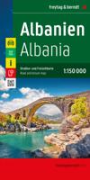
Wegenkaart - landkaart Albanië | Freytag & Berndt
Wegenkaart Albanië – freytag & berndt 1:150.000 met stadskaart Tirana & toeristische tips Voor auto, motor, camper of fiets – de perfecte kaart voor je reis door Albanië Deze gedetailleerde wegenkaart van Albanië (schaal 1:150.000) is de ideale keuze voor reizigers die het land met eigen vervoer willen ontdekken. Van de ruige bergen in het noorden tot de zonnige stranden van het zuiden – deze kaart geeft een helder en compleet overzicht van het hele land, inclusief toeristische routes, bezienswaardigheden, campings en stellplaatsen. De kaart is dubbelzijdig bedrukt en bevat een uitneembare stadsplattegrond van Tirana, plus een infogids met top 10 tips in het Duits, Engels en Albanees. Daarmee is deze kaart een uitstekende reisgenoot voor autovakanties, motortochten, camperreizen én fietsroutes. ✅ Voordelen Gedetailleerde schaal 1:150.000 Ideaal voor zowel hoofdwegen als kleine, minder bekende routes – geschikt voor auto, motor en fiets. Toeristische routes en hoogtepunten gemarke…
13,95
Nieuw
Wegenkaart - landkaart Bermuda | ITMB
Een degelijke kaart met aanduidingen van o.a. nationale parken, vliegveld, benzinepomp, dirt-roads. Als overzichtskaart goed te gebruiken. Bermuda is a lovely mid-Atlantic island far off the coast of South Carolina. It is full of colonial architecture and an ‘island’ way of life. Tourism is a key ingredient of the colony’s lifeblood and the island is very popular with cruise ships. There is ample accommodation for longer-term visitors, good roads, and much history. The airport was built by the US Navy during WW2 and is still a US Naval Air Station, but shares the runway with civil aviation. The map includes an excellent inset of St. George’s, which still has its stocks close to the town hall, and another of Hamilton, the capital. This is where most cruise ships dock. For those with the time, the map shows the Railway Trail along the former route of the island’s now-defunct rail line. Lots to see; lots to do!   Map size: 27*39"   Legend Includes: Roads by classification, Rivers and Lak…
13,95
Nieuw
Wegenkaart - landkaart Nepal | ITMB
Een degelijke kaart met aanduidingen van o.a. nationale parken, vliegveld, benzinepomp, dirt-roads en kleine plattegrond van hoofdstad. Als overzichtskaart goed te gebruiken. This is a completely new map, using original ITMB artwork (the previous edition was licenced from a British firm). It is a double-sided (east half/west half) map with good inset maps of Kathmandu and of its surrounding valley, excellent hypsometry, and as detailed a rendering of the roads as has been possible. The civil unrest that beset this lovely country is now a thing of the past, and Nepal is enjoying a well-deserved touristic boom. The map is printed on paper, double-sided Legend Includes: Roads by classification, airports, international and regional boundaries, forts, rivers, lakes, caves, parks, museums, temples, viewpoints, palaces, motels, hotels, tourist information centres, and more.
13,95
Wegenkaart - landkaart Brazilië | ITMB
Een degelijke kaart met aanduidingen van o.a. nationale parken, vliegveld, benzinepomp, dirt-roads en kleine plattegrond van hoofdstad. Als overzichtskaart goed te gebruiken. Brazil, or more properly, Brasil, is a difficult country to map as a country, in that most of the developed areas are in the relatively small extreme south of the country. The vast region of the Amazon Basin is lightly populated and is not easy to access. Our solution has been to portray the south portion on one side at a detailed scale, to enable such locations as Rio and Sao Paulo a better scale to help travellers, while mapping the north at a respectable but more limited scale on the That said, one still needs both sides of the map, as Brasilia, the capital, falls on the north side other side of the sheet. I should also note that roads north of Brasilia tend to be less well-paved than those in the south. The  shape of the country also presents mapping difficulties, in that little room is available for inset ma…
13,95
Nieuw
Wegenkaart - landkaart Ecuador | ITMB
Duidelijke wegenkaart van Ecuador, aan 2 zijden bedrukt. Met stadsplattegronden van Quito, Guayaquil. Aanduidingen van benzinestations, Nationale parken en bezienswaardigheden. Very detailed, double sided travel map of Ecuador shows road network and physical features. Distances between communities are shown, as well as gas stations outside of major towns. National parks and points of interest are also shown. Includes an inset map of Quito and Environs of Guayaquil as well as a comprehensive place name index. Printed on waterproof synthetic paper suitable for tropical conditions.
13,95
Nieuw
Wegenkaart - landkaart Ierland | ITMB
As technology improves, we are able to produce more detailed maps than was previously possible. Such is the case with Ireland, a part of the world consisting of two countries divided by religion and history. Preparing a map of Ireland as a double-sided map means cutting the island into two geographic portions. Side 1 covers the northern half. This includes the portion known as Northern Ireland, or Ulster, and a fair portion of the Republic of Ireland, or Eire; essentially everything north of Dublin and west to Counties Mayo and Galway. Side 2 covers the southern half of the island from just north of Dublin to the outer tips of County Kerry. It also includes a nice inset map of central Dublin. Naturally, all motorways and roads are included, as are touristic attractions, camping/caravan sites, ferry terminals, and Top Attractions. This is a very detailed travel map of the island, printed on waterproof paper for durability. We had great fun driving around Ireland researching this map. I…
14,95
Nieuw
Wegenkaart - landkaart Madagascar | ITMB
Een degelijke kaart met aanduidingen van o.a. nationale parken, vliegveld, benzinepomp, dirt-roads en kleine plattegrond van hoofdstad. Als overzichtskaart goed te gebruiken. Tweezijdig! IThe large island off the east coast of Africa is Madagascar. The actual name of the country is the Malagasy Republic, but the public is much more likely to know the country by its island name, so we call our map by the island’s name, rather than using the country name. Makes sense to us! Regardless, this is a major touristic destination. The double-sided map covers the island in great detail, with an inset map of the capital city, Antananarivo. As with other ITMB maps, this one includes a listing of ‘must see’ attractions, such as Tsingy National Park and the famous Lemur’s Park. The island also has a regular surface route to the Comoro Islands, which are also included on this map. Legend Includes: Railroads, Forest, Mational Park, International Airport, Domestic Airport, Fort, holtel, Cave, Museum, …
13,95
Nieuw
Wegenkaart - landkaart Ghana | ITMB
Een degelijke kaart met aanduidingen van o.a. nationale parken, vliegveld, benzinepomp, dirt-roads en kleine plattegrond van hoofdstad. Als overzichtskaart goed te gebruiken. Folded road and travel map in color. Scale 1:500,000. Distinguishes roads ranging from motorways to other roads. Legend includes tracks, railroads, ferry routes, international airports, national airports, aerodromes/small aircrafts, gasoline/petrol stations, bus stations, hospitals/medical facilities, castles/forts, points of interest, ruins or archaeological sites, campsites and huts, museums, lodges, churches, mosques. Includes inset map of Cape Coast, Accra and Kumasi. Extensive index.
13,95
Nieuw
Wegenkaart - landkaart Afghanistan | ITMB
Een degelijke kaart met aanduidingen van o.a. nationale parken, vliegveld, benzinepomp, dirt-roads en kleine plattegrond van hoofdstad. Als overzichtskaart goed te gebruiken. Legend Includes: Roads by classification, silk road, airports, towns, villages, ruins, national parks, lakes, swamps, points of interest and other information It is a bit difficult to credit Afghanistan having touristic potential at the moment, but it is an extremely important country right now, and that justifies a very good map of the country. This is our third edition of this country and each one keeps getting better. We can’t justify sending a researcher into a combat zone to gather data, but we are thankful to those aid workers and soldiers who have added to our information base and helped make this map more useful. In this edition, we are showing some new roads, reflecting the reality that the country is succeeding in improving its infrastructure in spite of a very tense political situation. We have also pl…
13,95

Klanten-reviews van Wegenkaart - landkaart Wegenkaart - landkaart Albanië | ITMB

Er zijn nog geen beoordelingen voor dit productBen jij de eerste die een review plaatst?

Meer over Wegenkaart - landkaart Wegenkaart - landkaart Albanië | ITMB

Verken gerelateerde categorieën

Webshop.nl maakt gebruik van cookies. Ga je verder op onze website, ga dan akkoord met het plaatsen van cookies en de verwerking van deze data door ons en vermelde partners.