webshop.nl
Categorieën
  Sluiten

Meer ITMB
Meer ITMB in Literatuur boeken

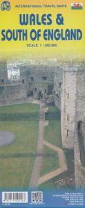
Wegenkaart - landkaart Wales & south of England - Zuid Engeland | ITMB

Een degelijke kaart met aanduidingen van o.a. nationale parken, vliegveld, benzinepompen. We are gradually increasing the scales for our data of Great Britain and this is our latest effort. Most visitors to the UK fly into one of London's four airports and combine a visit to the city with an opportunity to travel to various destinations within stri...
13,95

Webshops met dit product

Webshop
Bezorging
Prijs

Anderen bekeken ook

Wegenkaart - landkaart Wales & south of England - Zuid Engeland | ITMB
Een degelijke kaart met aanduidingen van o.a. nationale parken, vliegveld, benzinepompen. We are gradually increasing the scales for our data of Great Britain and this is our latest effort. Most visitors to the UK fly into one of London's four airports and combine a visit to the city with an opportunity to travel to various destinations within striking distance of London. England is so incredibly rich in heritage and scenic attractions that it is extremely difficult to portray the country as a map of the entire entity. As a result, England lends itself nicely to be divided into a central/northern portion and a southern portion. To fit areas as diverse as Cornwall and Norwich on one sheet, one needs to have a vertical frame, with Devon/Cornwall up to the top of Wales on one side and Wiltshire to Kent up to York (admittedly, not normally considered to be part of 'southern', but vertically, that's what happens. At this scale, all of southern England and all of Wales can be shown in good d…
13,95
Wegenkaart - landkaart England & Wales - Engeland | ITMB
Een degelijke kaart met aanduidingen van o.a. nationale parken, vliegveld, benzinepompen. ITMB publishes a map of Great Britain, but each portion of GB needs its own map to show roads and attractions in more detail. This is a brilliant map of both England and Wales, showing the entire 'country' in a double-sided format. The place names index is formidable, but England in particular is a series of little villages, so it has been very difficult to decide what to include and what to leave out. This map is showing motorways, divided carriageways, all A & B highways, railway lines, airports, historic sites and touristic attractions, parks and gardens, and just about everything that we could fit on to the page to provide users with a detailed, usable map. We have been able to fit all of southern England/Wales as far north as Chester/Lincoln on side A and with a little overlap, from those cities north to the well over the Scottish border, up to Perth/Dundee filling side B. The Isle of Man and…
13,95
Wegenkaart - landkaart Wales & southwest England | ITMB
Een degelijke kaart met aanduidingen van o.a. nationale parken, vliegveld, benzinepompen. Finally, we have been able to create our own map of the lovely country of Wales. I use the word ‘country’ in its truest sense, as Wales was invaded and taken over by the English centuries ago. Regardless, the Welsh language and Welsh culture continue to flourish, although English is commonly spoken. We have visited Wales on several occasions and find that the attractions are so numerous that we could never see them all. There are too many castles to count, but some of the best preserved in the British Isles are in Wales, notable Caernarfon, but nearby Harlech is a World Heritage Site. St, David’s must be one of the smallest and loveliest cathedrals in the world, and Tintern Abbey ruins among the most poignant anywhere. We took Johnny to Abergavenny for lunch in March, not that it made any difference; he just pined for a McDonalds. This map is double-sided, with Wales on one side and the West Count…
13,95
Wegenkaart - landkaart USA Northeast - Noordoost USA | ITMB
Een degelijke wegenkaart van het noordoosten van de USA. (1:1.000.000) met aanduidingen van o.a. nationale parken, vliegveld, benzinepomp, dirt-roads. Als overzichtskaart goed te gebruiken. (1:1.000.000 Scale) including adjacent US states and bordering Canada . We started it wanting to do a map of just New England, but that will have to be a future title. By the shape of the USA, the New England States fill most of one side of the map, but New York City and Philadelphia are included as well as a goodly portion of New York State. The second side covers the rest of the state, plus all of New Jersey, Delaware, Maryland, Pennsylvania, and most of Ohio, West Virginia and the northern portion of Virginia. In terms of cities, Cincinnati is at the bottom left of the sheet and Richmond at the bottom right, with Detroit at upper left and Albany at upper right. The value of this map for visitors is that it covers a reasonably comprehensive portion of the USA, stretching as it does from northern M…
13,95
Spoorwegenkaart England Southeast & Midlands Rail/Road | ITMB
The shape of the UK makes it difficult to map logically. The term South East, within crowded England, is generally more restrictive than is appropriate for a map. Our definition of SE is from the English Channel north to the northern tip of East Anglia and west to Portsmouth/Reading/Peterborough. This occupies side one of the sheet. Side two consists of that complex portion of England generally called ‘The Midlands’ stretching from Cambridge/Peterborough west to the Welsh border and from Luton/Gloucester north to Manchester/Grimsby. London is, of course, prominent, but only as a main roads map. This is the most recent sectional map of the UK that ITMB has published, and was necessitated by the realization that, to see England properly, one needs a detailed enough map to show rail lines, motorways, A-type highways and B-type secondary roads, but also the tertiary level of road joining villages. The road network of England is incredibly complex and cannot be shown in proper detail withou…
13,95
Wegenkaart - landkaart Brazilië | ITMB
Een degelijke kaart met aanduidingen van o.a. nationale parken, vliegveld, benzinepomp, dirt-roads en kleine plattegrond van hoofdstad. Als overzichtskaart goed te gebruiken. Brazil, or more properly, Brasil, is a difficult country to map as a country, in that most of the developed areas are in the relatively small extreme south of the country. The vast region of the Amazon Basin is lightly populated and is not easy to access. Our solution has been to portray the south portion on one side at a detailed scale, to enable such locations as Rio and Sao Paulo a better scale to help travellers, while mapping the north at a respectable but more limited scale on the That said, one still needs both sides of the map, as Brasilia, the capital, falls on the north side other side of the sheet. I should also note that roads north of Brasilia tend to be less well-paved than those in the south. The  shape of the country also presents mapping difficulties, in that little room is available for inset map…
13,95

Klanten-reviews van Wegenkaart - landkaart Wales & south of England - Zuid Engeland | ITMB

Er zijn nog geen beoordelingen voor dit productBen jij de eerste die een review plaatst?

Meer over Wegenkaart - landkaart Wales & south of England - Zuid Engeland | ITMB

Productomschrijving

Een degelijke kaart met aanduidingen van o.a. nationale parken, vliegveld, benzinepompen. We are gradually increasing the scales for our data of Great Britain and this is our latest effort. Most visitors to the UK fly into one of London's four airports and combine a visit to the city with an opportunity to travel to various destinations within striking distance of London. England is so incredibly rich in heritage and scenic attractions that it is extremely difficult to portray the country as a map of the entire entity. As a result, England lends itself nicely to be divided into a central/northern portion and a southern portion. To fit areas as diverse as Cornwall and Norwich on one sheet, one needs to have a vertical frame, with Devon/Cornwall up to the top of Wales on one side and Wiltshire to Kent up to York (admittedly, not normally considered to be part of 'southern', but vertically, that's what happens. At this scale, all of southern England and all of Wales can be shown in good detail, especially the motorways, A-type roads, and most B-type roads. Most C-level village roads are also there, but the scale available makes them somewhat difficult to see. Also, the scale enables us to add many more place names than was previously possible, but there are limits to what one can portray at any particular scale and the smallest level of village life will have to await more detailed maps at 1:250,000 that we will be preparing at a future date. This map is what we call a 'work in progress' and we would welcome input as to how to improve future editions. The map is quite detailed but not cluttered, and covers an area that one can drive in a four to five hour time period from Heathrow. A generation ago, this would have been impossible, but road improvements have extended a visitor's ability to cover more distance in the same time period as I used to cover in the 1960s. Somewhat surprisingly, the map also shows how the 'greenbelt' surrounding London is steadily disappearing as the city continues to expand. I suspect that most of our yellow urban infill areas are shown too conservative for modern times. The artwork, is accurate, detailed, attractively portrayed, and hopefully of interest to those visiting England.   Legend Includes: Roads by classification, Rivers and Lakes, National Park, Airports, Points of Interests, Mining, Highways, Main Roads, Zoos, Fishing, , and much more...

Productspecificaties

Artikelnummer(s)
Brand
ITMB

Verken gerelateerde categorieën

Webshop.nl maakt gebruik van cookies. Ga je verder op onze website, ga dan akkoord met het plaatsen van cookies en de verwerking van deze data door ons en vermelde partners.