webshop.nl
Categorieën
  Sluiten

Meer A-Z Map Company
Meer A-Z Map Company in Thrillers & fantasy boeken

Wegenkaart - landkaart Visitors map Scotland - Schotland | A-Z Map Com

xplore the whole of Scotland from Dumfries and Galloway in the South to the Orkney Islands in the North. With detailed road mapping and illustrated town plans of major cities, this feature rich, helpful tourist guide is ideal for touring around Scotland. Published at a clear 8.7 miles to 1 inch scale (5.51 cm to 1 km), this handy map is a detailed ...
11,50

Webshops met dit product

Webshop
Bezorging
Prijs

Anderen bekeken ook

Wegenkaart - landkaart Visitors map Scotland - Schotland | A-Z Map Com
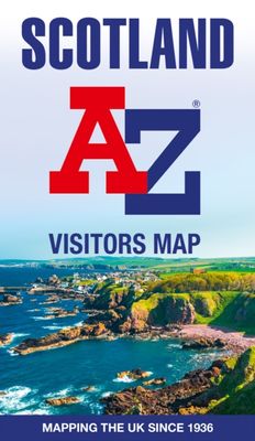
xplore the whole of Scotland from Dumfries and Galloway in the South to the Orkney Islands in the North. With detailed road mapping and illustrated town plans of major cities, this feature rich, helpful tourist guide is ideal for touring around Scotland. Published at a clear 8.7 miles to 1 inch scale (5.51 cm to 1 km), this handy map is a detailed and informative exploration of what Scotland has to offer.   Highlights include: 8 inset street maps to major cities and popular destinations, including: Edinburgh, Glasgow, Stirling, and Cairngorms National Park, with detailed descriptions and places of interestLocations of visitor centres and tourist information sitesUseful key to map symbols making it a clear and easy readMore than 700 places of interest The perfect map for exploring Scotland whether you are a tourist or a local.
11,50
Wegenkaart - landkaart Visitors map Devon | A-Z Map Company
Explore the whole county of Devon extending from Taunton to Plymouth. With detailed road mapping and illustrated town plans of major cities, this feature-rich, helpful tourist guide is ideal for visitors to Devon. Published at a clear 3.33 miles to 1 inch scale (2.11 cm to 1 km), this handy map is a detailed and informative exploration of all Devon has to offer.   Highlights include:* 8 inset street maps to major cities and popular destinations, including: Exeter, Paignton, Dartmouth and Torquay, with detailed descriptions and places of interest* Locations of visitor centres and tourist information sites* Useful key to map symbols making it a clear and easy read The perfect map for exploring Devon whether you are a tourist or a local.
11,50
Wegenkaart - landkaart 3326 Adventure Map Scotland - Schotland | Natio
Wegenkaart van Schotland met vermelding van veel bezienswaardigheden, nationale parken en attrakties. Watervast en scheurvast. Juist door deze vermeldingen onderscheidt de kaart zich van andere wegenkaarten. National Geographic's Scotland AdventureMapis designed to meet the needs of adventure travelers with its durability and detailed, accurate information. The map includes the locations of cities and towns with a user-friendly index, a clearly marked road network complete with distances and designations for roads/highways, plus secondary routes for those seeking to explore off the beaten path.    AdventureMaps differ from a traditional road map because of the specialty content that they include. Each map contains hundreds of diverse and unique recreational, ecological, cultural and historic destinations - outside of the major tourist hubs. National Geographic AdventureMaps are the perfect companion to a guidebook, yet far easier to pack!    The Scotland AdventureMap is printed in the …
17,50
Wegenkaart - landkaart Visitors map Devon | A-Z Map Company
Explore the whole county of Devon extending from Taunton to Plymouth. With detailed road mapping and illustrated town plans of major cities, this feature-rich, helpful tourist guide is ideal for visitors to Devon. Published at a clear 3.33 miles to 1 inch scale (2.11 cm to 1 km), this handy map is a detailed and informative exploration of all Devon has to offer.   Highlights include:* 8 inset street maps to major cities and popular destinations, including: Exeter, Paignton, Dartmouth and Torquay, with detailed descriptions and places of interest* Locations of visitor centres and tourist information sites* Useful key to map symbols making it a clear and easy read The perfect map for exploring Devon whether you are a tourist or a local.
11,50
Wegenkaart - landkaart Visitors map Yorkshire | A-Z Map Company
Explore the whole region of Yorkshire extending from Sheffield to Darlington. With detailed road mapping and illustrated town plans of major cities, this feature rich, helpful tourist guide is ideal for touring around Yorkshire. Published at a clear 3 miles to 1 inch scale (1.9 cm to 1 km), this handy map is a detailed and informative exploration of what Yorkshire has to offer.   Highlights include: 4 inset street maps to major cities and popular destinations, including: Bradford, Middlesborough and York, with detailed descriptions and places of interestLocations of visitor centres and tourist information sitesUseful key to map symbols making it a clear and easy read The perfect map for exploring Yorkshire whether you are a tourist or a local.
11,50
Wegenkaart - landkaart Visitors map Yorkshire | A-Z Map Company
Explore the whole region of Yorkshire extending from Sheffield to Darlington. With detailed road mapping and illustrated town plans of major cities, this feature rich, helpful tourist guide is ideal for touring around Yorkshire. Published at a clear 3 miles to 1 inch scale (1.9 cm to 1 km), this handy map is a detailed and informative exploration of what Yorkshire has to offer.   Highlights include: 4 inset street maps to major cities and popular destinations, including: Bradford, Middlesborough and York, with detailed descriptions and places of interestLocations of visitor centres and tourist information sitesUseful key to map symbols making it a clear and easy read The perfect map for exploring Yorkshire whether you are a tourist or a local.
11,50
Wegenkaart - landkaart Touring Map of Scotland - Schotland | Collins
Best-selling map of Scotland. More than 1,000 places of tourist interest plotted and named on the map. The features have been plotted onto an up-to-date and attractive Collins map of Scotland.   A clear, easy to follow road map with colour classified roads. Ideal for tourists with hundreds of distinctive tourist symbols and tourist information centres all shown.   This map includes: • The whole of Scotland on a double sided sheet at 5 miles to 1 inch • Over 25 categories of tourist information shown on the map including youth hostels, picnic sites and ferries as well as the more obvious tourist sites such as castles, wildlife parks and museums • Detailed town centre maps of Edinburgh, Glasgow, Aberdeen, Dundee, Inverness and Perth • New places of interest including Japanese Garden (near Dollar), Macallan Distillery Centre, Moat Brae (Dumfries) and Scottish Submarine Centre (Helensburgh) • Road updates include the new Dalry bypass, Maybole bypass under construction, A9 dualling sections…
9,95
Wegenatlas Handy Road Atlas Scotland - Schotland | Collins
Handzame A% wegenatlas van Schotland met register en stadsplattegronden. Discover new places with handy road atlases from Collins. Your ideal companion for navigating around Scotland. It has extremely clear, route planning maps of Scotland, detailed city plans of the major cities and towns and fits neatly into your glovebox, briefcase or bag.   Main featuresClear, attractive route planning maps of the whole of Scotland supported by comprehensive, fully indexed city centre street maps of Aberdeen, Dundee, Edinburgh, Glasgow, Inverness and Perth. Scale of main maps: 1:625,000 (9.9 miles to 1 inch). Also includes* Places of tourist interest are highlighted* Attractive layer colouring showing land height* Road network fully classified and colour coded* Detailed street mapping of Edinburgh, including the Royal Mile with all its attractions clearly marked, Leith and Holyrood Park* Detailed street mapping of Glasgow, including the West End, city centre and M74 extension* Detailed street mappi…
9,95

Klanten-reviews van Wegenkaart - landkaart Visitors map Scotland - Schotland | A-Z Map Com

Er zijn nog geen beoordelingen voor dit productBen jij de eerste die een review plaatst?

Meer over Wegenkaart - landkaart Visitors map Scotland - Schotland | A-Z Map Com

Productomschrijving

xplore the whole of Scotland from Dumfries and Galloway in the South to the Orkney Islands in the North. With detailed road mapping and illustrated town plans of major cities, this feature rich, helpful tourist guide is ideal for touring around Scotland. Published at a clear 8.7 miles to 1 inch scale (5.51 cm to 1 km), this handy map is a detailed and informative exploration of what Scotland has to offer.   Highlights include: 8 inset street maps to major cities and popular destinations, including: Edinburgh, Glasgow, Stirling, and Cairngorms National Park, with detailed descriptions and places of interestLocations of visitor centres and tourist information sitesUseful key to map symbols making it a clear and easy readMore than 700 places of interest The perfect map for exploring Scotland whether you are a tourist or a local.

Productspecificaties

Artikelnummer(s)
Brand
A-Z Map Company

Verken gerelateerde categorieën

Webshop.nl maakt gebruik van cookies. Ga je verder op onze website, ga dan akkoord met het plaatsen van cookies en de verwerking van deze data door ons en vermelde partners.