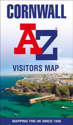
Wegenkaart - landkaart Visitors map Cornwall | A-Z Map Company

0
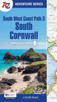
Explore the whole county and area extending into Devon as far as Great Torrington, Tavistock and Plymouth. This detailed and up-to-date map contains more than 1,000 places of interest and an index to 3,000 towns and villages. Published at a clear 2.5 miles to 1 inch scale (1.6 kms to 1 cm), a handy road map includes primary route destinations, sel...

Verkopers met dit product

Webshop
Bezorging
Prijs
DeZwerver.nl logo
DeZwerver.nl
niet bekend
12,50

Anderen bekeken ook

Wegenkaart - landkaart Visitors map Devon | A-Z Map Company
Explore the whole county of Devon extending from Taunton to Plymouth. With detailed road mapping and illustrated town plans of major cities, this feature-rich, helpful tourist guide is ideal for visitors to Devon. Published at a clear 3.33 miles to 1 inch scale (2.11 cm to 1 km), this handy map is a detailed and informative exploration of all Devon has to offer.   Highlights include:* 8 inset street maps to major cities and popular destinations, including: Exeter, Paignton, Dartmouth and Torquay, with detailed descriptions and places of interest* Locations of visitor centres and tourist information sites* Useful key to map symbols making it a clear and easy read The perfect map for exploring Devon whether you are a tourist or a local.  
11,50
Wegenkaart - landkaart Visitors map Lake District | A-Z Map Company
Explore the whole region and area extending from Cockermouth and Penrith in the north to Ulverston and Grange-over-Sands in the south and from the M6 in the east to the coast in the west. Published at a clear 2.45 miles to 1 inch scale, this detailed visitors map of the Lake District includes primary route destinations and selected caravan and camping sites. Plus, there is detailed informative text for visitor attractions and places of interest.   There are also 12 town centre street maps of: Ambleside, Cockermouth, Coniston, Grange-over-Sands, Grasmere, Hawkshead, Kendal, Keswick, Penrith, Ulverston, Windermere and Bowness-on-Windermere. Each town centre map includes descriptive text and useful information about its visitor attractions and places of interest. Each town plan also has a separate index, while the main road map index lists towns, villages, hamlets and locations.   The 'Index to Places of Interest' lists tourist sites by feature type. For 2024, there is also now added ele…
12,50
Wegenkaart - landkaart Cornwall | Goldeneye
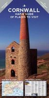
Cornwall Map and Guide of Places to Visit is the ideal guide to the very best of Cornwall. Cornwall remains Britain's Number 1 holiday destination for a week or a fortnight's break. Our Goldeneye Cornwall Leisure Map & Travel Guide has been researched, compiled and published in Cornwall by Cornish locals.   Our team knows Cornwall like no other organisation! Our Cornwall Map & Guide presents Cornwall's multiple attractions in an accessible, easy-to-read and follow, format. In fact, we've been producing this publication for over 30 years and it is firmly part of our DNA. The Cornwall Map and Guide is in the format of a fold-out map and has a detailed visitor map on one side and visitor information on the other: Cornwall Visitor MapAn unbelievably detailed map on one side with lots of additional visitor informationThe ideal scale for touring at 1:126,720 (2 miles to 1 inch)Tourist attractions like beaches & surfing, gardens, harbours & National Trust properties are clearly highlightedCl…
16,50
Wegenkaart - landkaart Visitors map Wales | A-Z Map Company
Explore the whole country from Cardiff and Pembrokeshire to Isle of Anglesey and Conwy, extending as far north as Liverpool. This detailed and up-to-date map contains 700 places of interest and an index to 4,000 towns and villages. Published at a clear 3.5 miles to 1 inch scale (2.2 kms to 1 cm), a handy road map includes primary route destinations, visitor attractions, ferry terminals and places of interest.   Plus, there is detailed informative text for Cardiff, Swansea and the Gower Peninsula, the Pembrokeshire Coast, Snowdonia, the North Wales Coast and Caernarfon. The perfect map for exploring Wales whether you are a local or a tourist.
10,95
Wegenkaart - landkaart Visitors map Scotland - Schotland | A-Z Map Company
xplore the whole of Scotland from Dumfries and Galloway in the South to the Orkney Islands in the North. With detailed road mapping and illustrated town plans of major cities, this feature rich, helpful tourist guide is ideal for touring around Scotland. Published at a clear 8.7 miles to 1 inch scale (5.51 cm to 1 km), this handy map is a detailed and informative exploration of what Scotland has to offer.   Highlights include: 8 inset street maps to major cities and popular destinations, including: Edinburgh, Glasgow, Stirling, and Cairngorms National Park, with detailed descriptions and places of interestLocations of visitor centres and tourist information sitesUseful key to map symbols making it a clear and easy readMore than 700 places of interest The perfect map for exploring Scotland whether you are a tourist or a local.
11,50
Reisgids Devon - Cornwall | Rough Guides
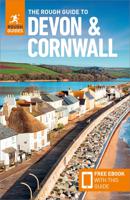
Zeer goede reisgids voor zowel de georganiseerde maar vooral voor de zelfstandige reiziger. Boordevol informatie over reizen, slapen, eten, maar ook musea en cultuur. Voor Europese landen meestal completer en beter dan de Lonely Planet ! This Devon & Cornwall guidebook is perfect for independent travellers planning a longer trip. It features all of the must-see sights and a wide range of off-the-beaten-track places. It also provides detailed practical information on preparing for a trip and what to do on the ground. And this Devon & Cornwall travel guidebook is printed on paper from responsible sources, and verified to meet the FSC's strict environmental and social standards.   This Devon & Cornwall guidebook covers: Exeter and mid-Devon, East Devon, South Devon, Dartmoor, Plymouth and around, Exmoor, North Devon and Lundy, Southeast Cornwall, The Lizard and Penwith peninsulas, the Isles of Scilly, Cornwall's Atlantic coast, Bodmin and Bodmin Moor.   Inside this Devon & Cornwall …
24,95
Wegenkaart - landkaart Visitors map London | A-Z Map Company
Clear and easy-to-read map of central London and surrounding area. Contains detailed mapping, presented in a handy compact format. This attractive map, ideal for both tourists and residents, and fully updated, has an extensive area of coverage and displays a wealth of detail.   Fully classified roads Congestion and ULEZ charging zones Postal districts and boundaries clearly depicted Full indexes to street names (on back of map), place names and places of interest Fully updated London underground map conveniently located on the back cover Extends from Hampstead in the north to Clapham in the south and from Hammersmith in the west to Greenwich in the east.   The perfect map for exploring London whether you are a tourist or a local.   Scale: 1:17,500 (3.6 inches to 1 mile)
12,50
Wegenkaart - landkaart Visitors map Yorkshire | A-Z Map Company
Explore the whole region of Yorkshire extending from Sheffield to Darlington. With detailed road mapping and illustrated town plans of major cities, this feature rich, helpful tourist guide is ideal for touring around Yorkshire. Published at a clear 3 miles to 1 inch scale (1.9 cm to 1 km), this handy map is a detailed and informative exploration of what Yorkshire has to offer.   Highlights include: 4 inset street maps to major cities and popular destinations, including: Bradford, Middlesborough and York, with detailed descriptions and places of interestLocations of visitor centres and tourist information sitesUseful key to map symbols making it a clear and easy read The perfect map for exploring Yorkshire whether you are a tourist or a local.
11,50
Wegenkaart - landkaart Pocket Map Outer Hebrides | Collins
Explore new places with handy pocket maps from Collins. Handy little full-colour map of the Western Isles of Scotland. Detailed mapping and tourist information for the islands of Lewis, Harris, Uist, Benbecula, Barra and St Kilda.   Excellent value and very detailed for its size. Famed for its stunning coastline, wildlife and traditional food and drink, the Outer Hebrides have a distinct identity. Discover these unique islands with this handy pocket map.   Main features of this map include: Clear mapping at a scale of 3.2 miles to 1 inchTourist attractions located and describedSights, places to stay, cafe/restaurant, things to do are all highlighted on the mapTransport links map showing how to get to and depart the islandsIndex to places of interest and place names Essential for those planning a trip around the Western Isles.
7,95
Wegenkaart - landkaart Touring Map of Scotland - Schotland | Collins
Best-selling map of Scotland. More than 1,000 places of tourist interest plotted and named on the map. The features have been plotted onto an up-to-date and attractive Collins map of Scotland.   A clear, easy to follow road map with colour classified roads. Ideal for tourists with hundreds of distinctive tourist symbols and tourist information centres all shown.   This map includes: • The whole of Scotland on a double sided sheet at 5 miles to 1 inch • Over 25 categories of tourist information shown on the map including youth hostels, picnic sites and ferries as well as the more obvious tourist sites such as castles, wildlife parks and museums • Detailed town centre maps of Edinburgh, Glasgow, Aberdeen, Dundee, Inverness and Perth • New places of interest including Japanese Garden (near Dollar), Macallan Distillery Centre, Moat Brae (Dumfries) and Scottish Submarine Centre (Helensburgh) • Road updates include the new Dalry bypass, Maybole bypass under construction, A9 dualling section…
9,95

Klanten-reviews van Wegenkaart - landkaart Visitors map Cornwall | A-Z Map Company

Er zijn nog geen beoordelingen voor dit productBen jij de eerste die een review plaatst?

Meer over Wegenkaart - landkaart Visitors map Cornwall | A-Z Map Company

Productomschrijving

Explore the whole county and area extending into Devon as far as Great Torrington, Tavistock and Plymouth. This detailed and up-to-date map contains more than 1,000 places of interest and an index to 3,000 towns and villages. Published at a clear 2.5 miles to 1 inch scale (1.6 kms to 1 cm), a handy road map includes primary route destinations, selected caravan and camping sites, visitor attractions and places of interest.   Town centre street maps of Bodmin, Bude, Falmouth, Fowey, Launceston, Liskeard, Looe, Newquay, Padstow, Penzance,Plymouth, St. Ives and Truro are also included, plus detailed informative text for Bodmin Moor, Land’s End and Isles of Scilly. The perfect map for exploring Cornwall whether you are a local or a tourist.

Verken gerelateerde categorieën

Webshop.nl maakt gebruik van cookies. Ga je verder op onze website, ga dan akkoord met het plaatsen van cookies en de verwerking van deze data door ons en vermelde partners.