Productomschrijving
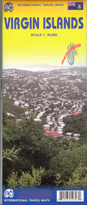
Een degelijke kaart met aanduidingen van o.a. nationale parken, vliegveld, benzinepomp, dirt-roads en kleine plattegrond van hoofdstad. Als overzichtskaart goed te gebruiken. Virgin Islands Travel Reference Map is a brand new artwork and has been digitally prepared from GIS downloads, so is extremely precise in its portrayal of physical features. This version is printed on double-sided ITM plastic paper for both durability and waterproofing, and covers both the British and the American land masses that comprise the Virgins. Named after Queen Elizabeth the First, the network of islands has a colourful history which we have enhanced in a series of topical capsule comments. The more populated island of St. Croix includes an elaborate myriad of roads and inset maps of Christiansted and Frederiksted. The St. Thomas island portion includes detailed insets of Charlotte Amalie and Cruz Bay on St. Johns. The other side of the sheet covers the BVI region; less populated and oh so very British. I remember staying in Road Town for several days many years ago. This map includes an inset of the town showing all the major buildings and nothing has changed since I was there fifteen years ago. The map also includes an inset of The Valley, the only town on Virgin Gorda and, I’m sure, the only map ever published of that small settlement. Legend Includes: Roads by classification, Airports, Harbors, Gas Stations, Shipwrecks, Hotels, Lodges, Castles, Museums, Monuments, Churches, Historical Sites, Ruins, Viewpoints, Point of Interests, Police Stations, Schools, Hospitals, Shopping Centres, Light Houses, Beaches, Wind Mills, Caves, Parks, Zoos, and more.

