webshop.nl
Categorieën
  Sluiten

Meer ITMB
Meer ITMB in Literatuur boeken

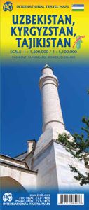
Wegenkaart - landkaart Uzbekistan, Kyrgyzstan, Tajikistan | ITMB

0
Een degelijke kaart met aanduidingen van o.a. nationale parken, vliegveld, benzinepomp, dirt-roads en kleine plattegrond van hoofdstad. Als overzichtskaart goed te gebruiken.   Finally, our ITMB map of Uzbekistan is back in print! Tourism to the ‘Stans’ is increasing as these former parts of the Soviet Empire find their way in a changing world. Thi...

Webshops met dit product

Webshop
Bezorging
Prijs

Anderen bekeken ook

Wegenkaart - landkaart Uzbekistan, Kyrgyzstan, Tajikistan | ITMB
Een degelijke kaart met aanduidingen van o.a. nationale parken, vliegveld, benzinepomp, dirt-roads en kleine plattegrond van hoofdstad. Als overzichtskaart goed te gebruiken.   Finally, our ITMB map of Uzbekistan is back in print! Tourism to the ‘Stans’ is increasing as these former parts of the Soviet Empire find their way in a changing world. This time, we have combined the country with the two other Stans on one side, which makes sense given their shape; then, on the reverse side, we have expanded the artwork to show Kyrgyzstan and Tajikistan to good advantage. The map also includes excellent inset maps of Samarkand, Tashkent, Dushanbe, and Bishkek, which I’m sure all are familiar names. Needless to say, all three countries count as ‘adventure’ travel. Facilities are good in major cities, but roads are of an uncertain quality, and accommodations sparse. Still, this is an exceptionally interesting part of the world. The traditional Great Silk Road passed through this region, and to t…
13,95
Wegenkaart - landkaart Kyrgyzstan and Tajikistan | ITMB
This is a new title for ITMB. The two Central Asian countries of Kyrgyzstan and Tajikistan are rapidly developing a touristic market and we feel that the world needs a good map to reflect their growing importance. The two ‘stans were part of the Soviet empire that fell apart in 1990, creating a dozen new countries. This double-sided map covers Kyrgyzstan on one side, with an inset map of its capital, Bishkek. The main attractions are Osh and Suyab, both ancient market centres on the Silk Road, and Lake Issyk-Kul, the world’s second largest alpine lake. The reverse side concentrates on Tajikistan mountainous country just west of the Himalayas, with an inset of its capital, Dushanbe. Both of these countries should be considered ‘adventure’ destinations.
13,95
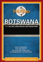
Wegenkaart - landkaart Botswana | Infomap
Goede betrouwbare kaart van Botswana. Met GPS coordinaten. Easy to read in a vehicle Practical, user-friendly scale Extensive countrywide accommodation listing and contact details Experienced-based tips and route comments Includes many off-road tracks GPS co-ordinates of intersections Border post information Many points of interest Distances, fuel points, airports Booking details for national parks Roads and tracks in the national park and reserves Inset of Tuli Block A classic. Our Botswana map, now in its 14th edition, is one of our top sellers. From more frequented destinations such as the country’s famous game parks to other lesser known ones like Tsodilo Hills – Botswana’s World Heritage site with over 4000 rock paintings – this map is a one-stop resource for both self-drive travellers and fly-in tourists alike. Use it to navigate your way from Gaborone to Maun, from Kasane down the Hunters Road to Khubu Island, from Twee Rivieren to the Kalahari, or simply use it as a…
15,95
Wegenkaart - landkaart Afghanistan | ITMB
Een degelijke kaart met aanduidingen van o.a. nationale parken, vliegveld, benzinepomp, dirt-roads en kleine plattegrond van hoofdstad. Als overzichtskaart goed te gebruiken. Legend Includes: Roads by classification, silk road, airports, towns, villages, ruins, national parks, lakes, swamps, points of interest and other information It is a bit difficult to credit Afghanistan having touristic potential at the moment, but it is an extremely important country right now, and that justifies a very good map of the country. This is our third edition of this country and each one keeps getting better. We can’t justify sending a researcher into a combat zone to gather data, but we are thankful to those aid workers and soldiers who have added to our information base and helped make this map more useful. In this edition, we are showing some new roads, reflecting the reality that the country is succeeding in improving its infrastructure in spite of a very tense political situation. We have also pla…
13,95
Wegenkaart - landkaart Kyrgyzstan and Tajikistan | ITMB
This is a new title for ITMB. The two Central Asian countries of Kyrgyzstan and Tajikistan are rapidly developing a touristic market and we feel that the world needs a good map to reflect their growing importance. The two ‘stans were part of the Soviet empire that fell apart in 1990, creating a dozen new countries. This double-sided map covers Kyrgyzstan on one side, with an inset map of its capital, Bishkek. The main attractions are Osh and Suyab, both ancient market centres on the Silk Road, and Lake Issyk-Kul, the world’s second largest alpine lake. The reverse side concentrates on Tajikistan mountainous country just west of the Himalayas, with an inset of its capital, Dushanbe. Both of these countries should be considered ‘adventure’ destinations.
13,95
Wegenkaart - landkaart Kazachstan & Usbekistan | ITMB
Een degelijke kaart met aanduidingen van o.a. nationale parken, vliegveld, benzinepomp, dirt-roads en kleine plattegrond van hoofdstad. Als overzichtskaart goed te gebruiken. Kazachstan 1:3.000.000 Usbekistan schaal 1:1.580.000 The Stans of the former Soviet empire are difficult to map because in the aftermath of liberation, most place names, which the Russian overlords had Russified were changed and not always to their original names or former spellings. Time has sorted out most nomenclature problems, and we hope that this version is letter perfect. In this updated edition for both countries, we have obviously tried our best to create a detailed and accurate map. The big difference between this edition and the previous one is the addition of Uzbekistan to the second side. The two countries seem to share certain common characteristics, as do the other three more easterly Stans, so we feel that combining similarities is better for end users than keeping separate sheets for each country.…
13,95
Wegenkaart - landkaart Angola | ITMB
Goede overzichtskaart van Angola met een helder kleurgebruik. Angola is a fascinating mixture of ethnicity and wealth. It is still climbing out of the morass of post-colonial rule, but is now as safe as any country for travellers. Its infrastructure, particularly its roads, are of uneven quality, and we hope that this map will stimulate visitors to write us of their experiences with travelling through this vast country. We have tried to include as much detail as possible, and as accurately as possible, given the uncertain nature of much of the base material. The map includes a decent inset of Luanda , the capital, and all areas designated as parkland. This is the latest ITM map related to Africa and completes our coverage of Central and Southern Africa. East Africa and North East Africa have also been completed, and we are now working on Equatorial Africa. This map is double-sided (north half/south half). Legend Includes: Roads by classification, ferry route, ruins, camping sites, acco…
13,95

Klanten-reviews van Wegenkaart - landkaart Uzbekistan, Kyrgyzstan, Tajikistan | ITMB

Er zijn nog geen beoordelingen voor dit productBen jij de eerste die een review plaatst?

Meer over Wegenkaart - landkaart Uzbekistan, Kyrgyzstan, Tajikistan | ITMB

Productomschrijving

Een degelijke kaart met aanduidingen van o.a. nationale parken, vliegveld, benzinepomp, dirt-roads en kleine plattegrond van hoofdstad. Als overzichtskaart goed te gebruiken.   Finally, our ITMB map of Uzbekistan is back in print! Tourism to the ‘Stans’ is increasing as these former parts of the Soviet Empire find their way in a changing world. This time, we have combined the country with the two other Stans on one side, which makes sense given their shape; then, on the reverse side, we have expanded the artwork to show Kyrgyzstan and Tajikistan to good advantage. The map also includes excellent inset maps of Samarkand, Tashkent, Dushanbe, and Bishkek, which I’m sure all are familiar names. Needless to say, all three countries count as ‘adventure’ travel. Facilities are good in major cities, but roads are of an uncertain quality, and accommodations sparse. Still, this is an exceptionally interesting part of the world. The traditional Great Silk Road passed through this region, and to this day Tashkent is a major trading transfer point. Nine points of major interest are included, including the Ark-Citadel dating from 400BC, the Minaret of Kalta-Minor, and the great Caravanserai from the Middle Ages.   Legend Includes: Highway, Other Roads, Distance (km), Railways, Ferry Route, City with Population, Border crossing, Airport, Point of interest, Monument, Museum, Palace, Ruin, Beach, Lake, Wildlife and Nature Reserve, Camping Site, Desert, Glacier, etc.

Productspecificaties

Artikelnummer(s)
Brand
ITMB

Verken gerelateerde categorieën

Webshop.nl maakt gebruik van cookies. Ga je verder op onze website, ga dan akkoord met het plaatsen van cookies en de verwerking van deze data door ons en vermelde partners.