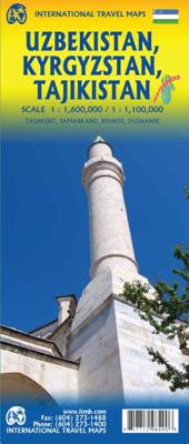
Wegenkaart - landkaart Uzbekistan, Kyrgyzstan, Tajikistan | ITMB

0
Een degelijke kaart met aanduidingen van o.a. nationale parken, vliegveld, benzinepomp, dirt-roads en kleine plattegrond van hoofdstad. Als overzichtskaart goed te gebruiken.   Finally, our ITMB map of Uzbekistan is back in print! Tourism to the ‘Stans’ is increasing as these former parts of the Soviet Empire find their way in a changing world. Th...

Verkopers met dit product

Verkoper
Bezorging
Prijs
DeZwerver.nl logo
DeZwerver.nl
2,95
13,95

Anderen bekeken ook

Wegenkaart - landkaart Uzbekistan, Kyrgyzstan, Tajikistan | ITMB
Een degelijke kaart met aanduidingen van o.a. nationale parken, vliegveld, benzinepomp, dirt-roads en kleine plattegrond van hoofdstad. Als overzichtskaart goed te gebruiken.   Finally, our ITMB map of Uzbekistan is back in print! Tourism to the ‘Stans’ is increasing as these former parts of the Soviet Empire find their way in a changing world. This time, we have combined the country with the two other Stans on one side, which makes sense given their shape; then, on the reverse side, we have expanded the artwork to show Kyrgyzstan and Tajikistan to good advantage. The map also includes excellent inset maps of Samarkand, Tashkent, Dushanbe, and Bishkek, which I’m sure all are familiar names. Needless to say, all three countries count as ‘adventure’ travel. Facilities are good in major cities, but roads are of an uncertain quality, and accommodations sparse. Still, this is an exceptionally interesting part of the world. The traditional Great Silk Road passed through this region, and to …
13,95
Reisgids Oezbekistan - Uzbekistan | Bradt Travel Guides
Als er geen Lonely Planet is, is dit het alternatief ... En vaak nog beter ook. De beste gids over Oezbekistan met alle mogelijke informatie, zowel praktisch (eten, slapen, reizen) als achtergronden over cultuur, landschap en bevolking. Written by Central Asian expert and experienced travel writer Sophie Ibbotson, who is Uzbekistan’s Tourism Ambassador to the UK, this new, fully updated fourth edition of Bradt’s Uzbekistan remains the definitive practical travel guide to an increasingly liberal destination – Central Asia’s most populous country and the heart of the Silk Road. It offers more detail for independent travellers than any other guidebook, sharing first-hand descriptions of everything from UNESCO World Heritage sites and one of the world’s best collections of Soviet avant-garde art, to riding across deserts by camel and cooking plov (lamb pilaf). A perfect spring or autumn destination, Uzbekistan is unexpectedly packed with diverse experiences, from the Silk Road cities o…
29,95
Wegenkaart - landkaart Kyrgyzstan and Tajikistan | ITMB
This is a new title for ITMB. The two Central Asian countries of Kyrgyzstan and Tajikistan are rapidly developing a touristic market and we feel that the world needs a good map to reflect their growing importance. The two ‘stans were part of the Soviet empire that fell apart in 1990, creating a dozen new countries. This double-sided map covers Kyrgyzstan on one side, with an inset map of its capital, Bishkek. The main attractions are Osh and Suyab, both ancient market centres on the Silk Road, and Lake Issyk-Kul, the world’s second largest alpine lake. The reverse side concentrates on Tajikistan mountainous country just west of the Himalayas, with an inset of its capital, Dushanbe. Both of these countries should be considered ‘adventure’ destinations.
13,95
Wegenkaart - landkaart Uzbekistan - Oezbekistan | Gizi Map
Oezbekistan op 1: 1.300.000 van Gizi Map met uitstekende weergave van de woestijnen en bergachtig terrein van het land door hoogtekleuren en veel namen van natuurlijke kenmerken, het oude Silk Routes-netwerk gemarkeerd, plus stratenplannen van Tasjkent, Buchara, Samarkand en Khiva. Alle plaatsnamen staan in het Latijnse alfabet.   Topografie met hoogtes van bergtoppen en afbeeldingen van moerassen, zoutvlaktes en woestijnen enz. Nationale parken zijn gemarkeerd en de kaart toont interne administratieve grenzen. Wegennet omvat geselecteerde lokale onverharde wegen, spoorlijnen zijn inbegrepen en lokale luchthavens zijn gemarkeerd. Een verscheidenheid aan symbolen geeft interessante plaatsen aan. Breedtegraad- en lengtegraadlijnen worden getekend met intervallen van 1 °.
17,95
Wegenkaart - landkaart Centraal-Azië: Oezbekistan, Kirgizië, Turkmenistan en Tajikistan | Reise Know-How Verlag
Wegenkaart - landkaart Oezbekistan, Kirgizië, Turkmenistan en Tajikistan Tweetalige kaart (Engels en Duits). Door ingetekende lengte- en breedtegraden is het gebruik van GPS mogelijk. Met hoogtelijnen en uitgebreid wegennetwerk: daarnaast worden ook de afstanden tussen belangrijke plaatsen duidelijk leesbaar weergegeven. Het kleurgebruik is zodanig dat je een goede indruk krijgt van hoogteverschillen en soorten landschap. Natuurlijk staan de toeristische bezienswaardigheden duidelijk vermeld.   Gedrukt op water- en scheurvast papier! Polyart is een synthetisch product vrij van giftige stoffen dus duurzaam. Het papier gaat echt lang mee.   Topography is indicated by altitude colouring with numerous spot heights and names of mountain ranges and passes. Salt lakes, swamps, seasonal rivers and glacier are also shown. Detailed presentation of the road network includes minor roads and tracks and railways are also shown.   Internal administrative units are presented with their boundaries and…
11,95
Wegenkaart - landkaart Kazachstan & Usbekistan | ITMB
Een degelijke kaart met aanduidingen van o.a. nationale parken, vliegveld, benzinepomp, dirt-roads en kleine plattegrond van hoofdstad. Als overzichtskaart goed te gebruiken. Kazachstan 1:3.000.000 Usbekistan schaal 1:1.580.000 The Stans of the former Soviet empire are difficult to map because in the aftermath of liberation, most place names, which the Russian overlords had Russified were changed and not always to their original names or former spellings. Time has sorted out most nomenclature problems, and we hope that this version is letter perfect. In this updated edition for both countries, we have obviously tried our best to create a detailed and accurate map. The big difference between this edition and the previous one is the addition of Uzbekistan to the second side. The two countries seem to share certain common characteristics, as do the other three more easterly Stans, so we feel that combining similarities is better for end users than keeping separate sheets for each country…
13,95
Wegenkaart - landkaart Canada | ITMB
Een degelijke kaart met aanduidingen van o.a. nationale parken, vliegveld, benzinepomp, dirt-roads en kleine plattegrond van hoofdstad. Well, it’s about time, eh?!? ITMB, after only thirty years on the go, finally gets around to publishing a map of Canada. When we first started mapping, there was a pressing need for good maps of Central and South America, then of Africa, then etc etc and we never found time to concentrate on our own country until fairly recently. This map was prepared by Natural Resources Canada and is, as a result, as accurate a map as one could hope to have. We are very proud of it, and very pleased to be able to use such top-rate cartography. The map covers all of the land mass of Canada, from its southernmost point to the top of Ellesmere Island and from the Atlantic coast to the Pacific. It’s an excellent map, but I’m going to give one proviso. Canada is the second-largest country on the face of the planet and there is no way that a single-sided sheet can portray…
13,95
Wegenkaart - landkaart Queensland | ITMB
Een degelijke wegenkaart van Queensland met aanduidingen van o.a. nationale parken, vliegveld, benzinepomp, dirt-roads en kleine plattegrond van hoofdstad. Als overzichtskaart goed te gebruiken. We complete our series of regional maps covering Australia with this map of Queensland, which nicely fills a double-sided sheet with only small portions of adjoining states showing. The map also includes a large inset map of central Brisbane. At this scale, the road/rail network of this part of Australia becomes very clear. The first side concentrates on the northern portion of the state, and the other side, the more densely-developed southern half. The map includes a listing of the state’s top attractions, and notes al major touristic attractions. Although gas/petrol stations are commonly found, we have included some gas symbols in remoter parts of Queensland to encourage drivers to venture into roads less travelled. All states and territories of Australia are now available from ITMB as separ…
13,95
Wegenkaart - landkaart Scandinavia - Scandinavië | ITMB
Een degelijke wegenkaart met aanduidingen van o.a. nationale parken, vliegveld. Als overzichtskaart goed te gebruiken. This is a new title for ITMB, providing detailed coverage of almost all of what most of us consider to be the Scandinavian countries. Only the southernmost portions of Denmark had to be left off. The map is double-sided, with Denmark and most of Norway and Sweden on one side and their balances and Finland on the reverse side. The road network, particularly the motorways and A-type roads shown up very well. Secondary roads show well and also are easy to see. Rail lines are present as well as ferry routes, of which there are many. The area of Scandinavia is so large in the European context that little attention has been paid to the region. When mapping a large area such as this is, it is difficult to show every detail. We have done our best and included all world heritage sites, major churches, castles, some campsites, and as many touristic attractions as could be fitte…
13,95

Klanten-reviews van Wegenkaart - landkaart Uzbekistan, Kyrgyzstan, Tajikistan | ITMB

Er zijn nog geen beoordelingen voor dit productBen jij de eerste die een review plaatst?

Meer over Wegenkaart - landkaart Uzbekistan, Kyrgyzstan, Tajikistan | ITMB

Productomschrijving

Een degelijke kaart met aanduidingen van o.a. nationale parken, vliegveld, benzinepomp, dirt-roads en kleine plattegrond van hoofdstad. Als overzichtskaart goed te gebruiken.

  Finally, our ITMB map of Uzbekistan is back in print! Tourism to the ‘Stans’ is increasing as these former parts of the Soviet Empire find their way in a changing world. This time, we have combined the country with the two other Stans on one side, which makes sense given their shape; then, on the reverse side, we have expanded the artwork to show Kyrgyzstan and Tajikistan to good advantage. The map also includes excellent inset maps of Samarkand, Tashkent, Dushanbe, and Bishkek, which I’m sure all are familiar names. Needless to say, all three countries count as ‘adventure’ travel. Facilities are good in major cities, but roads are of an uncertain quality, and accommodations sparse. Still, this is an exceptionally interesting part of the world. The traditional Great Silk Road passed through this region, and to this day Tashkent is a major trading transfer point. Nine points of major interest are included, including the Ark-Citadel dating from 400BC, the Minaret of Kalta-Minor, and the great Caravanserai from the Middle Ages.   Legend Includes: Highway, Other Roads, Distance (km), Railways, Ferry Route, City with Population, Border crossing, Airport, Point of interest, Monument, Museum, Palace, Ruin, Beach, Lake, Wildlife and Nature Reserve, Camping Site, Desert, Glacier, etc.


Productinformatie

    Verken gerelateerde categorieën

    Webshop.nl maakt gebruik van cookies. Ga je verder op onze website, ga dan akkoord met het plaatsen van cookies en de verwerking van deze data door ons en vermelde partners.