Wegenkaart - landkaart Ushuaia to Antarctica - Drake Passage | Zagier & Urruty

0
Deze kaart is geschikt voor bootreizen van Ushuaia naar Antarctica. De kaart bevat behalve dieptemeters en stromingen ook de plaatsen van scheepswrakken en andere interessante plekken. The ship voyage from South America to the Antarctic Peninsula is a travel of a lifetime. After two days navigating on a sea of miles deep with the strongest and wil...

Verkopers met dit product

Verkoper
Bezorging
Prijs
DeZwerver.nl logo
DeZwerver.nl
2,95
17,95

Anderen bekeken ook

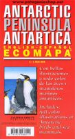
Wegenkaart - landkaart Antarctic Peninsula - Antarctica | Zagier & Urruty
Kaart van het Antarctisch Schiereiland met tekeningen van de voorkomende Fauna. Dit is het stuk van Antarctica waar vrijwel alle toeristen rondvaren op de cruiseschepen of zeilboten. The North of the Peninsula is the most visited part of Antarctica every summer. Glaciers, inlets and sailing ports, scientific stations, etc. On the back side large maps of the main visited islands and ports. Artistic drawings of birds and mammals.
17,95
Wegenkaart - landkaart Patagonian & Fuegian Channels - Chilean Fjords Cruise Chart Beagle Channel - Patagonië | Zagier & Urruty
Intricate representation of Chilean fjords along the western and far southern edge of southern South America. This clear and uncluttered map shows details of the coastline with minimal topographical information. Historical notes and elevations of coastline illustrated from different bearings. Scale 1:1,400,000 Historical and hydrographical chart. Cruise log for the intrincate coast of the south of South America. Insets of Beagle Channel "Glaciers Avenue", Agostini Fjord, Wulaia Inlet and Romanche Bay   Kaap Hoorn, Straat Magellaan, Punta Arenas, Ushuaia, Cordillera Darwin, Seno Agostini Uitgevouwen 70 x 100 cm
22,95
Wegenkaart - landkaart New Caledonia & Oceania Cruising | ITMB
Aan de ene kant een degelijke kaart  van Nieuw Caledonië, schaal 1:530.000, met aanduidingen van o.a. nationale parken, vliegveld, benzinepomp, dirt-roads. As overzichtskaart goed te gebruiken. Aan de andere kant een overzicht van cruise routes in Oceanië, schaal 1:12.000.000 The South Pacific island complex known as New Caledonia, or Nouvelle Caledonie in French, consists of a main island and half a dozen smaller islands (collectively called the Loyalty Islands. It is an overseas possession of France and uses the Euro as its currency. It is located about halfway between Australia and Fiji and is south of Vanuatu. The main island is one of the larger land masses in the Pacific, with a reasonably well-developed road infrastructure linking the capital city of Naomea with other urban areas. There are resort hotels at various locations along the coastline, but this is a territory that one would have to regard as being adventuresome. Most of the attractions are concentrated in the vicinity…
13,95
Wegenkaart - landkaart 788 Chili - Argentinië | Michelin
Zoals je van Michelin mag verwachten is deze kaart zeer overzichtelijk en heeft een duidelijk helder kaartbeeld. De kaart geeft uitgebreide toeristische informatie weer. De perfecte overzichtskaart!   This Chili - Argentinie map from Michelin is part of their red national map series. These are perfect for route planning as well as getting around by car once you're there. They clearly mark out major roads and also show many of the more important minor roads. A street plan of central Buenos Aires that highlights the city's mai attractions is included.   The map's simple folding design with durable paper cover, allows it to be read like a book and easily folded back together. Road numbers and intermediate distances are clearly displayed with the more scenic routes highlighted in green.   The map also features:   Political boundaries Regional and National Parks Important sights (points of interest, historic sites, etc.) Driving Times and Distances Road Safety Information A legend in multi…
12,95
Wegenkaart - landkaart - Wandelkaart trekkingmap Tierra del Fuego & Isla Navarino | Zagier & Urruty
Kaart gebaseerd op satellietfoto's met ingetekende hoogtelijnen, campsites, routes en hutten. Bedenk dat het allemaal wel heel globaal is, het is niet de meest ideale schaal om op te lopen. The Argentine and Chilean sectors of Tierra del Fuego. Satellital relief, winter resorts, secondary roads, tracks, distances. Special maps of Staten Land, Navarino Island and beagle Channel. The most updated available. Isla Navarino 1:200.000 rest 1:500.000
17,95
Wegenkaart - landkaart South Pacific Cruising & Samoa | ITMB
Een overzichtskaart van de zuidelijke Stille Oceaan met de cruise routes tussen de verschillende eilanden aangegeven. Op de achterzijde een overzichtskaart van Samoa This is a new venture for ITMB. Cruising is a rapidly-growing segment of the travel industry, experiencing double-digit growth rates annually. Obviously, this is a thriving market. In conjunction with several cruise ship lines, we have prepared a map of the South Pacific Ocean, which extends southwards from Hawai'i to the southern tip of New Zealand and eastwards from central Australia/Papua New Guinea to the Pitcairn Islands. Thus, it does not include the popular South East Asia and China coast routes. We think this has to change at a time when 25,000,000 people are travelling by cruise ships. At the same time, we must keep coverage area relevant for those end users of the artwork. Even at 1:12M, most of the area covered is water, with island countries such as Fiji, Tonga, Kiribati, Tahiti, and the Cook Islands being vis…
13,95
Reisgids Antarctica: Guide to your adventure Paperback | Rucksack Readers
To people who haven’t been there, Antarctica seems remote, extreme and perhaps even forbidding. Yet everybody who has visited comes back full of enthusiasm, with amazing memories and stunning photos. The author inspires interest in this amazing place while encouraging responsible, informed and sustainable tourism. She helps you to decide where and when to go, whether to include South Georgia and/or the Falklands, how to read between the lines of an itinerary, which operator to book with and what size of ship will suit you best. She provides practical information about weather, clothing and photography, and gives links to useful websites and further reading. She covers various specialist options from sea kayaking to camping on the ice. The wildlife section is lavishly illustrated with photos of creatures ranging from tiny krill through seabirds and penguins to seals, dolphins and whales with their amazing adaptations. Understanding their breeding cycles helps you to anticipate what you…
22,50
Wegenkaart - landkaart Norway - Noorwegen | ITMB
Norway is one of the most popular countries for visitors in Europe. We spent an interesting time researching this map in Norway, travelling all the way north to Nordkapp, a trip that took a week. We were actually on a cruise ship for much of the travel time. We also discovered a bookstore in Narvik that sells travel maps and obtained valuable research material there. Norway, as a country, is one of the prime travel destinations in the world – lots of wide open spaces, all the mod-cons, and fantastic scenery. Obviously, Nordkapp is a huge attraction, being the most northerly part of Europe one can access, but Norway has lots of other attractions. Roads in Norway tend to be of a very good quality, but are mostly two-laned and winding. There are coastal ferries joining isolated communities from south to north, and lots of ferries for car crossings of fiords. We took a local ferry from Alesund into the interior of Stor Fiord. It took all day to make the trip, but it was a great experience…
14,95
Wegenkaart - landkaart Chobe | Shell
Zeer bijzondere goede landkaart van Chobe National Park in Botswana. Uitermate handig zijn de GPS coordinaten van de meest belangrijke punten als campings of uitzichtpunten. De kaart is gebaseerd op een luchtfoto, waarbij alle details zijn ingetekend. The map: The Chobe map consists of a complete map of Chobe on the front of the map and there are 5 individual maps of the major tourist areas on the back of the map. These are Chobe river front east, Chobe river front west, Nogatsaa, Savute and a small orientation map. The map was compiled by using satellite images, giving one a birds eye-view of the area. The roads were tracked by means of a GPS and then super-imposed on the photographs. Detailed GPS co-ordinates are supplied for game-drive areas. The Chobe map contains 126 GPS co-ordinates. The four main tourist areas: The Chobe National Park consists of a variety of vegetation types and geological features, offering extreme contrasts and a wide range of wildlife experiences within the…
17,50
Wegenkaart - landkaart Cyprus | ITMB
Goede gedetailleerde kaart van Cyprus. De kaart is tweezijdig en gedrukt op scheur- en watervast papier. Voelt zwaarder aan, maar gaat langer mee! Kaartbeeld is helder met een mooi kleurgebruik waarbij je goed kunt zien hoe de hoogteverdeling is. Wegen en spoorlijnen staan er goed op, maar ook bijvoorbeeld extra aanduidingen voor bezienswaardigheden, campings en zelfs benzinepompen.  Cyprus is a lovely Mediterranean island; a popular tourist destination for Europeans. It is also a very historic island, with roots going back to Phoenician times and probably before. Politically, the island is divided into Turkish-controlled Northern Cyprus and EU-member Cyprus, the southern two-thirds of the island. Most travel is to the southern portion, with numerous resort hotels and beaches lining the coast. This is also the most economically-developed part of the island, as the northern portion has not been recognized by anyone except Turkey, which still maintains a significant military presence in…
13,95

Klanten-reviews van Wegenkaart - landkaart Ushuaia to Antarctica - Drake Passage | Zagier & Urruty

Er zijn nog geen beoordelingen voor dit productBen jij de eerste die een review plaatst?

Meer over Wegenkaart - landkaart Ushuaia to Antarctica - Drake Passage | Zagier & Urruty

Productomschrijving

Deze kaart is geschikt voor bootreizen van Ushuaia naar Antarctica. De kaart bevat behalve dieptemeters en stromingen ook de plaatsen van scheepswrakken en andere interessante plekken.

The ship voyage from South America to the Antarctic Peninsula is a travel of a lifetime. After two days navigating on a sea of miles deep with the strongest and wildest currents and winds, the traveler arrives to a paradise for people looking for nature, history and adventure.
This map is based in the Argentine Hydrographic Survey and the Ushuaia Maritime Museum charts and includes historic sites in the area as well as place for stamps and signatures from the ship and stations crew. A certificate for having crossed the Drake Passage is printed, too.

afmeting 65 x 95 cm

Verken gerelateerde categorieën

Webshop.nl maakt gebruik van cookies. Ga je verder op onze website, ga dan akkoord met het plaatsen van cookies en de verwerking van deze data door ons en vermelde partners.