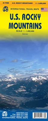
Wegenkaart - landkaart USA Rocky Mountains | ITMB

0
This is the latest American regional map that ITMB has published. This one covers Montana, Wyoming, Colorado, and parts of Idaho, New Mexico, and Arizona. It is, of course, the southern extension of the Canadian Rockies map through Blue Sky Montana and Mile High Denver. This is a double-sided map concentrating on roads and road quality, parks, tou...

Verkopers met dit product

Verkoper
Bezorging
Prijs
DeZwerver.nl logo
DeZwerver.nl
2,95
13,95

Anderen bekeken ook

Wegenkaart - landkaart Western Australia | ITMB
The State of Western Australia occupies the western third of the continental country of Australia. The main city is Perth, in the southwest portion, and this is the part of the State with the best land and the most people. Much of the interior is arid desert-like grassland with shallow lakes that often dry out. The road network in the south is generally paved highways and secondary roads, with one road and one rail line heading east to SZ and the rest of the country. Roads in the north tend to be dirt, with the exception of the highway going towards Darwin in NT. There are no roads through the Great Sandy Desert, but the Canning Stock Route crosses the eastern fringe, going north-south. One needs an expensive permit to drive this hazardous track. Most of the attractions of the State are to be found fairly close to the coastline. Most of the larger urban areas tend to have been named after British places, such as Albany, Exmouth, and Port Hedland, but many names have been adopted from …
13,95
Wegenkaart - landkaart Montana & Idaho | ITMB
Een degelijke kaart met aanduidingen van o.a. nationale parken, vliegveld, benzinepompen. ITMB is pleased to release two more state maps, this time of Montana on one side, and adjacent Idaho on the other side. Montana prides itself on being the ‘blue sky’ state. Due to its high elevation, the sky does appear to be a darker shade of blue than is common in areas closer to the ocean. The state is lightly populated, so much of its attractiveness rests with natural features, such as Glacier National Park on the Canadian border, and Yellowstone National Park on the Wyoming border. The state is also perfect camping country, and our map includes dozens of authorized campsites. It also includes the national heritage site of Little Big Horn, where Lt. Colonel Custer and the US 7th Cavalry were massacred after foolishly attacking a vastly larger encampment of Sioux and Cheyenne first nations people under the leadership of Sitting Bull. The second side of the map portrays the State of Idaho, an e…
13,95
Wegenkaart - landkaart Yellowstone National Park and Wyoming | ITMB
The USA is a vast and wonderful land to explore. ITMB is steadily increasing our coverage of this important travel destination and this month concentrates on the State of Wyoming, with a detailed travel map on one side, including small portions of adjacent states of Utah, Colorado, Nebraska, South Dakota, Montana, and Idaho. The state is lightly populated, with Cheyanne as its capital and main city. Interstates 80 and 90 both traverse the state, with Interstate 25 being the only north-south motorway. Yellowstone National Park occupies the northwest corner of the state and also occupies the second side of the sheet with an extremely detailed map. Yellowstone is the first area in the world to be proclaimed as a national protected area (Banff was second), and Yellowstone remains the paramount preserved wilderness environment in the world. There are several small urban areas within the park for accommodations and servicing, such as West Thumb, Canyon City, and Mammoth Hot Springs. The mai…
13,95
Wegenkaart - landkaart The Andes | ITMB
Een degelijke wegenkaart van de hele Andes met aanduidingen van o.a. nationale parken, vliegveld, Als overzichtskaart goed te gebruiken. We are pleased to be able to re-introduce this important title into our publishing range after a lapse caused by Covid. The Andes mountain chain is the southern extension of the Sierra Nevada chain through Mexico and Central America, which is, in turn the southern extension of the Rocky Mountain chain from Alaska to the Mexican border. The Andes is a magnificent series of high mountains that enters Colombia and spreads southwards through Ecuador and Peru all the way to southern Patagonia. The map is double-sided, with the Northern Andes on one side and the other side divided into two side-by-side maps portraying the Central Andes and the Southern Andes. Thus, the map coverage focuses on the Andes themselves, rather than on all of South America. All of Colombia and Peru are shown, most of Bolivia, all of Chile, and the Patagonian portion of Argentina …
13,95
Wegenkaart - landkaart Banff - Jasper national parks | ITMB
Gedetailleerde wegenkaart van deze 2 bekende nationale parken in Canada. Naast toerischtische informatie zjn de belangrijkste wandelpaden schetsmatig ingetekend en worden de campings weergegeven, hogtelijnen geven een goed beeld van de hoogteverschillen en bergern in het gebied.. Jasper staat op de ene kant en Banff op de andere zijde.  Banff is the first national park declared anywhere in the world, done at a time when the idea of reserving huge tracts of land for the enjoyment of future generations was an admirable, though unheard of, concept. The park in the Rocky Mountains of western Alberta remains as lovely and as enjoyable as it must have seemed to the early CPR railway surveyors searching for a route through the mountains to join the then-colony of British Columbia to Canada. Nowadays, the park is laced with roads and hiking trails, and the town of Banff within the park is severely pressed to maintain a balance between serving the needs of the millions of visitors each year an…
13,95
Wegenkaart - landkaart Nevada & Northern California | ITMB
Een degelijke kaart met aanduidingen van o.a. nationale parken, vliegveld, benzinepompen.   The USA is one of the most challenging countries to map due to its strong identification with state boundaries. Last month, we introduced two new maps of Idaho and Montana; this month, we wish to introduce Nevada. As a state, Nevada is mostly desert-like and is lightly populated. Its two major urban areas, Las Vegas and Reno, are extremely popular travel destinations. In addition, Nevada offers the Hoover Dam, one of the seven wonders of the modern world, a national park with 5,000-year-old pine trees, America’s second deepest lake (Tahoe), the eighth highest mountain peak in the USA, and the biggest air force bombing range in the world (Nellis). The map is double-sided, and covers northern California on the other side. This includes such treasures as Death Valley, part of the Mojave Desert, Yosemite National Park, the beautiful sequoia trees in the far northeast corner, and man-made wonders s…
13,95
Wegenkaart - landkaart Scotland - Schotland | ITMB
Anyone who has been in this business for a few years remembers Ordnance Survey and their brilliantly detailed artwork. They should also remember that OS guarded this artwork religiously. That all changed when the then head of government in the UK, one soon-forgotten Gordon Brown, decreed that commercial OS artwork had to be discontinued and artwork had to be made more freely available to users. I expected an outpouring of new artwork by private UK firms. It did not happen; in fact, the range of travel maps decreased dramatically. However, OS artwork is still an excellent source of mapping artwork. This is a wonderful double-sided, detailed map of Scotland. It is both extremely detailed and accurate. We have added symbols for parks, historic sites, battlefields, country hotels, and anything else that we think would interest visitors. In order to portray Scotland to best scale advantage, the only inset included with this map are those of outlying islands, such as the Shetlands. ITMB als…
13,95
Wegenkaart - landkaart USA Verenigde Staten | ITMB
Een degelijke kaart met aanduidingen van o.a. nationale parken, vliegveld, benzinepomp, dirt-roads en kleine plattegrond van hoofdstad. Als overzichtskaart goed te gebruiken. United States of America (USA) Travel Reference Map has been mapped before, but the USA is a huge country, extremely developed, and almost impossible to show on a map without over-simplification. Most commercial maps use small sheets of paper and print single-sided, making it impossible to show this vast country to advantage. Well, Lan’s been hard at work developing a ‘proper’ traveller’s aid to navigating around the USA, and here it is. We printed it on an exceptionally large sheet of paper, 39” tall by 54” wide (our normal printing size is 27”x39”). To do this, we merged our four existing databases into one, then split them so that the west side is on one side and the east side on the other. What results is a very large sheet, but a map at a VERY good scale. We were able to fit in 6,765 urban areas, all the Int…
13,95
Wegenkaart - landkaart Hawaii Volcanoes National Park & Big Island | ITMB
Een degelijke kaart met aanduidingen van o.a. nationale parken, vliegveld, benzinepomp, dirt-roads. Als overzichtskaart goed te gebruiken. We didn't suspect, when we started developing this title, that Mauna Loa Volcano would erupt as soon as our map of the national park was printed, but it did! It is on the news every night, and a marvelous touristic attraction. How many of us can ever see a massive eruption of molten lava? Now, we can! (at least, from a safe distance). The national park occupies one side of the map and is the latest in ITMB's series of national parks. By the nature of such parks, we show all the features and elevations, but in this case, we'll add the proviso that heights and lava flows are changing the landscape on a daily basis. Volcanoes are sort of like elephants-they go where they please! The reverse side of the sheet is a map of Big Island, where the park is located. Its name comes from being the largest island in area of all the Hawaiian archipelago. The map …
13,95
Wegenkaart - landkaart SC5-SC6 George to Kareedouw | Tracks4Africa
The Cape to Addo map series covers the southern parts of the Western Cape of South Africa in a series of eight highly detailed maps, printed on four sheets of A1 durable paper.   We start in Cape Town in the west and move along the southern coast through the Overberg, Winelands, Garden Route, Klein Karoo R62, Baviaanskloof to eventually arrive in the Addo National Park up to Gqeberha (Port Elizabeth) in the east.   The maps are highly detailed and well researched. Our map scale is 1:200 000 which allows us to show a lot of detail including minor gravel roads, hiking trails, farm boundaries and points of interest which are relevant to self-drive tourists.   The size of the paper is kept small enough to allow this to be the perfect road tripping map. We use Duraflex paper and print two maps per sheet of A1 paper, making this a four-sheet series. Each map sheet is individually packed in a plastic protective sleeve.   The maps are perfect for day drives, overlanding or just doing road tri…
29,95

Klanten-reviews van Wegenkaart - landkaart USA Rocky Mountains | ITMB

Er zijn nog geen beoordelingen voor dit productBen jij de eerste die een review plaatst?

Meer over Wegenkaart - landkaart USA Rocky Mountains | ITMB

Productomschrijving

This is the latest American regional map that ITMB has published. This one covers Montana, Wyoming, Colorado, and parts of Idaho, New Mexico, and Arizona. It is, of course, the southern extension of the Canadian Rockies map through Blue Sky Montana and Mile High Denver. This is a double-sided map concentrating on roads and road quality, parks, touristic attractions, and urban areas. We feel that the state-by-state approach to mapping the USA just does not work well. With todays infrastructure and vehicular capability, one can pass through three or four states in a normal day drive. 

Legend Includes: Roads by classification, US Divided Highway, Mountain peak, State park, National park, Ferry Route, Historic Route 66, Hot Spring, Museum, Skiing, Beach, Cave and much more.

Productinformatie

    Verken gerelateerde categorieën

    Webshop.nl maakt gebruik van cookies. Ga je verder op onze website, ga dan akkoord met het plaatsen van cookies en de verwerking van deze data door ons en vermelde partners.