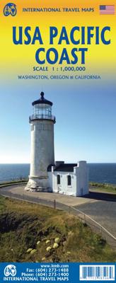
Wegenkaart - landkaart USA Pacific Coast Travel Reference Map | ITMB

0
Coverage is from Vancouver to Tijuana to Las Vegas, and information includes rest areas, parks, touristic attractions and the like, as well as detailed road information. There are no inset maps on this title, which also makes a very nice wall map of the west coast!   Legend Includes: International Boundary, State Boundary, County Boundary, Interst...

Verkopers met dit product

Verkoper
Bezorging
Prijs
DeZwerver.nl logo
DeZwerver.nl
2,95
13,95

Anderen bekeken ook

Wegenkaart - landkaart USA Pacific Coast Travel Reference Map | ITMB
Coverage is from Vancouver to Tijuana to Las Vegas, and information includes rest areas, parks, touristic attractions and the like, as well as detailed road information. There are no inset maps on this title, which also makes a very nice wall map of the west coast!   Legend Includes: International Boundary, State Boundary, County Boundary, Interstate Hwy, Freeway / UC, Toll Hwy / UC, Multilane Hwy / UC, US Divided Hwy, Two lane road / State Highway, Other Road / Track, Pacific Crest Trail, Ferry Route, Time Zone, Mountain peak (feet) State Park, National Forest, National Park, Exit Number and approx. distance between two exists (dist. in miles), Approx. Road Distance (in miles), Interstate Highway, United States Highway, State Highway, Historic Route 66, Large Urban area, State Capital, More than 250,000, 85,000 - 250,000, < 85,000, Town, River / Lake, Salt Lake, Indian reserve, Military property area, Rest Area, Lodge, Point of Interest, Natural Point of Interest, International Airpo…
13,95
Wegenkaart - landkaart - Stadsplattegrond Los Angeles & California South Coast | ITMB
Dubbelzijdige kaart met aan de ene kant een plattegrond, 1 op 15.000, van Los Angeles. Aan de andere kant een degelijke kaart met aanduidingen van o.a. nationale parken, vliegveld, benzinepomp en campings van de zuidkust van Californië Als overzichtskaart goed te gebruiken.   Legend Includes: Roads by classification, Accommodation, Museum, Church, Building, Points of tourist, Post Office, Police Station, School, Bicycle Route, Hiking Path, Road Barrier, Tourist Information, Hospital, Live Theatre, Cinema, Dept. Store, Bus Terminal, Pedestrian Street, Staircase, International Airport, State Park with Campsites, State Park without Campsites, Campsite, Wayside or Roadside Park, Rest Area, Lodge, Point of Interest, Domestic/Regional Airport, Information Center, Golf Course, Hot Spring, Port of Entry, Border Crossing, Gas Station, Service Area, University or College, Skiing, Lighthouse, Beach, Cave, and more.
13,95
Wegenkaart - landkaart USA Rocky Mountains | ITMB
This is the latest American regional map that ITMB has published. This one covers Montana, Wyoming, Colorado, and parts of Idaho, New Mexico, and Arizona. It is, of course, the southern extension of the Canadian Rockies map through Blue Sky Montana and Mile High Denver. This is a double-sided map concentrating on roads and road quality, parks, touristic attractions, and urban areas. We feel that the state-by-state approach to mapping the USA just does not work well. With todays infrastructure and vehicular capability, one can pass through three or four states in a normal day drive.  Legend Includes: Roads by classification, US Divided Highway, Mountain peak, State park, National park, Ferry Route, Historic Route 66, Hot Spring, Museum, Skiing, Beach, Cave and much more.
13,95
Wegenkaart - landkaart Mexico Pacific Coast en Guadalajara | ITMB
Een degelijke kaart met aanduidingen van o.a. nationale parken, vliegveld, benzinepomp, dirt-roads. Als overzichtskaart goed te gebruiken. The area of coverage has been extended to cover everything on Mexico’s western coast, from Mazatlan to Acapulco, and shows all of the roads and sights inland as far as Zacatecas, San Luis Potosi, and Queretaro. As a bonus, we have included a detailed map of Mexico’s third largest city, Guadalajara, on the reverse side, for the convenience of visitors to this fascinating section of the country; printed on paper, double-sided.
13,95
Wegenkaart - landkaart Sunshine Coast - British Columbia | ITMB
Mooi autokaart in overzichtelijke kleur van ITMB. Indexed. English text and legends. The coastline of Canada’s British Columbia is long and varied. The best-known portion is the part just north and west of Vancouver, known as the Sunshine Coast. The rugged Coast Mountain Range makes road-building impractical for much of the interior, so communities such as Gibsons, Sechelt, and Powell River are joined together by Highway 101 and by ferries. Many Fiords take kayakers deep into pristine wilderness areas, and former logging roads are now commonly used for wilderness hikes. The famous Strait of Georgia, used by cruise ships to Alaska, cuts through the middle of the map, with the largely unpopulated and wild Bute Inlet leading TO Waddington Glacier and the vast Homathko Icefield. Side 2 of the map covers southwestern BC, including all of Vancouver Island and the southern interior as far as Nelson and north to 100 Mile House. Insets of downtown Vancouver and Victoria are included.   Legend …
13,95
Wegenkaart - landkaart Denver and Colorado | ITMB
Een degelijke kaart met aanduidingen van o.a. nationale parken, vliegveld, benzinepomp, dirt-roads en kleine plattegrond van hoofdstad. Als overzichtskaart goed te gebruiken. This is a brand new title for ITMB. Denver, the ‘mile-high’ city on the eastern slopes of the Rocky Mountains, is a vibrant, fairly modern city. It is the state capital, and the gold-coated dome of the legislative building highlights the wealth and strength of the state. The Denver Zoo is becoming one of the great attractions of the city, as are the Center for Performing Arts and the Museum of Science and Nature. Larimer Square is the focal point for entertainment, and Coors Field for sports. Our map shows a wide-ranging number of accommodations and eateries, and notes all points of interest. The State of Colorado map fills the reverse side of the sheet and, due to the positioning of the state’s boundaries, nicely fills the 40x28 sheet size of the map. Small portions of neighbouring states show around the edges, …
13,95
Wegenkaart - landkaart Bhutan & Northeast India | ITMB
Een degelijke kaart met aanduidingen van o.a. nationale parken, vliegveld, benzinepomp, dirt-roads en kleine plattegronden van Thimphu, Paro en Calcutta. Als overzichtskaart goed te gebruiken.   De ene kant van de kaart heeft Bhutan erop staan, met een schaal van 1:35.000. De andere kant van de kaart omvat noordoost India. Schaal 1:1.300.000    Bhutan is a beautiful mountainous country, squeezed between India and China. It is not a part of the world experiencing significant change, and this version is pretty much the same as our previous one, although updated with minor changes. Printed double-sided, with Northeast India on the other side.   Legend Includes: Roads by classification, Express Way, National Highway, Major Highway, Secondary Road, Other road/track, Railway, Ferry Route , State Boundary, Undefined Boundary, River and Lake, Glacier, Desert/ swamp, Mountain peak, Pass, Historical Site, Monument, Bhuddist Monument, Radio Tower, Post Office, Police Station, Hospital, Library, …
13,95
Wegenkaart - landkaart USA Verenigde Staten | ITMB
Een degelijke kaart met aanduidingen van o.a. nationale parken, vliegveld, benzinepomp, dirt-roads en kleine plattegrond van hoofdstad. Als overzichtskaart goed te gebruiken. United States of America (USA) Travel Reference Map has been mapped before, but the USA is a huge country, extremely developed, and almost impossible to show on a map without over-simplification. Most commercial maps use small sheets of paper and print single-sided, making it impossible to show this vast country to advantage. Well, Lan’s been hard at work developing a ‘proper’ traveller’s aid to navigating around the USA, and here it is. We printed it on an exceptionally large sheet of paper, 39” tall by 54” wide (our normal printing size is 27”x39”). To do this, we merged our four existing databases into one, then split them so that the west side is on one side and the east side on the other. What results is a very large sheet, but a map at a VERY good scale. We were able to fit in 6,765 urban areas, all the Int…
13,95
Wegenkaart - landkaart Cayman Islands (Kaaiman Eilanden) & Jamaica | ITMB
Een degelijke kaart met aanduidingen van o.a. nationale parken, vliegveld, benzinepomp, dirt-roads en kleine plattegrond van verschillende steden. Als overzichtskaart goed te gebruiken. De kaart is aan twee zijden bedrukt, de ene zijde omvat de Cayman Islands (schaal 1:37.500 en 1:70.000). Op de andere zijde staat de kaart van Jamaica (schaal 1:250.000) en plattegronden van onder andere Kingston. We are pleased to announce the latest new Caribbean map to our growing series. The Caymans, for there are three major islands and numerous little shoals, remains a British colony, like the British Virgin Islands, the Turks and Caicos, and Bermuda. Tourism is the number one industry of the Cayman Islands, with dozens of hotels dotting the beachfronts, especially north of George Town. There are numerous dive sites for viewing tropical fish and we have shown about a hundred on the map, as well as every side street and gas station. One interesting place to visit is Hell, which is a frozen lava er…
13,95
Wegenkaart - landkaart USA South - Atlantic States | ITMB
Een degelijke kaart met aanduidingen van o.a. nationale parken, vliegveld, benzinepomp, dirt-roads van de Oosttkust van de USA van Philadelphia tot Florida  . Als overzichtskaart goed te gebruiken. We call the map the Atlantic States guardedly for obvious reasons. First, the northeastern Atlantic States are missing and second, Florida's Caribbean coastline is included. Also, to cover an area so long, we had to go further inland than 'just' the coast, so all of Pennsylvania and West Virginia are included. The area of coverage of side A is Philadelphia/Pittsburg south to Augusta and Charleston. Side B continues south to the southernmost portion of Florida and west to Panama City. Inset maps of Orlando and Miami are included on this side as well. Both road and rail connections are shown, and distances between communities shown. Places of touristic interest are included, albeit suitable to the scale. An extensive place name index is included.  Legend Includes: Roads by classification, Riv…
13,95

Klanten-reviews van Wegenkaart - landkaart USA Pacific Coast Travel Reference Map | ITMB

Er zijn nog geen beoordelingen voor dit productBen jij de eerste die een review plaatst?

Meer over Wegenkaart - landkaart USA Pacific Coast Travel Reference Map | ITMB

Productomschrijving

Coverage is from Vancouver to Tijuana to Las Vegas, and information includes rest areas, parks, touristic attractions and the like, as well as detailed road information. There are no inset maps on this title, which also makes a very nice wall map of the west coast!   Legend Includes: International Boundary, State Boundary, County Boundary, Interstate Hwy, Freeway / UC, Toll Hwy / UC, Multilane Hwy / UC, US Divided Hwy, Two lane road / State Highway, Other Road / Track, Pacific Crest Trail, Ferry Route, Time Zone, Mountain peak (feet) State Park, National Forest, National Park, Exit Number and approx. distance between two exists (dist. in miles), Approx. Road Distance (in miles), Interstate Highway, United States Highway, State Highway, Historic Route 66, Large Urban area, State Capital, More than 250,000, 85,000 - 250,000, < 85,000, Town, River / Lake, Salt Lake, Indian reserve, Military property area, Rest Area, Lodge, Point of Interest, Natural Point of Interest, International Airport, Domestic/Regional Airport, Information Center, Golf Course, Hot Spring, Port of Entry / Border Crossing, Gas Station / Service Area, University of College, Museum, Skiing, Lighthouse, Beach, Cave, Campsite, Wayside or Roadside park, Indian Area, Spring, Waterfall, Ranger station, Viewpoint, Harbor, Mountain pass, Monument, Nature Reserve, World Heritage site, Spanish Mission, Mine / Quarry, Dam, Snowpark / Winter Rec, State Park with campsites, State Park without campsites,and much more...

Productinformatie

    Verken gerelateerde categorieën

    Webshop.nl maakt gebruik van cookies. Ga je verder op onze website, ga dan akkoord met het plaatsen van cookies en de verwerking van deze data door ons en vermelde partners.