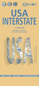
Wegenkaart - landkaart USA Interstate | Borch
Mooie, overzichtelijke wegenkaart van de snelwegen in Amerika. Handig als je grote afstanden in het land moet afleggen. Our soft-laminated folded map of the USA in the 9th edition shows: USA West, USA East, Hawaiian Islands, Puerto Rico each 1:4 000 000, Alaska 1:8 000 000, USA administrative & time zones. Borch Maps are easy to fold, durable and water-repellent with a wipeable surface. Borch Maps show hotels, museums, monuments, markets, public transport, top sights and points of interest, useful statistics, conversion charts for temperatures, weights and measurements, climate charts showing temperatures, sunshine hours, precipitation and humidity, overview maps, time zones, and much more... "Get your motor running, head out on the highway"! The Interstate highway system (officially the "Dwight D. Eisenhower National System of Interstate and Defense Highways") authorized by the Federal Aid Highway Act of 1956 and supported by former US President Eisenhower who had been impressed b…
11,50


